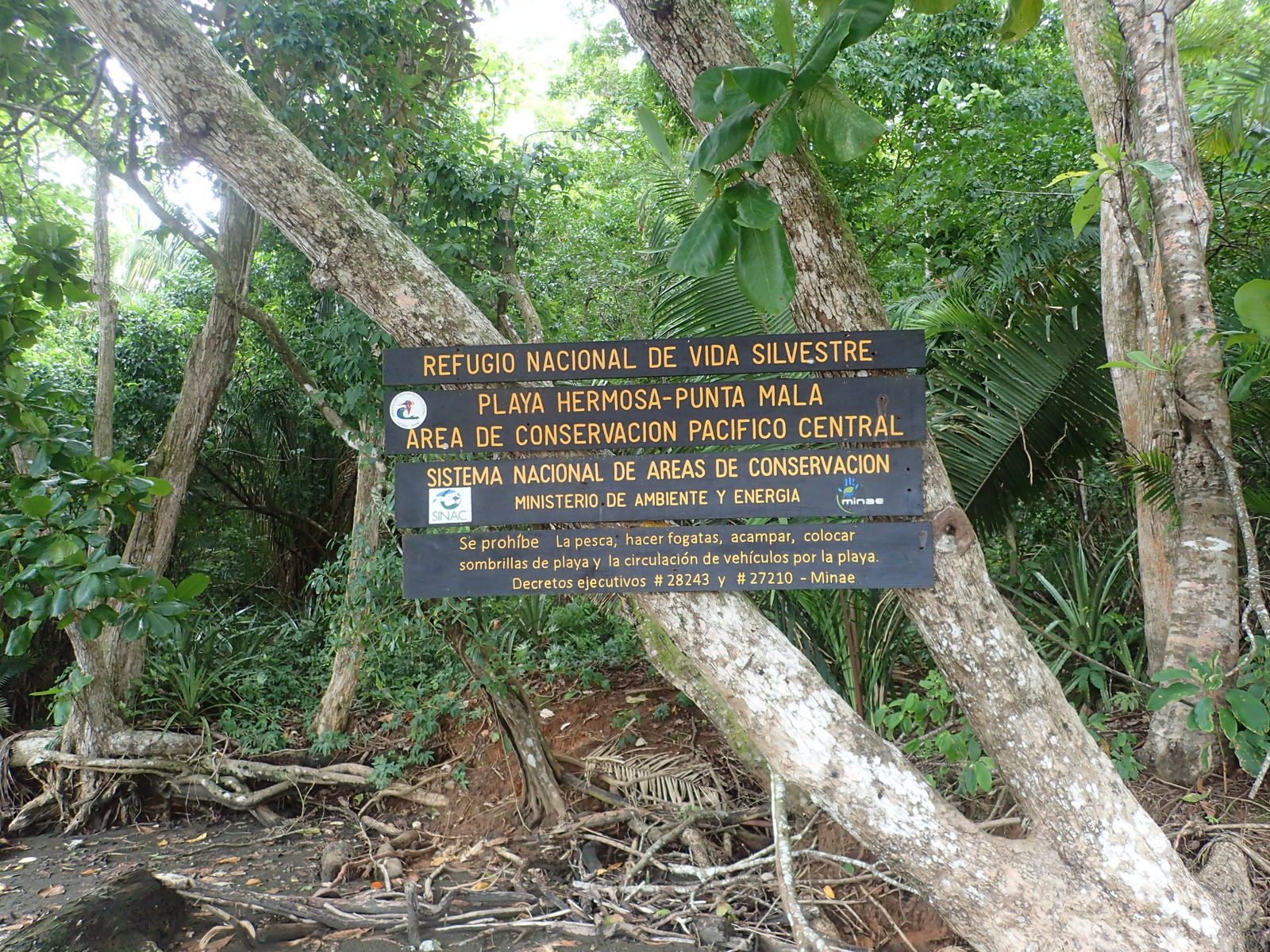
Refugio Nacional de Vida Silvestre Playa Hermosa-Punta Mala stretches 13 km southeast along the Pacific from the village of Hermosa to the village of Esterillos Oeste. It encompasses wetlands, a small lagoon, mangrove estuary, rock reef, tropical rain forest and of course spectacular beaches with some of the best surf breaks in the world.
east | west | getting there | best time | nearby | lodge | hills | photos
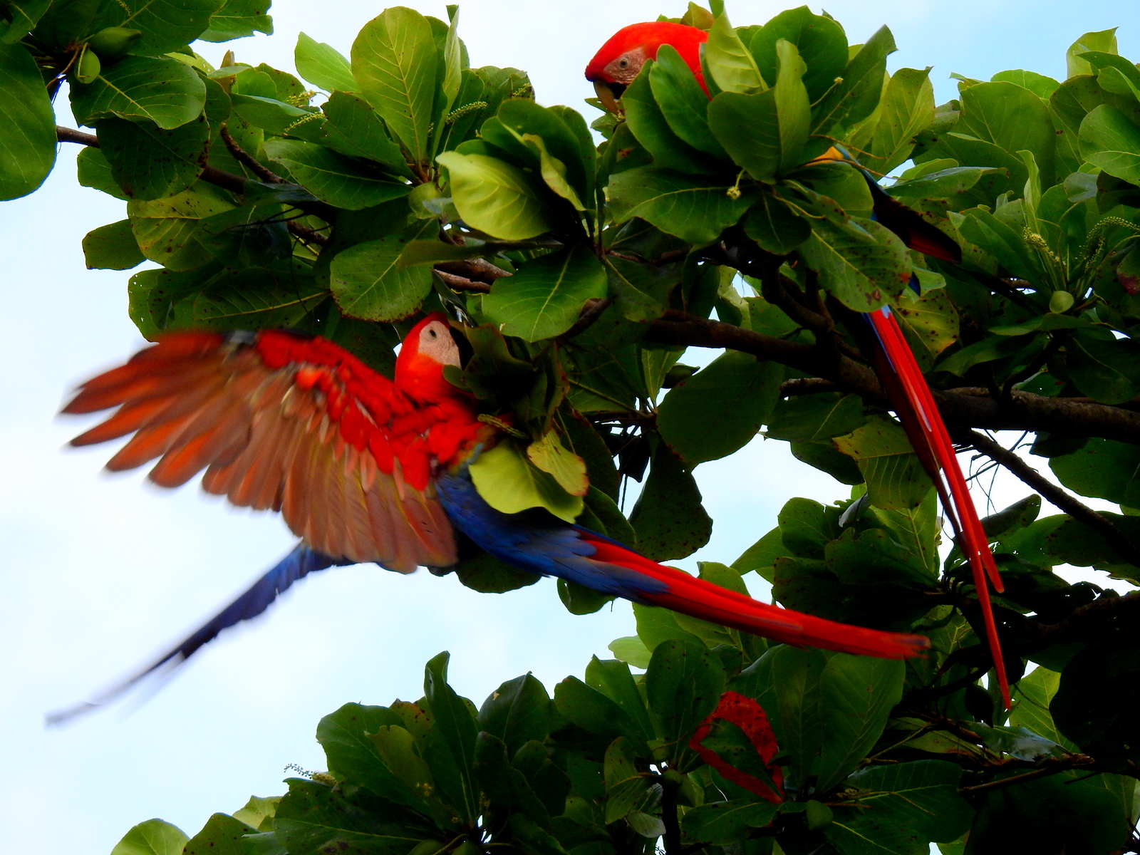
The refuge is part of the Area de Conservacion Pacifico Central and has habitats and resident plants, trees, birds, insects, and wildlife in common with its more famous and much more crowded neighbors to the south, Manuel Antonio National Park and north, Carara National Park.
There are no trails but the whole natural area is quite easy to access and explore from the beach in two halves – the west side from Hermosa and the east side from the village of Esterillos Oeste.
Playa Hermosa is smooth tan and gray sand stretching straight and unbroken for miles until it disappears into the mist thrown up by the huge relentless waves. It’s backed by a clear cut, flat grassy plain, pasture, rice paddies, and wetlands – golden and tan in the dry season or lime green in the rains.
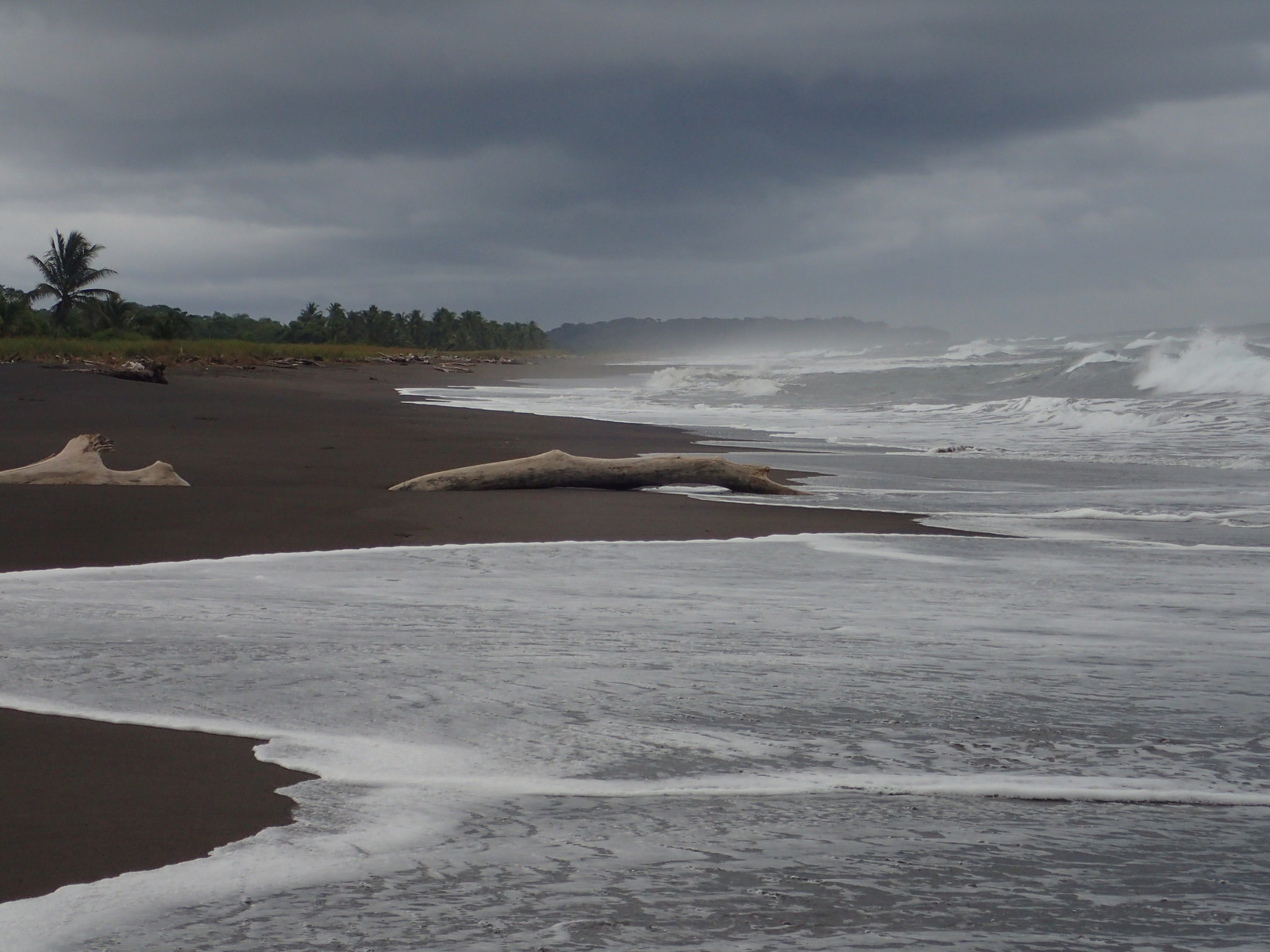
In contrast the beach on either side of Punta Mala is sharply curving, rocky and broken by long volcanic ridges stretching out into the crashing surf. Towering rain forest trees climb steep hills in a mosaic of emerald, chartreuse, spinach, peacock, forest and moss green and the shore juts and curves hiding the next stretch from sight.
east | west | getting there | best time | nearby | lodge | hills | photos
West/North Sector Playa Hermosa, Río Gloría Wetlands & Estero Los Diegos
We frequently walk the beach east from Tortuga del Mar in the village of Hermosa to the Río Tusubres -about 15 km (9 miles) round trip.
At the east end of town the tiny Laguna Pochotal fills the wedge of land formed by the intersection of Calle Playa Hermosa and the Carretera Pacifica Fernandez Oreamuno more commonly known as the Costanera Sur or Hwy 34. It is an oasis for water birds holding fresh water, or at least mud, through most of the dry season.
Calle Playa Hermosa follows a few meters off the beach to Quebrada Muerto where it turns inland and skirts behind the Hermosa Palms housing development, an island of houses within the reserve. Where the road rejoins the beach you’ll see a public parking area and the the new wildlife refuge offices on the right (relocated a few years ago when the old headquarters at the end of the road near the Río Tusubre were destroyed in a flood.
There’s an undeveloped private land inholding to the north of the beach which is currently an important wetlands fed by the quebrada Muerto and Río Gloría. The river is nearly indiscernible from the surrounding grassy pasture in the dry season but turns into a raging torrent through knee deep swamp when the rains come.

A billboard near the gate proclaims the swamp will be drained and a golf course and housing development is coming soon…we’re hoping they go bankrupt before destroying the habitat.
Further south and east the Río Gloría meets Estero Los Diegos and water from the Río Tulín joins the Río Turrubaritos to form the Río Tusubres which almost immediately backs up into a calm lagoon with black, red, and endangered white mangrove trees filling in behind the palms stabilizing the sand of Playa Hermosa.
The beach road continues south and east on the thin strip of land between the estuary and the beach until it dead ends into the wide mouth of the Río Tusubres.
Each time we reach the Río Tusubres we wonder about crossing. It’s a big river but at low tide in the dry season would probably only be waist high where it crosses the beach. As detailed in the getting there section there are fifteen foot long very toothy reasons to stay out of the river.
east | west | getting there | best time | nearby | lodge | hills | photos
East/South Sector Playa Punta Mala, Punta Judas & Estero Roto
The 15 km (9 miles) round trip walk from the public parking at the west end of Playa Esterillos Oeste around the point to the mouth of the Río Tusubres is exactly the same distance as the walk from Hermosa to the rivermouth but the two halves of the refuge are strikingly different.
The communities on opposite ends are also quite different.
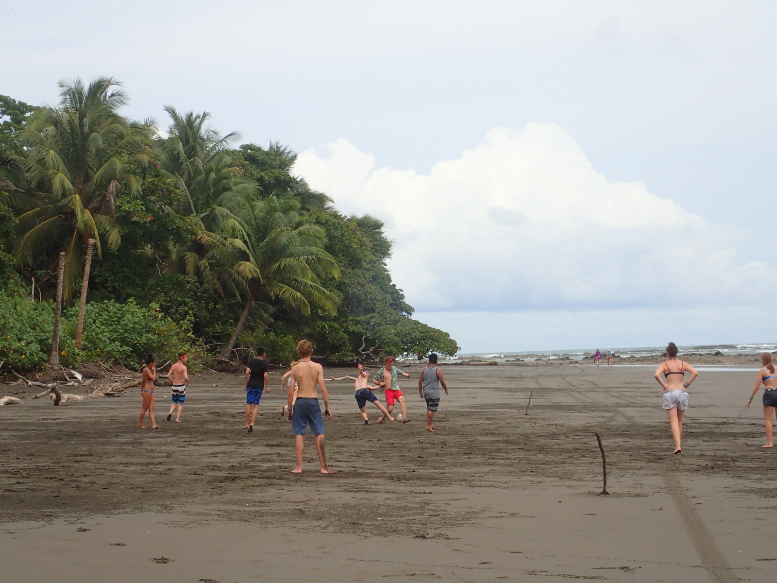
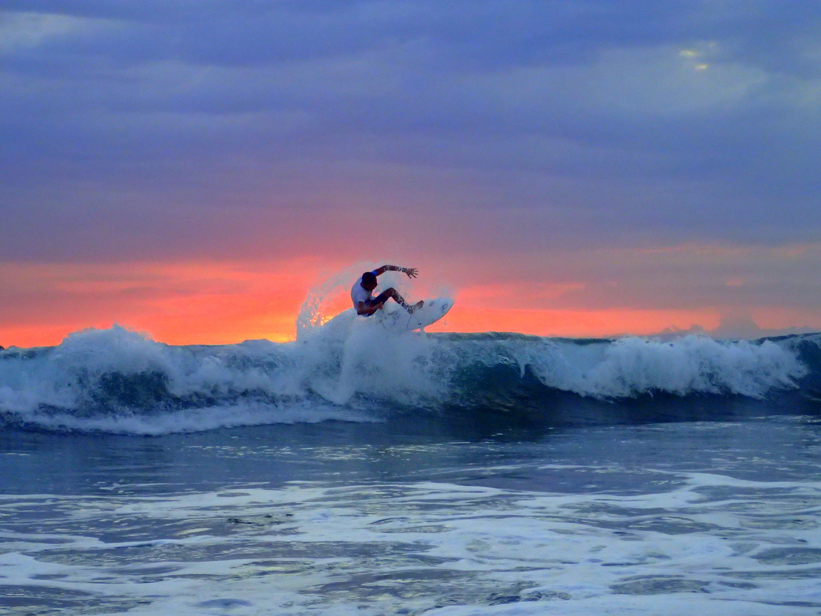 Hermosa is a California hip surfer hangout with cool and funky little hotels, pizza, sushi, bacon guacamole burgers, and bars with balconies over the sand shaded by palm trees webbed together with hammocks and slacklines. Surfers dot the huge waves and inside the bars images of the same surfers fill a large screen live feed accompanied by thrash metal music.
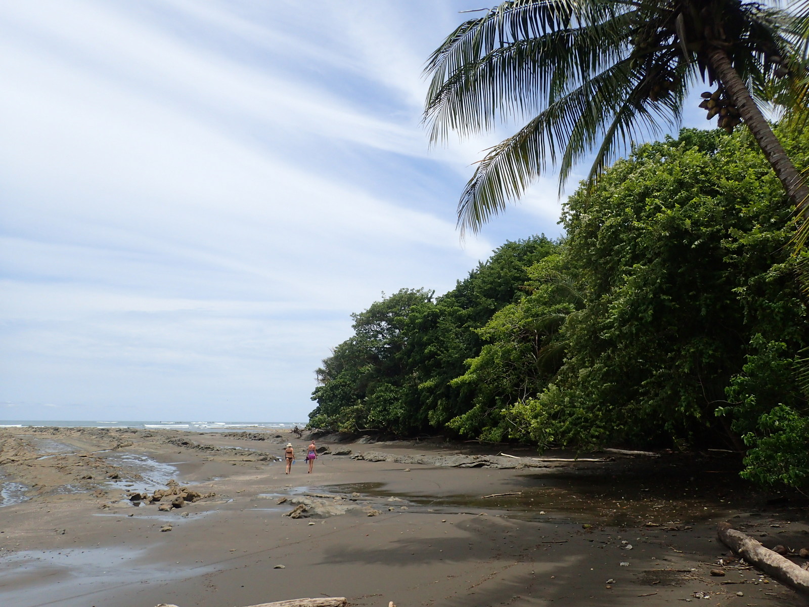
Esterillos Oeste is different in every way from Playa Hermosa. The waves are smaller and broken by the rocky points jutting into the swell. Surfers are replaced by families splashing in the shallows. There are a few small hostels, budget hotels and cabinas plus a campground, a mini-super, a soda serving typical Costa Rican food and restaurant with simple seafood.
Graffiti covered crumbling cinder block structures are testament to the vagaries of enforcement of maritime zone building regulations. Prohibiting repairs and additions to houses and businesses that technically were illegal to build in the first place prevents further development in the 50 meter zone of protected beachfront but there’s no mechanism for cleanup when the properties are abandoned.
La Sirena (the Mermaid) statue stands in the Pacific ocean in front of town welcoming tourists to walk out on the rocks and snap selfies with her when the tide is low.
Heading west along the beach from town the first thing to note is the natural shower/micro waterfall where a small quebrada that forms on pours over the rocks behind the trees. Great for rinsing the sand off when you return from your hike around the point.
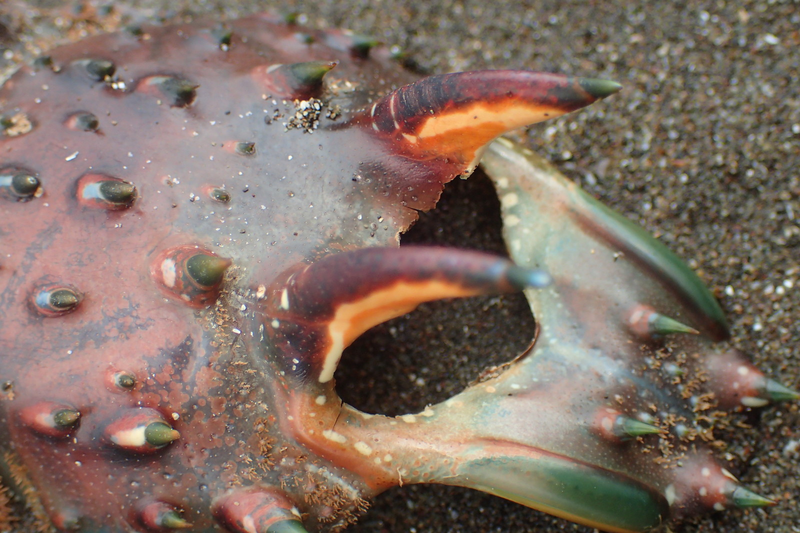
Playa Punta Mala is a mix of gray sand and pebbles with streaks of sedimentary rock stretching out into the water. A few tide pools hold gobies, starfish and urchins. It’s not obvious where Punta Mala ends and Punta Judas begins but the longer point is popular with (illegal) fishermen who walk out on the rocks to reach deeper water.
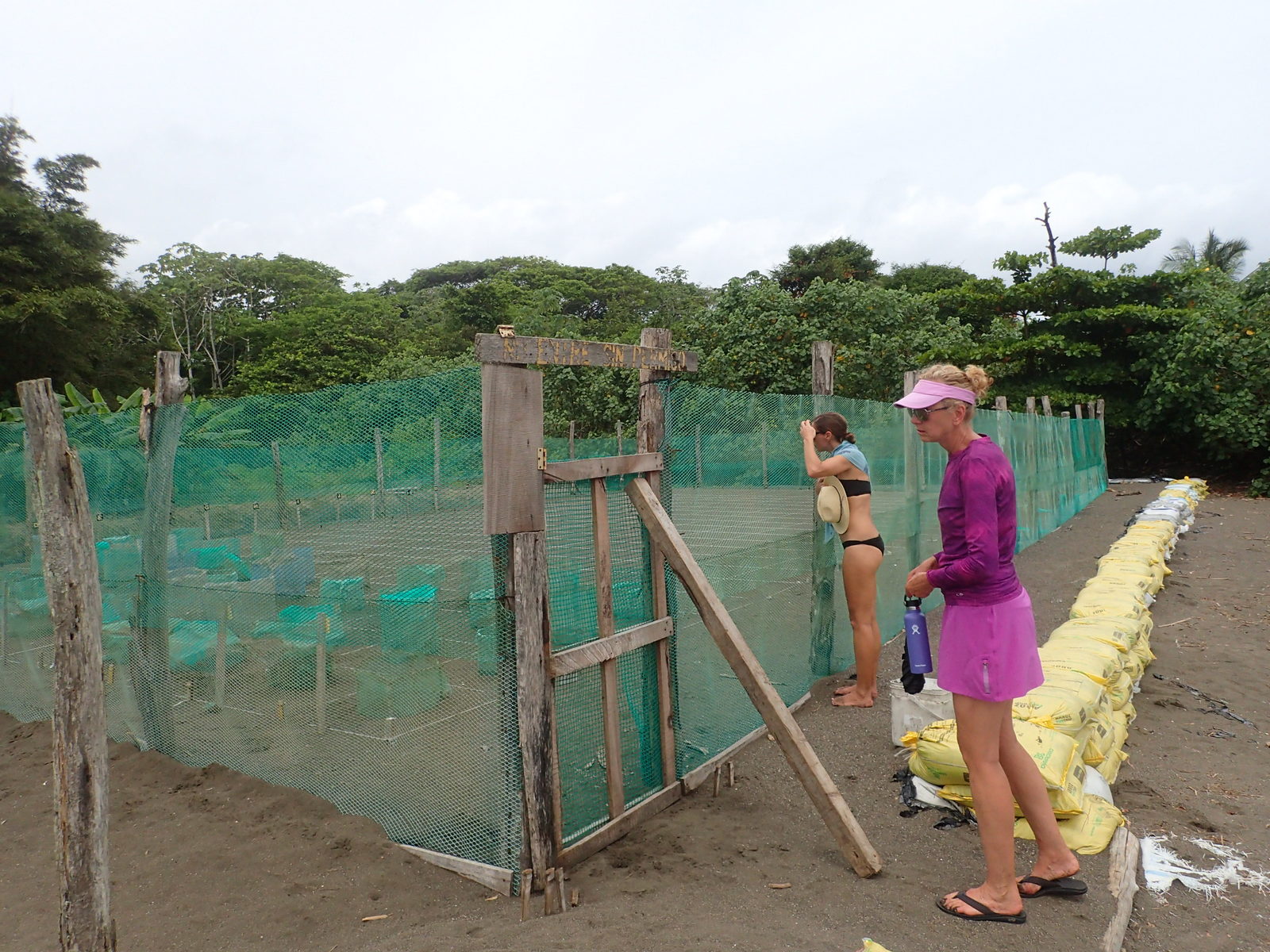
The turtle nursery holds one nest per grid square. The sand bag wall is to keep the eggs from being washed away by storm surges during particularly high tides.
Eggs are collected from nests spotted by volunteers or called in by locals. The nest are dug up and transferred to the guarded incubator enclosure immediately after they are covered and the female Olivaceous Ridley sea turtle heads back to the ocean.
It’s difficult to quantify illegal activity but researchers estimate that even in this age of ecology conservation most eggs laid outside of patrol areas are poached and sold on the black market as aphrodisiacs.

Estero Roto is much smaller than Estero Los Diegos and the outlet is easy to cross at the mouth on the beach. Another kilometer west the walk dead ends into the Río Tusubres which we mentioned before would be fairly easy to wade at low tide except it is guarded by crocodiles.
Fishing is illegal in the reserve but there are always a few anglers casting into the surf, the Río Tusubres and the deep water around the rocks of punta Judas.
east | west | getting there | best time | nearby | lodge | hills | photos
Punta Mala Lodge
The Araya family owns a 300 acre ranch extending over most of the point. Sofia Araya offers 3 little rustic houses for rent in a rain forest clearing a short walk up from the beach. The setting offers more solitude and intimacy with wilderness than we imagined possible less than an hour from the megalopolis of the central valley.
Punta Mala Lodge is behind a guarded gate about a half a kilometer from the turnoff on Hwy 34 about 1 km west of the entrance to Esterillos Oeste. You can drive nearly to the beach but only with reservations. Night time turtle nesting tours can be arranged and there are a dozen kilometers of trails around the property.
east | west | getting there | best time | nearby | lodge | hills | photos
Getting to Punta Mala/Playa Hermosa Wildlife Refuge
Soon after they moved to Hermosa a decade ago friends of ours drove east to the mouth of the Tusubres along the sandy gravel road described above hoping to take a shortcut from the west sector to the east sector by crossing the river.
They were wading into the current with their backpacks on top of their heads when they noticed a man standing on the far shore shaking his head. When the old timer stretched his arms out in front and began clapping them open and closed like the jaws of a croc our friends turned around and scrambled splashing out of the water. The old man laughed and gave them a thumbs up.
There are large crocodiles in the river and occasionally in the ocean in front of Playa Punta Mala and Playa Hermosa.
We strongly recommend driving the 16 km along Hwy 34 between Hermosa to Esterillos, crossing the Río Tusubres on the bridge, and walking each sector separately instead of trying to wade across.
Driving
The west/Hermosa sector has a dirt/sand road called Calle Playa Hermosa (not to be confused with Calle Hermosa which heads inland) along the entire length of the beach and there are numerous pullouts where surfers and birdwatchers park. Do not leave anything in your vehicle.
At times the road has been closed to vehicles ~2 km before the eastern end at the Estero Los Diegos and mouth of the Río Tusubres.
The main office and official parking is located 4 km down the road next to the Hermosa Palms housing development. However, there is no entrance fee and no need to check in.
The east/Mala sector can only be reached on foot unless you’re staying at the Punta Mala Lodge. There is a small parking lot at the west end of the village of Esterillos Oeste where the main road dead ends into the beach.
Public Bus
Playa Hermosa is on the bus route between Quepos or Uvita and San José so several buses per day pass in front of the soccer field just a block off the beach. It’s easy to get dropped off if you ask your driver to stop, but you may have to take a taxi or Uber into Jacó to depart. Hermosa is not a normal stop for the express buses, there’s no station or ticket office and travelers have had mixed results trying to flag down an express bus either direction.
Esterillos Oeste is on the same routes but it’s about a 2 km walk from the stop on Hwy 34 to the end of the beach where the refuge begins. It may be possible to get an Uber from the bus stop but ride sharing services are still developing outside San José.
One of the main bus companies serving the central Pacific is Transportes Morales phone (506) 2223-5567.
Boat
A daily speedboat makes the trip across the Gulfo Nicoya in about an hour. The boat lands in Herradura (north of Jacó) and Montezuma (near the tip of the Nicoya Peninsula). Passengers are transferred to vans for other local destinations including Hermosa on the Central Pacific and Santa Teresa, Tambor, Mal País and Cabuya on the peninsula.
Guided Tours
As far as we know there are no wildlife or bird watching tours to the Refugio Nacional de Vida Silvestre Playa Hermosa-Punta Mala. If you are traveling with a private guide it’s well worth a day or two or even just a stop for a couple of hours on the way to Manuel Antonio, Corcovado or other points south.
east | west | getting there | best time | nearby | lodge | hills | photos
Best Time to Visit – Weather & Climate at Punta Mala
The drop down menu summarizes typical rainfall and weather patterns for every month of the year plus daily calendars with tides, surf swells, turtle nesting and more to help you plan your visit. We’ve also written a general summary of best times to visit Costa Rica.
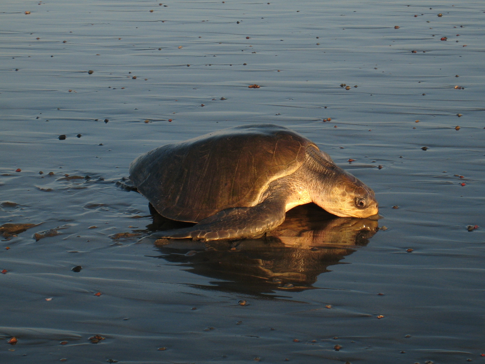
There are occasional (maybe three a year if we’re lucky) Leatherback sea turtles (Dermochelys coriacea) nesting on the beaches of the refuge but there are hundreds of Olive Ridley (Lepidochelys olivacea) turtles. Starting in June, peaking in August through November and trickling in until mid January the females come ashore at night to lay eggs.
The Central Pacific coast follows Costa Rica’s most stereotypical weather patterns. The dry season is from mid December through April with rains picking up in May through August. The heaviest precipitation is from September through November.
Escaping the frozen north for a tropical vacation mid-winter is the most popular but our favorite time to visit is June and July. Afternoon showers cool it down a bit, the clouds make for spectacular sunsets, and storms over the ocean put on spectacular lightning shows at night when most of the rain falls.
This area is below the latitude of the dry forest region of northwest Costa Rica and remains green year round. It never had the desert like appearance common in Guanacaste for four months starting each January.
It is warm year round with high temperatures averaging 84 °F (29 °C) to 95 °F (35 °C) and about five degrees cooler at night. The water is also warm appropriate for rash guards rather than wetsuits.
east | west | getting there | best time | nearby | lodge | hills | photos
In the Region
If you’re not lucky enough to gain access to Cerro Judas and the hills above the point by staying at Punta Mala Lodge you can see similar trees, habitat and wildlife on the cell tower hill above Hermosa where there’s a public road and private (but open to the public) trails from the top of the ridge back to the valley.
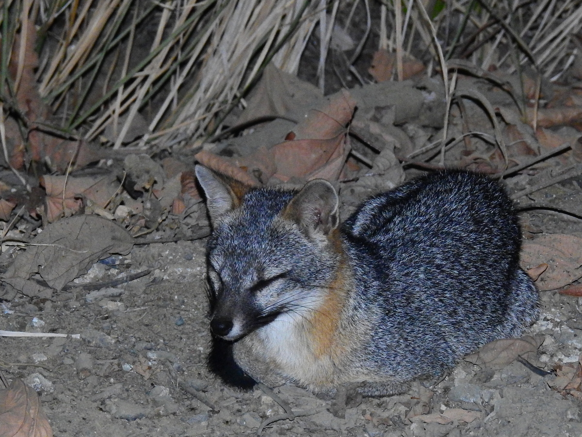
It’s amazing so close to civilization and with all of the luxury home development going on but we’ve seen Margay (Leopardus wiedii – jungle cats similar to Ocelots), Gray Fox (Urocyon cinereoargenteus) and even the rare Spider monkeys as well as large troops of Howlers and Capuchin. Toucan, Trogons and dozens of other birds are abundant and easy to see in the gallery forests.
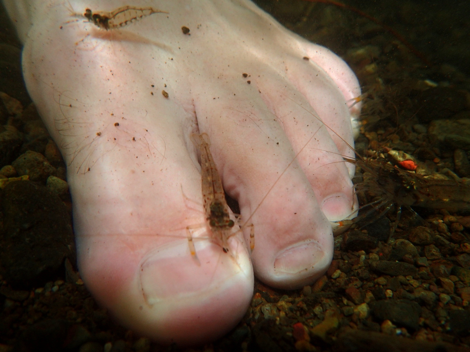
As a bonus for climbing the steep hill there’s a waterfall where you can take a dip near the bottom of the trail. If you sit still long enough dangling your feet in the pool tiny freshwater shrimp will discover your toes and pinch away in a ticklish pedicure.
Some of Costa Rica’s other best natural areas are within an hour drive of Hermosa/Mala including Manuel Antonio, Carara National Park, La Cangreja National Park, and Rainmaker Biological Reserve
The three Esterillos Oeste, Centro and Este each have distinct personalities and between them offer dozens of small hotels, air B&Bs, restaurants and bars. There are many vacation homes for rent in the hills above the beaches as well as backing the Wildlife Refuge adjacent to the Araya family ranch.
Jacó is one of Costa Rica’s largest and liveliest beach towns. Once best known for prostitution, gambling, drugs and debauchery it’s really cleaned up it’s act in the past ten years and is now one of our favorite places in Costa Rica when we’re looking to spend some urban time.
east | west | getting there | best time | nearby | lodge | hills | photos