We frequently get questions about route finding from visitors planning to drive in Costa Rica where geography, weather, and (lack of) infrastructure can conspire to make it surprisingly difficult to get “there”.
We recommend a three pronged approach which includes a good map for the overview, Waze for turn-by-turn directions, and asking early and often about local conditions.
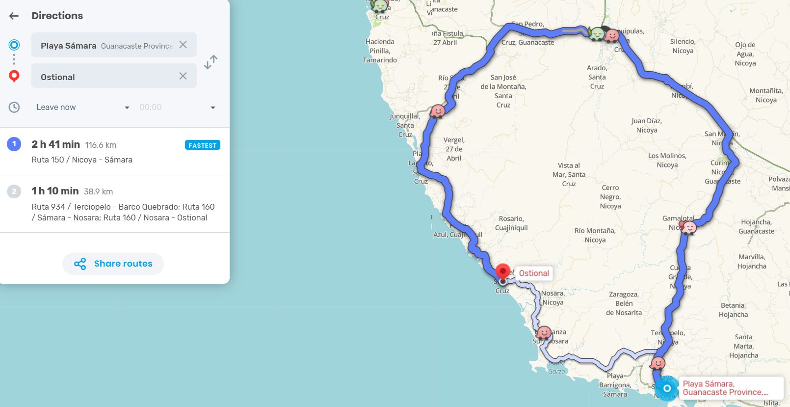
Like all of Google’s products Waze uses nifty algorithms, machine learning and artificial “intelligence” to decide what’s best for you. Sometimes – like the image above where the recommended route avoided flooded rivers – that’s good. Other times it can be sketchy.
Waze takes into account official road closures, traffic patterns and user contributed hazard alerts but mainly relies on GPS data from moving phones to determine the best route.

Tico’s are some of the most extreme drivers in the world – extremely bad on streets and highways but extremely skilled at traversing seemingly impassable roads. I’ve crawled to the top of a mountain on a 4WD track in a Land Cruiser only to find a Costa Rican family setting out a picnic on the hood of their Honda Accord.
Waze tracks the locals and won’t hesitate to suggest their possibly quite difficult route to you.
Wrong Waze?
We were taking the back road (route 301) from our friend’s coffee farm to Playa Hermosa a few years ago after tropical storm Nate washed out roads all over the Pacific side.
We’ve done the drive several times so weren’t concerned with routing but Sue was in the navigator’s seat with Waze pulled up to monitor road conditions. Unfortunately so few people travel this way that there was no data about the 50 meter wide, 15 meter deep crevasse carved out by storm runoff in the stream outside Cangrejo. We ended up turning around half way down the mountain.
The alternate route through Santiago de Puriscal adds about two hours to the drive but could have been even longer without Waze.
We were about half way to Santiago when Sue said “Oh crap. Waze shows a bridge out on the road ahead…oh wait there’s a way around…turn right here.”
I said “¿ right… here?” as I looked up the hill at a gravel strewn riverbed “this isn’t a road”.
I locked it in “double” four wheel low, dropped the big diesel V8 into granny gear and turned right.
It was less than a kilometer and after a bit of skidding and grinding we pulled out onto another paved road where I was barely surprised at all to see a Tico family with a picnic basket in the back of their Honda Accord waiting to turn down into the riverbed.
We’re confident making judgement calls on Waze recommended routes – after all we literally make the map of Costa Rica – but generally we recommend newbies follow their suggestions.
Oh, and don’t forget to smile and wave to the Bueyero because you may need him down the road. We’ve seen a pair of oxen move a semi that was stuck in the mud.
All Roads Lead to San José
There are other surprises awaiting the unsuspecting traveler when considering transportation in Costa Rica. For example almost literally, all roads lead to San José.
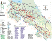
Take a look at the map linked in the image to see what we mean. It’s a PDF so you can also download and print it for sketching in possible routes, taking notes or even (it’s current, accurate and has enough detail for almost any trips) use it to navigate when you arrive.
For example, Monteverde Cloud Forest Reserve and Arenal Volcano National Park are two of the most popular destinations for travelers to Costa Rica and they’re only 15 km apart as the crow flies. Unfortunately as the cliché goes on to note, we’re not crows. Vehicle traffic must travel more than 100 km and four hours circumnavigating Lake Arenal on alternately paved and rugged roads.
Public buses make the trip in around eight hours and require a change at Tilarán. Most people could walk the 15 km straight line distance in significantly less than eight hours (if it weren’t also straight up and dense jungle).
Fortunately there are alternatives. Several local hotels and tour operators offer minibus/boat/jeep or minibus/boat/horseback options that not only cut hours off of the travel time but also pass through some beautiful forests and provide spectacular views.
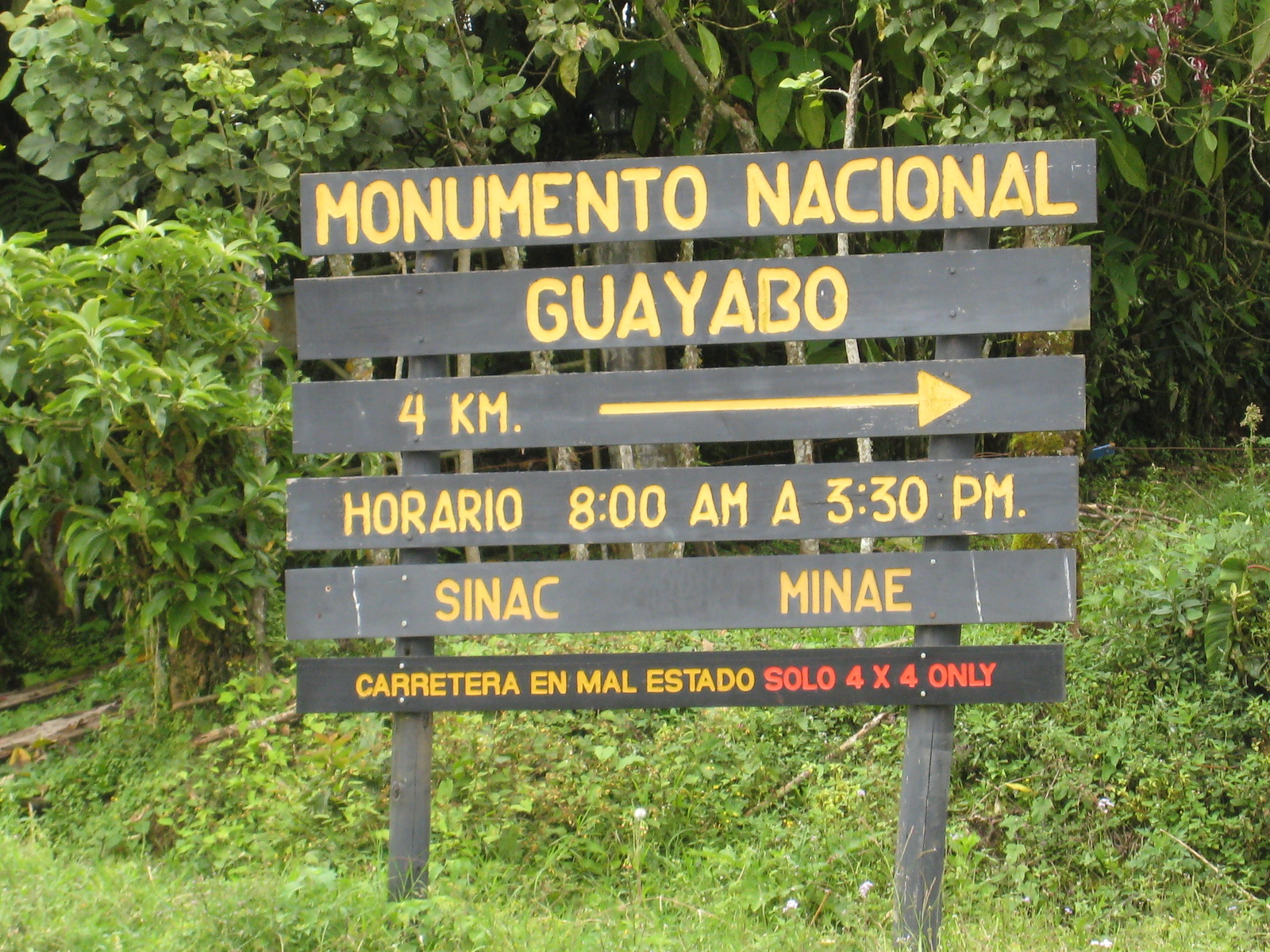
No Roads or Seasonal Roads
Other destinations where transportation alternatives are important to consider include Tortuguero National Park (air or boat access only), Corcovado National Park and especially the northern gateway Drake Bay (roads impassable in the rainy season), the southern Nicoya Peninsula (ferry or overland), border crossing to Panama or Nicaragua (illegal to take a rental car across).
Make Life Simpler – Choose Destinations First
It will be much easier if you just decide where you want to go and what you want to see and do then worry about transportation later. There’s almost always some reasonable way to arrange destinations and plug in transportation between them no matter where you decide to go.
It can also be very helpful to look at pre-made itineraries designed by people with years of experience even if you aren’t planning on using a travel service. Transportation, variety and wow factor are already built in to professional itineraries and there’s no rule that says you can’t do the same on your own.
If you need help, contact us.