The collection of practical, helpful and fun maps of Costa Rica. We’ve been making, buying and studying maps of Costa Rica for over twenty years and these are some of the best we’ve come across. Sources for traffic, road maps, topo, printable downloads, online images, weather and many more.
Just click the thumbnail image or links.
|
|
||
With new online tools and gps location and tracking anyone can make a map of Costa Rica and one of the most useful is made by everyone. We used to maintain a “live” traffic and construction map that was updated by drivers for some of the tourist transportation companies e-mailing or texting us with conditions and us adding it to the map.
WAZE (see link above) has changed all that and now tracks tens of thousands of phones as they move around Costa Rica and calculates traffic based on how fast they are moving. I know, I know, Google and Apple have been doing this forever in the U.S. and Europe but Costa Rica is always a decade or so behind…¡Pura Vida!
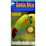
It’s been great for us because although GPS mapping and routing is getting better in Costa Rica it’s still unreliable enough that the sales of our printed Waterproof Travel Map are increasing faster than ever. Once people are good and lost they can reach in the glove box and pull out the big picture, re-orient and head back out on the road.
If you run across a particularly interesting map of Costa Rica we’d love to hear about it.


