Costa Rica Guide

travel information and maps

  • Vacation Planning
  • Best Trips Ever>>
  • More Fun Than Humanly Possible
  • Costa Rica
    • Top Ten
    • Best Time to Visit Costa Rica
    • Things To Do in Costa Rica
    • Maps
    • Transportation
      • Rental Cars
        • Advantages of Driving
        • Disadvantages Driving
        • Code of the Road
        • Navigation & Drive Time
        • Rental Insurance Explained
        • Can’t Get There
      • Airports
        • Flights Worth Taking
        • LIR or SJO
        • Airfare Deals
        • Domestic Airlines
        • Domestic Air Tips
      • Taxis
      • Bus Schedule
    • Food
      • Typical Menu
      • Batidos & Refrescos
      • Gallo Pinto
      • Tamales
      • Ceviche
      • Ensalada Palmito
      • Sopa Negra
      • Vinagre Chilera
    • Weather
      • Seasons in Costa Rica
      • Current Storms in Costa Rica
    • Regions
  • Nature & Wildlife
    • National Parks
    • Wildlife Refuges
    • Ecozones
    • Best Places to See Wildlife in Costa Rica
  • Practical Info
    • Health & Safety
      • Health Tips
        • Altitude Sickness
        • Chikungunya
        • Natural Disasters
      • Crime
        • Cons & Rip-offs
        • Corruption
        • Violent Crime
    • Will My Phone Work?
    • Packing List
    • Passports & Docs
    • Money – How To?
    • How Much Does it Cost?
    • Travel Tips
  • Stories
    • Photos
    • Trek Across Costa Rica
    • Sendero de Oro
    • Quebrada Gata
    • Bicycle Touring
    • About Us
  • Move to Costa Rica
  • Free Travel Pack
no obligation custom trip plan & price quote

1-866-816-0197

· Copyright © 2023 ·

Topographical Map Images

Costa Rica Topo map sheets available in the 133 map series
Topo sheets available in the 133 map series

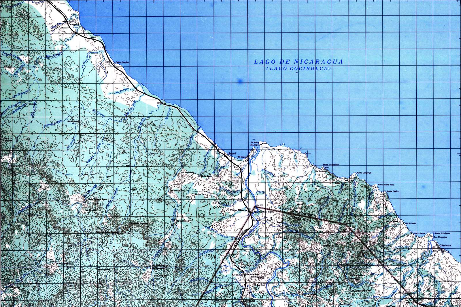
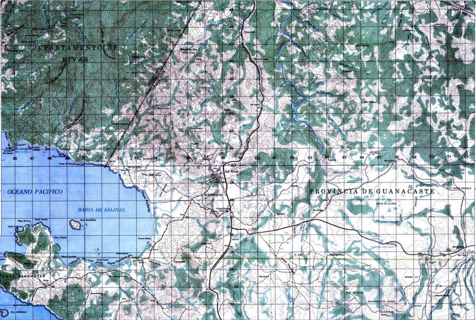
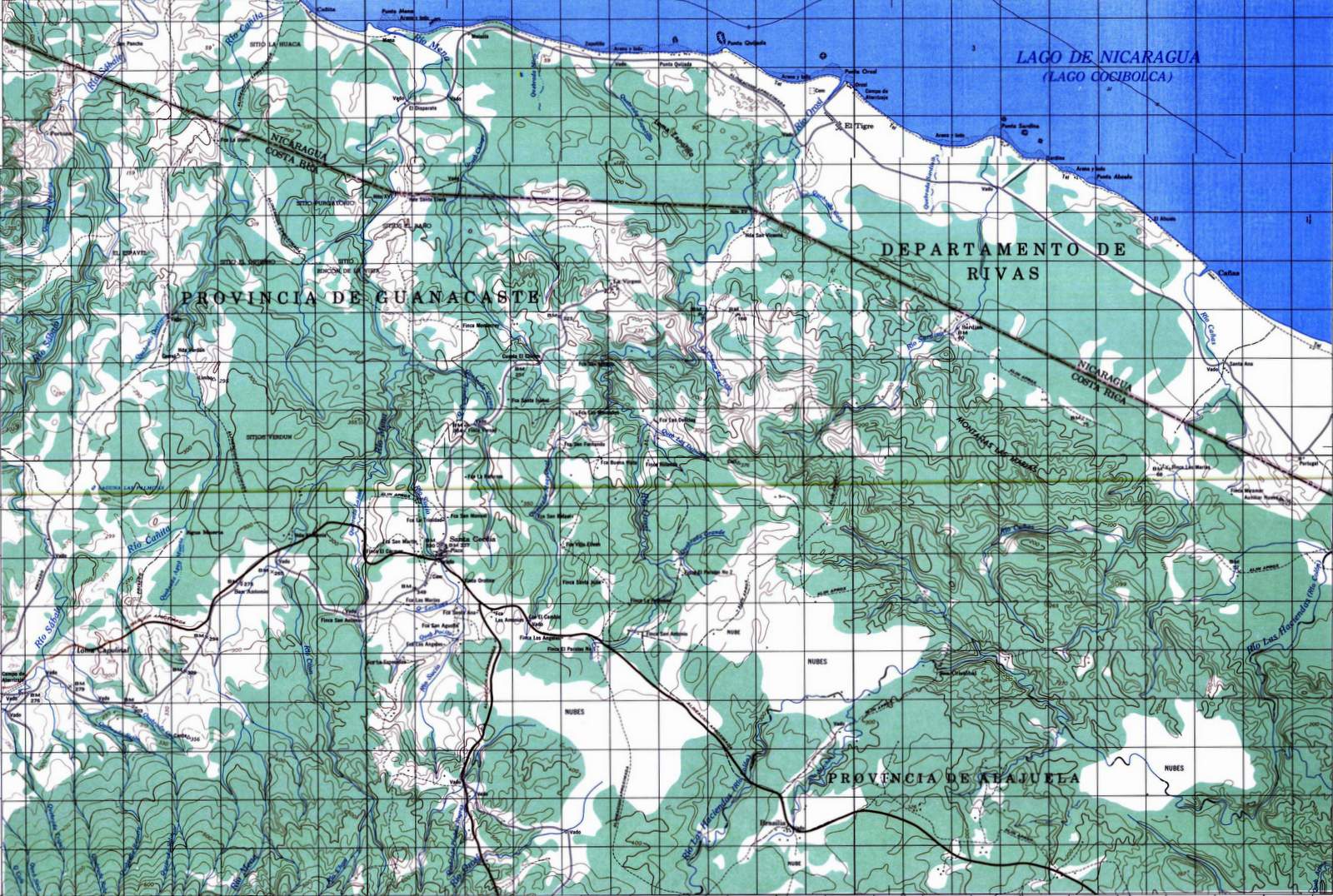
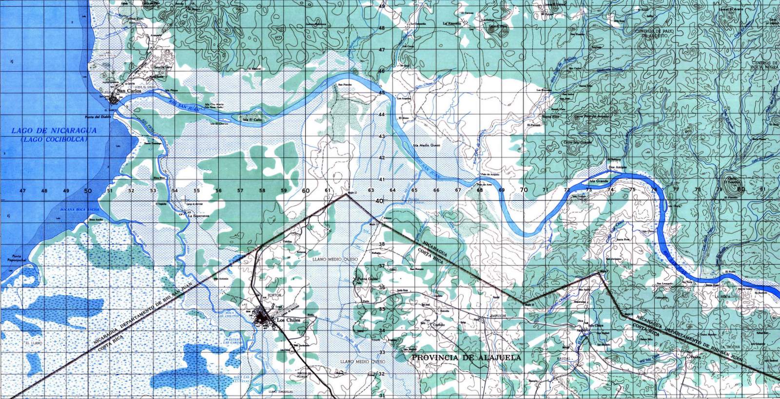
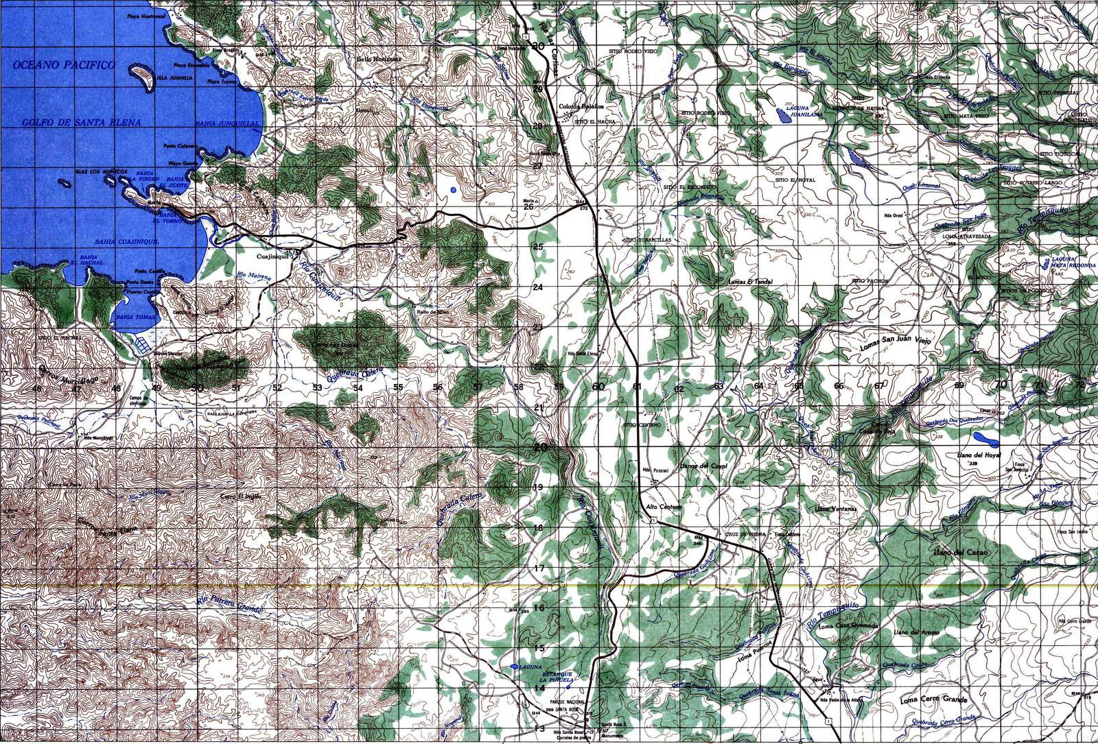
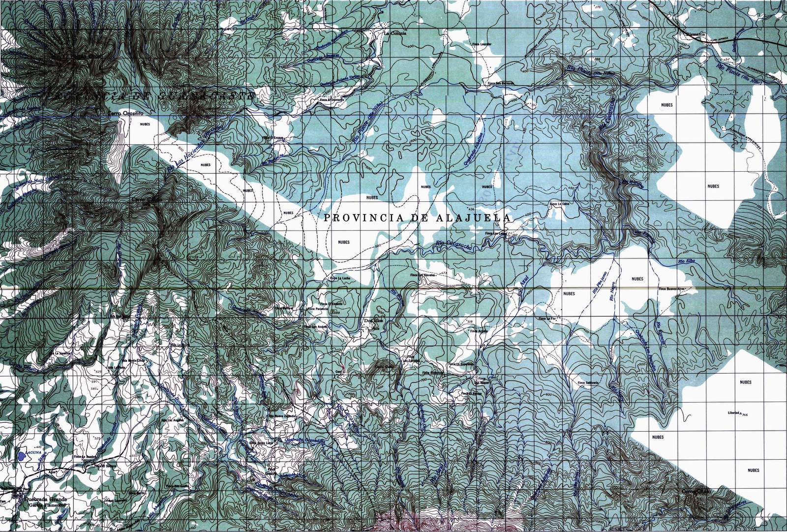
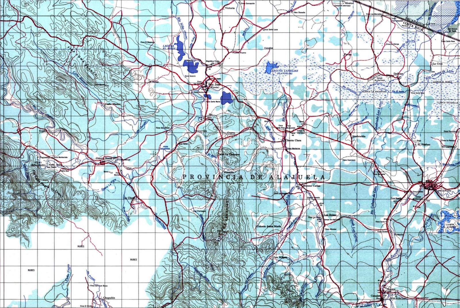
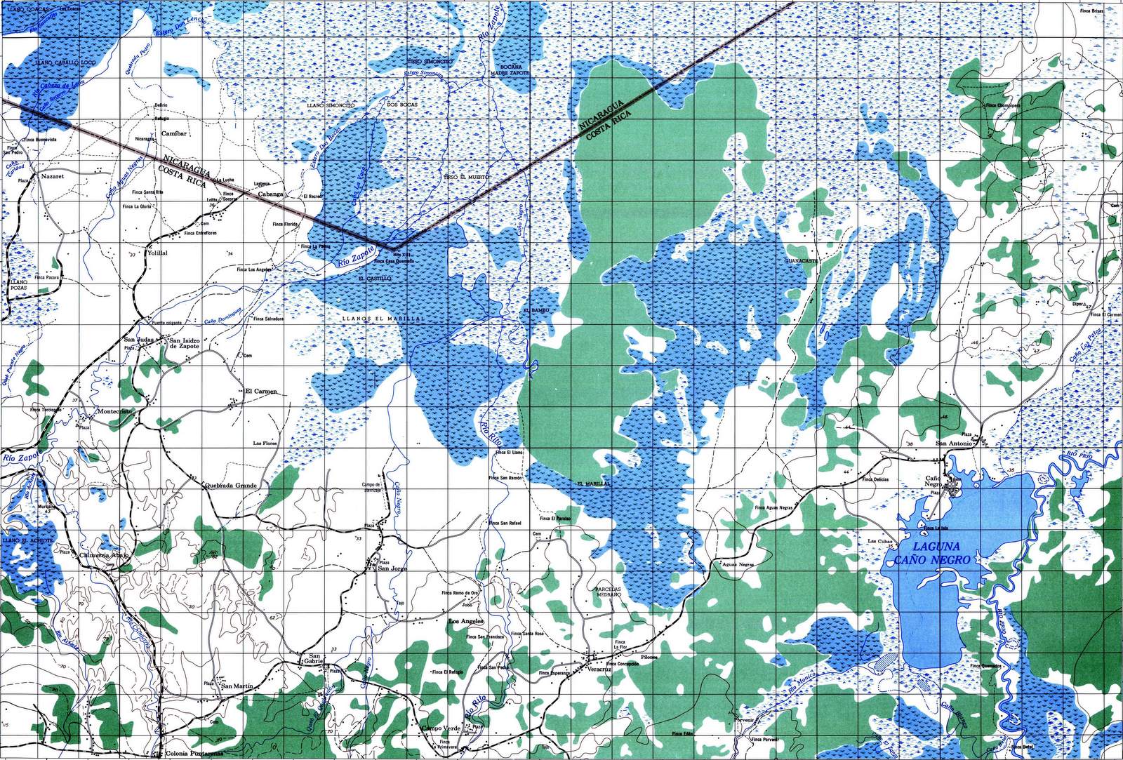
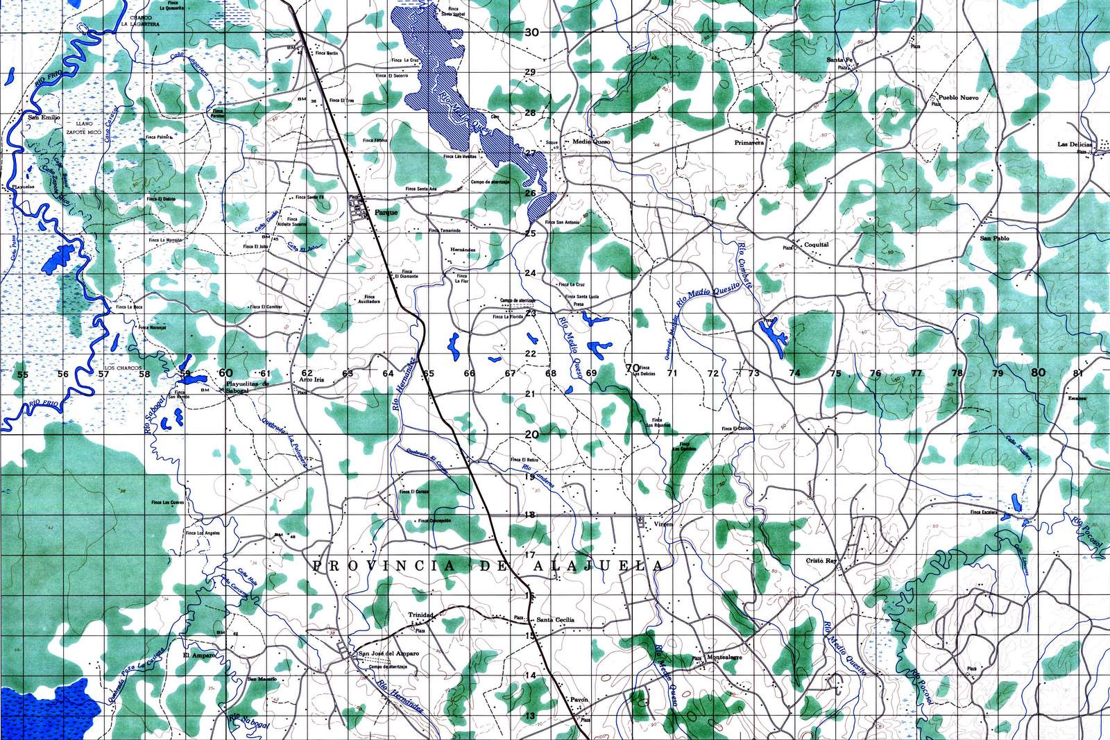
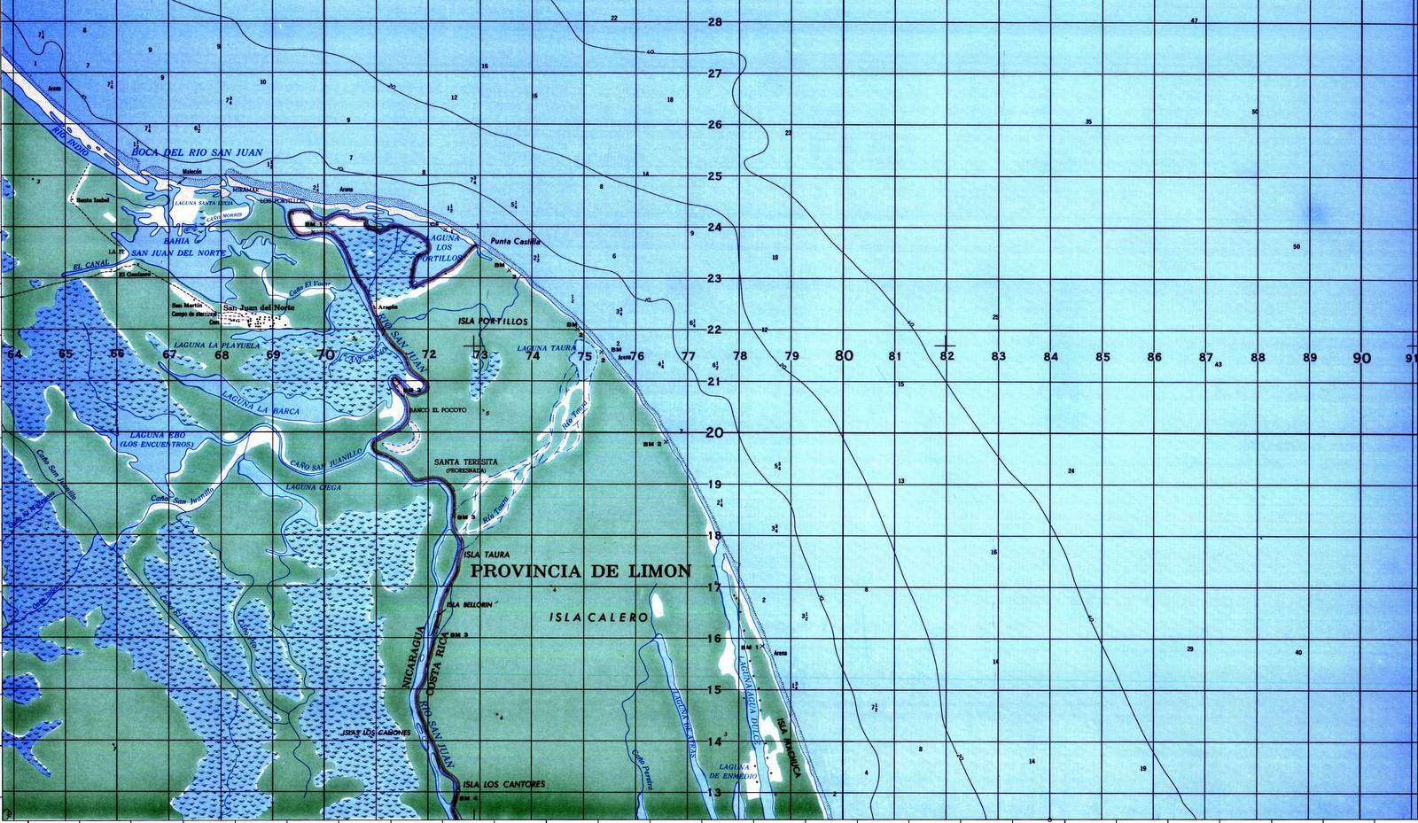
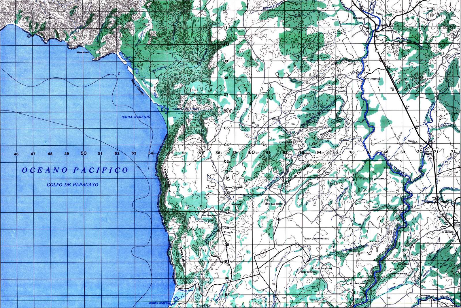
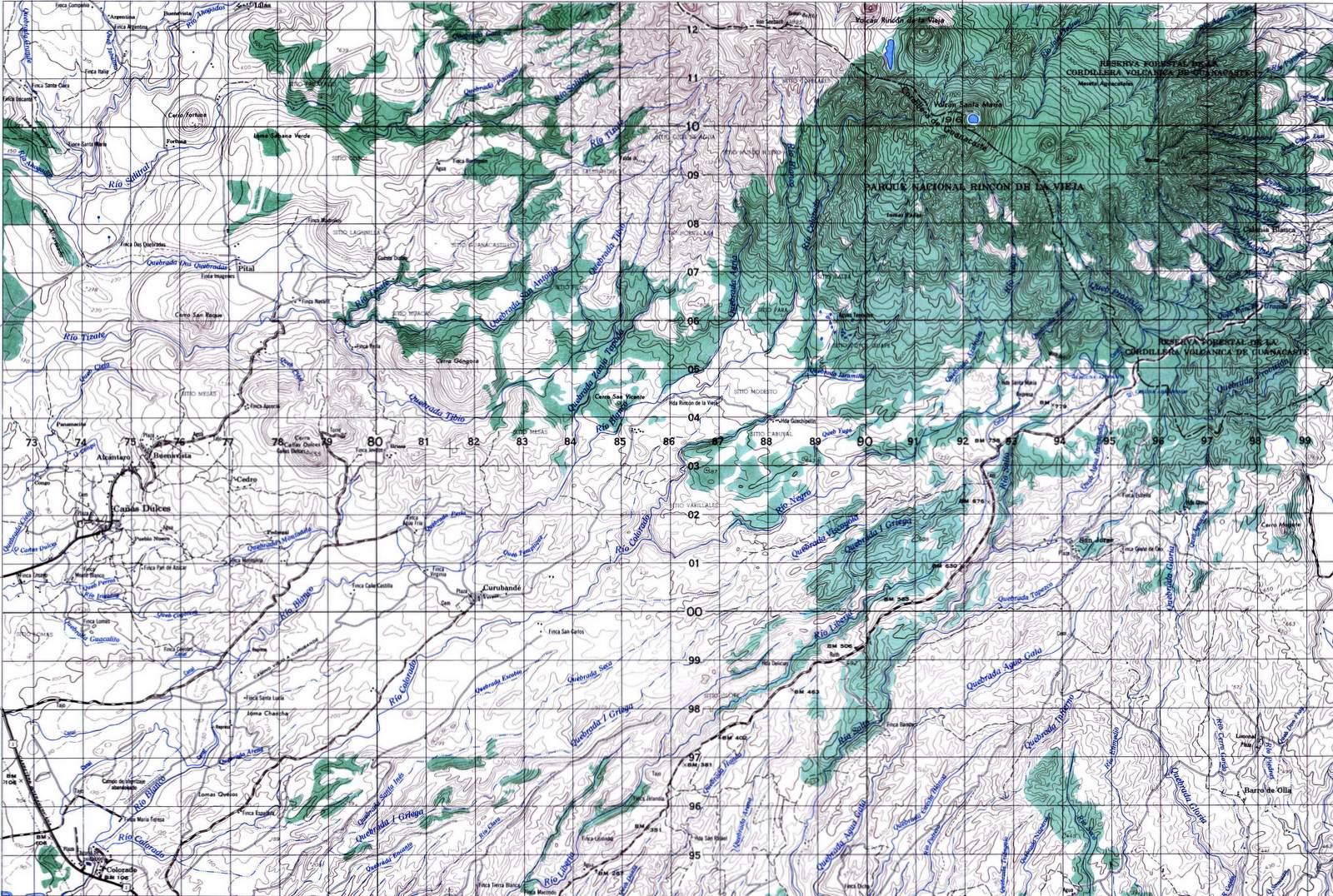
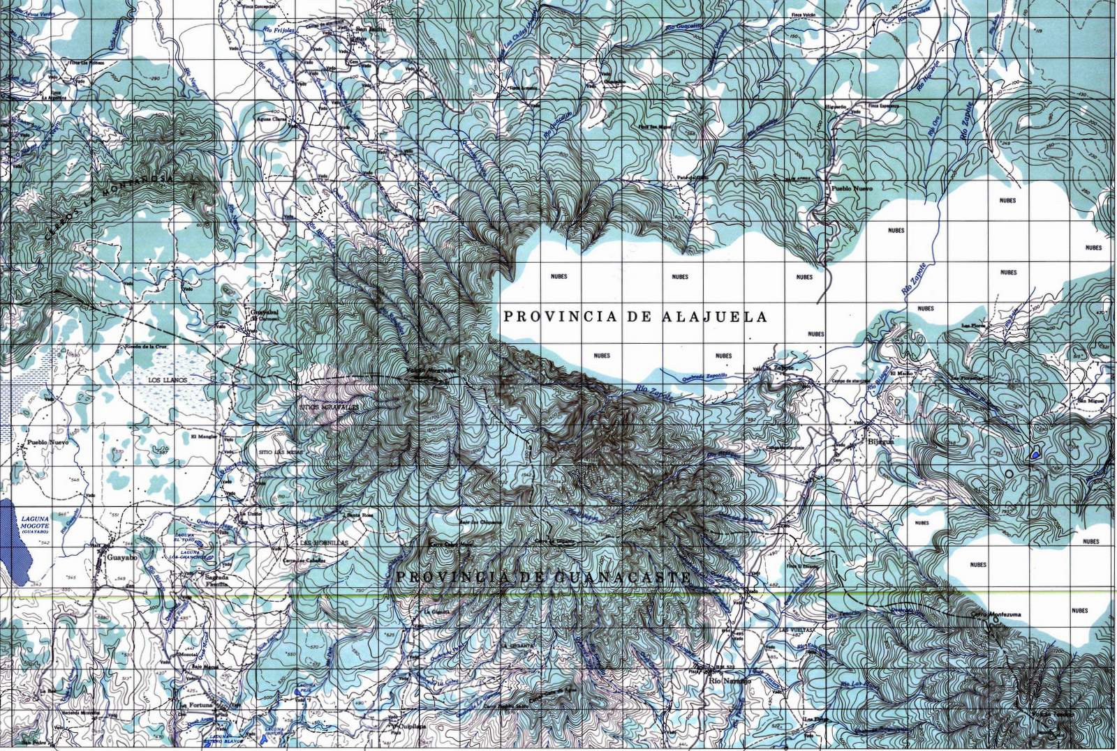
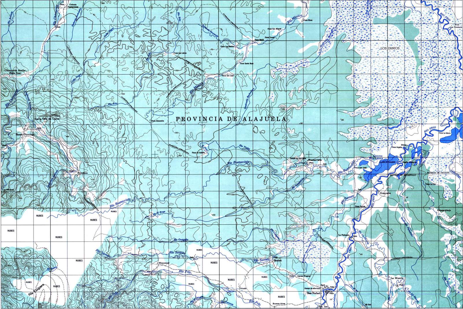
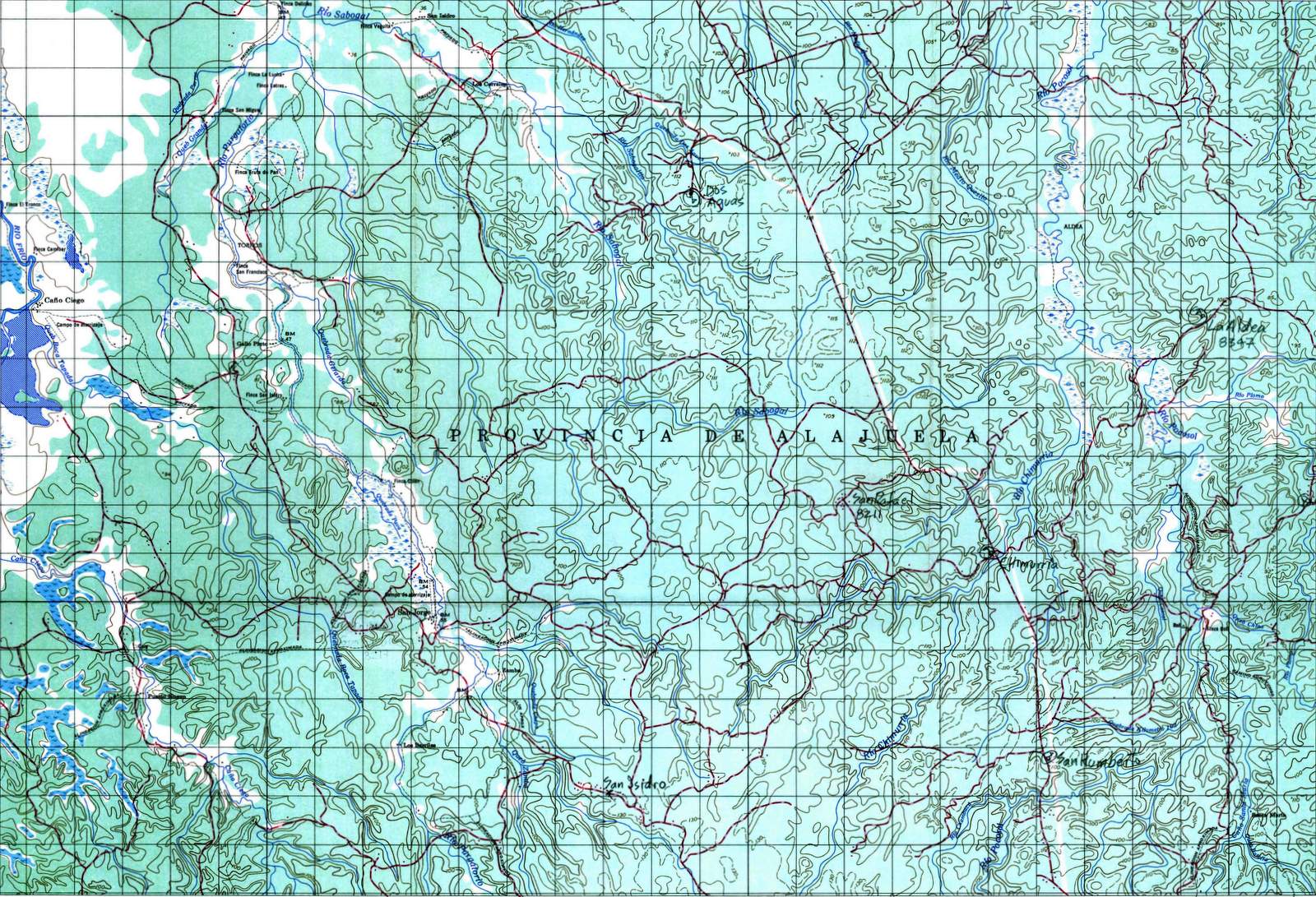
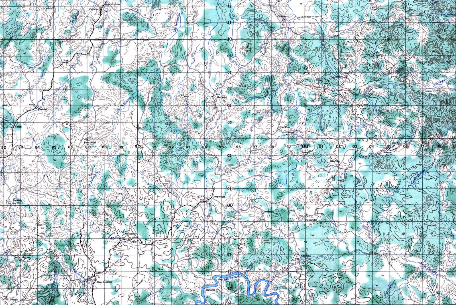
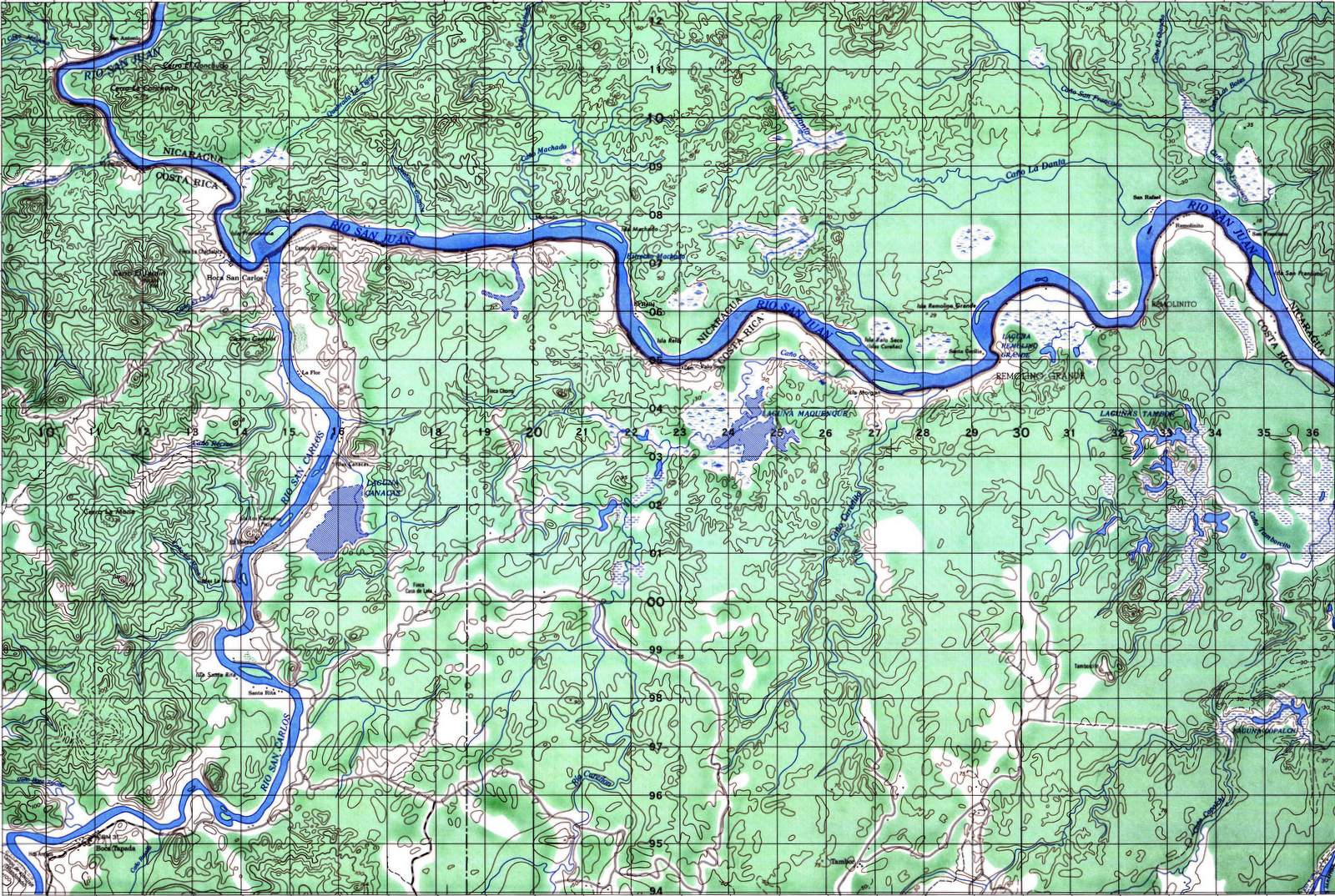
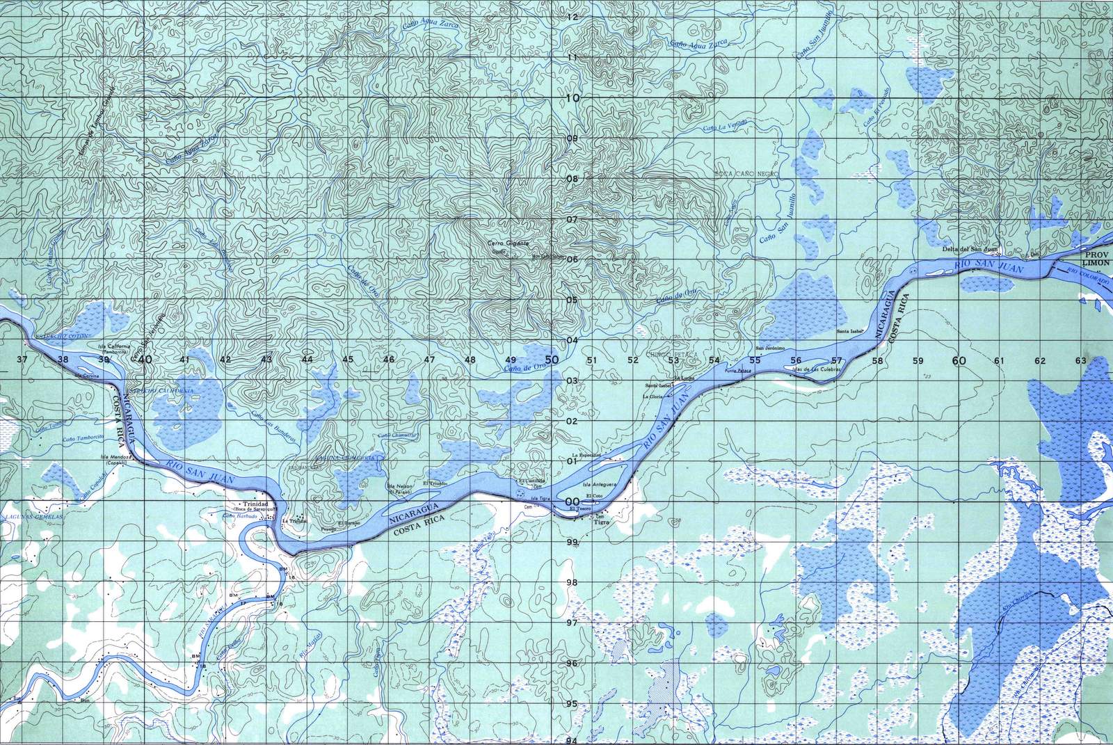
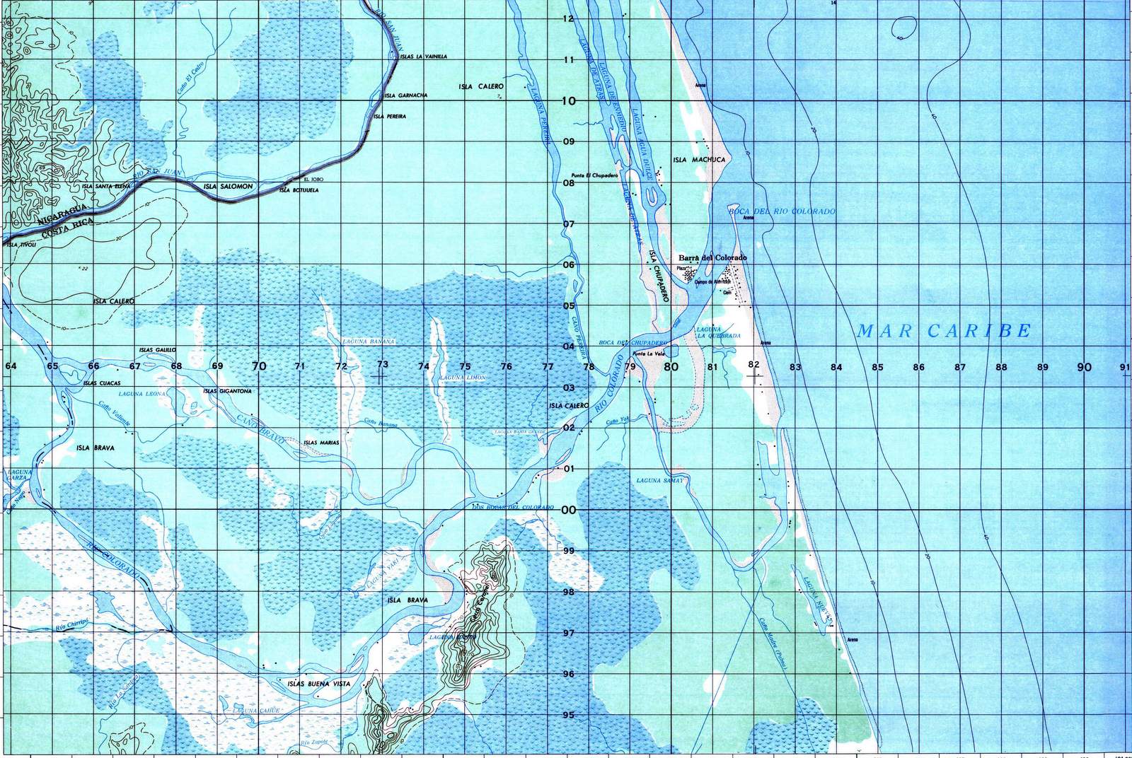
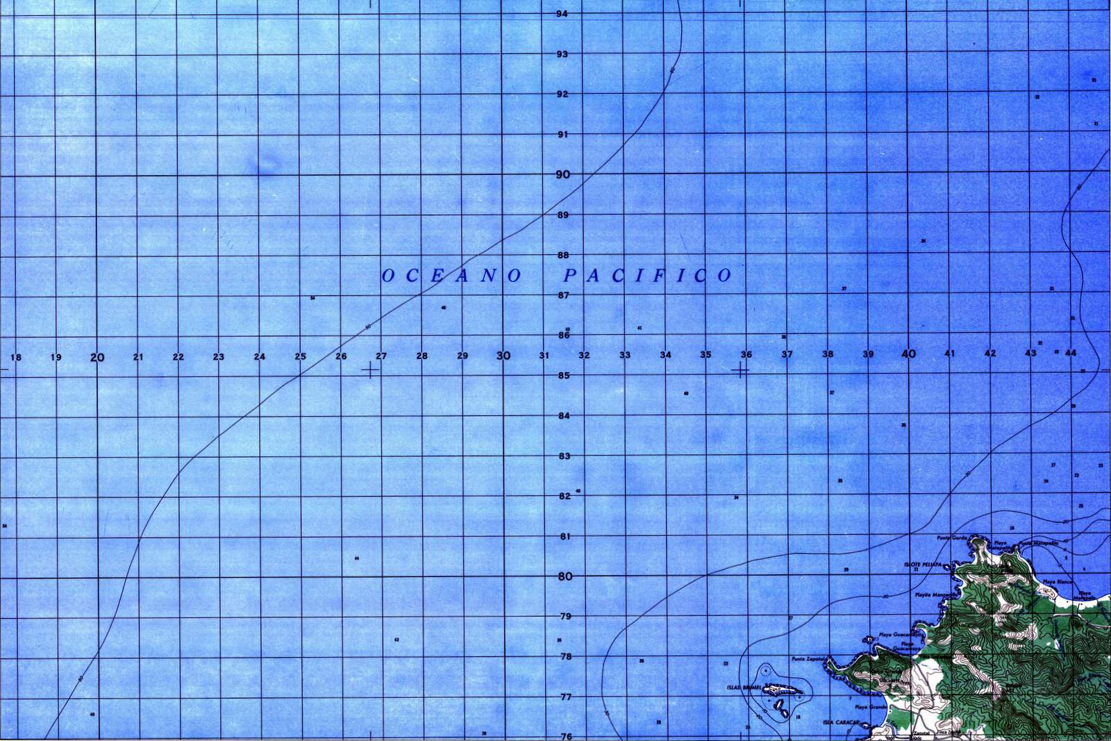
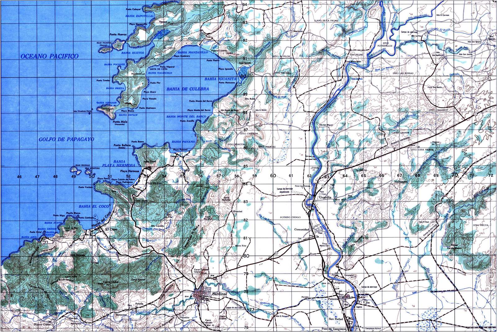
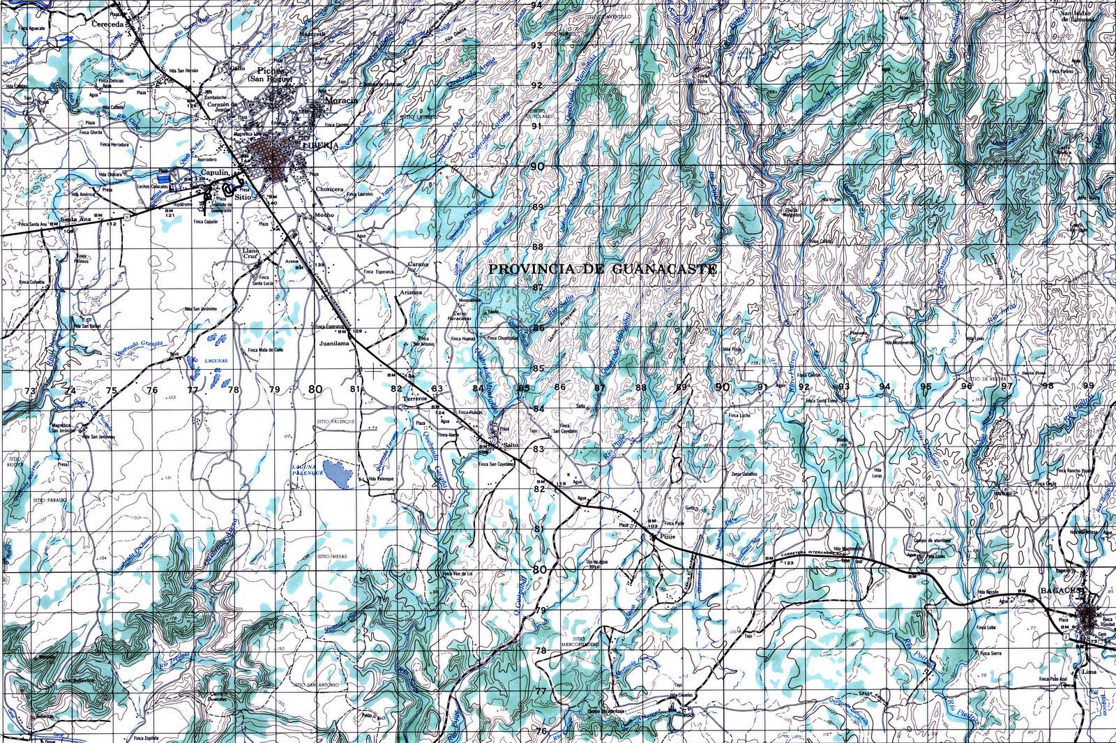
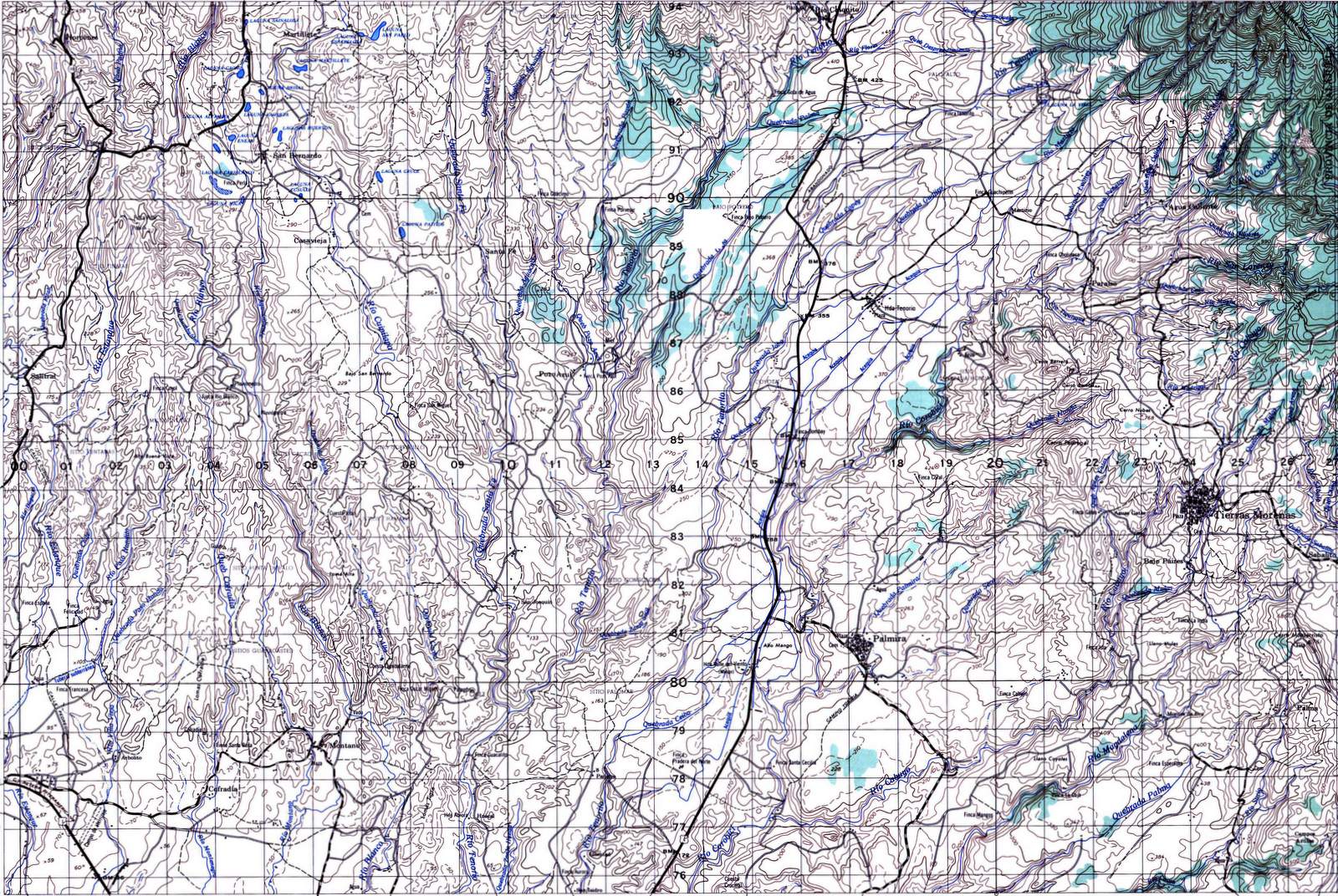
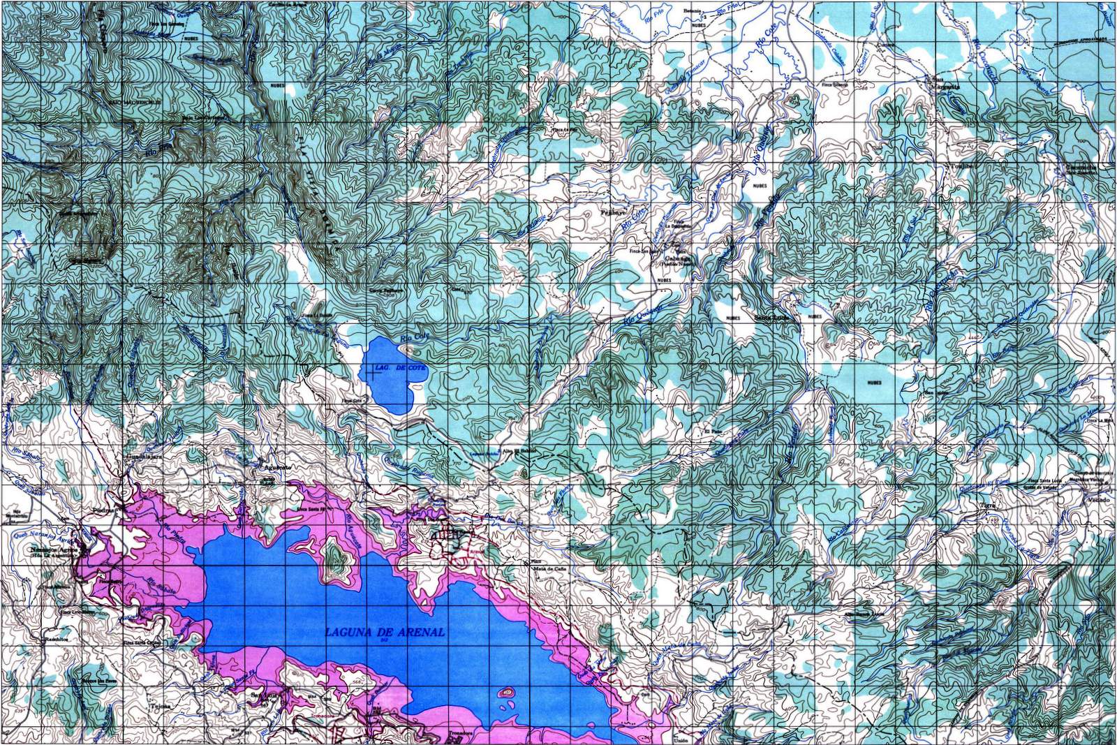
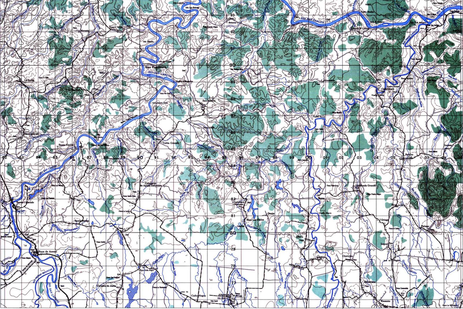
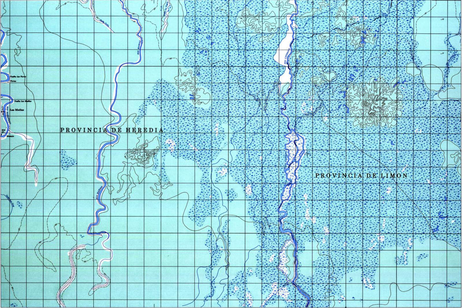
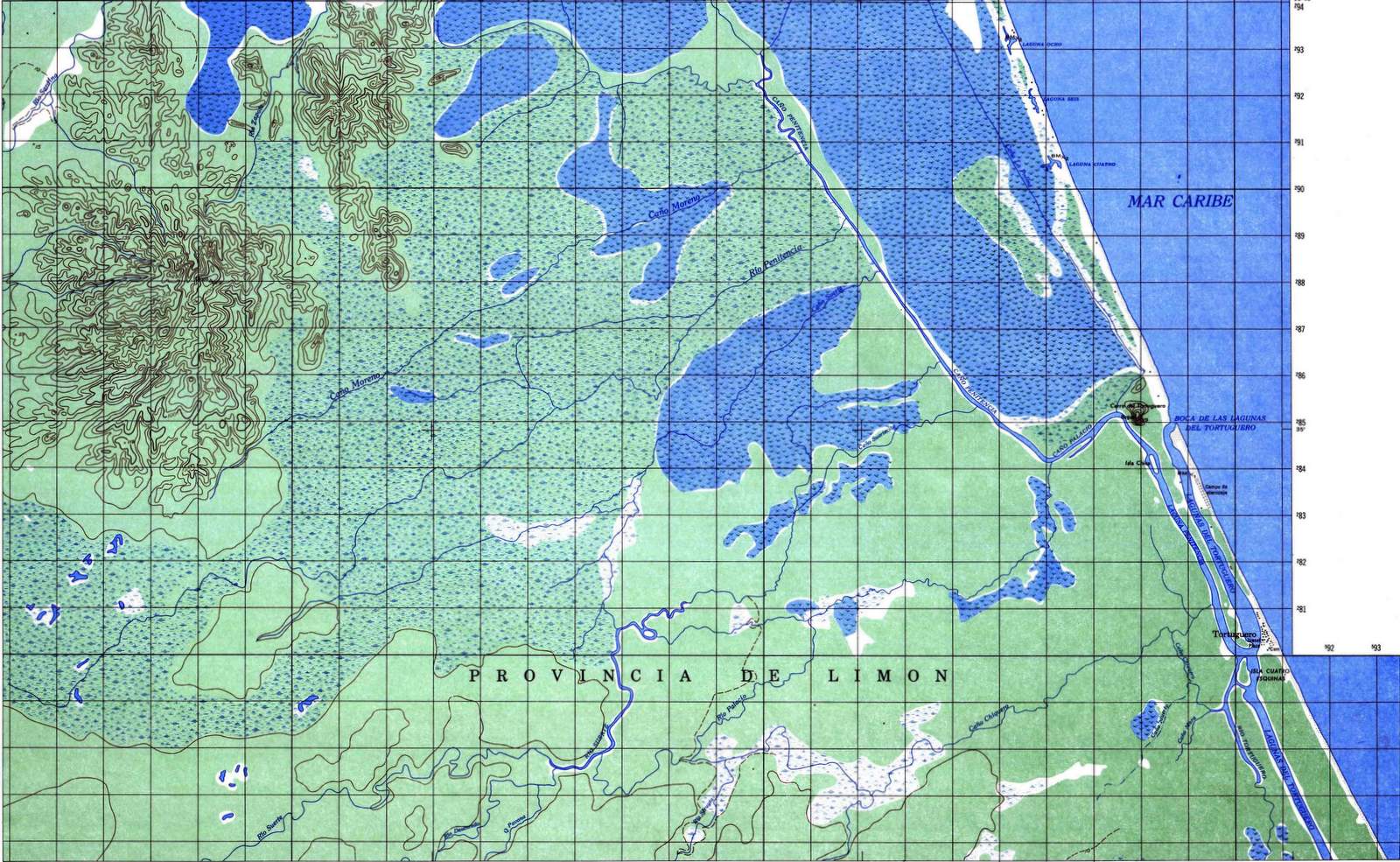
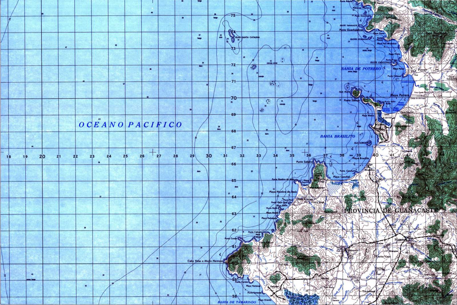
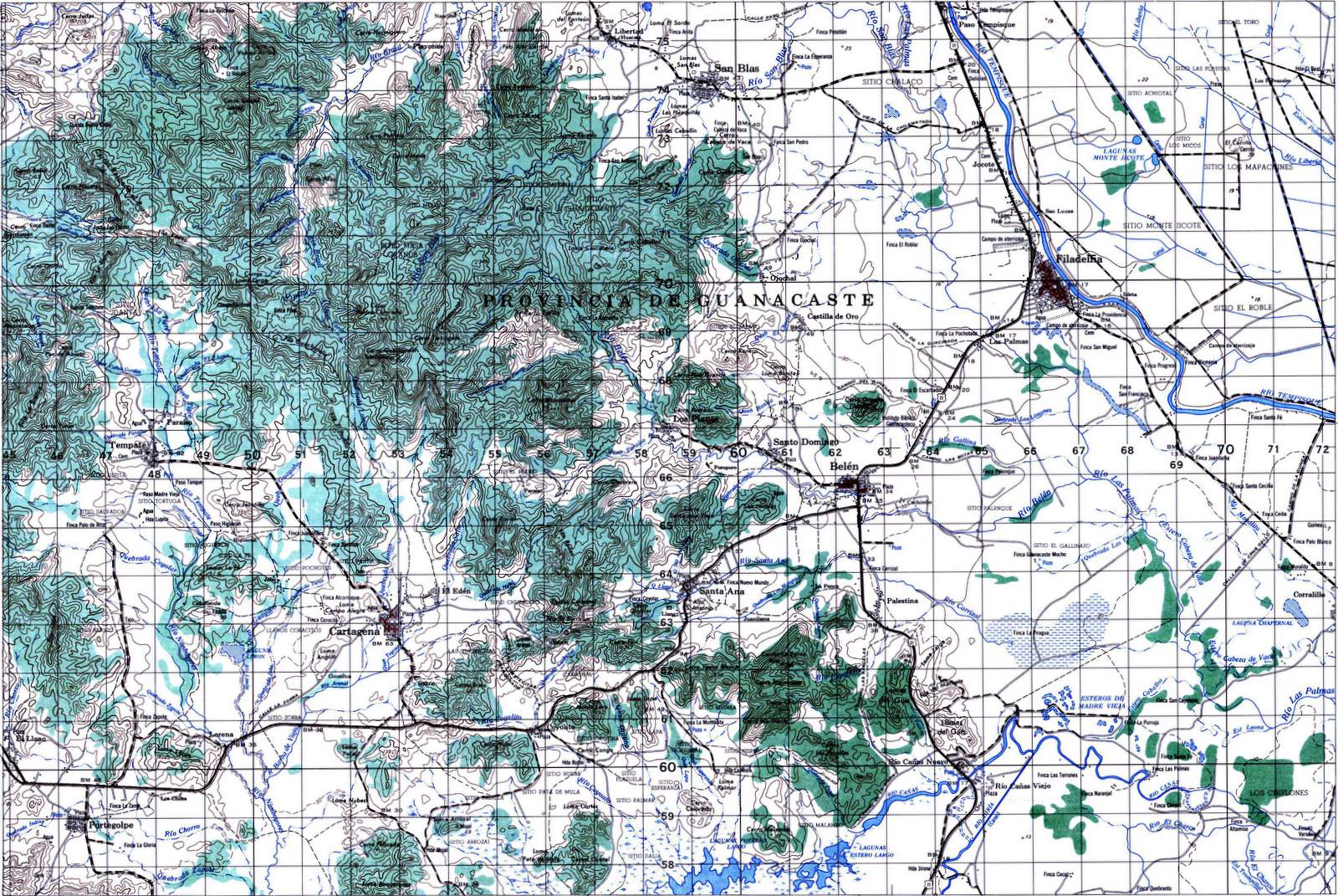
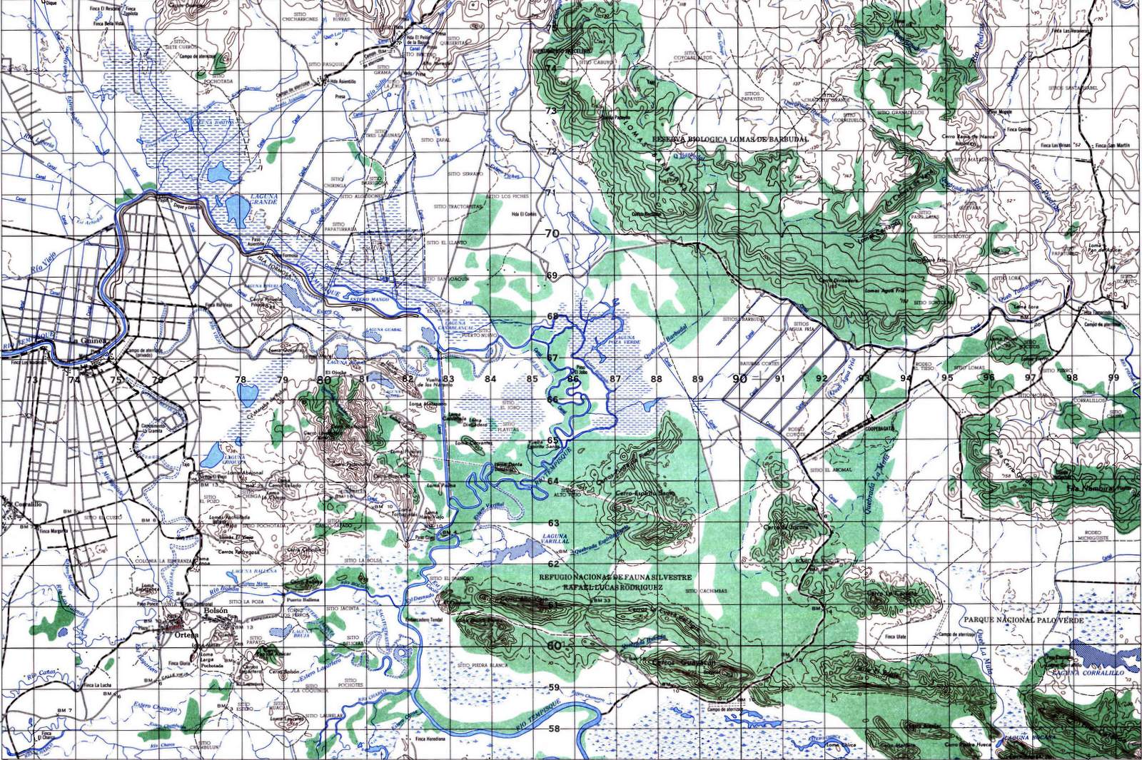
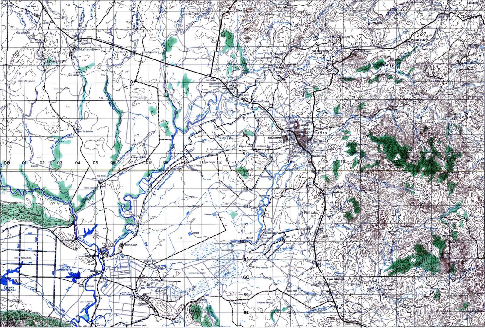
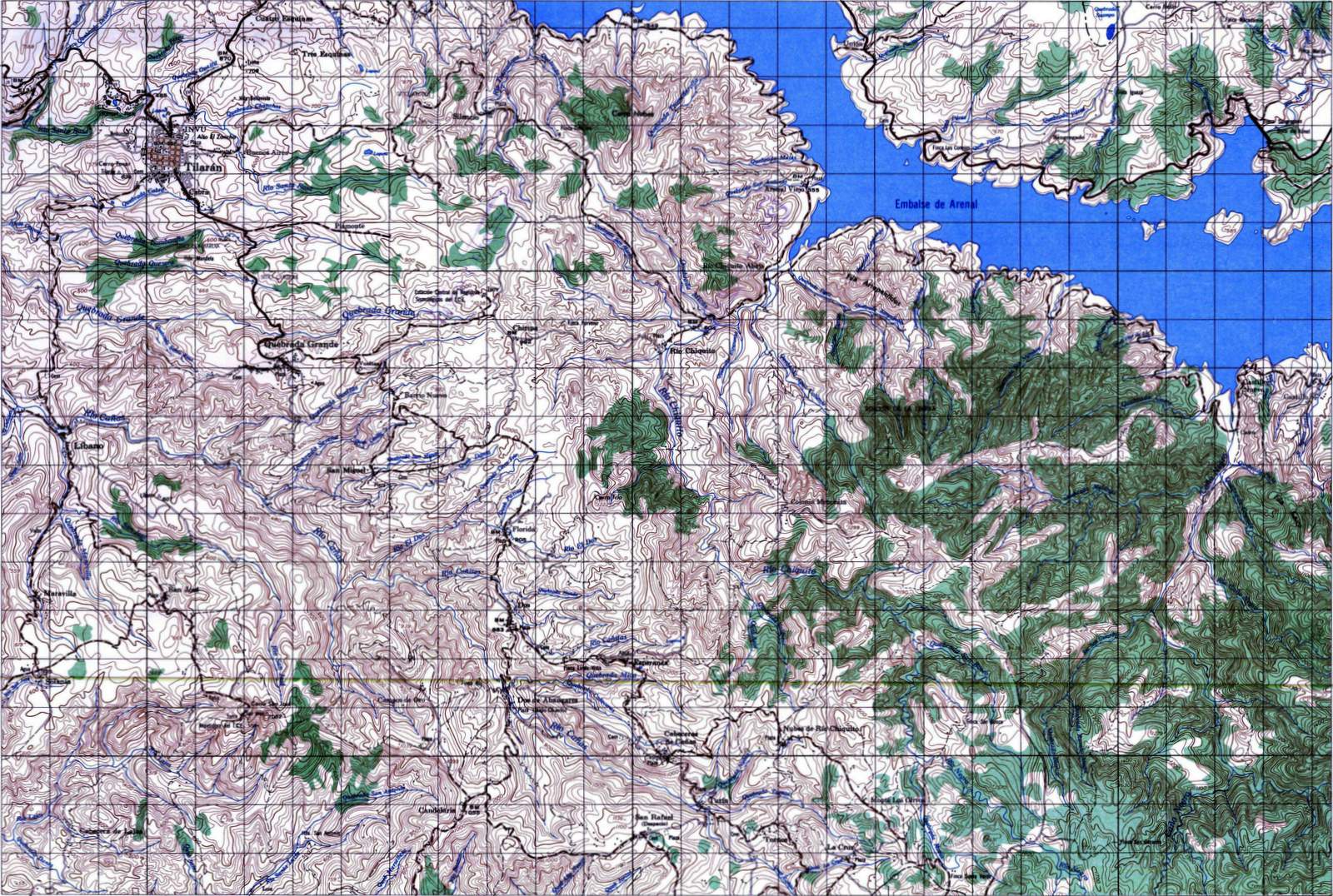
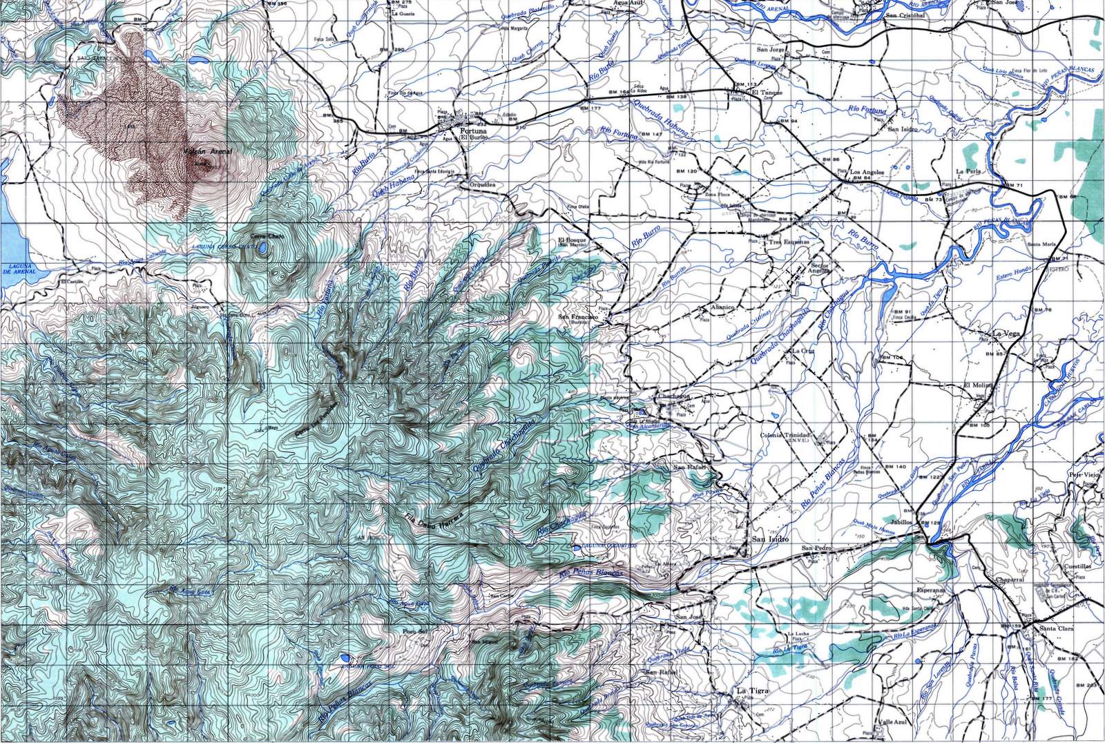
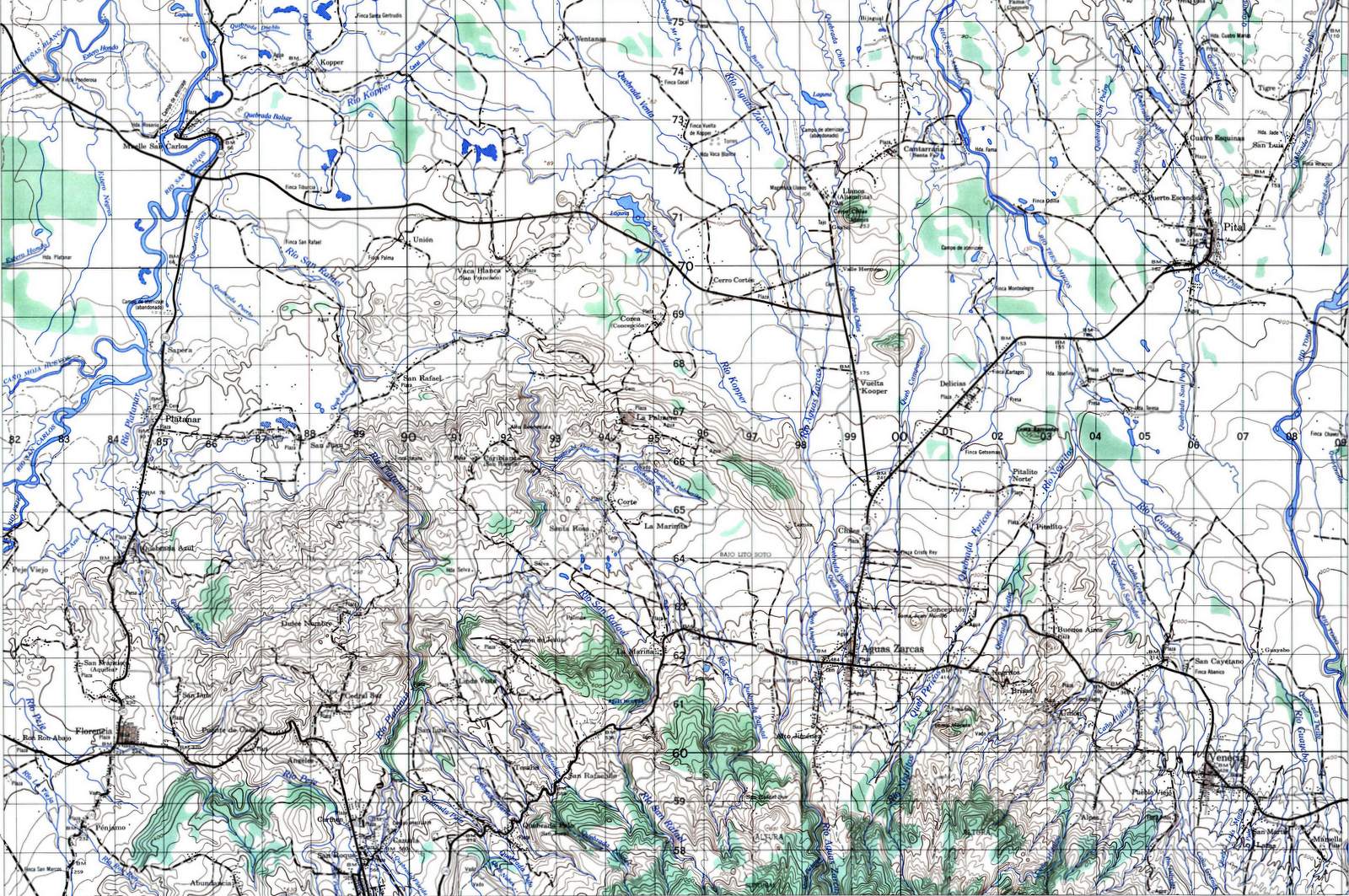
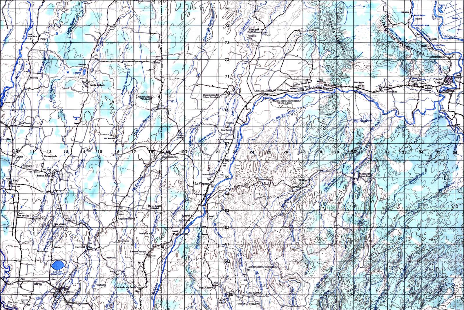
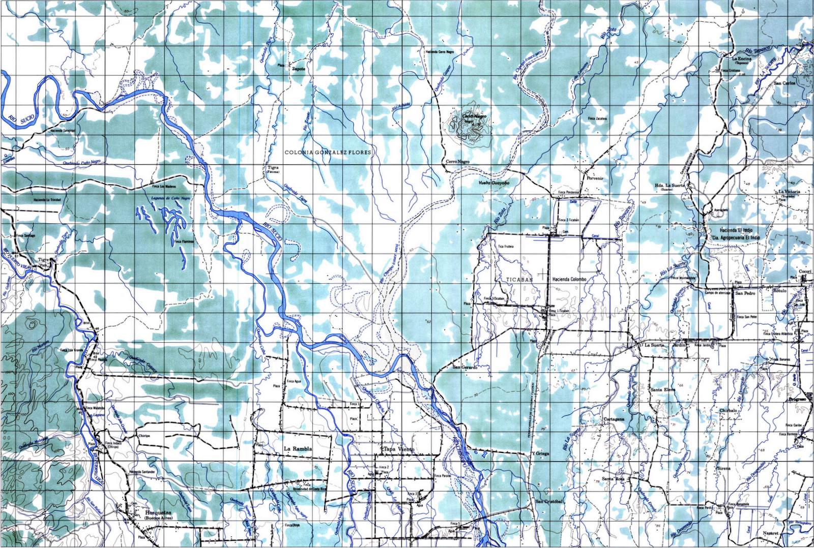
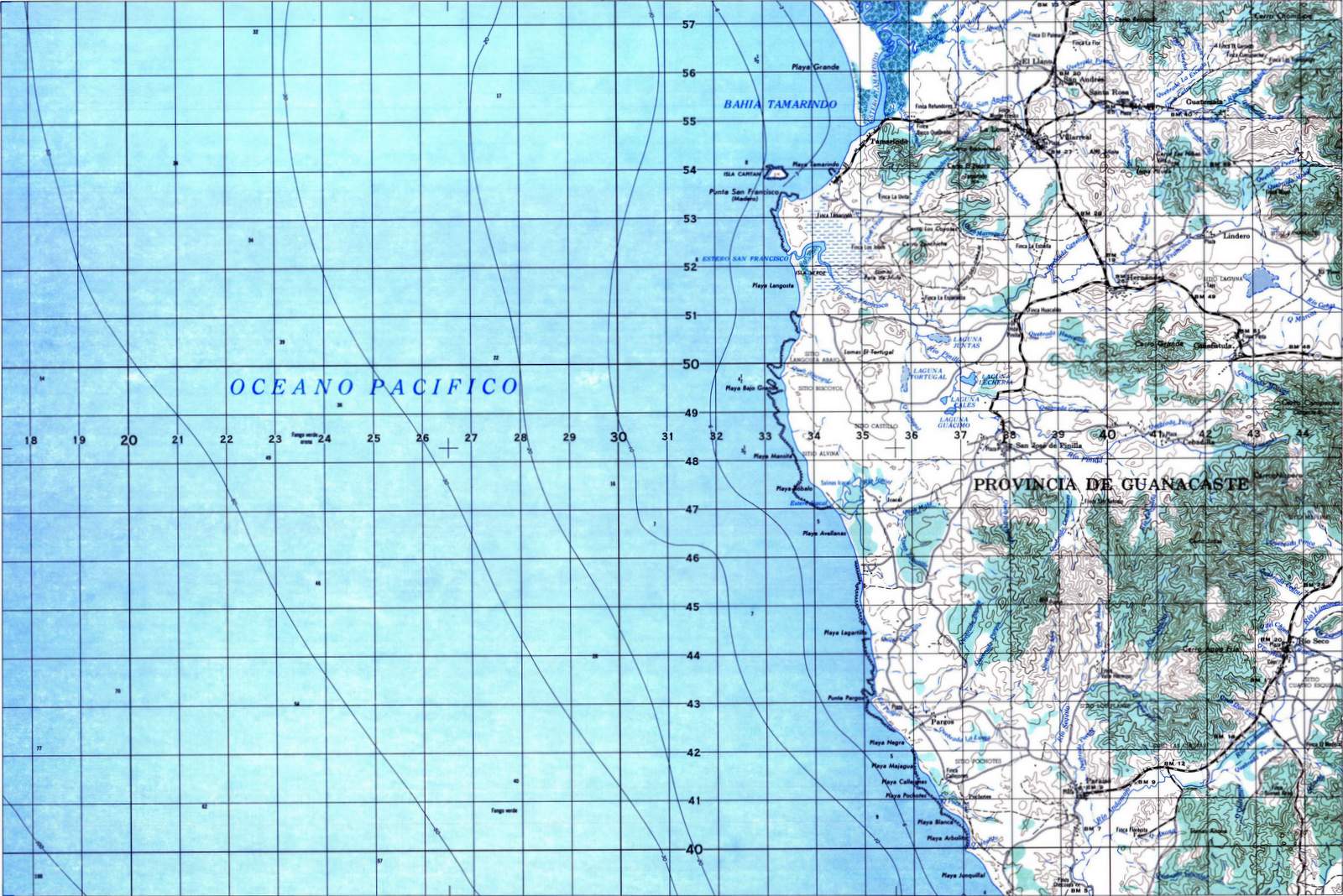
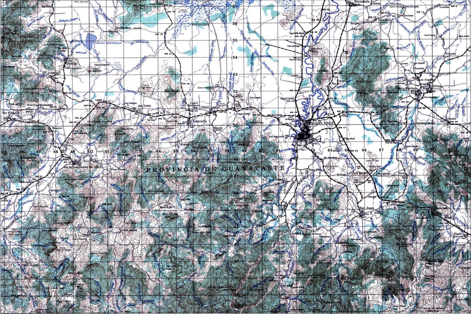
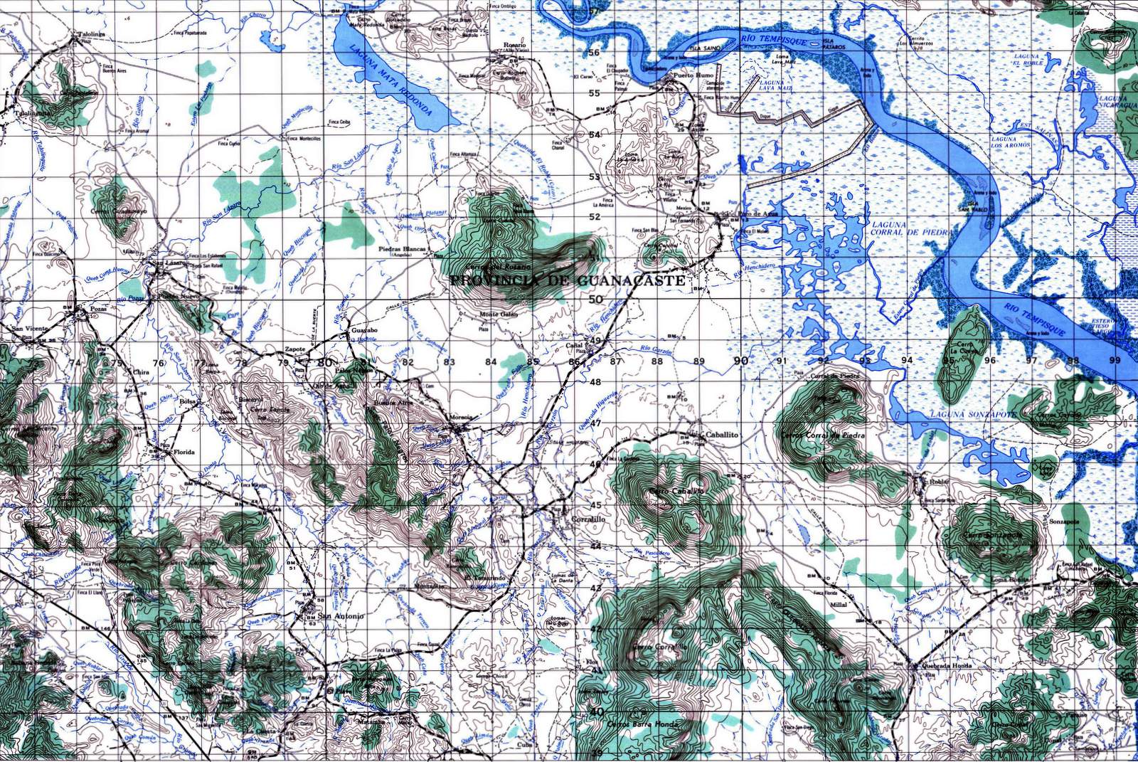
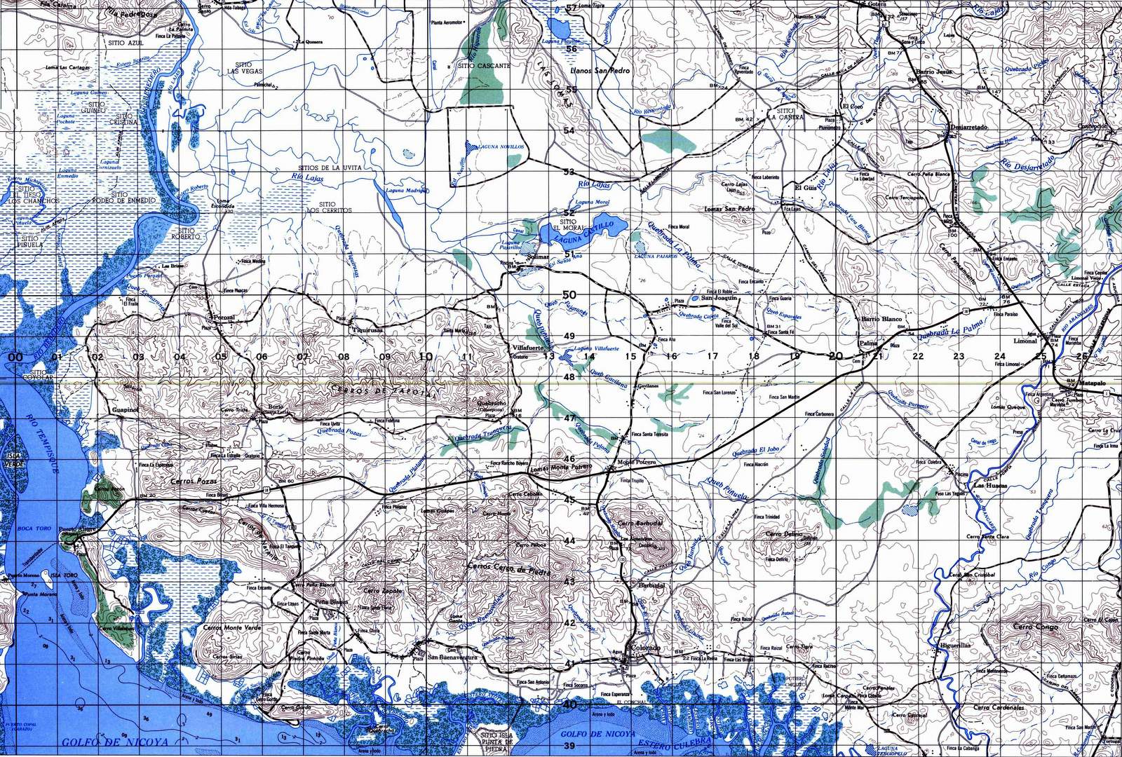
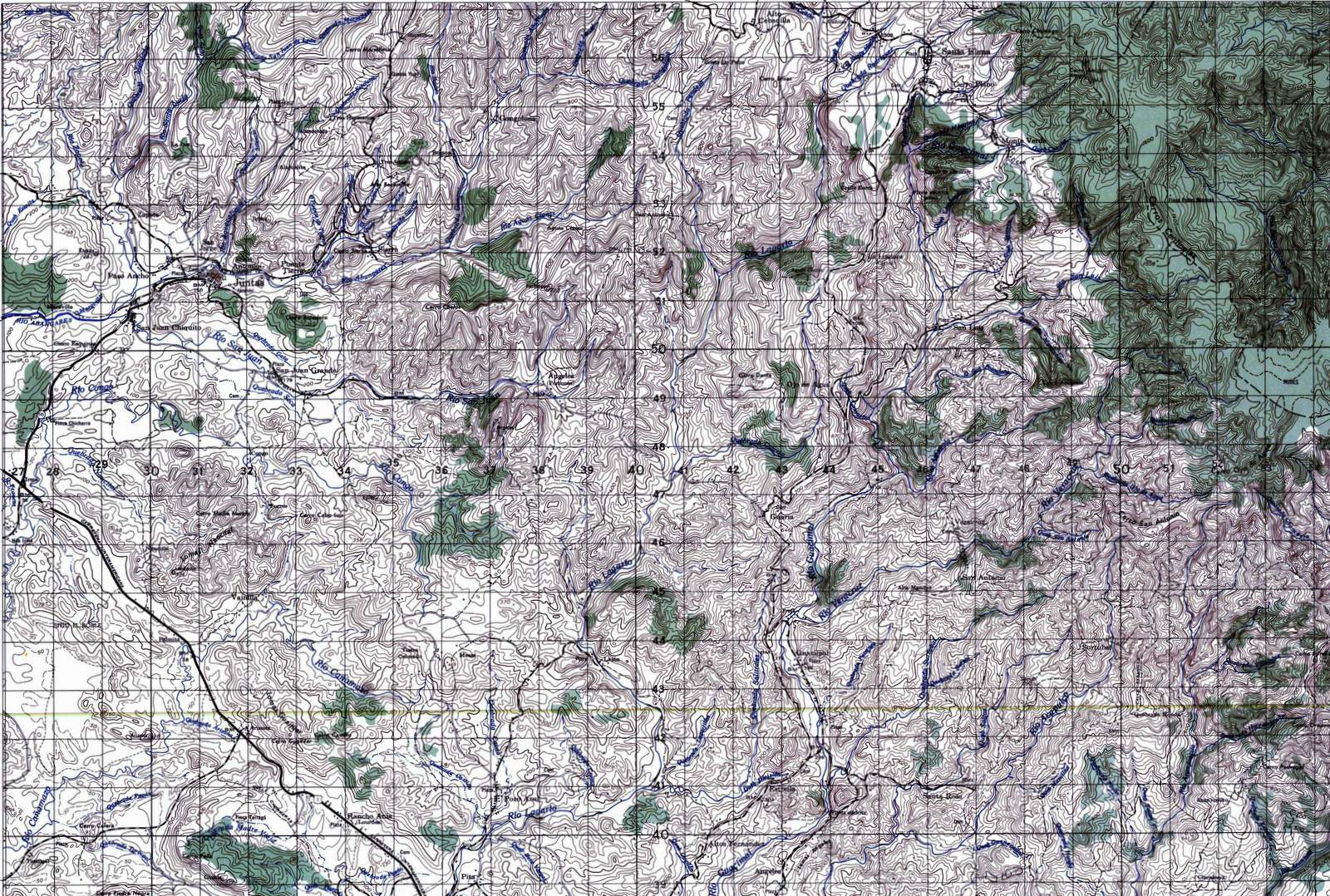
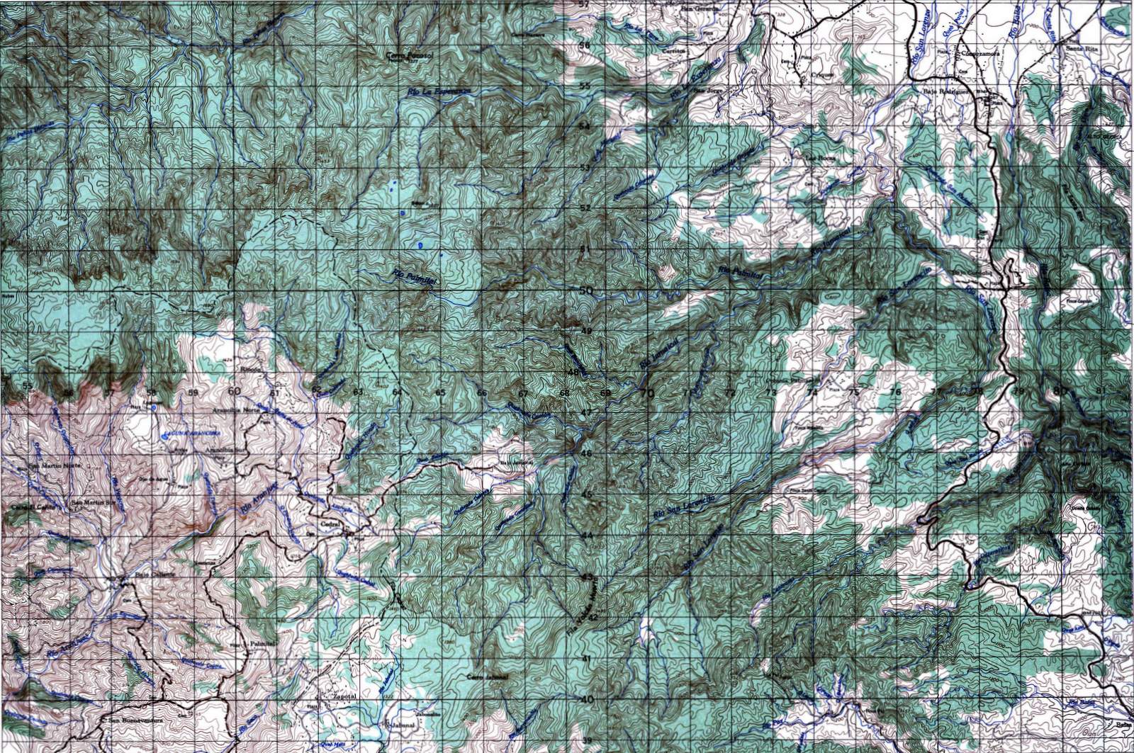
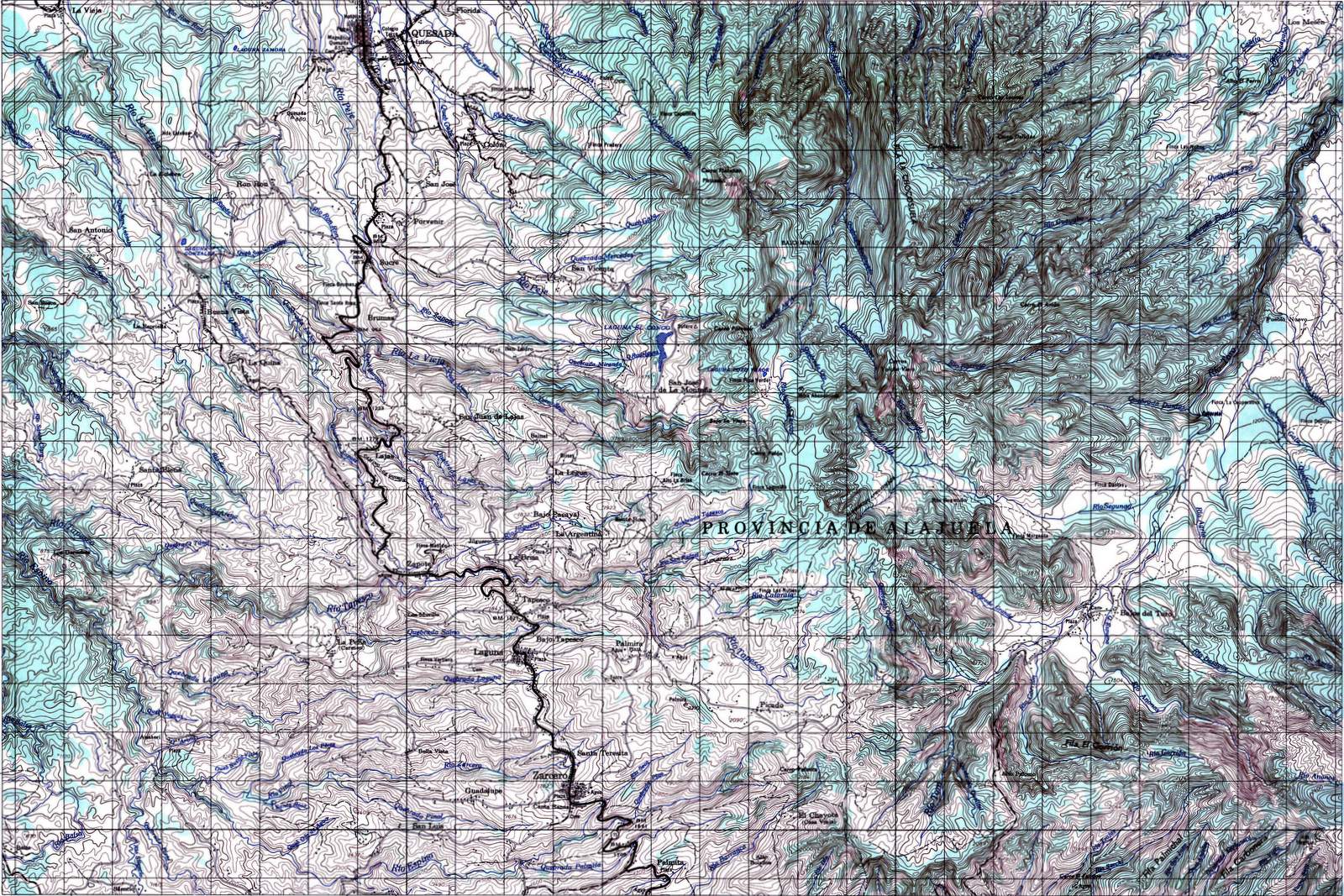
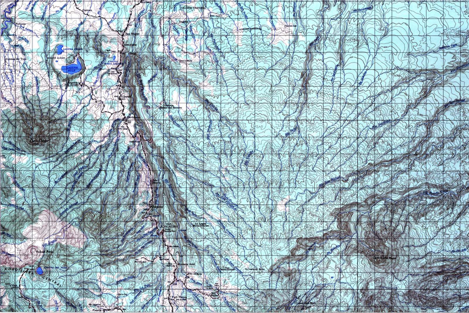
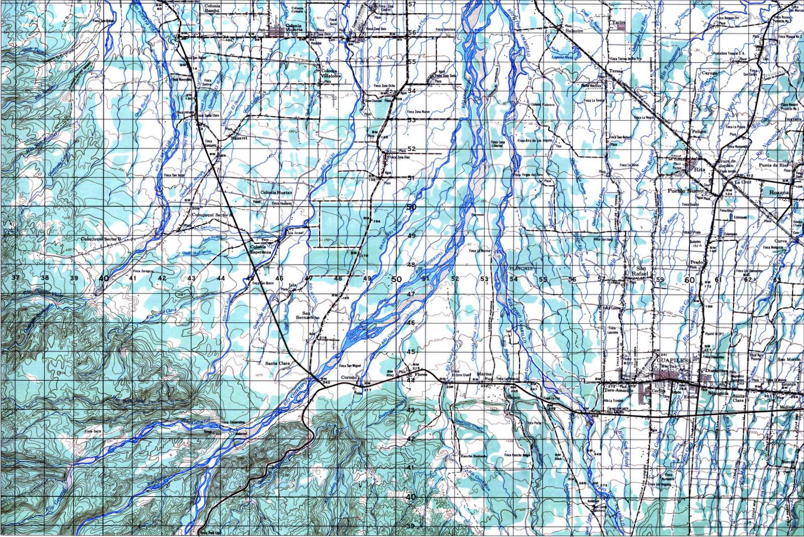
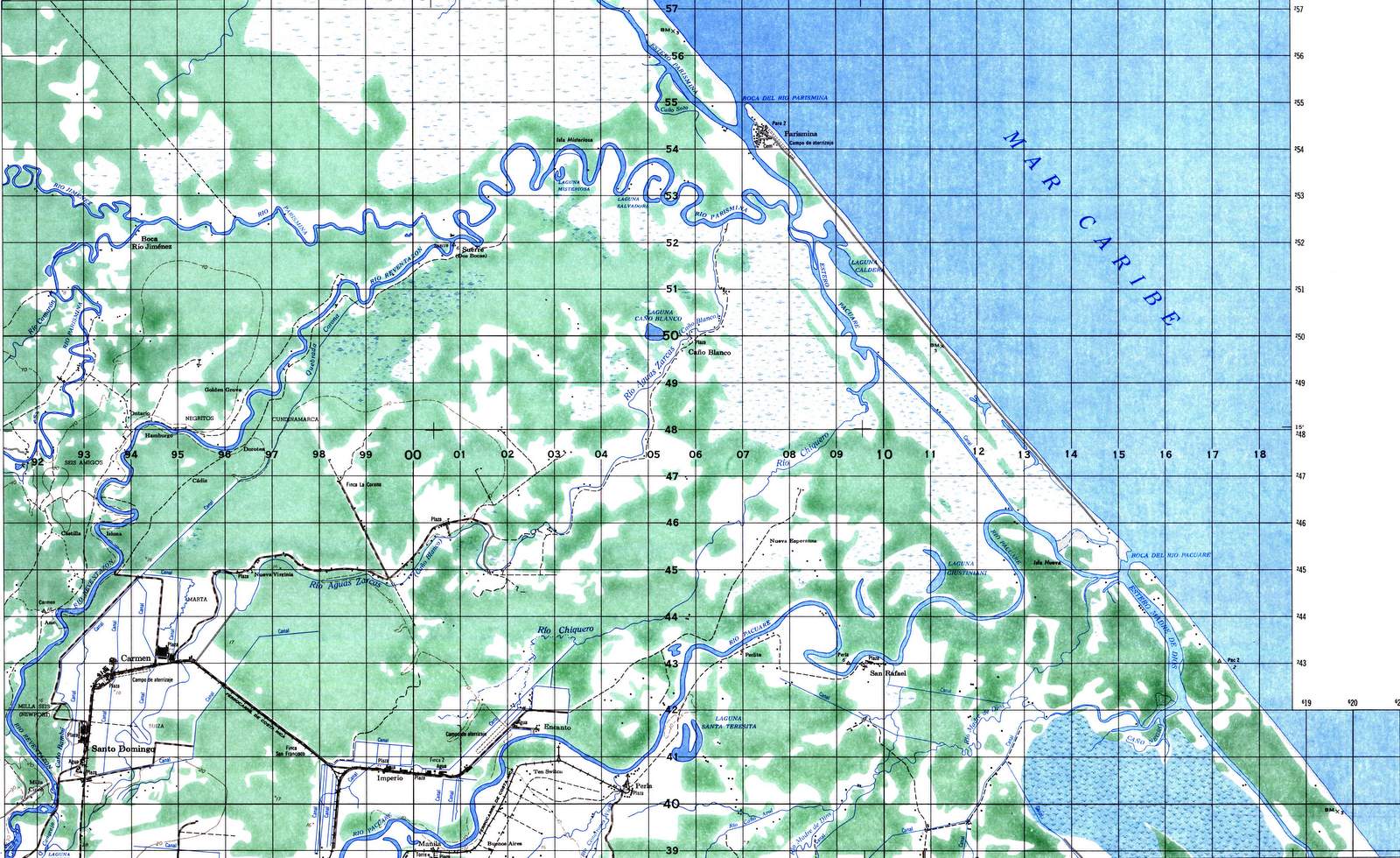
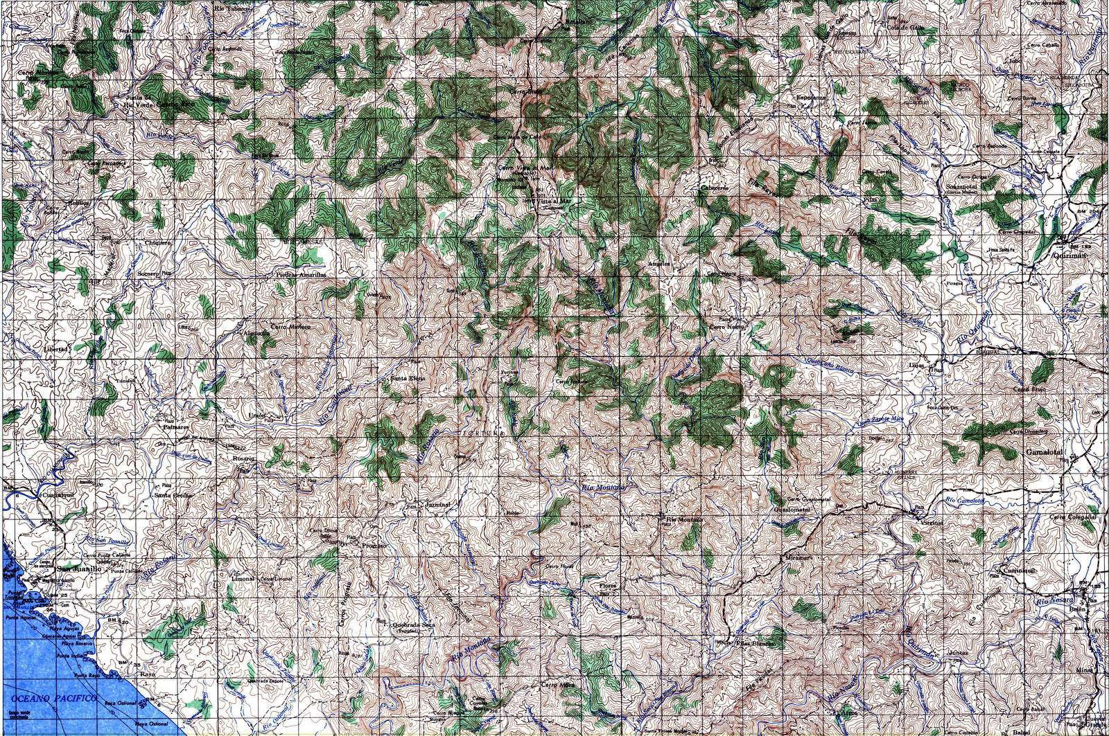
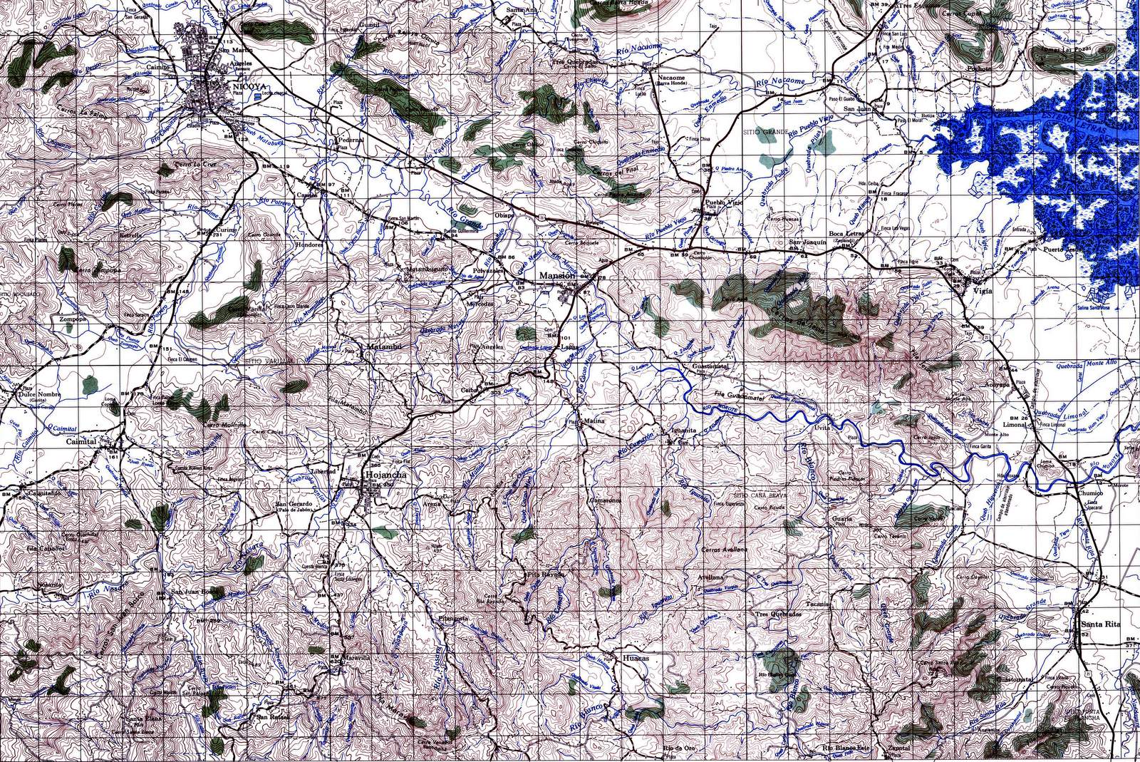
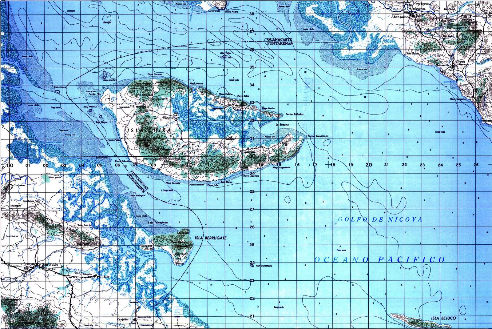
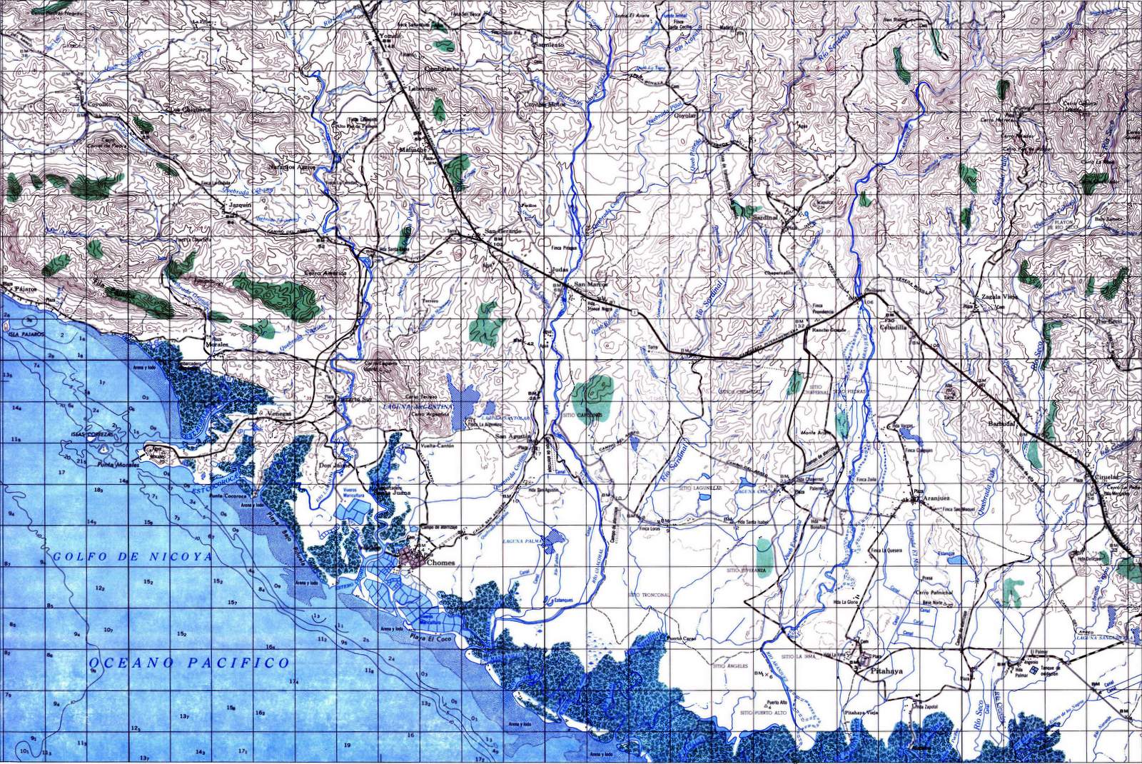
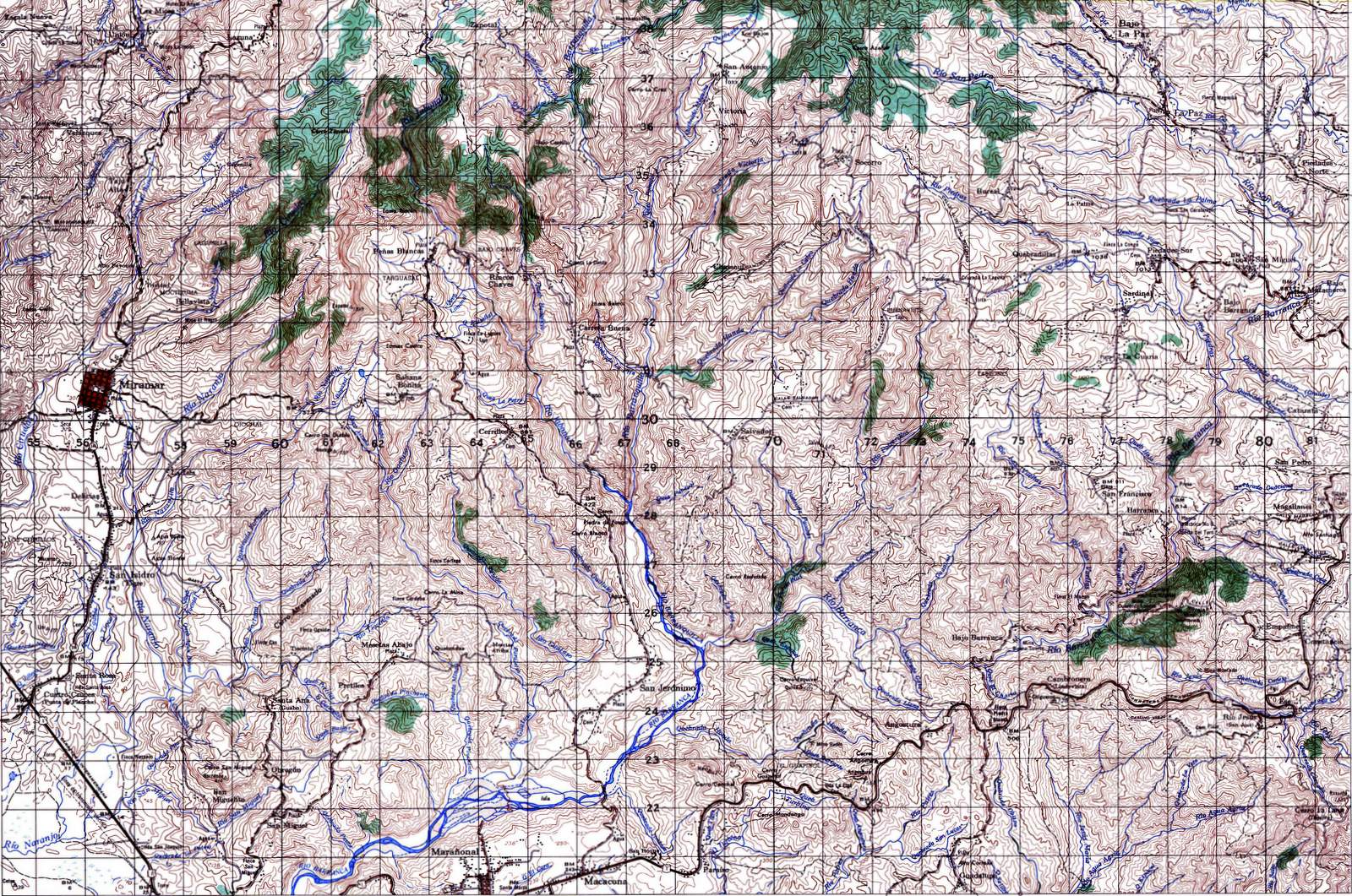
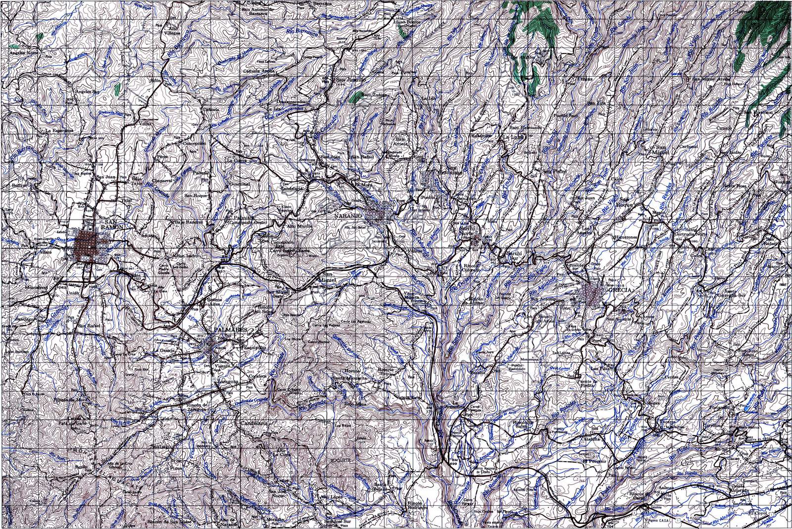
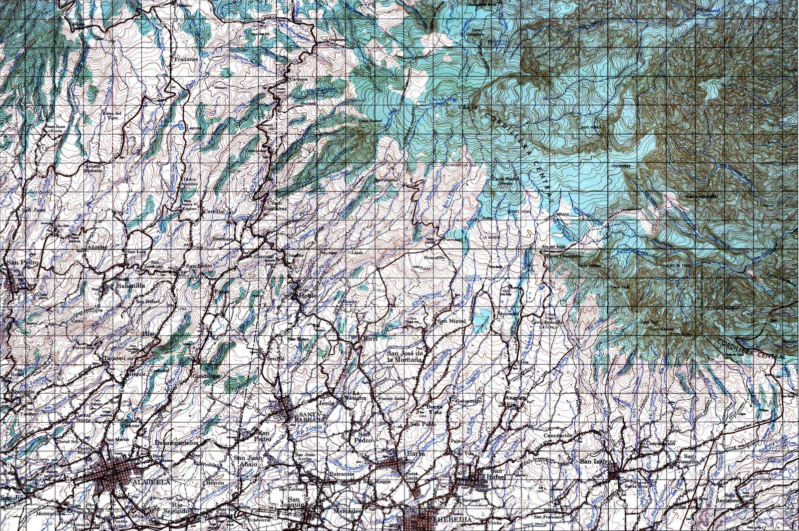
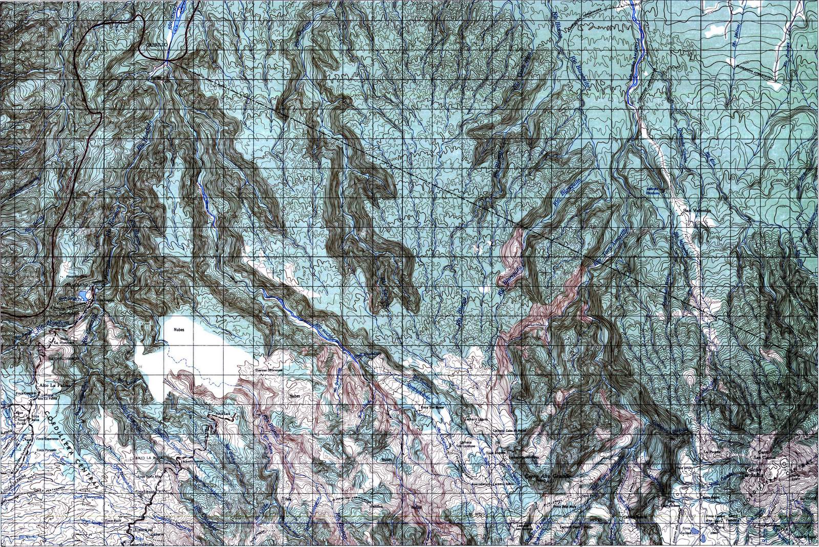
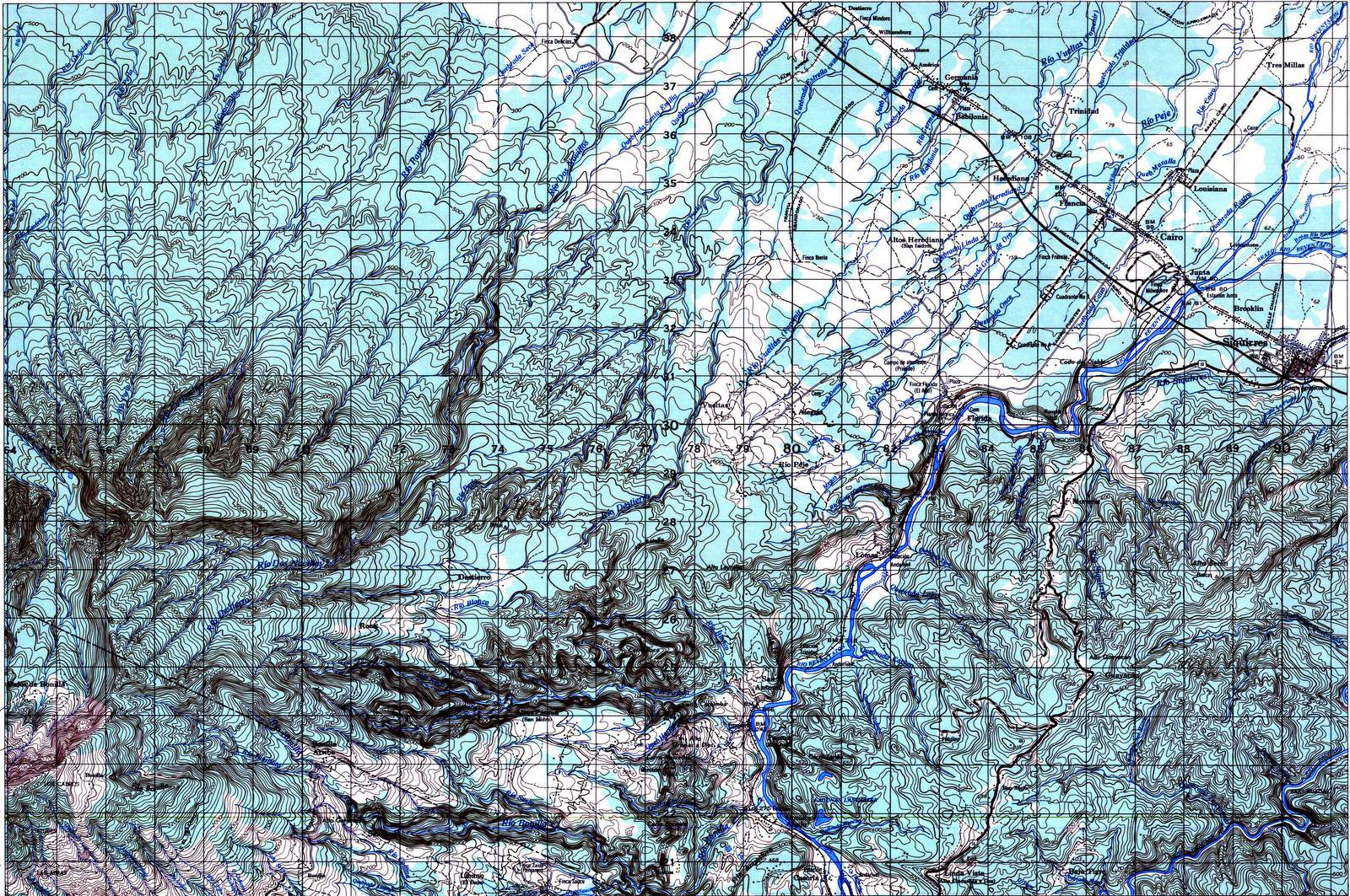
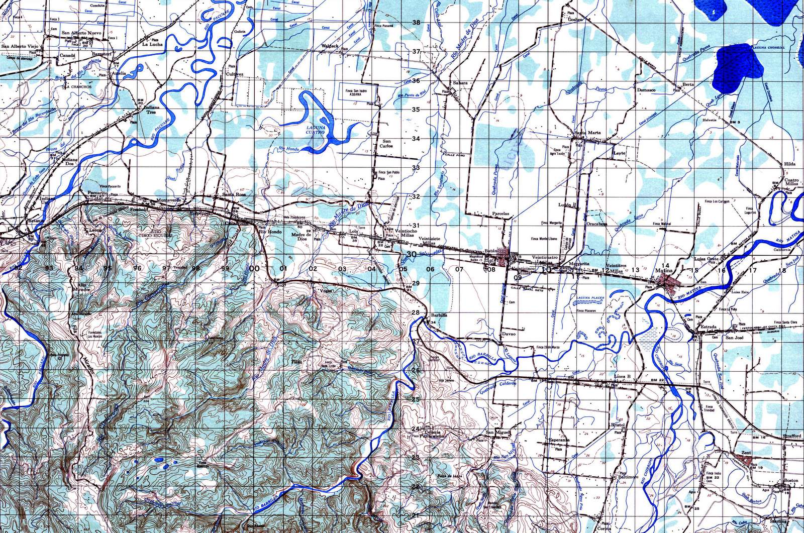
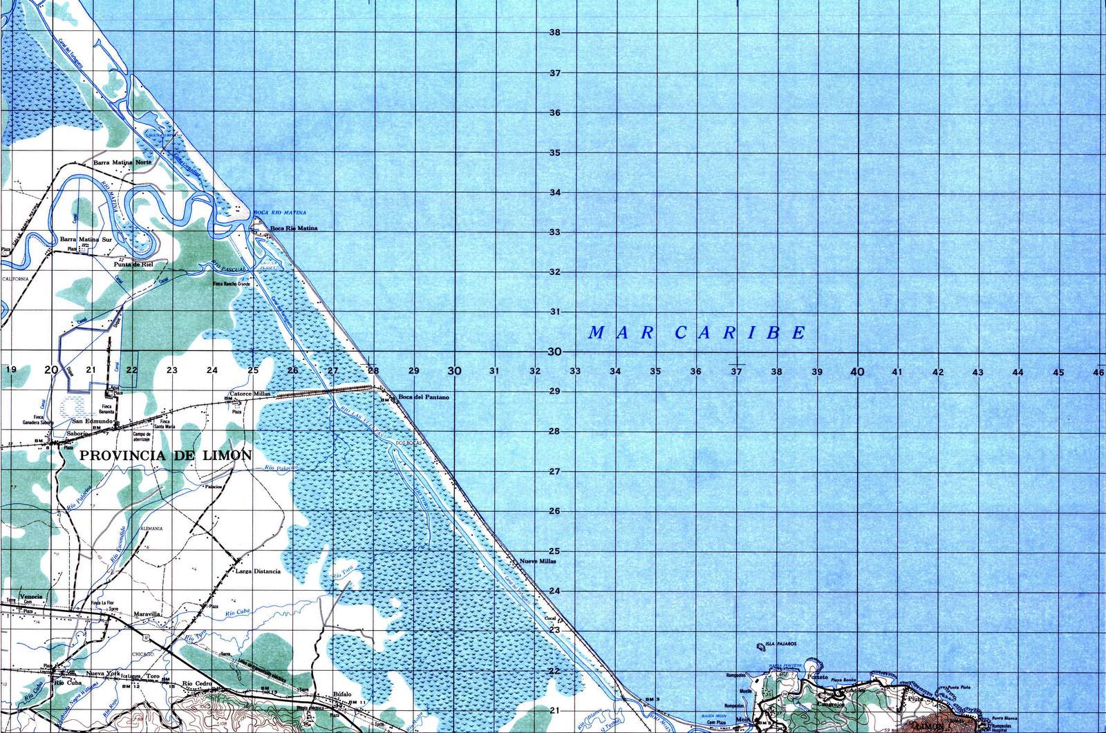
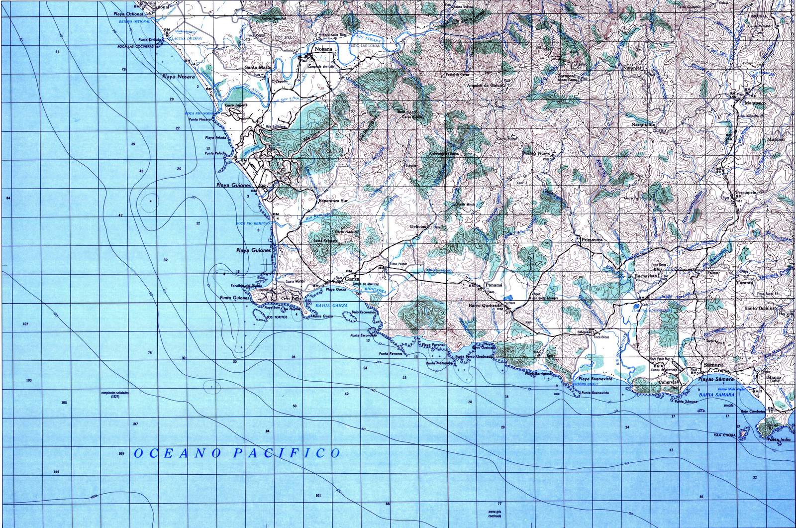
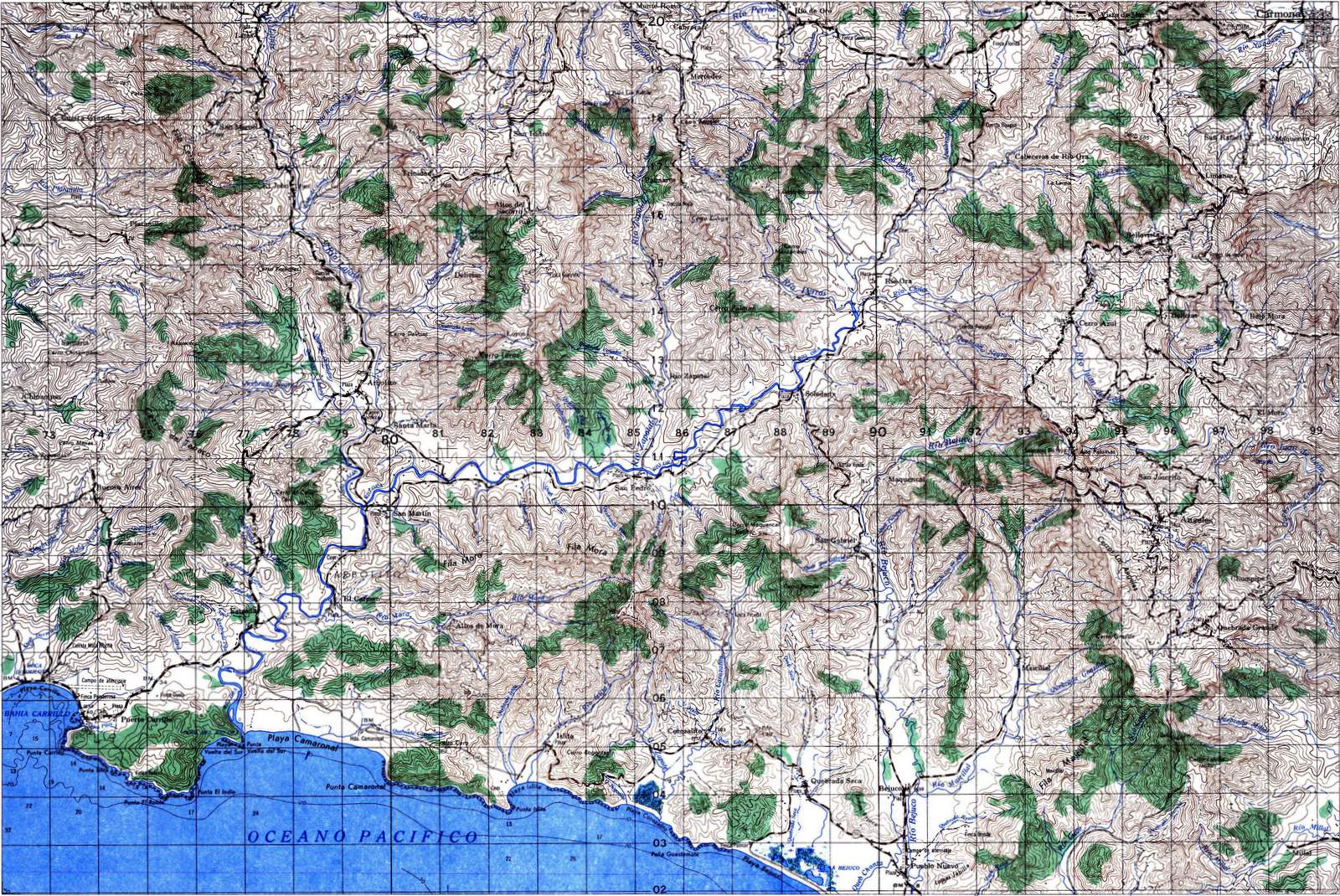
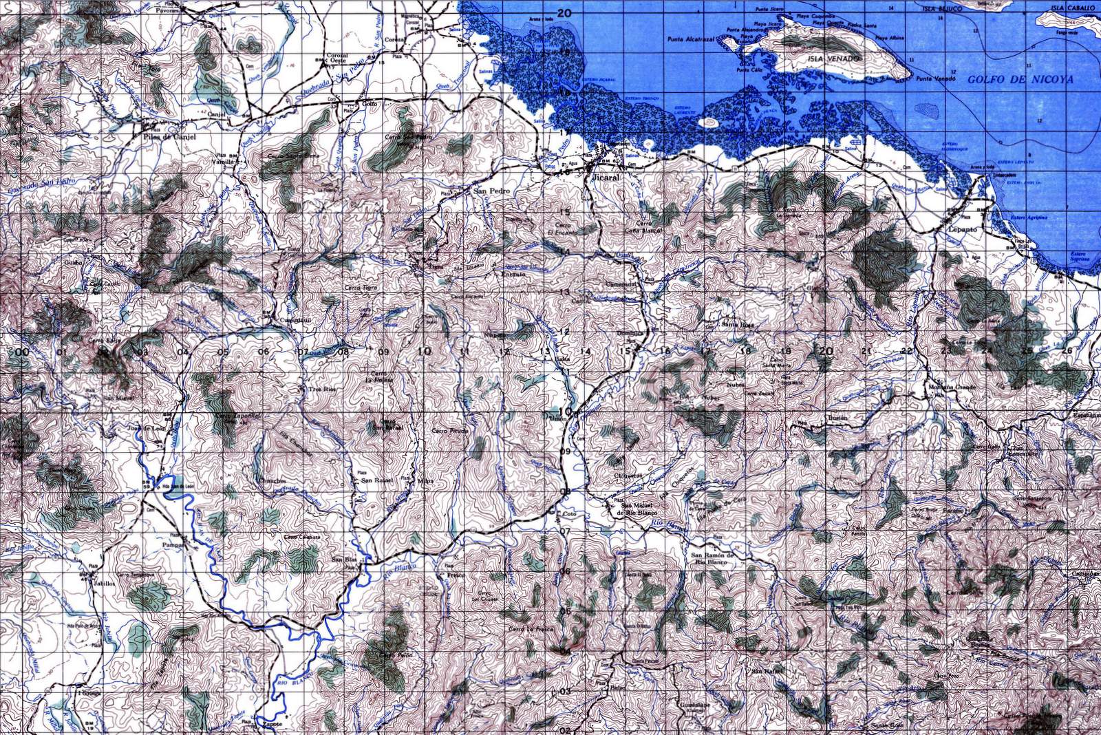
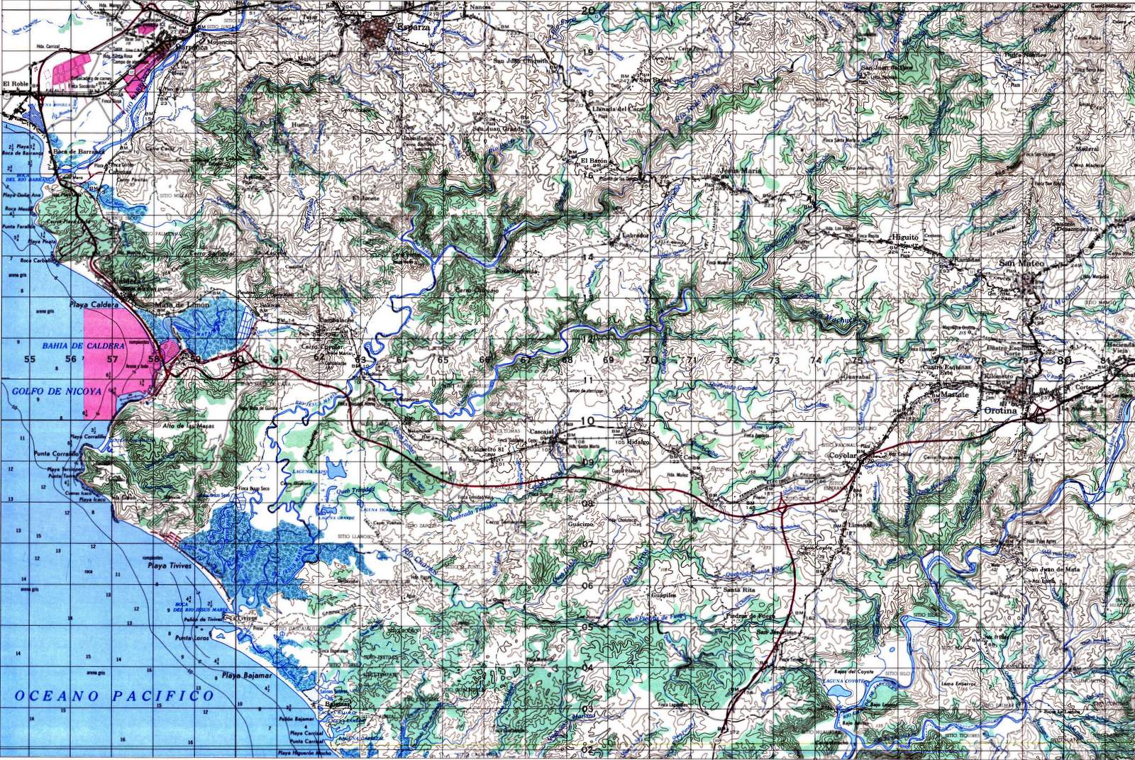
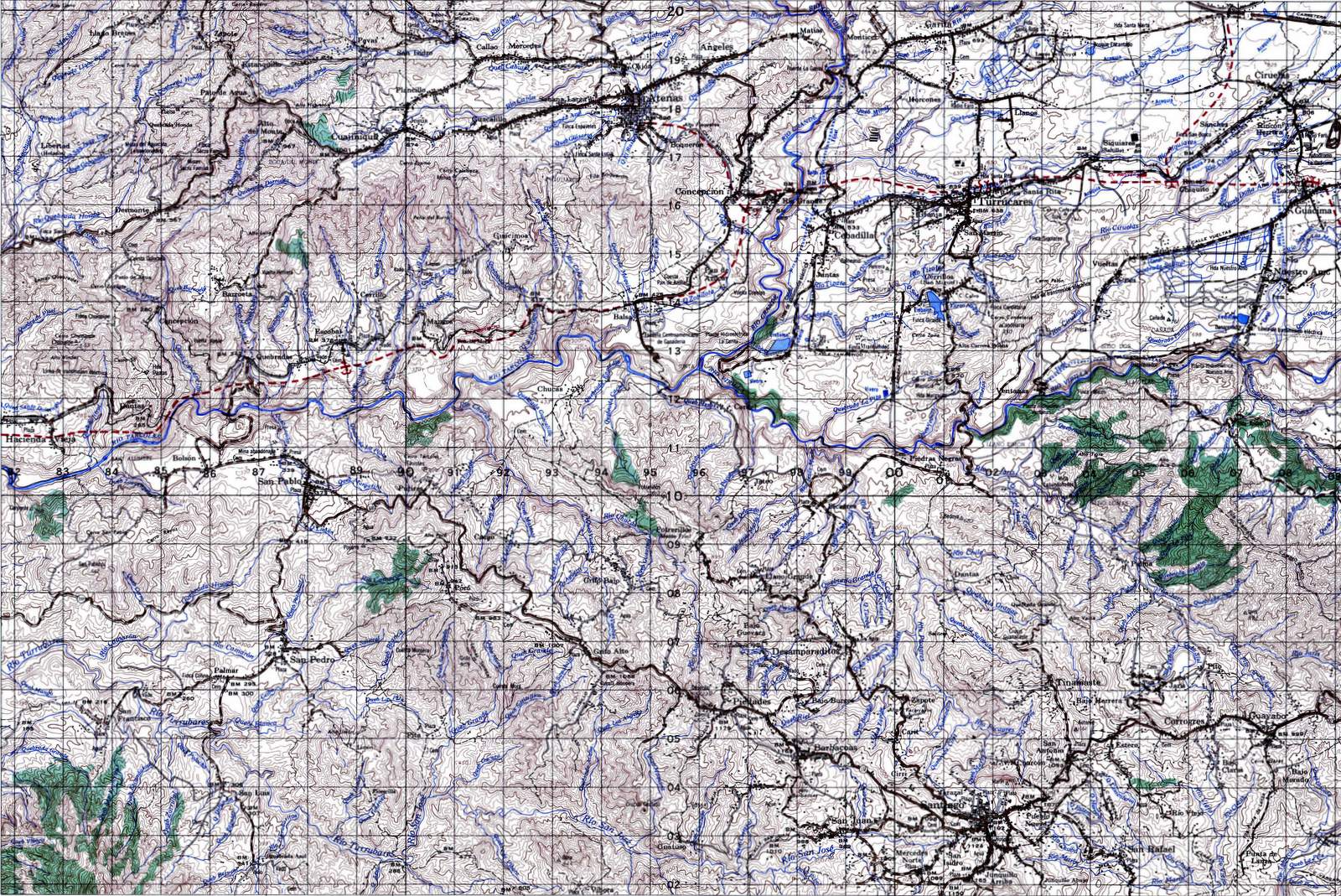
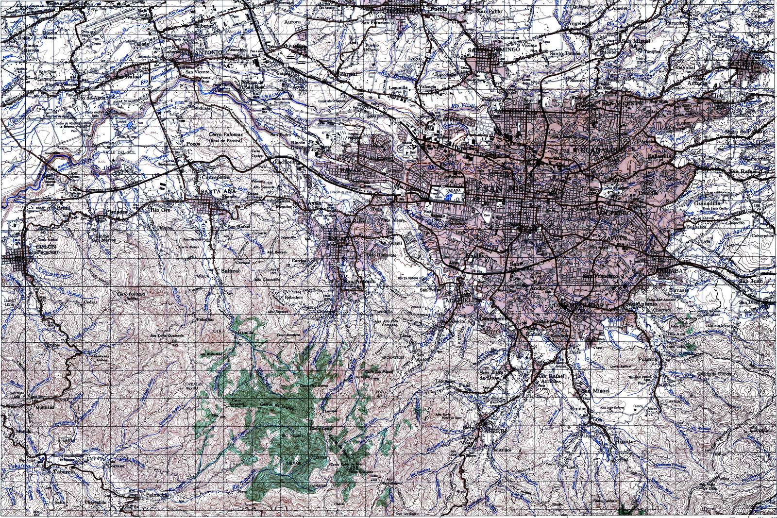
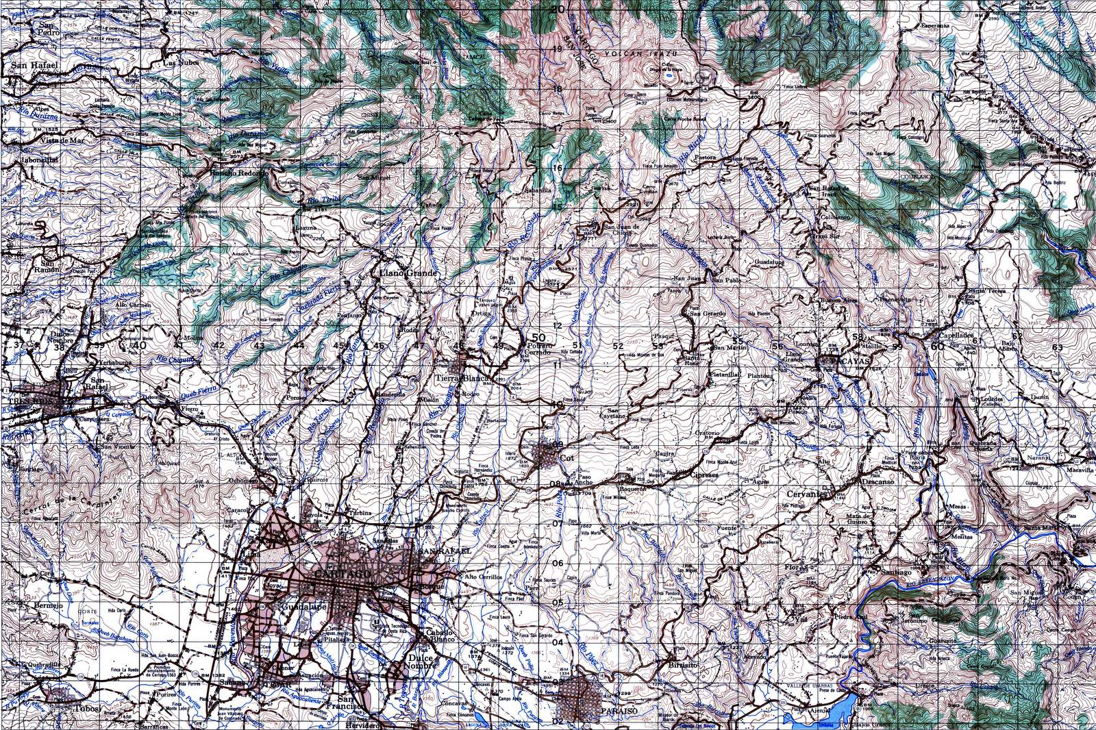
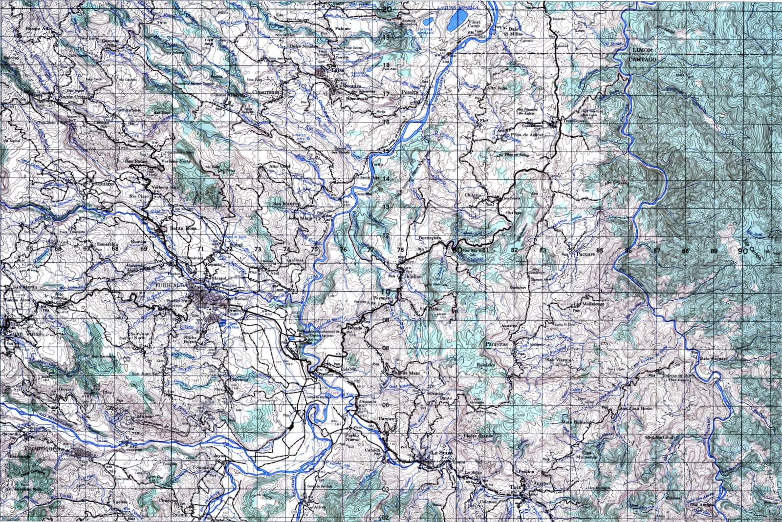
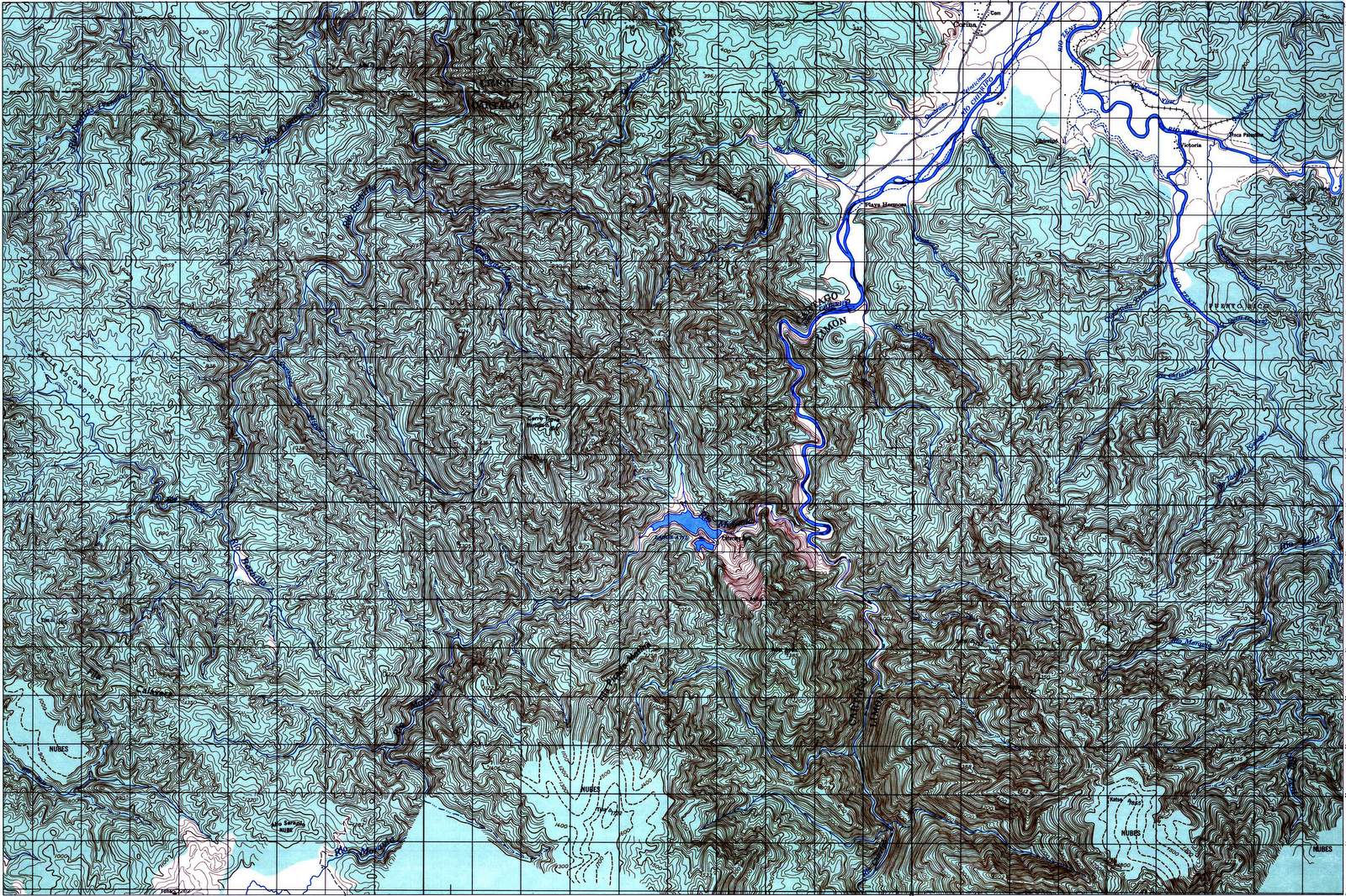
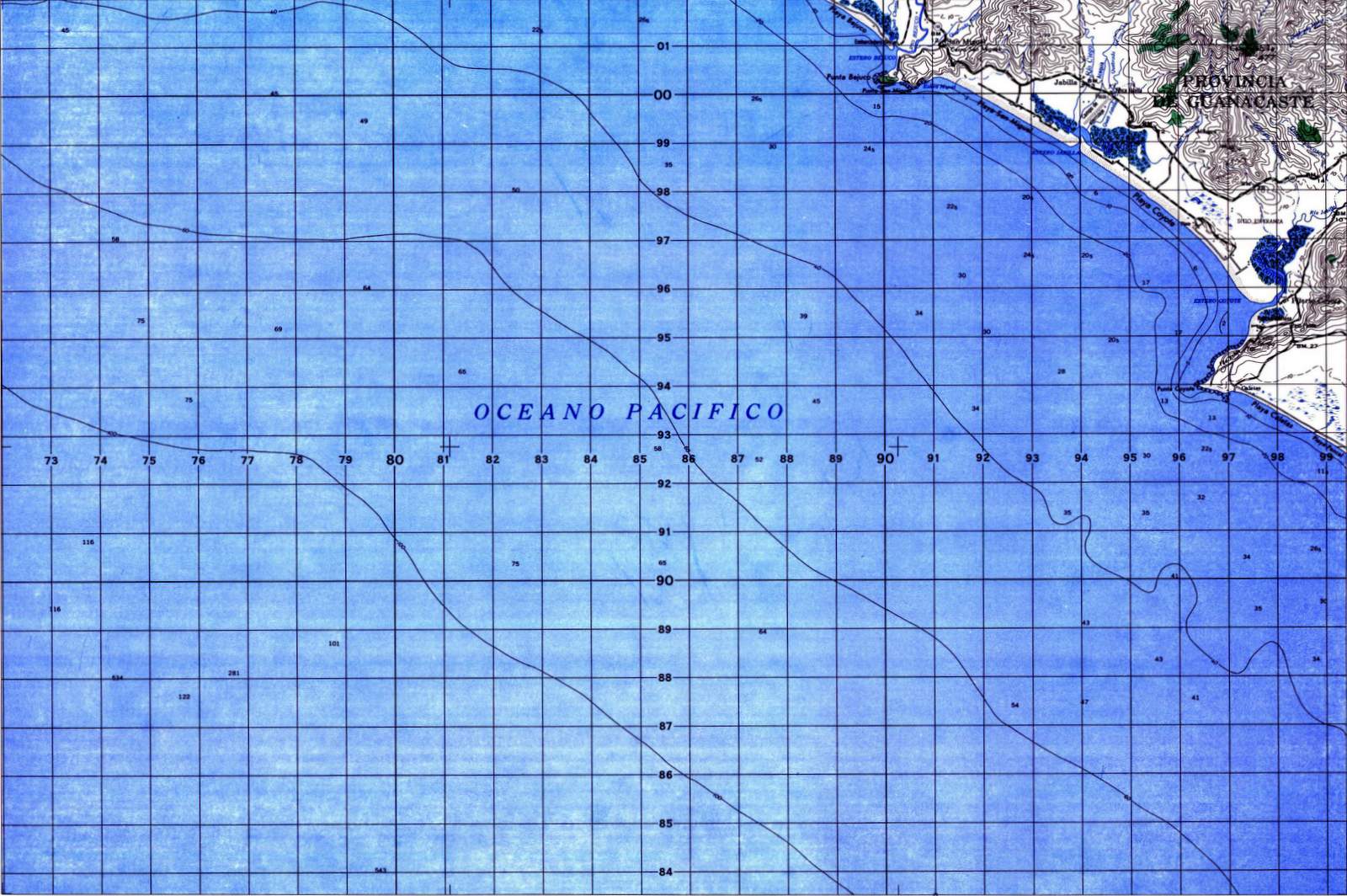
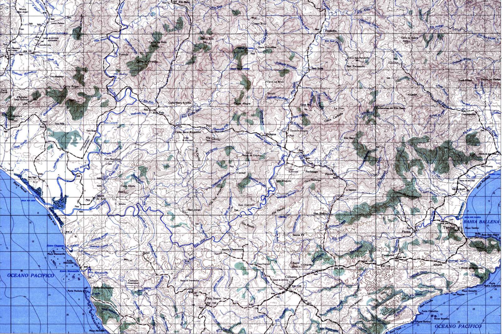
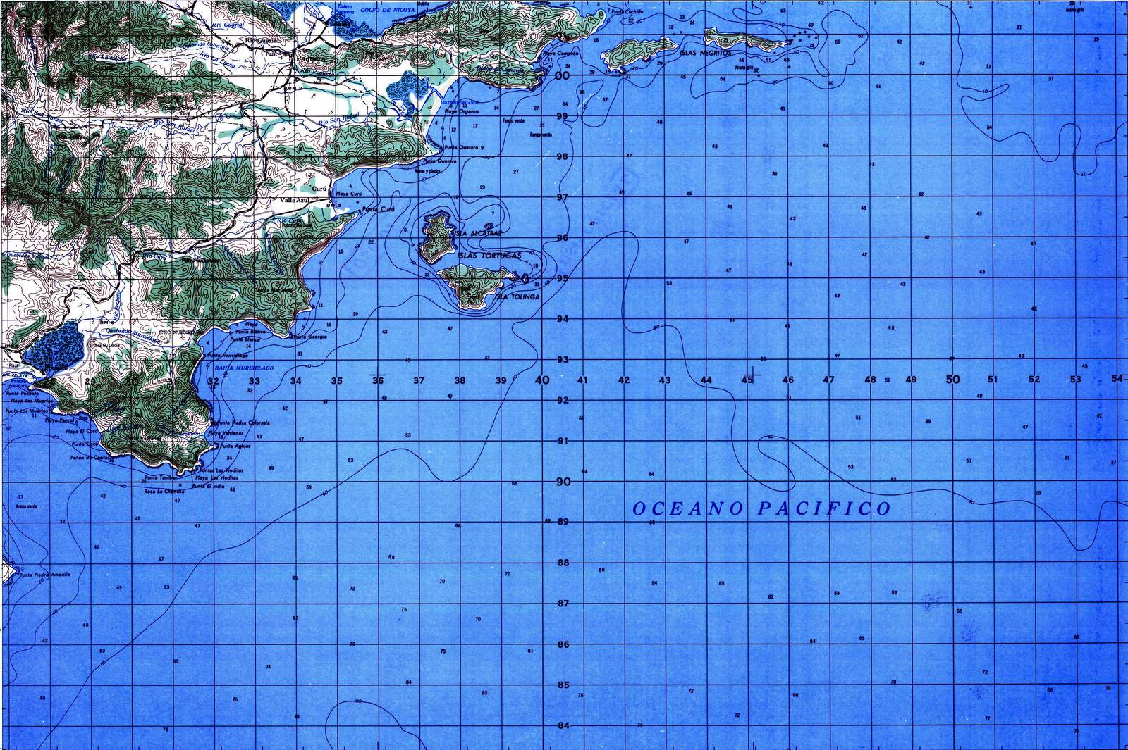
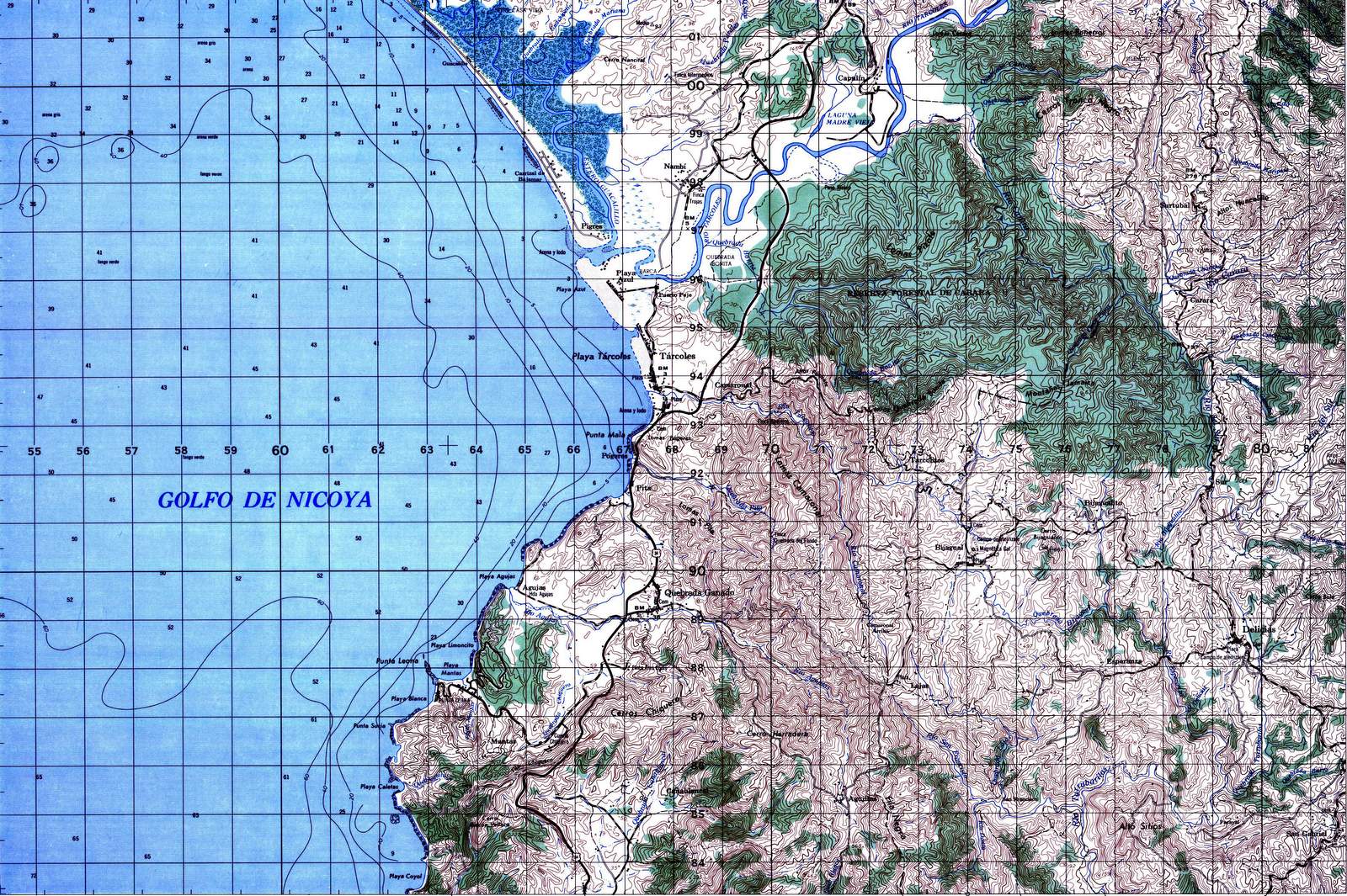
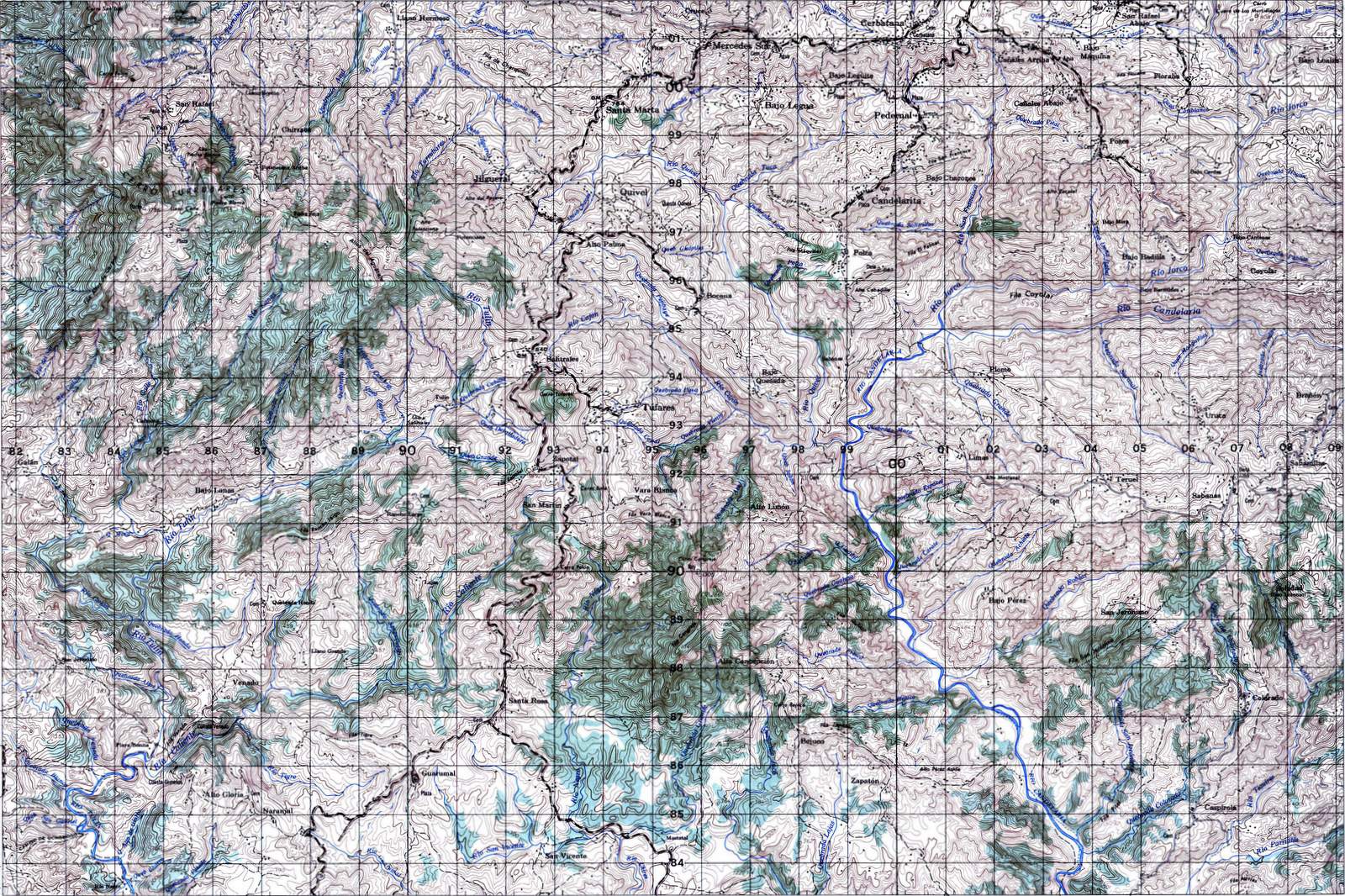
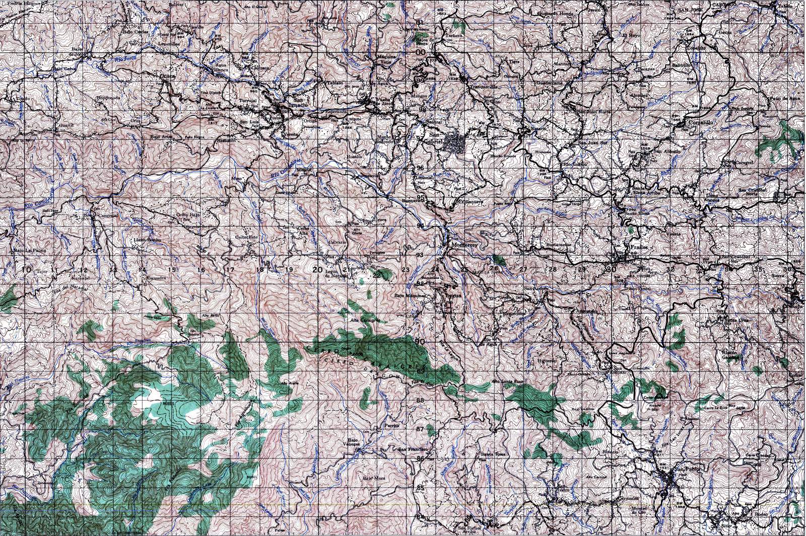
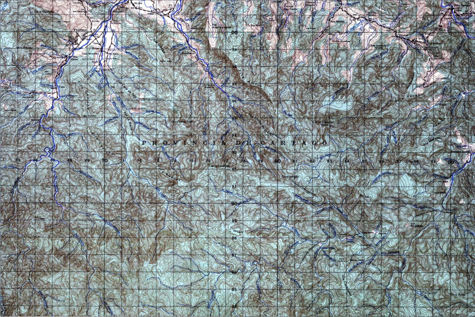
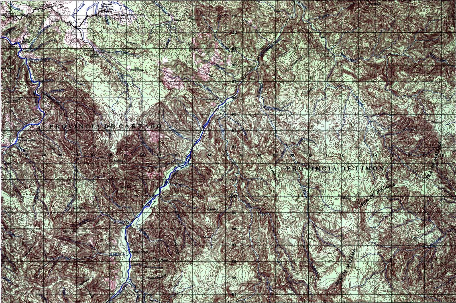
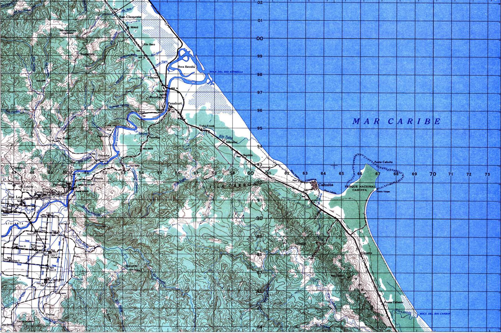
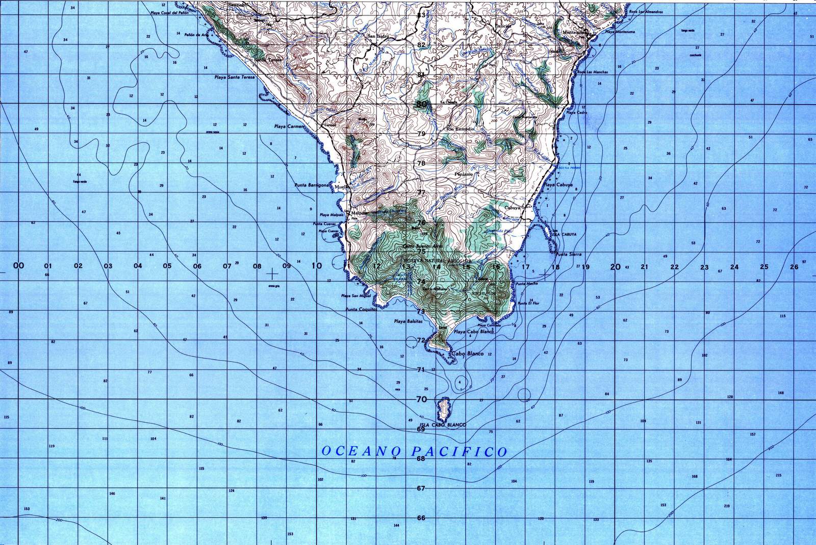
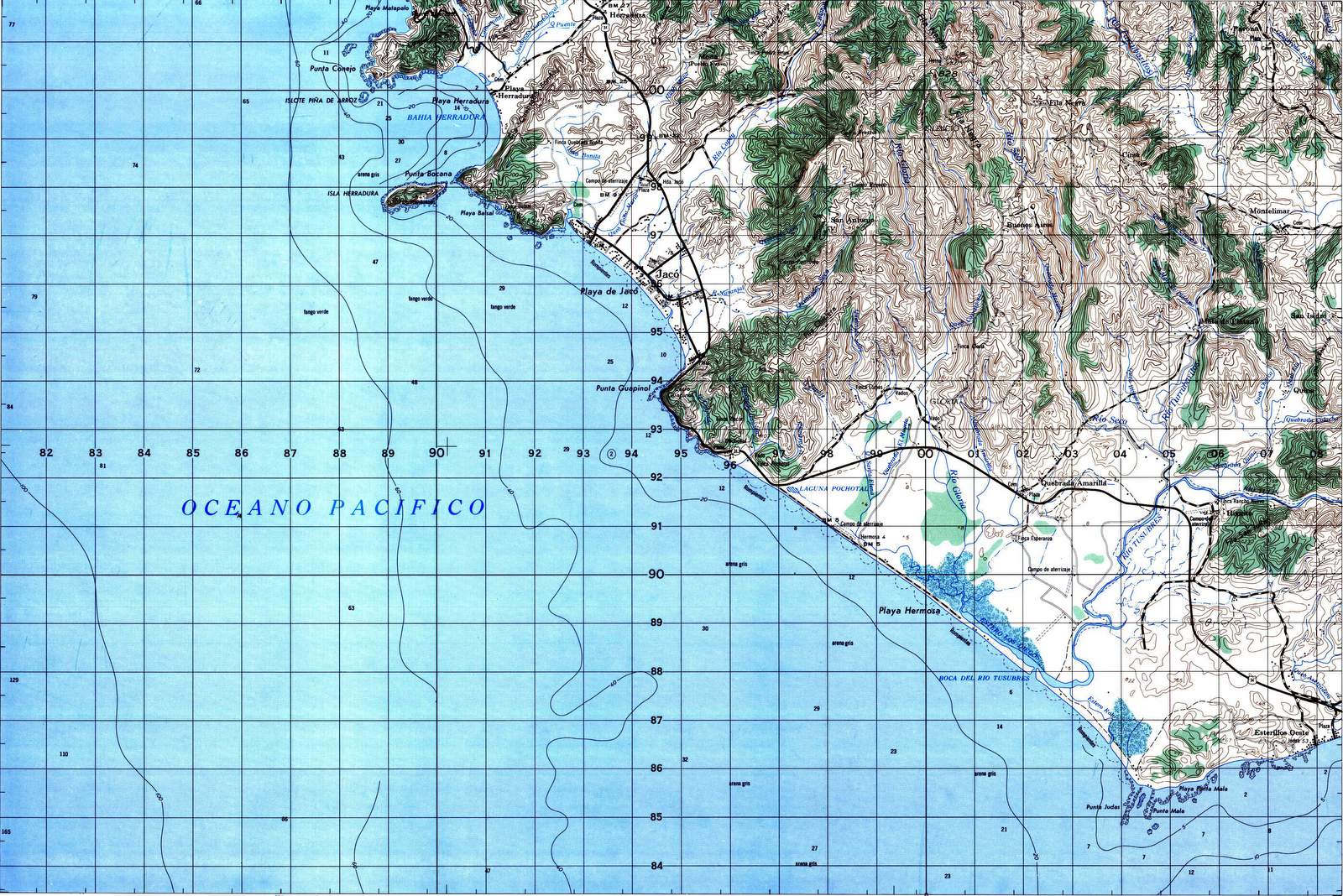
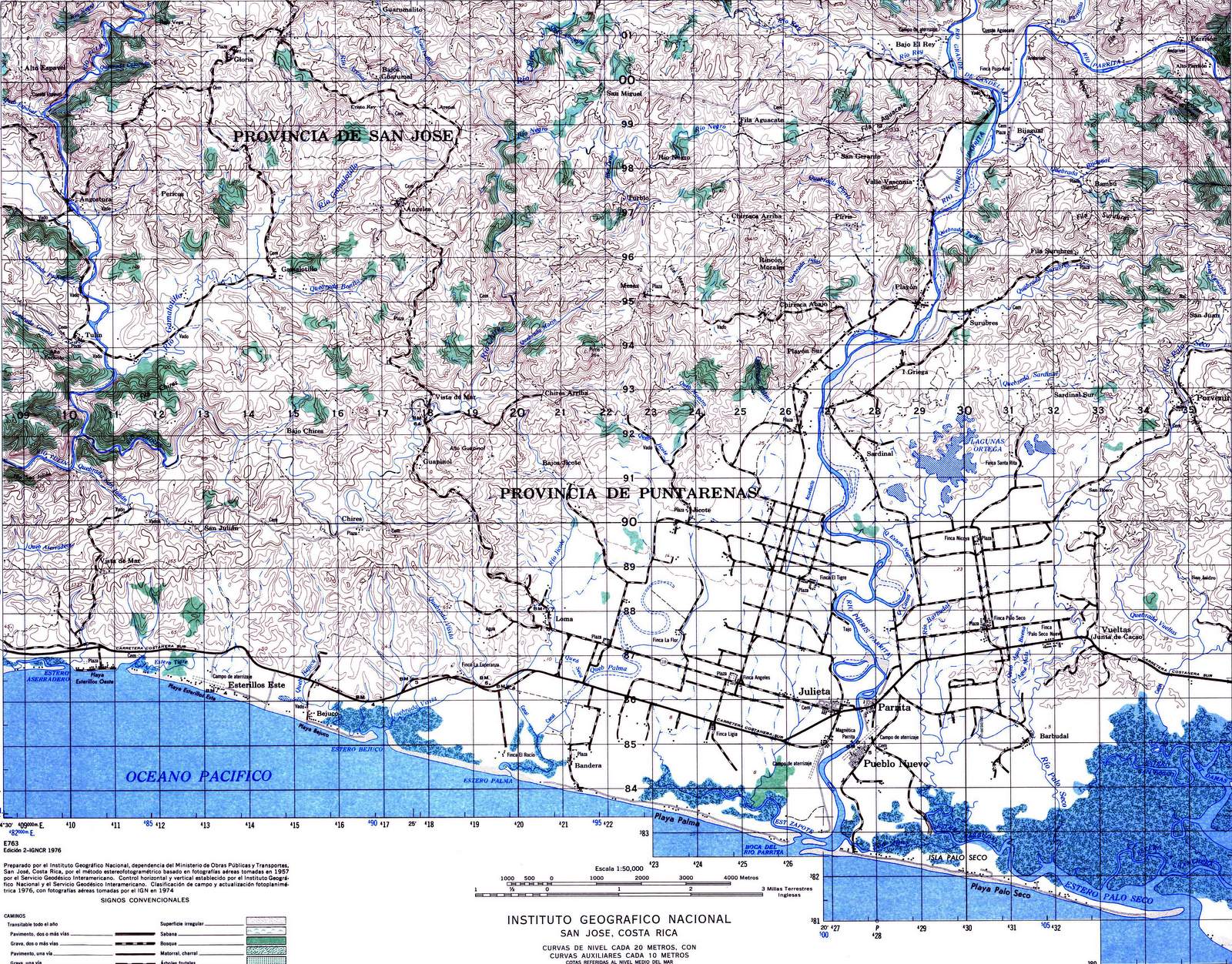
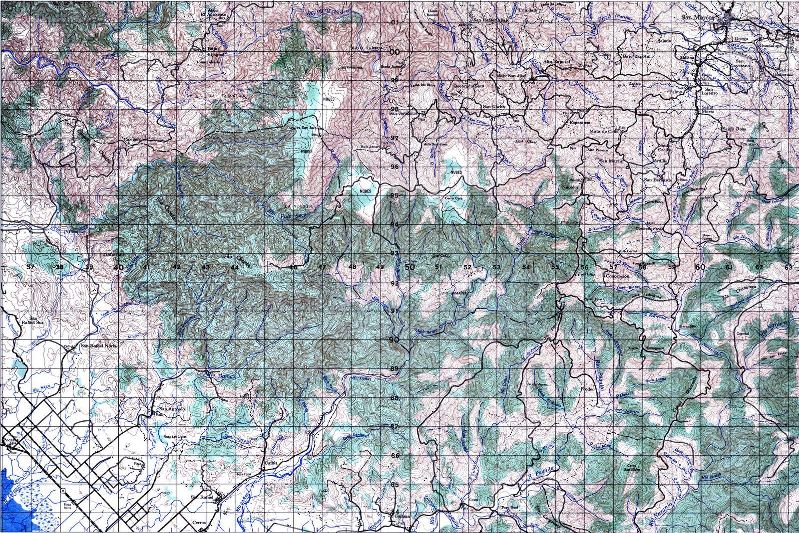
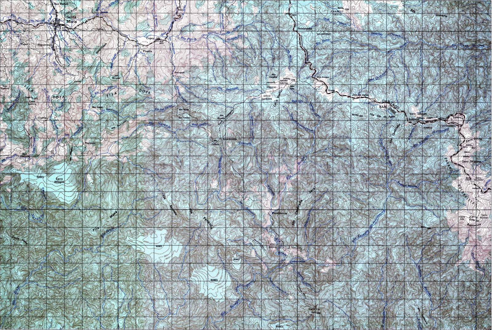
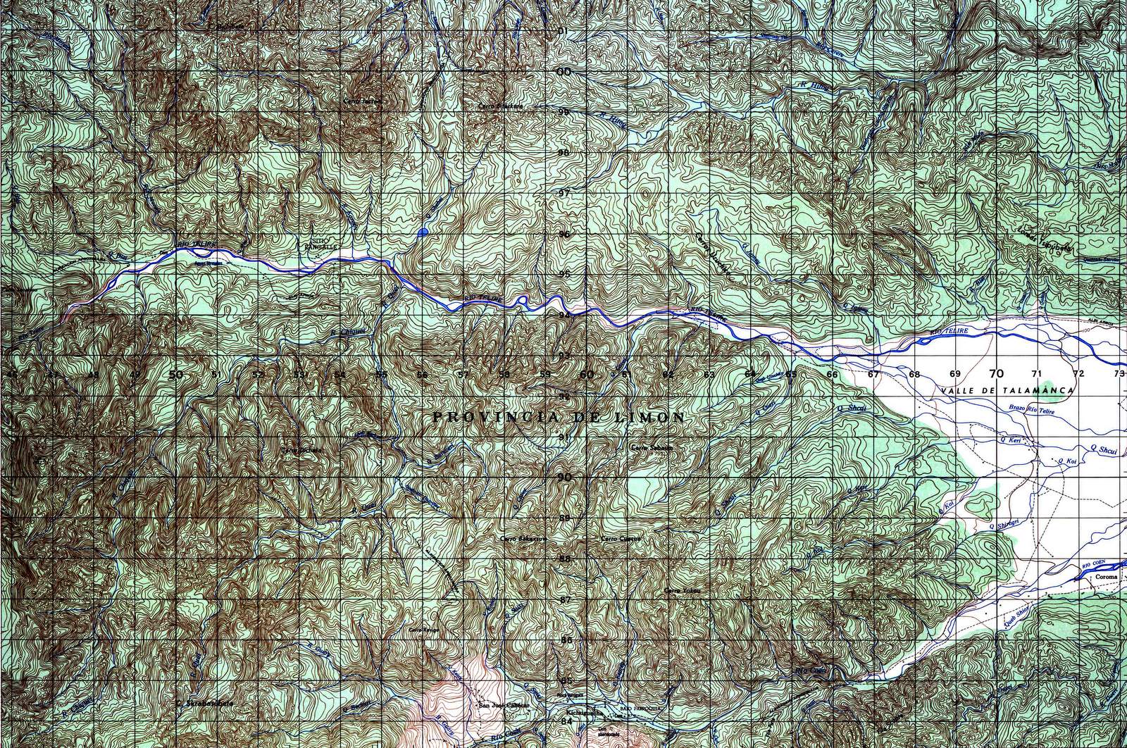
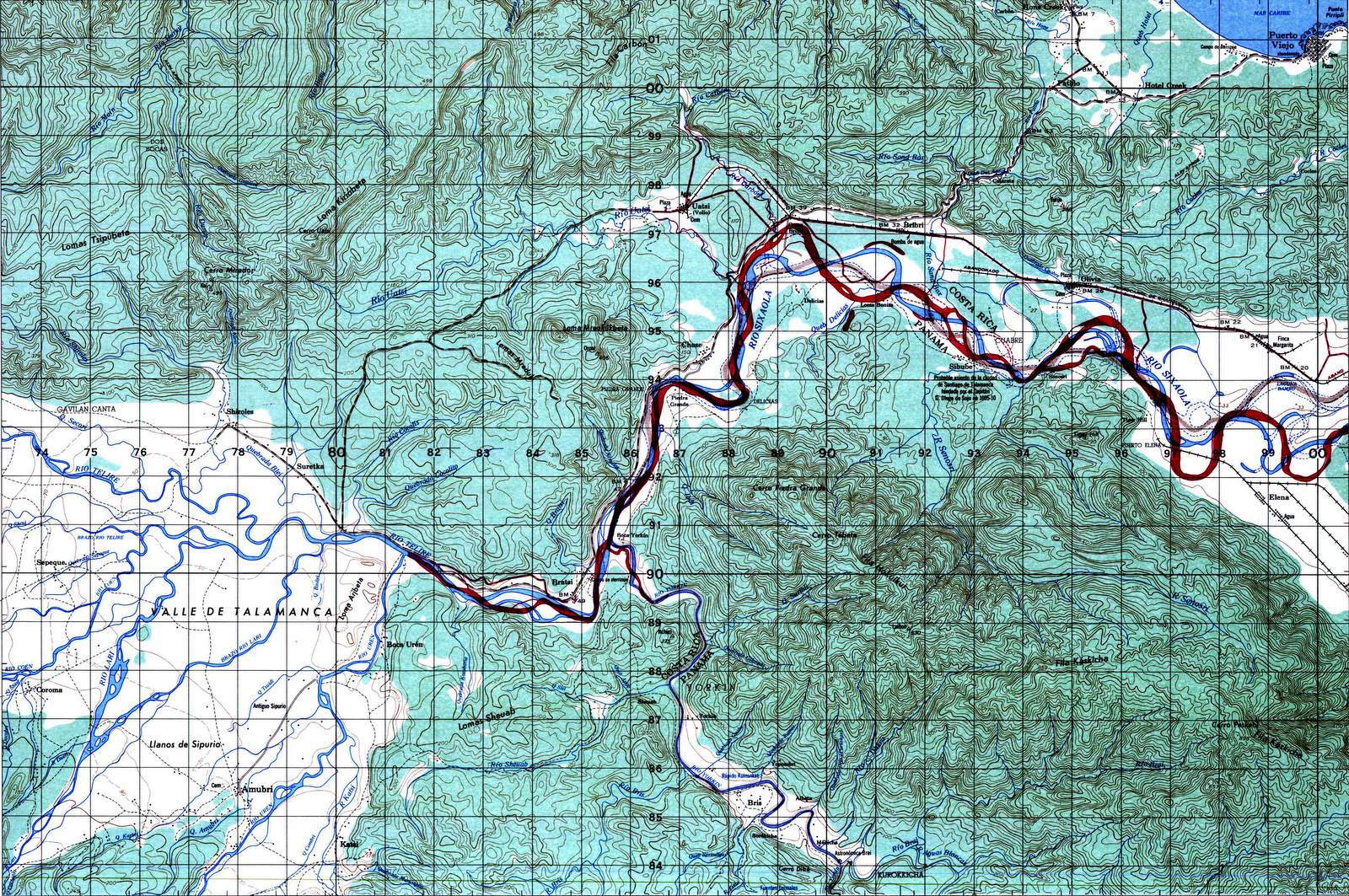
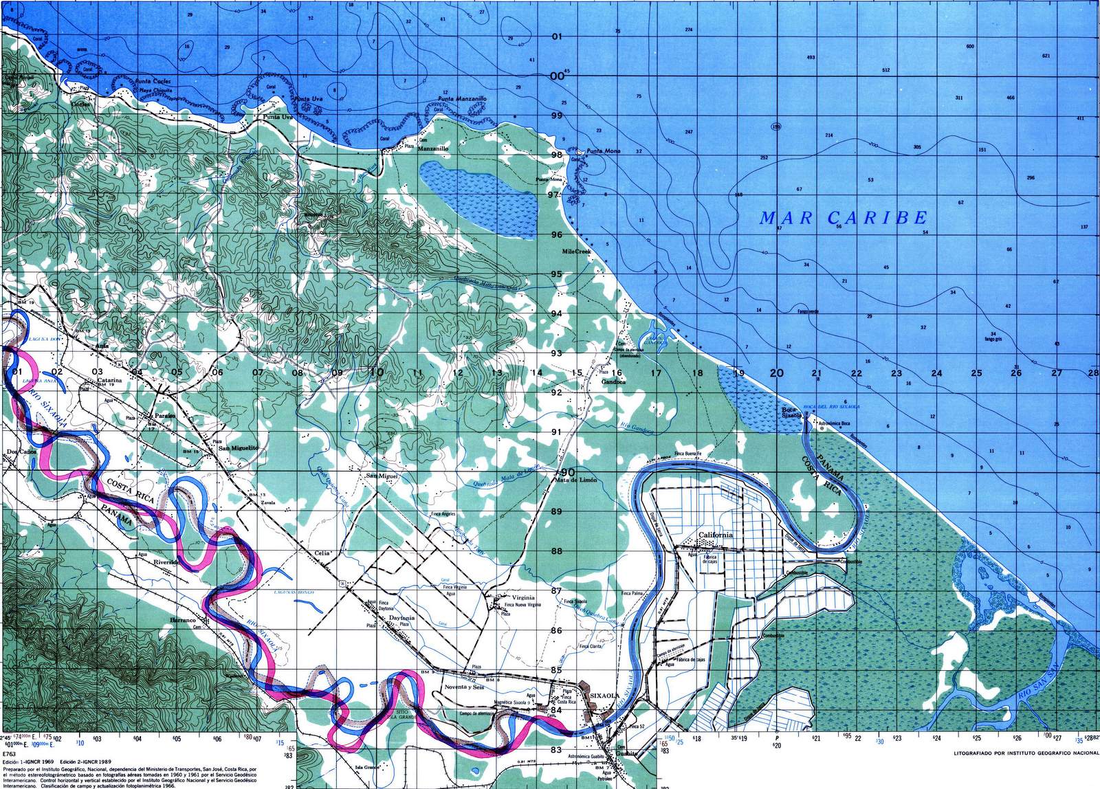
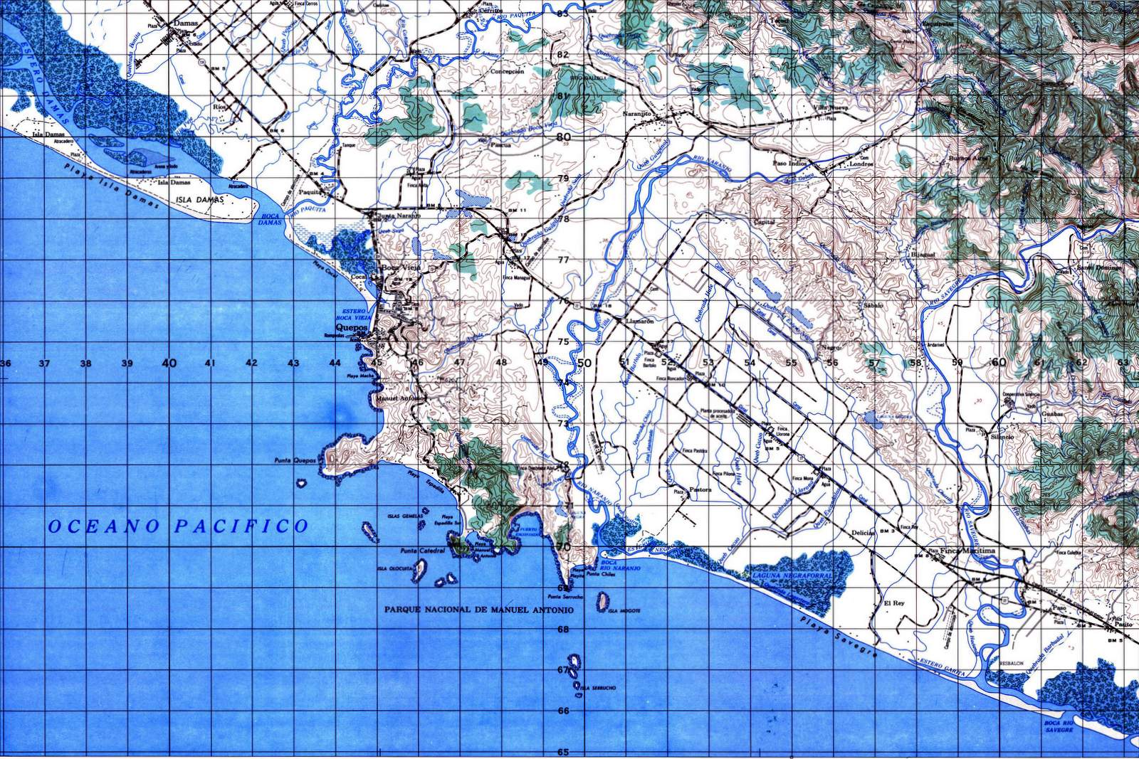
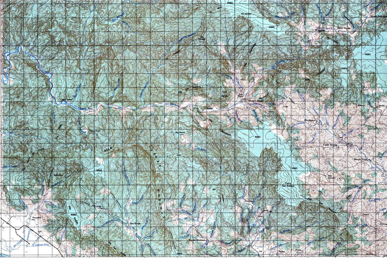
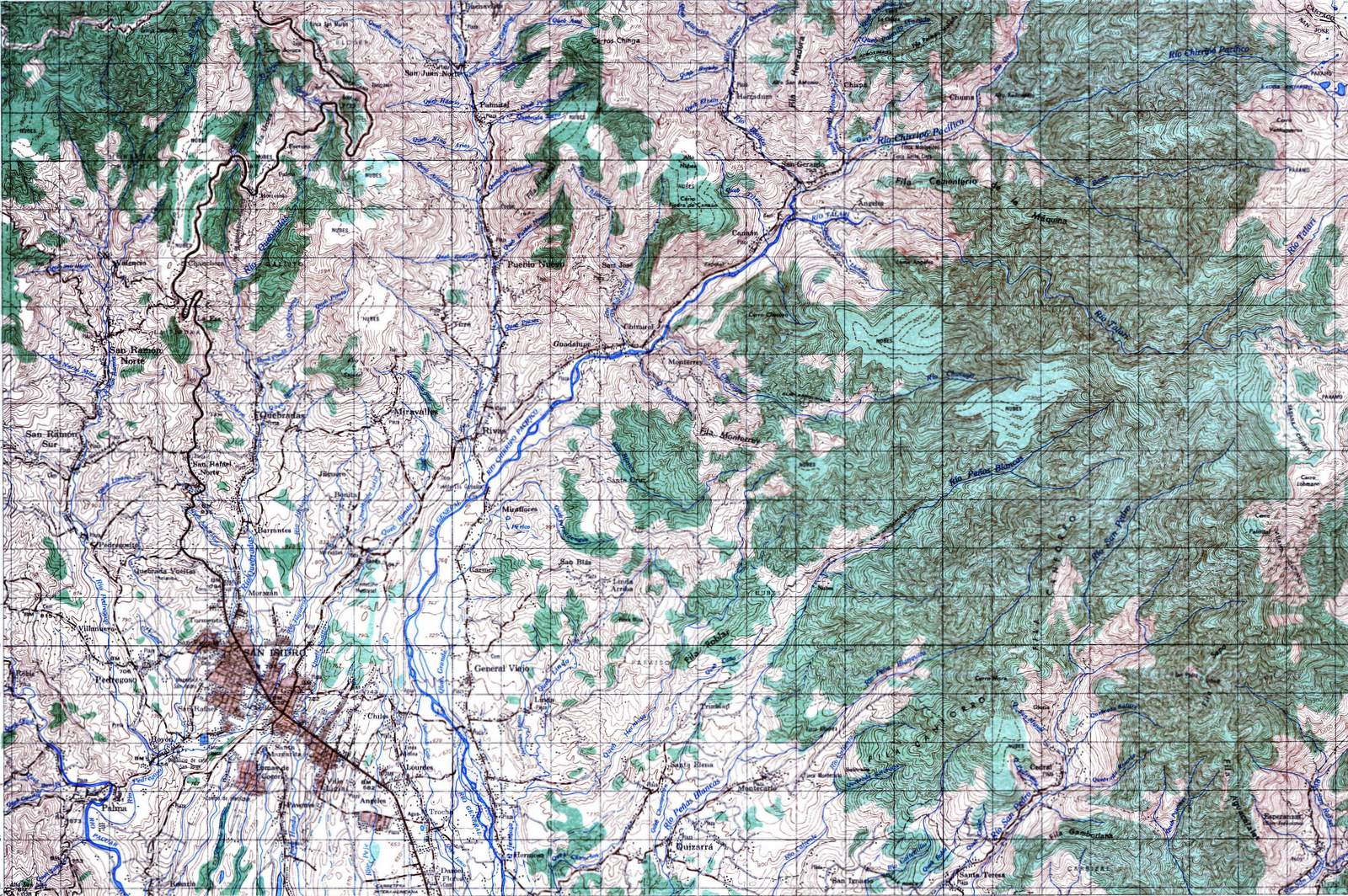
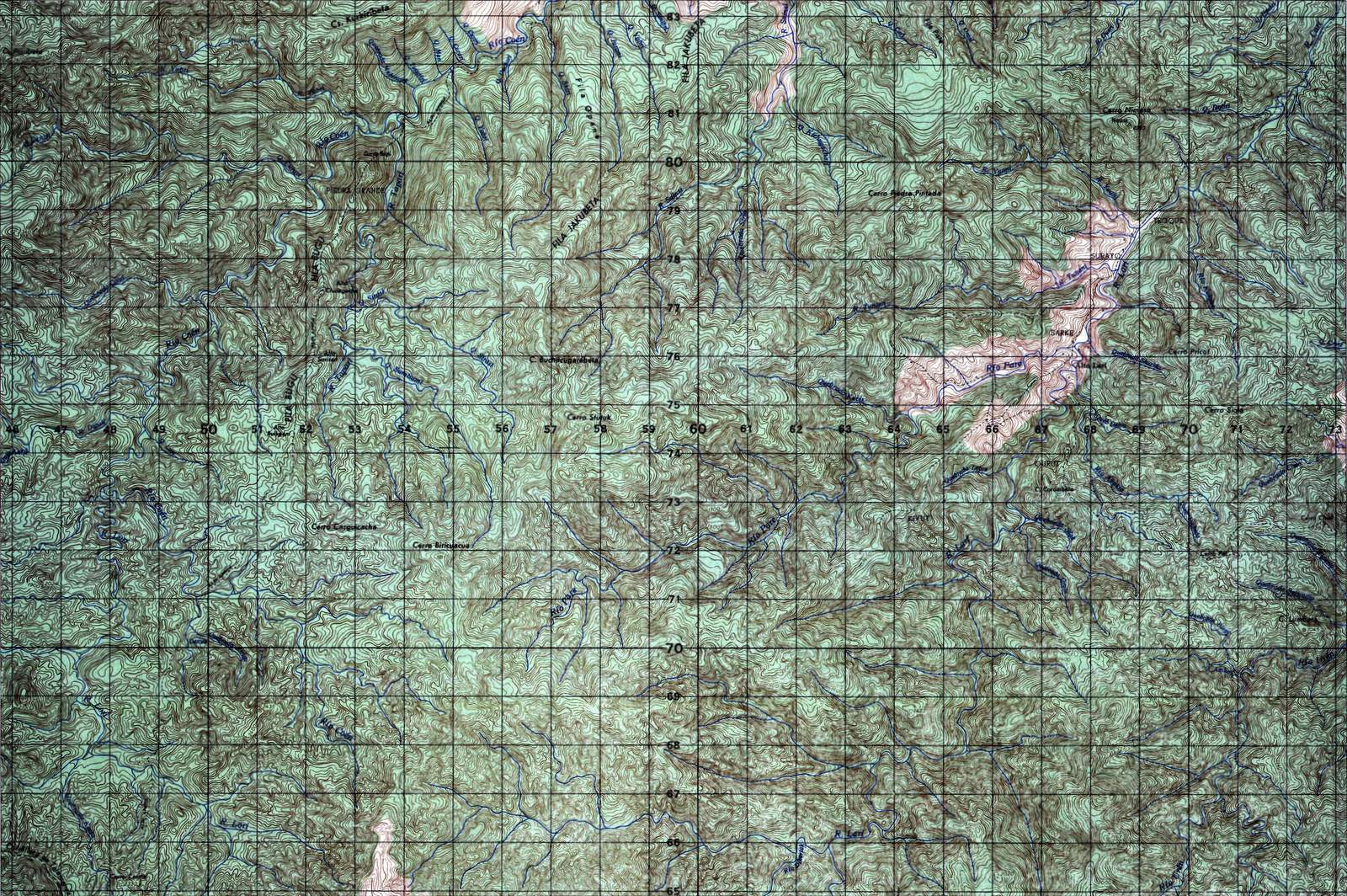
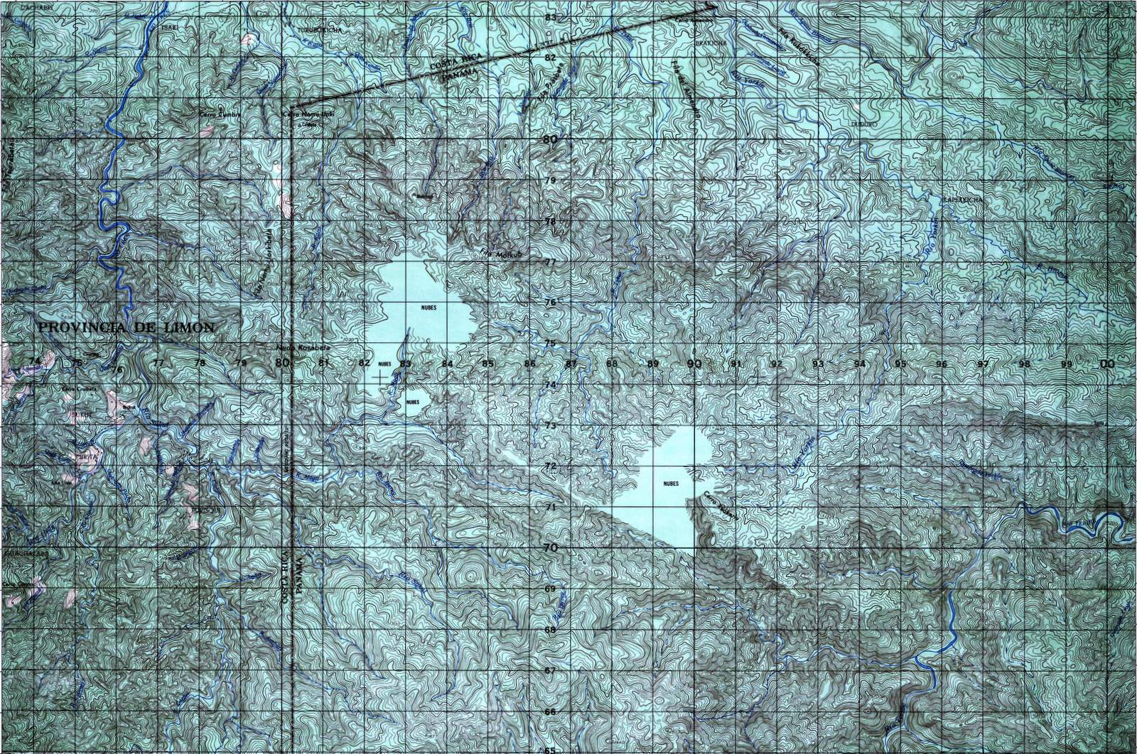
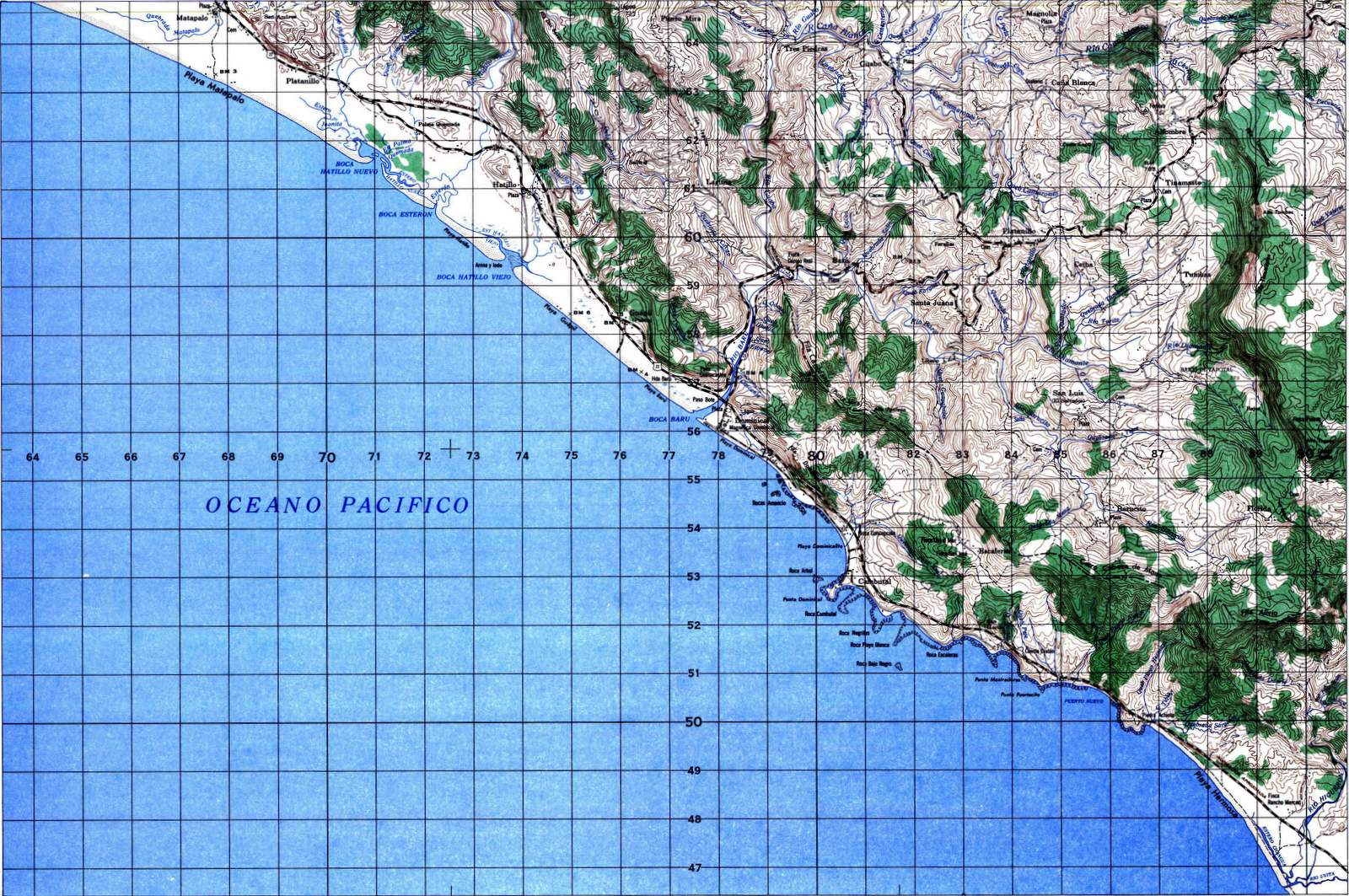
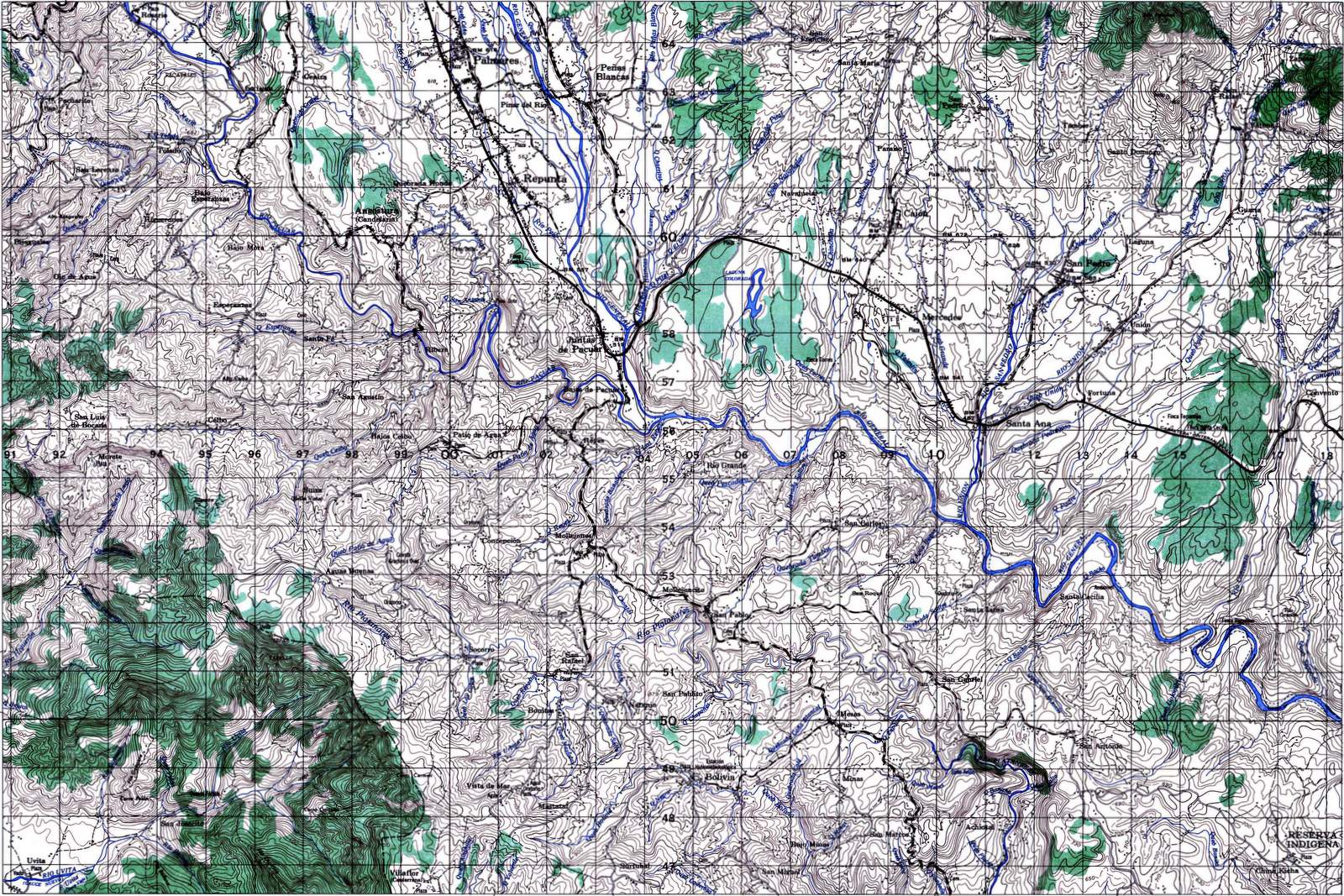
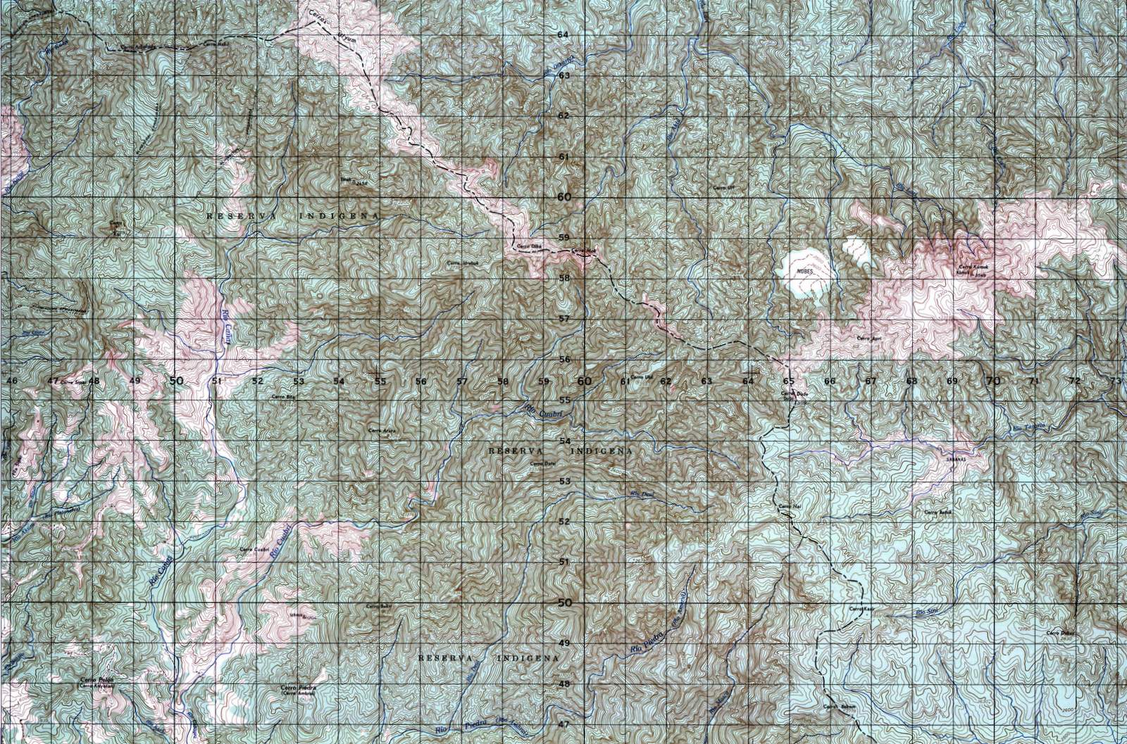
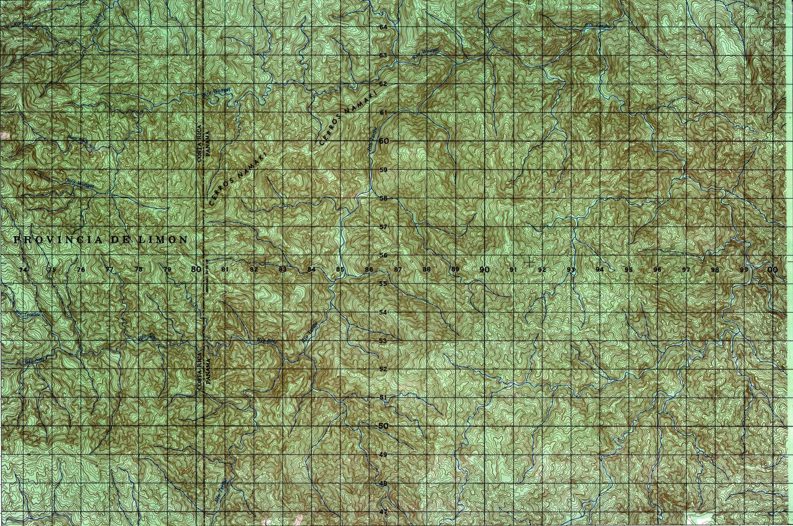
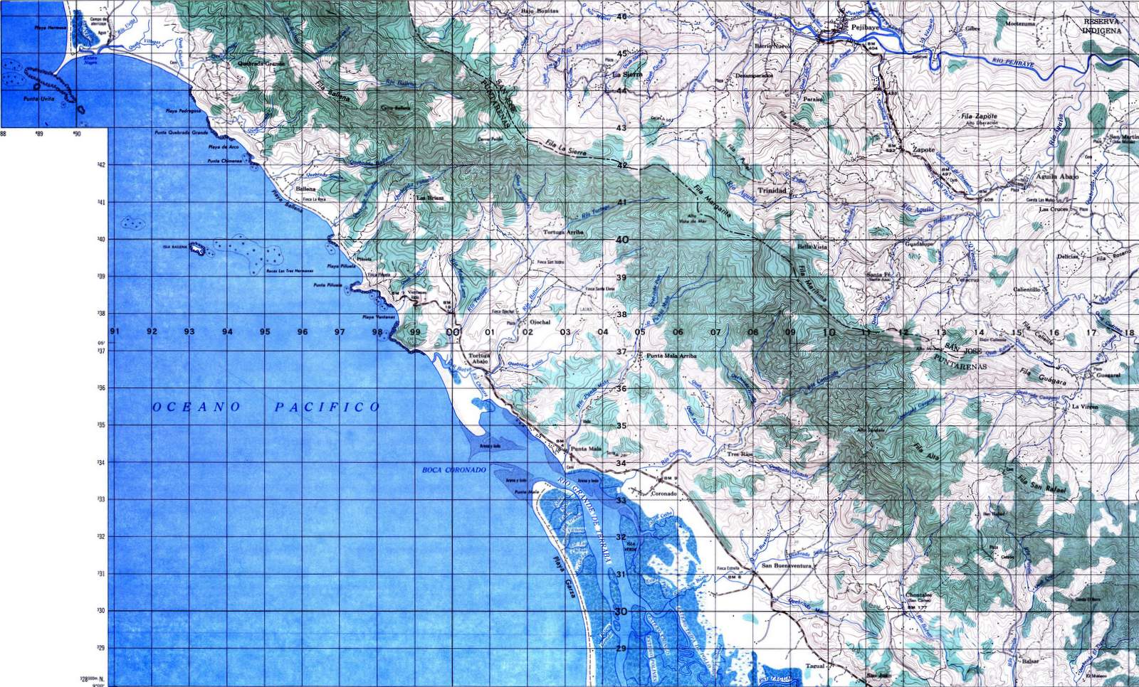
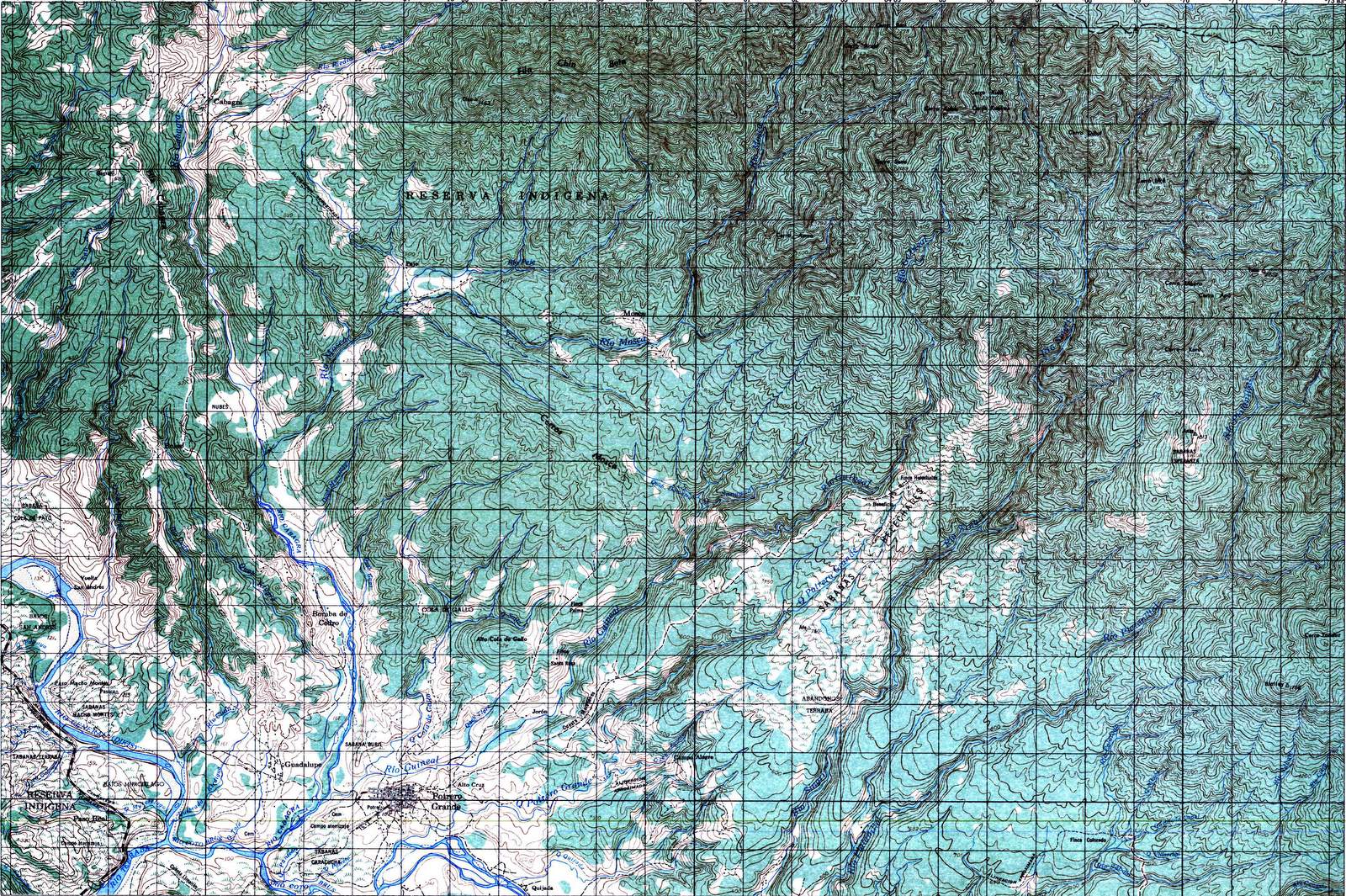
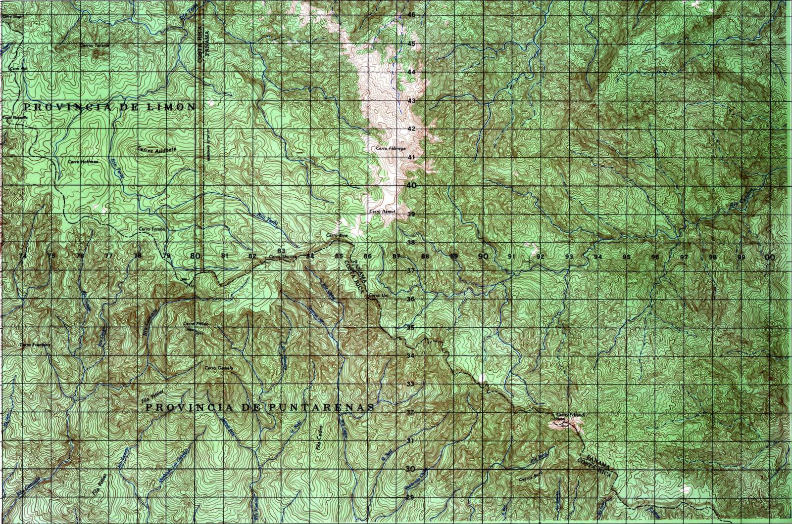
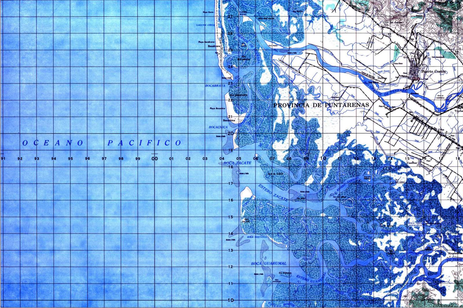
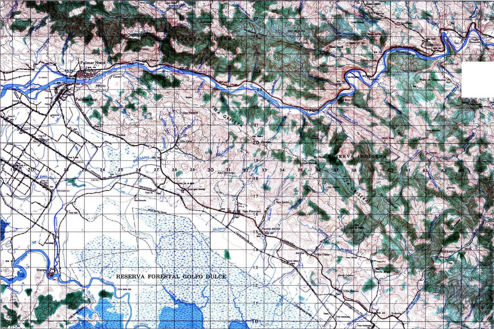
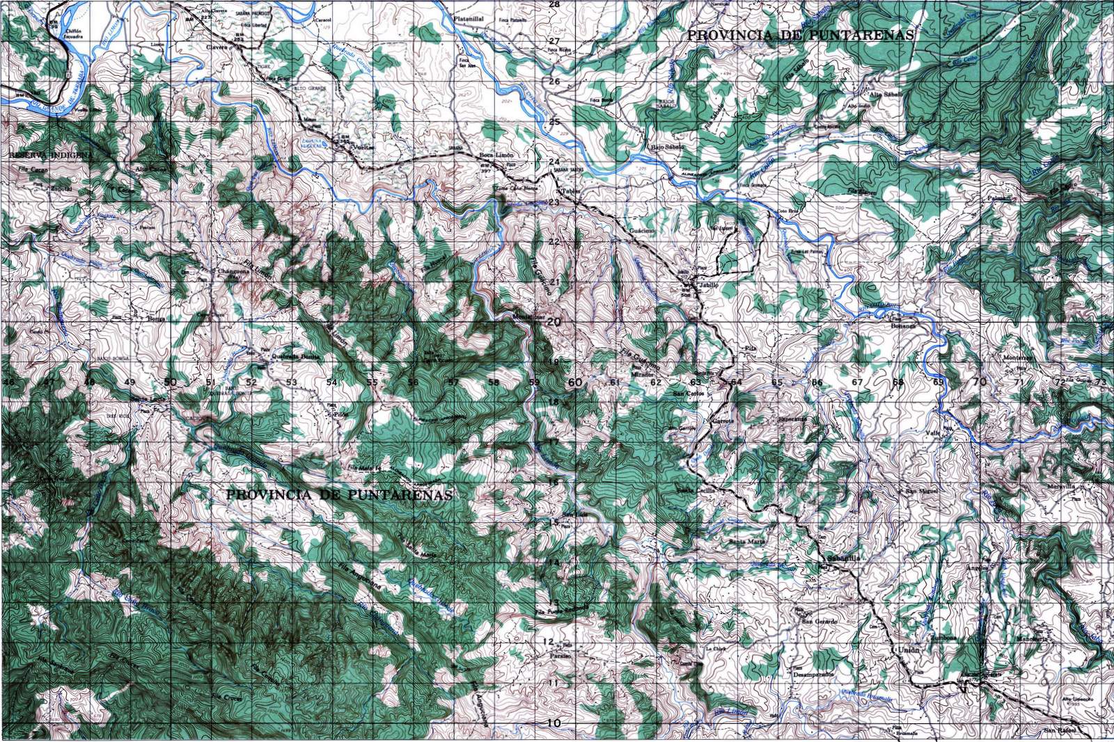
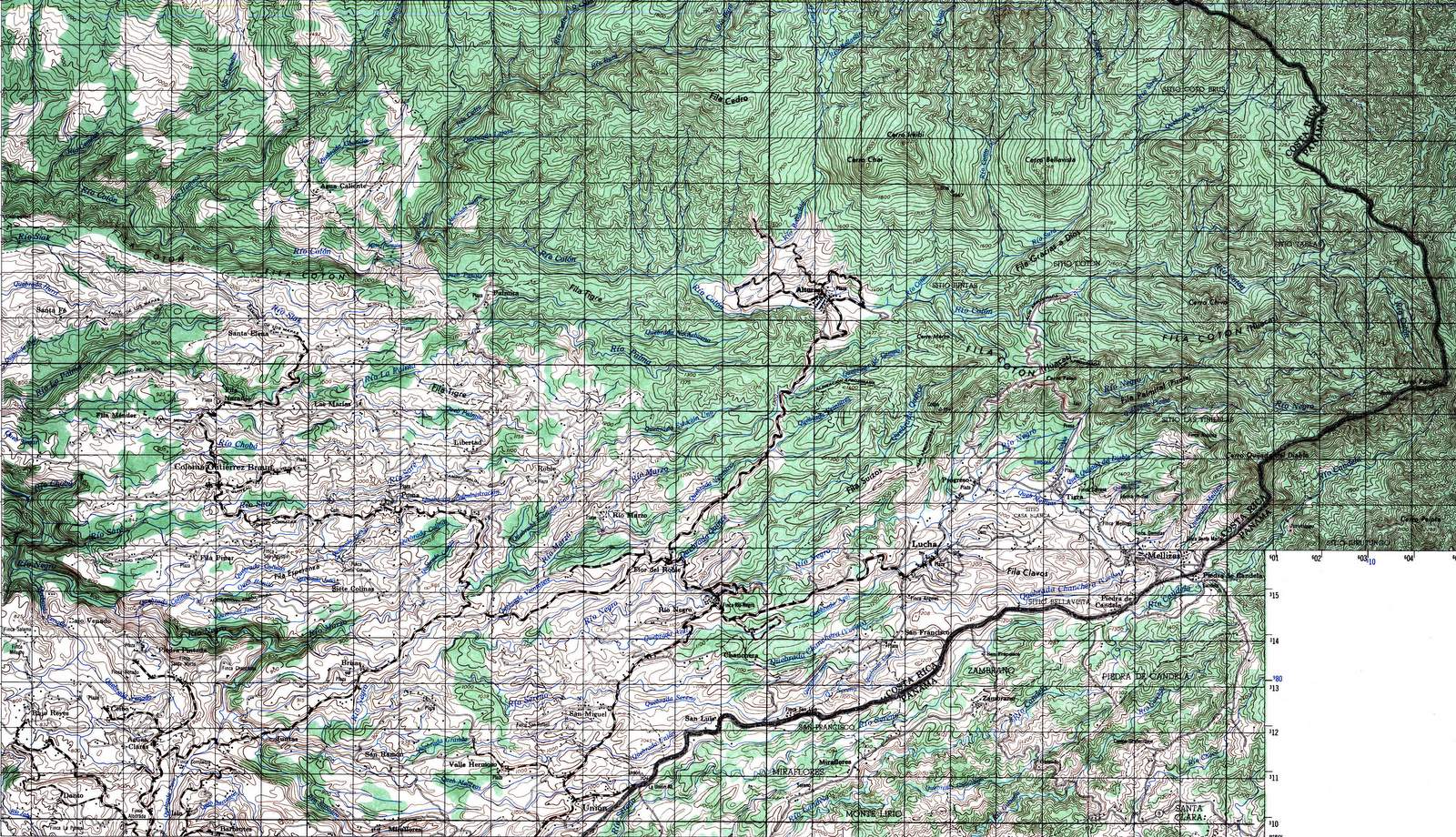
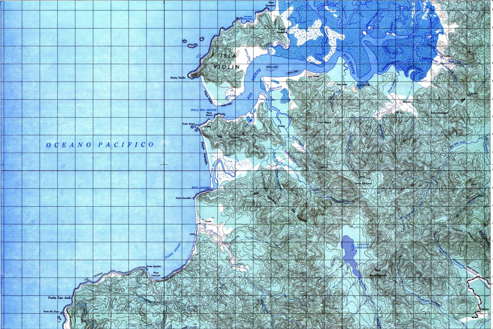
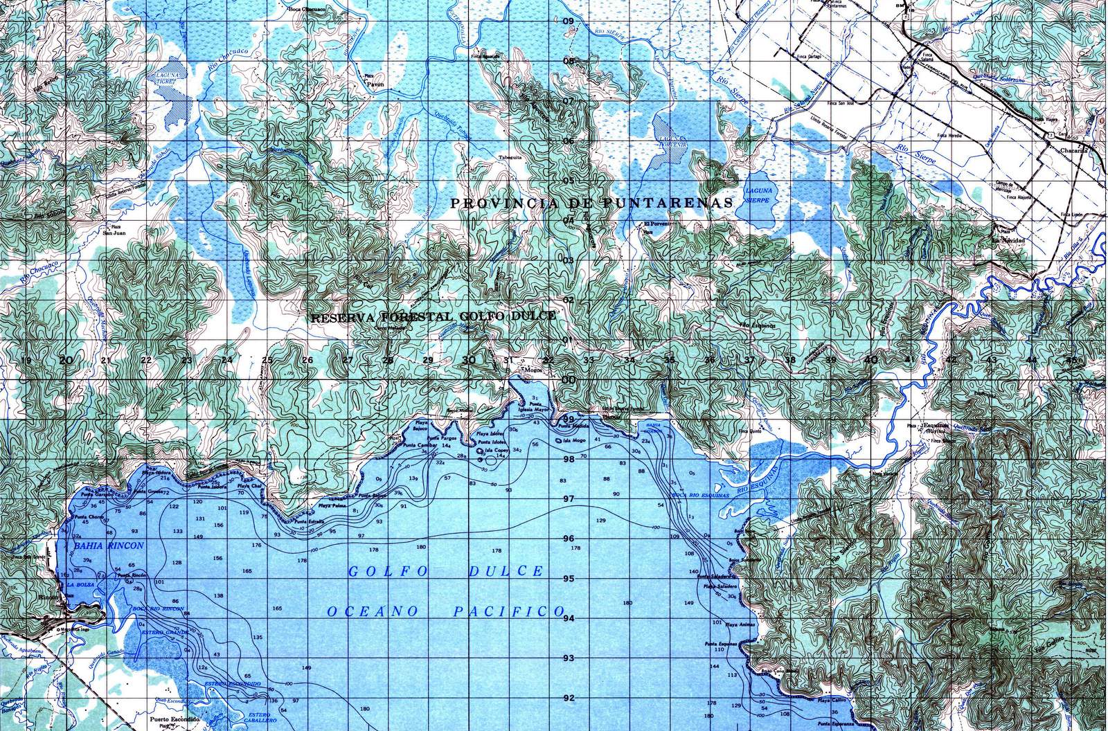
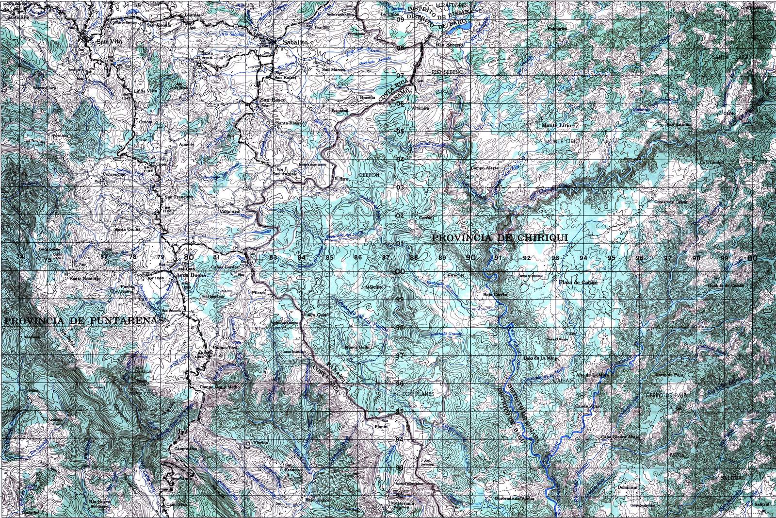
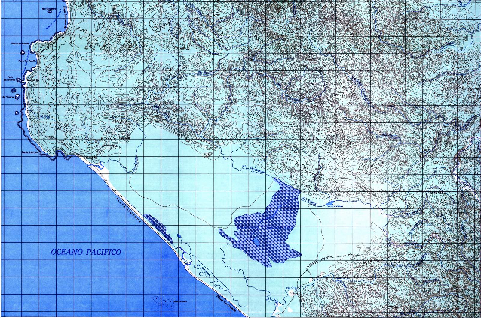
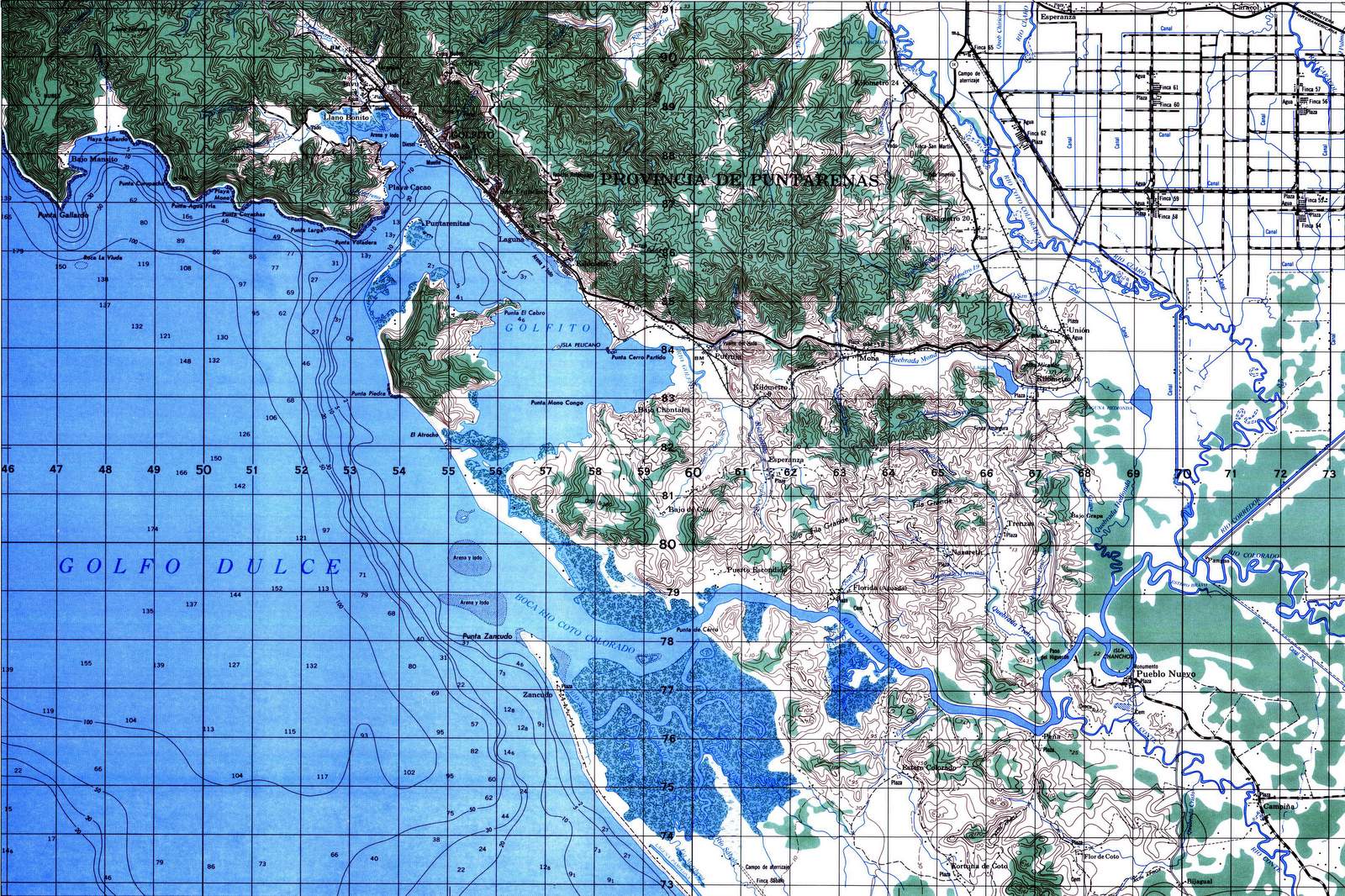
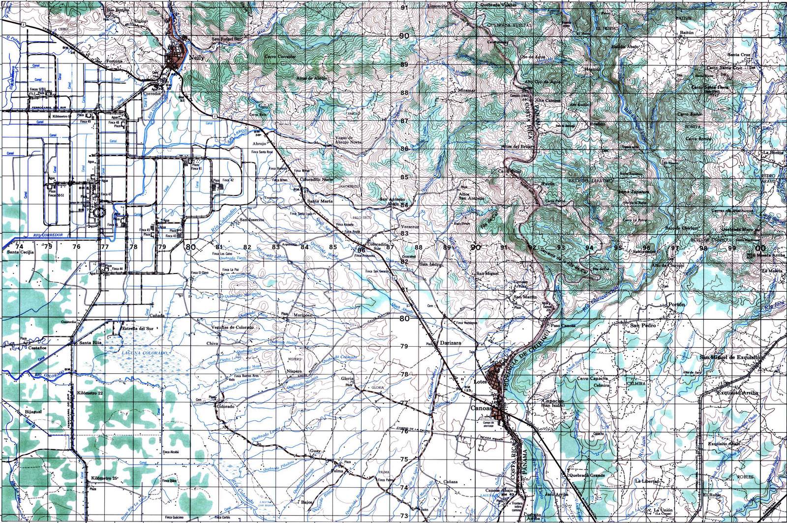
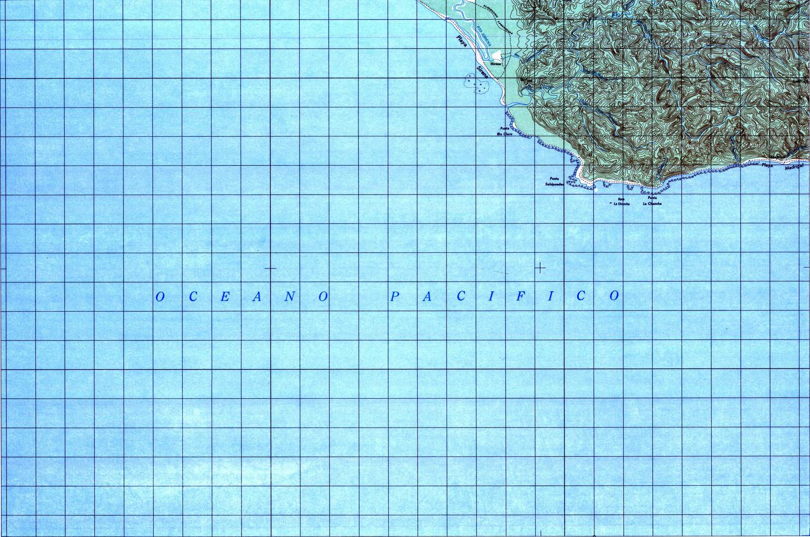
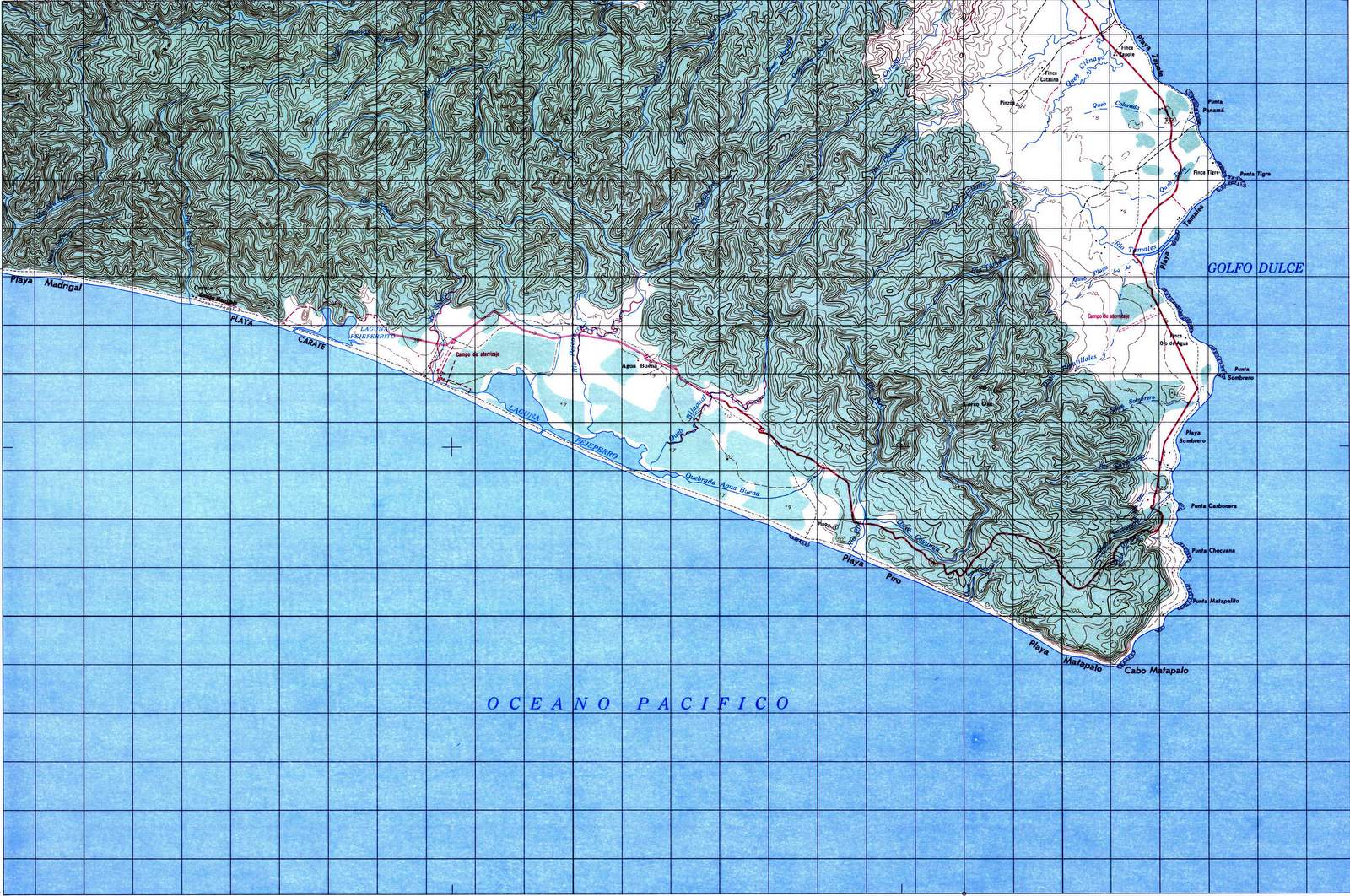
The 133 sheet series of topographic maps from the Instituto Geográfico Nacional (IGN) covers all of Costa Rica at a scale of 1:50,000 (1 cm = 0.5 km or 1 inch = 0.79 miles) and includes elevation contours at 10 meter, 20 meter or 30 meter intervals depending on the sheet.

That scale and contour interval is right at the upper limit to be useful for foot or bicycle travel and there are some huge climbs and drops that are invisible at this resolution.  A 100 foot cliff might be invisible so asking locally about routing is a good idea even if you have the maps.

See IGN contact information or other topo map sources for Costa Rica.

The topo maps are based on a survey of Costa Rica completed in the 1970’s and early 1980’s.  The mountains, valleys and rivers haven’t moved too much although a couple of the volcanoes have gotten a bit taller or shorter due to eruptions and new reservoirs have been created by dams.  Surprisingly outside the central valley the roads haven’t changed nearly as much as you might expect in 40 years of development.

Even within the central valley and cities the main roads are pretty much the same. Most of the blank spots that used to be coffee fields have been filled in with cul de sacs, housing developments and shopping centers.

Map Locator

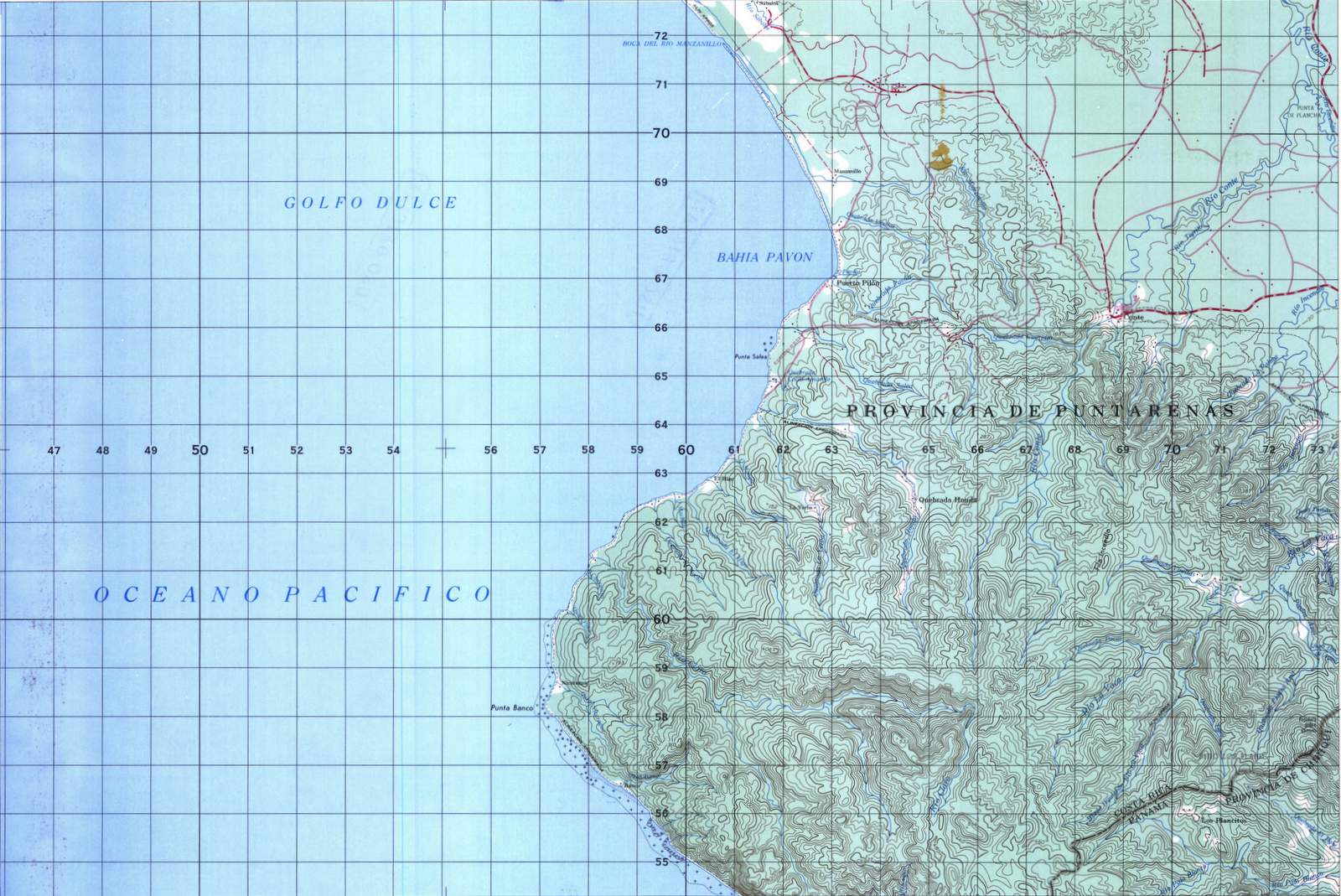
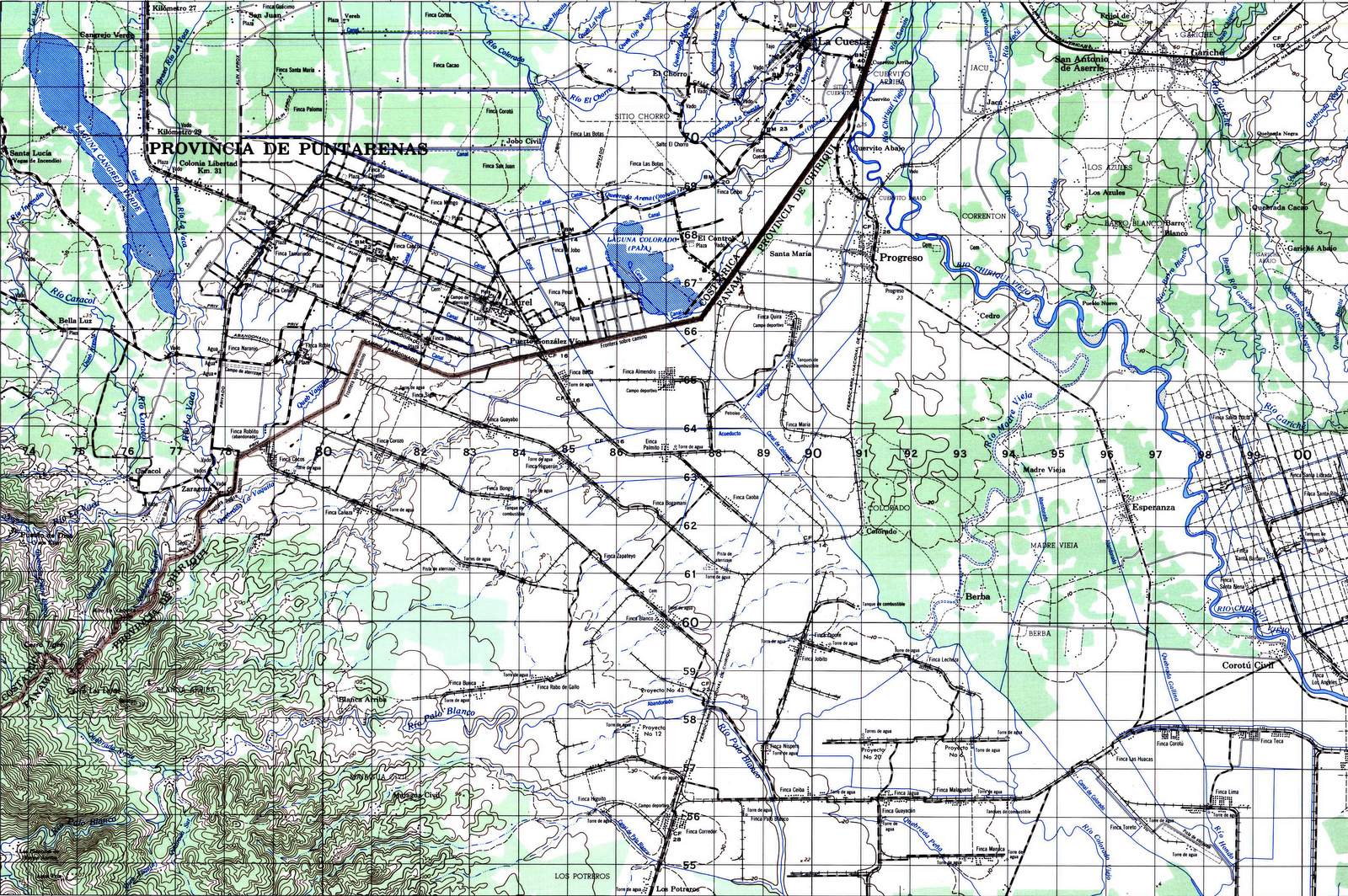
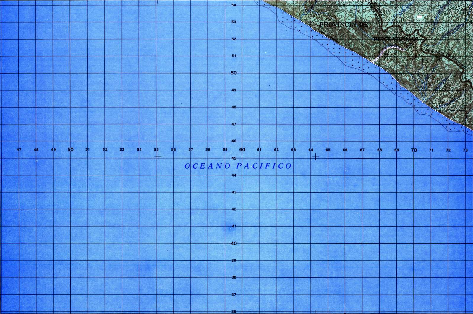
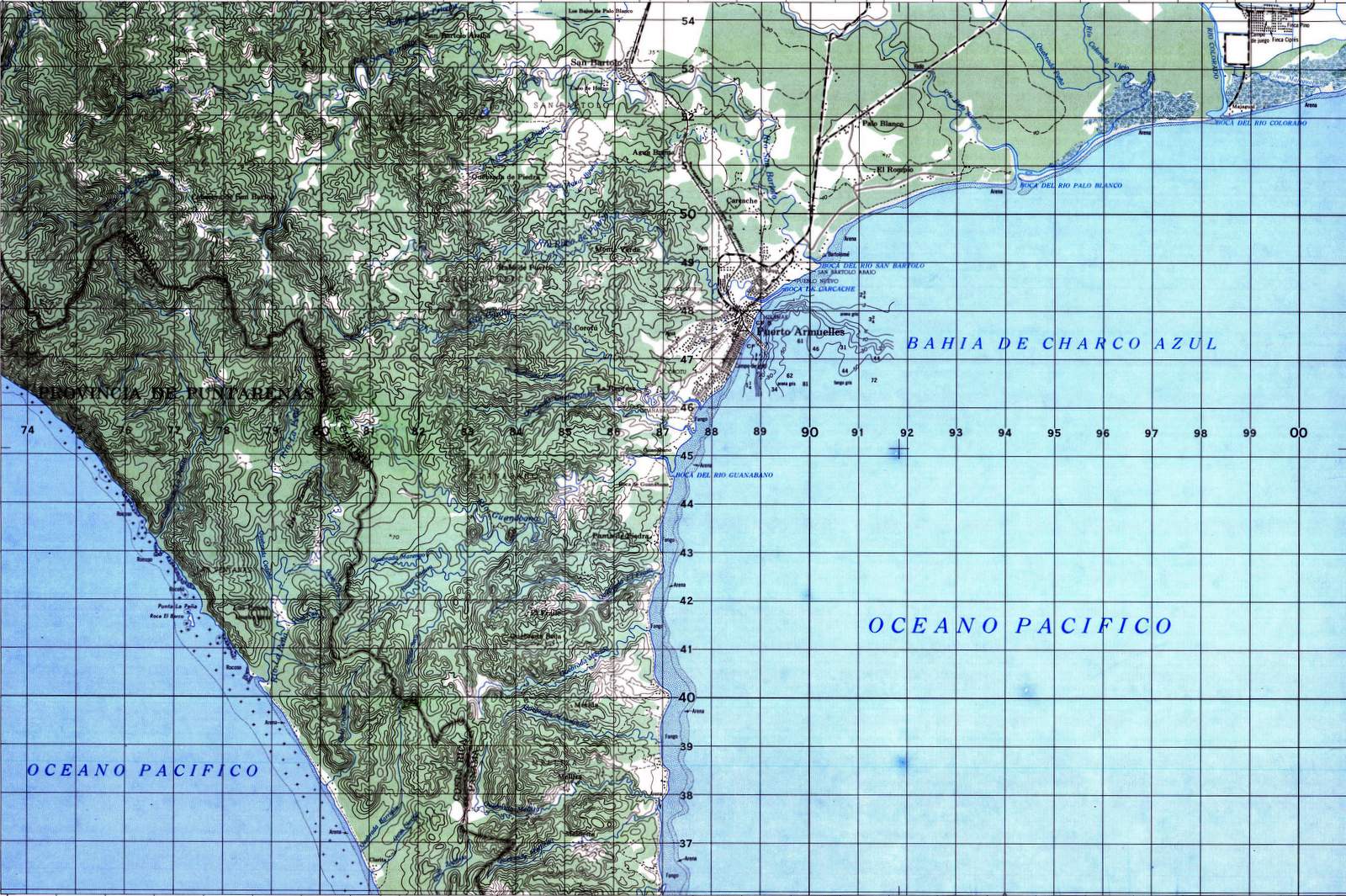
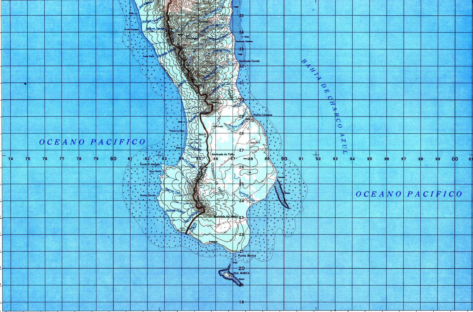
Use the table below to determine which maps you’ll need for your day hike, trek or 4WD expedition.  The maps are both named and coded (according to an arcane and obsolete method involving where they meet at the corners and a Roman numeral).  Click for enlarged image and mouse over for the IGN map series code.


Costa Rica topographic map of Penas Blancas , 1:50,000 scale
Costa Rica topographic map of Bahia De Salinas , 1:50,000 scale Costa Rica topographic map of Orosi, 1:50,000 scale Costa Rica topographic map of Cairo, 1:50,000 scale Costa Rica topographic map of Los Chiles, 1:50,000 scale
Costa Rica topographic map of Santa Elena, 1:50,000 scale Costa Rica topographic map of Murcielago, 1:50,000 scale Costa Rica topographic map of Cacao, 1:50,000 scale Costa Rica topographic map of Upala, 1:50,000 scale Costa Rica topographic map of Zapote, 1:50,000 scale Costa Rica topographic map of Medio Queso, 1:50,000 scale Costa Rica topographic map of Pocosol, 1:50,000 scale Costa Rica topographic map of Punta Castilla , 1:50,000 scale
Costa Rica topographic map of Ahogados, 1:50,000 scale Costa Rica topographic map of Curubande, 1:50,000 scale Costa Rica topographic map of Miravalles, 1:50,000 scale Costa Rica topographic map of Guatuso, 1:50,000 scale Costa Rica topographic map of San Jorge, 1:50,000 scale Costa Rica topographic map of Infiernito, 1:50,000 scale Costa Rica topographic map of Cutris, 1:50,000 scale Costa Rica topographic map of Trinidad, 1:50,000 scale Costa Rica topographic map of Colorado, 1:50,000 scale
Costa Rica topographic map of Punta Gorda, 1:50,000 scale Costa Rica topographic map of Carrillo Norte , 1:50,000 scale Costa Rica topographic map of Monteverde, 1:50,000 scale Costa Rica topographic map of Tierras Morenas , 1:50,000 scale Costa Rica topographic map of Arenal, 1:50,000 scale Costa Rica topographic map of Monterrey, 1:50,000 scale Costa Rica topographic map of Tres Amigos, 1:50,000 scale Costa Rica topographic map of Chaparron, 1:50,000 scale Costa Rica topographic map of Chirripo Alantico , 1:50,000 scale Costa Rica topographic map of Tortuguero, 1:50,000 scale
Costa Rica topographic map of Matapalo, 1:50,000 scale Costa Rica topographic map of Belen, 1:50,000 scale Costa Rica topographic map of Tempisque, 1:50,000 scale Costa Rica topographic map of Canas, 1:50,000 scale Costa Rica topographic map of Tilaran, 1:50,000 scale Costa Rica topographic map of Fortuna, 1:50,000 scale Costa Rica topographic map of Aguas Zarcas, 1:50,000 scale Costa Rica topographic map of Rio Cuarto, 1:50,000 scale Costa Rica topographic map of Rio Sucio, 1:50,000 scale Costa Rica topographic map of Agua Fria, 1:50,000 scale Costa Rica topographic map of California, 1:50,000 scale
Costa Rica topographic map of Villareal, 1:50,000 scale Costa Rica topographic map of Diria, 1:50,000 scale Costa Rica topographic map of Talolinga, 1:50,000 scale Costa Rica topographic map of Abangares, 1:50,000 scale Costa Rica topographic map of Juntas, 1:50,000 scale Costa Rica topographic map of San Lorenzo, 1:50,000 scale Costa Rica topographic map of Quesada, 1:50,000 scale Costa Rica topographic map of Poas, 1:50,000 scale Costa Rica topographic map of Guapiles, 1:50,000 scale Costa Rica topographic map of Guacimo, 1:50,000 scale Costa Rica topographic map of Parismina, 1:50,000 scale
Costa Rica topographic map of Marbella, 1:50,000 scale Costa Rica topographic map of Cerro Brujo, 1:50,000 scale Costa Rica topographic map of Matambu, 1:50,000 scale Costa Rica topographic map of Berrugate, 1:50,000 scale Costa Rica topographic map of Chapernal, 1:50,000 scale Costa Rica topographic map of Miramar, 1:50,000 scale Costa Rica topographic map of Naranjo, 1:50,000 scale Costa Rica topographic map of Barba, 1:50,000 scale Costa Rica topographic map of Carrillo, 1:50,000 scale Costa Rica topographic map of Bonilla, 1:50,000 scale Costa Rica topographic map of Matina, 1:50,000 scale Costa Rica topographic map of Moin, 1:50,000 scale
Costa Rica topographic map of Garza , 1:50,000 scale Costa Rica topographic map of Cerro Azul, 1:50,000 scale Costa Rica topographic map of Venado, 1:50,000 scale Costa Rica topographic map of Golfo, 1:50,000 scale Costa Rica topographic map of Barranca, 1:50,000 scale Costa Rica topographic map of Rio Grande, 1:50,000 scale Costa Rica topographic map of Abra, 1:50,000 scale Costa Rica topographic map of Istaru, 1:50,000 scale Costa Rica topographic map of Tucurrique, 1:50,000 scale Costa Rica topographic map of Barbilla, 1:50,000 scale Costa Rica topographic map of Rio Banano, 1:50,000 scale Costa Rica topographic map of San Andres, 1:50,000 scale
Costa Rica topographic map of Puerto Coyote , 1:50,000 scale Costa Rica topographic map of Rio Ario, 1:50,000 scale Costa Rica topographic map of Tambor, 1:50,000 scale Costa Rica topographic map of Tarcoles, 1:50,000 scale Costa Rica topographic map of Candelaria, 1:50,000 scale Costa Rica topographic map of Caraigres, 1:50,000 scale Costa Rica topographic map of Tapanti, 1:50,000 scale Costa Rica topographic map of Pejibaye, 1:50,000 scale Costa Rica topographic map of Chirripo, 1:50,000 scale Costa Rica topographic map of Estrella, 1:50,000 scale Costa Rica topographic map of Cahuita, 1:50,000 scale
Costa Rica topographic map of Cabuya, 1:50,000 scale Costa Rica topographic map of Herradura, 1:50,000 scale Costa Rica topographic map of Parrita, 1:50,000 scale Costa Rica topographic map of Dota, 1:50,000 scale Costa Rica topographic map of Vueltas, 1:50,000 scale Costa Rica topographic map of Cuereci, 1:50,000 scale Costa Rica topographic map of Matama, 1:50,000 scale Costa Rica topographic map of Telire, 1:50,000 scale Costa Rica topographic map of Amubri, 1:50,000 scale Costa Rica topographic map of Sixaola, 1:50,000 scale
Costa Rica topographic map of Quepos, 1:50,000 scale Costa Rica topographic map of Savegre, 1:50,000 scale Costa Rica topographic map of San Isidro, 1:50,000 scale Costa Rica topographic map of Durika, 1:50,000 scale Costa Rica topographic map of Siola, 1:50,000 scale Costa Rica topographic map of Sukut, 1:50,000 scale
Costa Rica topographic map of Dominical, 1:50,000 scale Costa Rica topographic map of Repunta, 1:50,000 scale Costa Rica topographic map of Buenos Aires , 1:50,000 scale Costa Rica topographic map of Kamuk, 1:50,000 scale Costa Rica topographic map of Namaki, 1:50,000 scale
Costa Rica topographic map of Coronado, 1:50,000 scale Costa Rica topographic map of General, 1:50,000 scale Costa Rica topographic map of Cabagra, 1:50,000 scale Costa Rica topographic map of Pittier, 1:50,000 scale
Costa Rica topographic map of Terraba, 1:50,000 scale Costa Rica topographic map of Changuena, 1:50,000 scale Costa Rica topographic map of Coto Brus, 1:50,000 scale Costa Rica topographic map of Union, 1:50,000 scale
Costa Rica topographic map of Sierpe, 1:50,000 scale Costa Rica topographic map of Rincon, 1:50,000 scale Costa Rica topographic map of Piedras Blancas , 1:50,000 scale Costa Rica topographic map of Canas Gordas , 1:50,000 scale
Costa Rica topographic map of Llorona, 1:50,000 scale Costa Rica topographic map of Golfo Dulce, 1:50,000 scale Costa Rica topographic map of Golfito, 1:50,000 scale Costa Rica topographic map of Canoas, 1:50,000 scale
Costa Rica topographic map of Madrigal, 1:50,000 scale Costa Rica topographic map of Carate, 1:50,000 scale Costa Rica topographic map of Pavon, 1:50,000 scale Costa Rica topographic map of Laurel, 1:50,000 scale
Costa Rica topographic map of Rio Cana Blanca , 1:50,000 scale Costa Rica topographic map of Puerto Armuelles , 1:50,000 scale
Costa Rica topographic map of Burica, 1:50,000 scale


Buy the maps at the Instituto Geográfico Nacional in San José

After using the table of images above to determine the locations you are interested in you can purchase the maps at the Costa Rica National Institute of Geography located in the headquarters of the National Registry on the third floor of wing 4. Tico address – Curridabat, opposite PriceSmart. Phone (506) 2202-0601, other contacts, GPS location 9.919358, -84.048886

Instituto Geográfico Nacional (IGN) sede central del Registro Nacional en Curridabat, frente a PriceSmart, en el tercer piso del Módulo 4. telefónico directo: (506) 2202-0601, other contacts

Ray & Sue

Cost · ToDo · Plan·Costa Rica Guide logo animated·Top10 · Best Time · Contact


toll free Costa Rica travel desk!
1-866-816-0197

CONTACT US

Photos
  • Tortuguero Beach – National Park & Sea Turtles Nesting
  • Tortuguero Village & Canals Photos
  • Guayabo National Monument
  • San Gerardo de Dota National Park
  • Karen Mogensen Nature Reserve
  • Lower Savegre & Rafiki
  • Savegre National Park
  • Pacuare River Rafting Overnight
  • Portalón Estero Rey National Wildlife Refuge
  • Hacienda Barú National Wildlife Refuge Photos
  • Rainmaker Biological Reserve Photos
  • Hills of Portalón Wildlife Refuge
  • Funny, Quirky, Weird – Costa Rica Humor
  • Bahía Junquillal National Wildlife Refuge Photos
  • Playa Hermosa-Punta Mala National Wildlife Refuge Photos
  • La Cangreja National Park Photos
  • Pacuare Gilligan’s Island
  • Rincón de la Vieja – Hacienda Guachipelín Photos
  • Quirky, Weird, Funny – Costa Rica Humor
  • Lankester Botanical Gardens Photos


Costa Rica Guide on facebook
Costa Rica Guide on Facebook