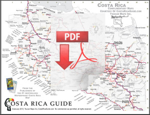

Click thumbnails above for the large jpg map image or detailed, printable, zoomable pdf map
The handy printable highway map of Costa Rica includes a table of driving distances and an alphabetical index of grid coordinates for most cities and towns and features national parks, reserves and wildlife refuges.
The map can be stored on any portable device, i-pad, tablet or computer for use offline or when cell/3G/4G service is unavailable. The maps are formatted to print at high resolution on standard 8.5 x 11 pages. Scribble notes on it and keep it handy for the big picture.
Detailed Regional Printable Maps
Arenal | Jacó | Manuel Antonio | Monteverde | Nosara | Tamarindo | Tenorio
We do not sell advertising or charge lodges, restaurants, tours and other businesses a fee to be included so if you’re looking for a real map instead of a poster plastered with marketing material this is it.
Waterproof Costa Rica Travel Map

If you want more detail order the #1 bestselling full color Waterproof Travel Map of Costa Rica, 39″ x 26″ and includes all the downloadable maps plus several other detail maps* Shows national parks, wildlife refuges, beaches, drive distances and drive time calculator. It even includes a few handy Spanish translations for navigational phrases if you need to ask directions. 2020 update in January.
©Costa Rica Guide, Toucan Maps Inc., Ray & Sue Krueger Koplin
Costa Rica Guide, Toucan Maps Inc. provides these maps at no charge for personal use and without warranty. Commercial use prohibited without prior license – these maps may not be modified, sold, given away, or reproduced in any form including print or digital, or online copies for commercial purposes.
If you would like to share this map please link to this page.
Detailed Printable Local PDF Maps
La Fortuna | Hermosa | Quepos | Santa Elena | Guiones | Langosta | Celeste
Updates & Contributions
We visit each region regularly and all of our maps are updated frequently. However, if you see an error, omission, or something that’s changed please let us know. All of our maps are geo-coded so GPS coordinates are very helpful but not required.
North & South 2 Page Version
Back by popular demand the 2 page version splits the country in half which allows bigger maps, more readability and added detail. The large print pdf map download automatically includes both pages.
North
The majority of Costa Rica vacations stay on page one of the map which includes the central Pacific coast from Dominical north to Manuel Antonio and Jacó, the beaches of the Nicoya Peninsula and Guanacaste including Playa Tamarindo.
The northern Caribbean including Tortuguero plus popular inland destinations like Rincón de la Vieja, Tenorio and Celeste waterfall, Arenal volcano and La Fortuna, Monteverde cloud forest and the routes to them from SJO international airport near the capital and LIR international airport outside Liberia are on page one.
South
If you’re headed to Corcovado National Park on the Osa Peninsula or Puerto Viejo, Cocles, Cahuita, Manzanillo or the other beaches of the southern Caribbean you’ll also want to print out page two.
The second page also includes a table of driving distances and index of grid coordinates for main cities and attractions.
Other Printable Maps of Costa Rica
Arenal | Jacó | Manuel Antonio | Monteverde | Nosara | Tamarindo | Tenorio

