Costa Rica Guide

travel information and maps

  • Vacation Planning
  • Best Trips Ever>>
  • More Fun Than Humanly Possible
  • Costa Rica
    • Top Ten
    • Best Time to Visit Costa Rica
    • Things To Do in Costa Rica
    • Maps
    • Transportation
      • Rental Cars
        • Advantages of Driving
        • Disadvantages Driving
        • Code of the Road
        • Navigation & Drive Time
        • Rental Insurance Explained
        • Can’t Get There
      • Airports
        • Flights Worth Taking
        • LIR or SJO
        • Airfare Deals
        • Domestic Airlines
        • Domestic Air Tips
      • Taxis
      • Bus Schedule
    • Food
      • Typical Menu
      • Batidos & Refrescos
      • Gallo Pinto
      • Tamales
      • Ceviche
      • Ensalada Palmito
      • Sopa Negra
      • Vinagre Chilera
    • Weather
      • Seasons in Costa Rica
      • Current Storms in Costa Rica
    • Regions
  • Nature & Wildlife
    • National Parks
    • Wildlife Refuges
    • Ecozones
    • Best Places to See Wildlife in Costa Rica
  • Practical Info
    • Health & Safety
      • Health Tips
        • Altitude Sickness
        • Chikungunya
        • Natural Disasters
      • Crime
        • Cons & Rip-offs
        • Corruption
        • Violent Crime
    • Will My Phone Work?
    • Packing List
    • Passports & Docs
    • Money – How To?
    • How Much Does it Cost?
    • Travel Tips
  • Stories
    • Photos
    • Trek Across Costa Rica
    • Sendero de Oro
    • Quebrada Gata
    • Bicycle Touring
    • About Us
  • Move to Costa Rica
  • Free Travel Pack
no obligation custom trip plan & price quote

1-866-816-0197

· Copyright © 2023 ·

Manuel Antonio Map

Click for larger version of the Manuel Antonio Map
larger image
Click to download the PDF version of the Manuel Antonio map
pdf map download

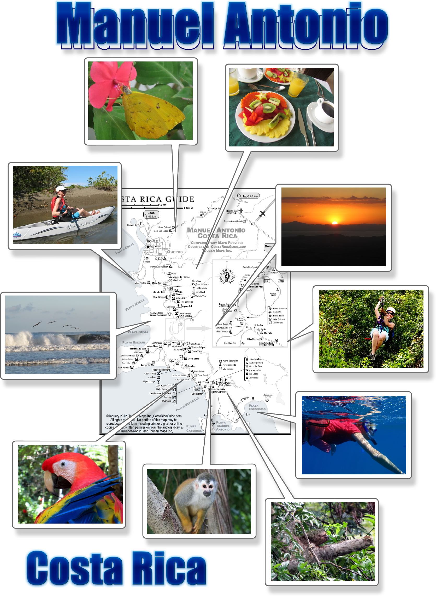
Choose either a large Manuel Antonio map image or the more detailed and fully zoomable pdf map

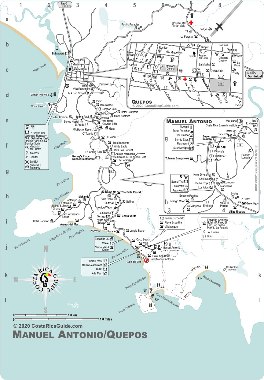
Free printable pocket map of the Manuel Antonio region from Quepos south to the national park featuring hotels, resorts and lodges with approximate price ranges for each.

Food and entertainment categories include bakeries, restaurants (with symbols for seafood, pizza, fast food etc), bars, nightclubs, casinos, ice cream shops, supermarkets and pulperias.

Manuel-Antonio-photo-map

Locate the practical necessities like airstrip, laundries, medical centers, shopping malls, internet access, police stations, ATMs, and banks.

Natural features like streams, rivers, beaches and beach access plus the most popular tour locations are highlighted.  This map includes Manuel Antonio national park entrances, parking, trails, miradors and other attractions.

Download for use on your phone or other device when cell signal or wi-fi are not available for live map feeds or print it out, scribble notes on it and keep it in your pocket.  We do not sell advertising or charge lodges, restaurants, tours and other businesses a fee to be included on any map. If you’re looking for a real map instead of a page of coupons and marketing material this is it.

Waterproof Costa Rica Travel Map

Waterproof Travel Map of Costa Rica
Waterproof Map

If you’d like more detail and permanence order the full color, 39″ x 26″ Waterproof Travel Map of Csota Rica – includes all the downloadable maps plus several other detail maps* Shows national parks, wildlife refuges, beaches, drive distances and drive time calculator.  It even includes a few handy Spanish translations for navigational phrases if you need to ask directions.  Updated for 2020.

…get it free ($12.95 – retail) just by sharing Costa Rica Guide – click for limited time offer…


*The full central valley enlargement from the airport to San José (including details of the cities of Alajuela, Heredia, Escazú and San José) is not available for download (it’s too large to print at home at a readable scale) and only included on the waterproof map.

©Costa Rica Guide, Toucan Maps Inc., Ray & Sue Krueger Koplin

Costa Rica Guide, Toucan Maps Inc. provides these maps at no charge for personal use and without warranty. Commercial use prohibited without prior license – these maps may not be modified, sold, given away, or reproduced in any form including print or digital, or online copies for commercial purposes.

If you would like to share this map please link to this page.

Updates

We visit each region regularly and all of our maps are updated frequently. However, if you see an error, omission, or something that’s changed please let us know. All of our maps are geo-coded so GPS coordinates are very helpful but not required.

Ray & Sue

Cost · ToDo · Plan·Costa Rica Guide logo animated·Top10 · Best Time · Contact


toll free Costa Rica travel desk!
1-866-816-0197

CONTACT US

Maps
  • Free GPS in Costa Rica
  • Printable Costa Rica Map
  • Traffic, Construction, Drive Times & Closures
  • Arenal Volcano & La Fortuna Map
  • Manuel Antonio Map
  • Half Million Dollar Mouse Click
  • Waterproof Map of Costa Rica – 2020
  • About GPS in Costa Rica
  • Free Map
  • Jacó, Herradura, Hermosa Map
  • Monteverde & Santa Elena Map
  • Nosara & Guiones Beach Map
  • Tamarindo Beach & Langosta Map
  • Tenorio, Celeste, Bijagua Map
  • Costa Rica Map Collection
  • Wall Map of Costa Rica
  • Printable Maps of All Costa Rica & Details Maps of Popular Destinations
  • Topo Maps
  • Find Locations
  • Rainfall Contour Maps


Costa Rica Guide on facebook
Costa Rica Guide on Facebook