Day 4 – March 20
Hiking – 9.9 km (6.2 miles), 913 meters (2,995 ft) elevation gain.

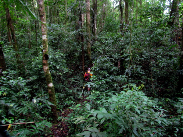
First a steep climb out of the the Río Coén valley, over the ridge on the west side of the Quebrada Yobri drainage then down to the Río Tapari – a major tributary of the Coén which we’d been told we’d need ropes to cross. After that we left the Río Coén drainage and headed straight up Cuesta Bugú and the rest of the trek would be in the highlands.
Big River
The one barrier that the baqueano had warned us about from the start was coming up this morning. The Río Tapari is the major tributary of the Río Coen and can sometimes be too deep to cross. “It depends on the rain in the mountains” was the doubly translated (Bribri to Spanish to English) response every time we tried to get more information.

We had to climb out of the Coén valley to get upstream on the Tapari where it was narrow enough and shallow enough to cross at the mouth of the canyon. Any higher and it was all raging white water, and lower down where it met the Coén it was slow and deep. Since only the gringos could swim and we hadn’t packed a boat the only choice was the ford.
When El Machete says something might not be possible you have to take it seriously but we weren’t about to turn around at this point. We brought tubular webbing and a few biners to haul the packs across and set up a roped traverse if necessary.

Turned out the water level was quite low (waist high at the deepest) and even though the current was fast it was easy enough to just walk across. We had lunch and then looked towards the challenge for the afternoon.
Big Rock

The contour lines on the topo map were as close together as they could be and still have white space showing and right across the middle of where we were headed was written “PIEDRA GRANDE” in all caps just like that – BIG ROCK.
We would climb straight up the tight cluster of contour lines going from 600 meters to over 1200 meters in less than a kilometer (about 2,000 feet of elevation gain in half a mile). That’s just silly steep. It’s steeper than a staircase. Kind of like a half mile tall step ladder but coated in mud and leaf litter so you slip backwards a foot every time you step forward 18″.
Camp Bugu
We were leaving the Coén behind and looked forward to camping on a ridge for a change instead of the soggy bottom of a river valley…I should have read my own article about how the ridges and peaks in Costa Rica trap moisture. It was the wettest camp of the whole trip and pretty miserable. We set up in the rain, cooked in the rain and slept in the rain. The funny thing about all that water was that there was not a drop to drink.
We were up on a ridge and the only standing water was in a tiny muddy spring that may not have been a spring at all but just a mud puddle in a depression. We ended up collecting rainwater off the tarp.

Since the modern marvel high tech Soto Muka camp stoves had crapped out the day before we had to expend some significant effort building a fire. After hacking off the waterlogged outside inch or so a fallen tree was dry enough in the middle to splinter firewood from with Andy’s machete.
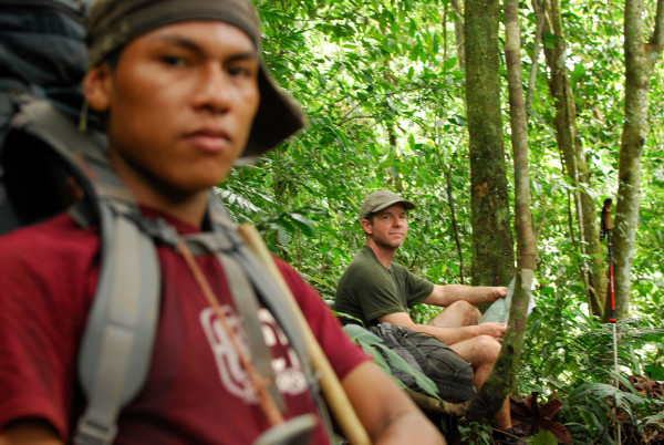
Justin was sick and he and Andres came in about forty minutes behind. We set up their tents so they’d a least have a dry(ish) place to crash. The kitchen roof tarp hadn’t been the biggest success up to this point but Chris did a diagonal stretch that improved its drainage and worked well for trapping rainwater. Chicken burritos and tortilla soup for dinner and it was delicious and hot.
Go to Another Day
Caribbean – 0 – 1 – 2 – 3 – today – 5 – 6 – 7 – 8 – 9 – 10 – Pacific
Photo Gallery Day 4 – Quebrada Mari to Fila Bugu
Each of the images below is linked to a larger version with a detailed description


Go to Another Day
Caribbean – 0 – 1 – 2 – 3 – today – 5 – 6 – 7 – 8 – 9 – 10 – Pacific