Costa Rica Guide

travel information and maps

  • Vacation Planning
  • Best Trips Ever>>
  • More Fun Than Humanly Possible
  • Costa Rica
    • Top Ten
    • Best Time to Visit Costa Rica
    • Things To Do in Costa Rica
    • Maps
    • Transportation
      • Rental Cars
        • Advantages of Driving
        • Disadvantages Driving
        • Code of the Road
        • Navigation & Drive Time
        • Rental Insurance Explained
        • Can’t Get There
      • Airports
        • Flights Worth Taking
        • LIR or SJO
        • Airfare Deals
        • Domestic Airlines
        • Domestic Air Tips
      • Taxis
      • Bus Schedule
    • Food
      • Typical Menu
      • Batidos & Refrescos
      • Gallo Pinto
      • Tamales
      • Ceviche
      • Ensalada Palmito
      • Sopa Negra
      • Vinagre Chilera
    • Weather
      • Seasons in Costa Rica
      • Current Storms in Costa Rica
    • Regions
  • Nature & Wildlife
    • National Parks
    • Wildlife Refuges
    • Ecozones
    • Best Places to See Wildlife in Costa Rica
  • Practical Info
    • Health & Safety
      • Health Tips
        • Altitude Sickness
        • Chikungunya
        • Natural Disasters
      • Crime
        • Cons & Rip-offs
        • Corruption
        • Violent Crime
    • Will My Phone Work?
    • Packing List
    • Passports & Docs
    • Money – How To?
    • How Much Does it Cost?
    • Travel Tips
  • Stories
    • Photos
    • Trek Across Costa Rica
    • Sendero de Oro
    • Quebrada Gata
    • Bicycle Touring
    • About Us
  • Move to Costa Rica
  • Free Travel Pack
no obligation custom trip plan & price quote

1-866-816-0197

· Copyright © 2023 ·

Puerto Viejo to Coroma

Day 1 – March 17 (St. Patrick’s Day)

"and they're off..." the race from the Caribbean coast to the Pacific begins
Ready, Set, Go

Total – 40.3 km (25 miles), 504 meters (1,654 ft) elevation gain.
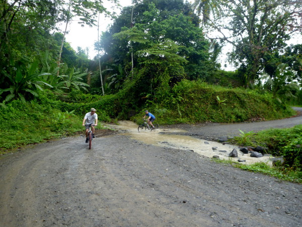
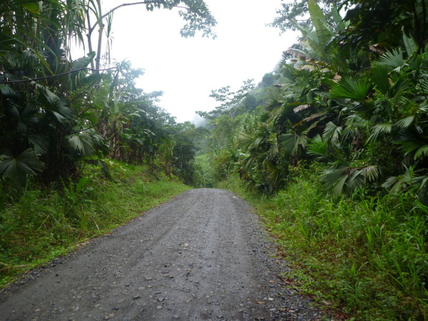
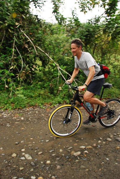
Mountain bike – Puerto Viejo to Suretka 29.6 km (18.4 miles), 447 meters (1,467 ft) elevation gain.
Boat – Suretka (Rio Telire) to Lari 6.1 km (3.8 miles), 5 meters (16 ft) elevation gain.
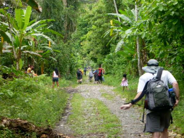
Hiking – Rio Lari to Coroma 4.6 km (2.9 miles), 52 meters (171 ft) elevation gain.

The Multi-Sport Tour

We got up early, waded out into the cool grey Caribbean Sea to make the first “coast” official then did a little last minute rearranging before tossing our packs in a truck.  It would follow us to the end of the road and take the mountain bikes back to the outfitter we rented them from.

Fun biking
Fun biking

It was almost anticlimactic starting out on a paved road past the boutique hotels of Puerto Viejo.  We could have just driven to the start of the trail but when I conjured up this scheme I’d started with the idea of walking coast to coast.  The only thing that sounded less adventurous than mountain biking the road was walking it. I shifted my expectations from hiking the whole way to self-propelled the whole way but I wasn’t about to drive any part of the coast-to-coast.

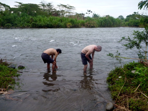
The first day was a relatively easy one traveling by mountain bike from Puerto Viejo de Talamanca on the Caribbean coast to the end of the road on the banks of the Río Telire at the Bri-Bri village of Suretka.  When the road ended we loaded into a dugout canoe for the only motorized segment of our journey across the Río Telire to where we could enter the Río Lari, cross it and pick up the trail to Coroma.

You can't get to Coroma by road and according to the locals there are no running vehicles but these old buses crossed the river somehow and used to ply the track running from the village to the landing
Walking to Coroma

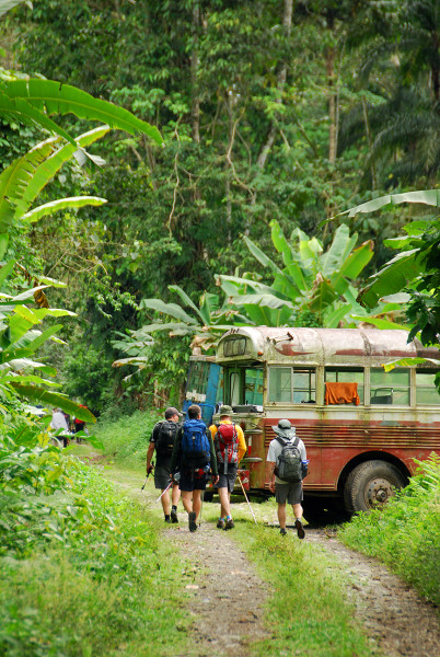
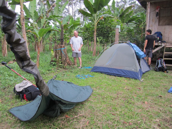
The last short segment on day one was on foot to the Bri-Bri village of Coroma where we set up camp in the front yard of our head porter.

Nicknames

I should apologize in advance to the guides and porters because although we did hear their names when we first met them they were Bribri and twisted our tongues into knots.  They had similar difficulties with ours.  Most of the time there was no one else around so we didn’t need to call out names.  You simply walk up to someone and start talking.

Take a break
Take a break

In the stories of our trek I refer to them with the nicknames we used on the trail – “the guide” (the head porter with all the different rock band t-shirts.  No one else had a clean shirt the whole time but I swear he had a new one on every morning), “porter number 6” (so named because we’d originally planed for five but the packs seemed unfairly heavy so we hired an extra) and of course “El Machete” for our machete wielding “baqueano” (indigenous guide) who led the way.

We never learned the meanings of nicknames they used for us.
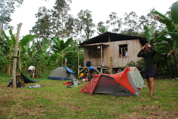
Camp Coroma

Camp in Coroma was very comfortable – front yard, grass, dinner was stewed chicken, black beans and rice prepared by our hostess.

Our first camp was in the front yard of one of the porter's homes in Coroma
Camp one

They were celebrating something in the community.  Could have been St. Patrick’s day but it could have been something completely different.  The language barrier (BriBri, we had fluent Spanish speakers) made it impossible to determine for sure.  What was certain was that they definitely wanted us to share in the Chiche (corn beer) they had brewed up in an old oil barrel.

We had a few sips to be polite but the last thing we wanted on the first day of the big hike was a homemade hooch hangover.

Go to Another Day
Caribbean – 0 – today – 2 – 3 – 4 – 5 – 6 – 7 – 8 – 9 – 10 – Pacific

Photo Gallery Day 1 – Puerto Viejo to Coroma

Each of the images below is linked to a larger version with a detailed description

Our starting point for the trek was Playa Negra north of Puerto Viejo de Talamanca - lat 9.27716 lng -83.2751 elevation sea level. From left to right Andy Leach, Justin Hamel, Andres Madrigal, Chris Carpenter, Ray Krueger Koplin. Front row - the beach dogs (they didn't trek with us).
Caribbean coast
"and they're off..." the race from the Caribbean coast to the Pacific begins
Ready, Set, Go
Playa Negra north of Puerto Viejo de Talamanca
Playa Negra
We spent night the night of day zero (before we started trekking) at Hotel Banana Azul and got our last hot shower for a while on the gray overcast morning of day one
Banana Azul
Sorting gear and making last minute preparations
Sorting gear
We tossed our backpacks on the support truck that would follow us to the end of the road at Suretka
Support truck
Eight steps completed, roughly half a million to go... lat 9.27716 lng -83.2751 elevation one foot above sea level
Eight steps completed
A few warmup stretches
Stretches
The first 29.6 km from Puerto Viejo to Suretka was by mountain bike, at first on pavement and then gravel road
Pavement
Our backpacks and a spare bicycle were carried on the support truck that followed us to the end of the road at Suretka
Support truck
Most of the border region near the Caribbean coast is covered with forest on the Panama side and banana plantations on the Costa Rica side.
Panama
Rolling into Bri-Bri
Bri-Bri
The department of transportation sign says "We're changing the roadmap of Costa Rica."
Road block
The Río Sixaola with Panama in the background
The Río Sixaola
The pavement ended at Bri-Bri
Pavement ends
"We can't possibly be lost already...can we?"
Can’t be lost…
Swapping a broken bike for the spare in the truck
Broke a bike
Panama is just across the river
Panama
Our first river crossing! Only about two hundred more to go.
First river crossing!
Andres hopped on the truck for a while to shoot some photos safari style
Safari style
On the road from Puerto Viejo to Suretka along the Panama border
On the road
As we neared the end of the road in Suretka the jungle started to replace the banana plantations
Jungle
One hill we didn't have to go over
Tunnel
Biking
Biking
Biking
Biking
Fun biking
Fun biking
Blowout. The tire bead slipped off the rim and it sounded like a gunshot when the inner tube exploded
Blowout.
The last outpost. The little pulperia in Surketa was the last chance for last second purchases and cold beverages.
The last outpost.
Biking Over the Quebrada Blei on a suspension bridge near Suretka
Quebrada Blei
Che Guevara, Bob Marley, Carlos Luis Falla and Presbere welcome us to the pulperia in Suretka
Che Guevara, Bob Marley
Last pulperia and last chance for last second purchases and cold beverages.
Last pulperia
At Suretka the road ends, bus service ends, the electrical lines and water pipes end, and the adventure begins
End of the line
Drop the bikes, this is the end of the road
Drop the bikes
You can fix anything with duct tape...for a while anyway.
Duct tape
At Suretka the road ends, bus service ends, the electrical lines and water pipes end, and the adventure begins
The road dead ends
Rio Telire
Rio Telire
We put the bikes in the truck and loaded into a dugout to cross the Río Telire and enter a channel of the Río Lari that we could boat and walk along to Coroma
In the cayuga
This short boat ride was the only place we "cheated" and used motorized transportation. The original plan was to make the trek across Costa Rica entirely human powered, but when it really came down to it no one seemed to think it detracted from the experience to use the dugout
Dugout
Headed there
Headed there
The blue plastic bags used by commercial plantations to concentrate pesticides
Banana trash
We were one porter shy so I doubled up on packs for the flat five km walk to Coroma
Double bagging
To Coroma
To Coroma
A new pedestrian bridge project to replace the old log. The only vehicles are horse and ox drawn carts and they use the ford to cross the river
Pedestrian bridge
Chris had a bit of a challenge setting up his hammock without any forest around
Camp Coroma
Oropendula nests
Most of the dugout captains carry a bicycle to get around the little villages where they pulled ashore
Dugout captain’s bike
Boats
Boats
Our head porter and guide was waiting for us at Suretka
Our head guide
You can lead a horse to water but you can't make him cross...unless of course you tie him to a canoe and pull him across...
Lead a horse to water
Loading gear
Loading gear
The canoe dropped us on the opposite bank of the Río Lari where we met our porters, shouldered our packs and set out on foot for Coroma
Opposite bank
Take a break
Take a break
You can't get to Coroma by road and according to the locals there are no running vehicles but these old buses crossed the river somehow and used to ply the track running from the village to the landing
Walking to Coroma
Bath time
Bath time
Seriously? You fat old men are going to die if you wander off into those mountains.
Seriously?
Adios amigos - go with god, you may need him where you're headed
Adios amigos
The kids were really curious and came out later to check out our gear. I thought we might end up having a slumber party in the tents.
Kids
Our first camp was in the front yard of one of the porter's homes in Coroma
Camp one
Chris was still experimenting with his Hennessy Hammock and got it a little low
Little low

Go to Another Day
Caribbean – 0 – today – 2 – 3 – 4 – 5 – 6 – 7 – 8 – 9 – 10 – Pacific


Ray & Sue

Cost · ToDo · Plan·Costa Rica Guide logo animated·Top10 · Best Time · Contact


toll free Costa Rica travel desk!
1-866-816-0197

CONTACT US

Over the Hill
  • Trans Talamanca Trek – How To
  • Over the Hill
  • Puerto Viejo to Coroma
  • Coroma to Kichuguecha
  • Kichuguecha to Quebrada Mari
  • Quebrada Mari to Fila Bugu
  • Fila Bugu to Catarata Ririgu
  • Catarata Ririgu to Rio Lori
  • Rio Lori to Ujarras
  • Ujarras to Cordoncillo
  • Cordoncillo to La Gran Vista
  • La Gran Vista to Playa Hermosa
  • Meals & Gear Transcontinental


Costa Rica Guide on facebook
Costa Rica Guide on Facebook