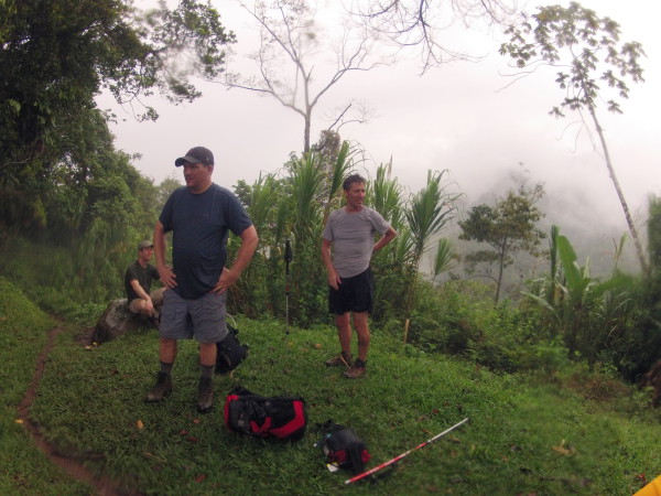
Costa Rica Guide

travel information and maps

  • Vacation Planning
  • Best Trips Ever>>
  • More Fun Than Humanly Possible
  • Costa Rica
    • Top Ten
    • Best Time to Visit Costa Rica
    • Things To Do in Costa Rica
    • Maps
    • Transportation
      • Rental Cars
        • Advantages of Driving
        • Disadvantages Driving
        • Code of the Road
        • Navigation & Drive Time
        • Rental Insurance Explained
        • Can’t Get There
      • Airports
        • Flights Worth Taking
        • LIR or SJO
        • Airfare Deals
        • Domestic Airlines
        • Domestic Air Tips
      • Taxis
      • Bus Schedule
    • Food
      • Typical Menu
      • Batidos & Refrescos
      • Gallo Pinto
      • Tamales
      • Ceviche
      • Ensalada Palmito
      • Sopa Negra
      • Vinagre Chilera
    • Weather
      • Seasons in Costa Rica
      • Current Storms in Costa Rica
    • Regions
  • Nature & Wildlife
    • National Parks
    • Wildlife Refuges
    • Ecozones
    • Best Places to See Wildlife in Costa Rica
  • Practical Info
    • Health & Safety
      • Health Tips
        • Altitude Sickness
        • Chikungunya
        • Natural Disasters
      • Crime
        • Cons & Rip-offs
        • Corruption
        • Violent Crime
    • Will My Phone Work?
    • Packing List
    • Passports & Docs
    • Money – How To?
    • How Much Does it Cost?
    • Travel Tips
  • Stories
    • Photos
    • Trek Across Costa Rica
    • Sendero de Oro
    • Quebrada Gata
    • Bicycle Touring
    • About Us
  • Move to Costa Rica
  • Free Travel Pack
no obligation custom trip plan & price quote

1-866-816-0197

· Copyright © 2025 ·

Coroma to Kichuguecha

Day 2 – March 18

Hiking – 13.7 km (7.8 miles), 529 meters (1,670 ft) elevation gain.

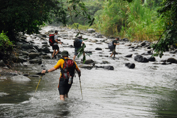
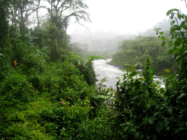
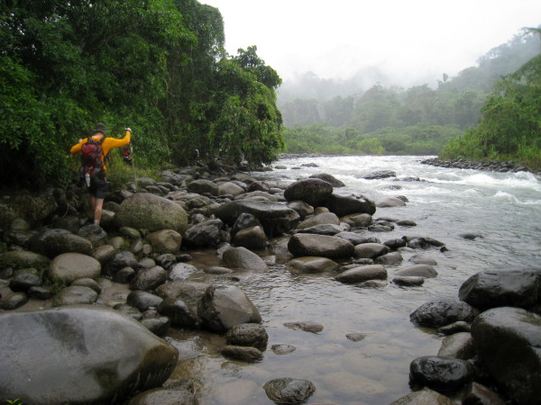
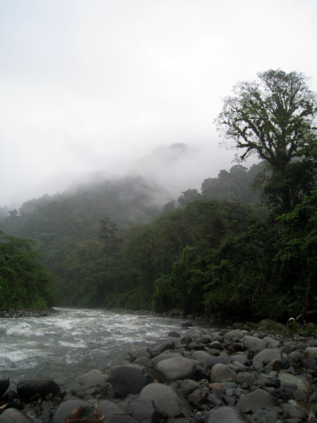
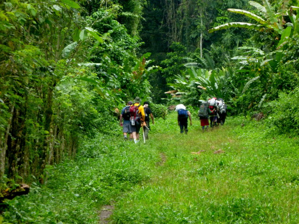
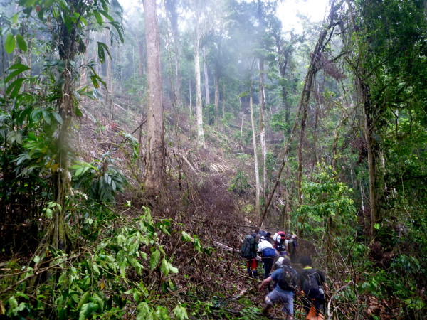
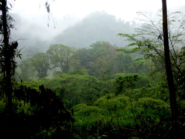
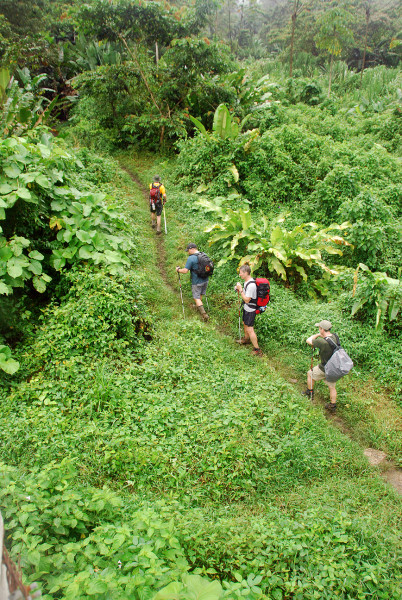
We followed the south bank of the Río Coén through the wide relatively flat Valle de Talamanca for most of the morning.

Packing Up and Heading Out

Ploting our course - Our "baqueano" (indigenous guide) knew the route by heart and didn't use maps, compasses or GPS. We knew his skill was the only thing that would get us to the other side of the Talamancas, but we were also curious about where we were headed. Each day we got a rough description of how many hours climbing, how steeply, when we'd hit rivers and other landmarks and from that we'd work out on the topo map where we were most likely headed.
Plotting our course

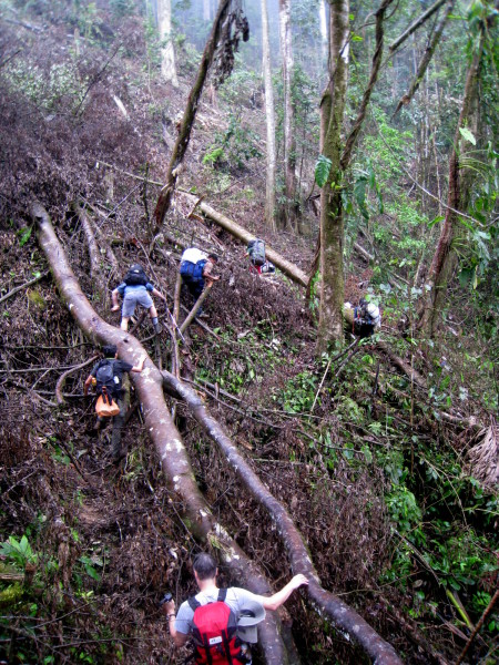
Our packs were smaller and lighter than the porters. It seemed like cheating and I’d never had anyone carry stuff for me before but the outfitter explained that it was sort of required.  The land we were crossing to reach La Amistad is an indigenous reserve owned and administered by the residents.  Although there were no fees or permits required to hike there it was expected that you’d hire one porter per trekker to contribute to the local economy.

Besides, I’m over the hill now and headed down fast.

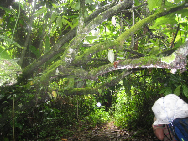
The top section of my pack is a dry bag and I typically carried my sleeping bag, dry warm clothes, first aid kit, toiletries, contacts, glasses, lunches, and a water filter (about 10 kilos or 22 lbs).  The bottom half is a belt pack where I kept things I wanted handy like a gortex, snacks, two or three liters of water or Gatorade, two cameras and the GPS.

Our packs were smaller and lighter than the porters.
Packing up

My porter carried the tent, Thermarest, sandals, dinners, some snacks and lunches, plus kitchen supplies – about 16 kilos or 35 lbs at the beginning and down to about 10 kilos at the end after we’d eaten the food – PLUS his own food, a tarp and change of clothes that weighed another 5 kilos or so.

Porter Number 6

We brought food for eight days even though we were planning to resupply when we reached the road at Ujarras the evening of day 7.  We also brought tons of powerbars and other snacks in case we got stuck somewhere for a couple of extra days.

Setting out
Setting out

When we first divide out the piles for the porters and they added their own supplies their packs were around 60 lbs. When I was a kid their age I carried an 70 pound pack a few hundred miles on outward bound in the Colorado Rockies so I knew it could be done but it seemed like a lot to ask.

We asked about an extra and the head porter told us he’d been fighting applicants off for weeks.  Apparently we not only paid quite well but none of them had ever been to the Pacific and we’re excited for the chance.  So we brought on porter number 6.

We frequently crossed the same river dozens of times and it was completely hopeless to try to keep your feet dry
Across & across again

He sort of ended up with a crappy deal because his pile included all the stuff we’d considered leaving and it was all heavy.  While the others all had lightweight thermarests and even relatively light tents and hammocks he was stuck with cans of chicken and bags of dried apricots.

He didn’t care.  He still smiling when we hit the trail, smiled the whole way through and by the end his pack was literally empty because we’d eaten everything in it.

Afterwards when we knew just how difficult their task was we gave them all huge tips (I think it was about 100% of their fee, but Justin did the math and distributed the propinas).

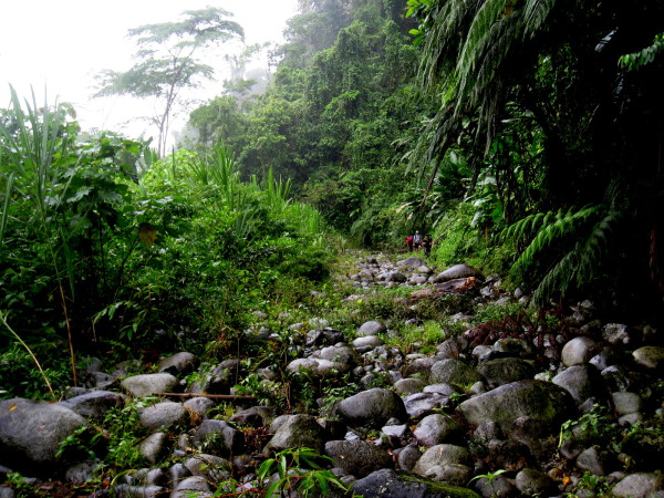
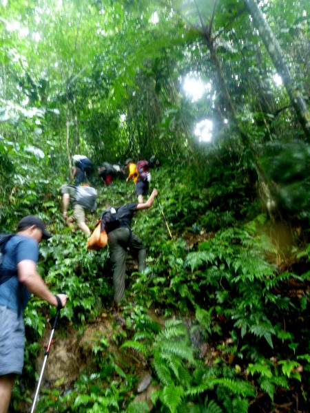
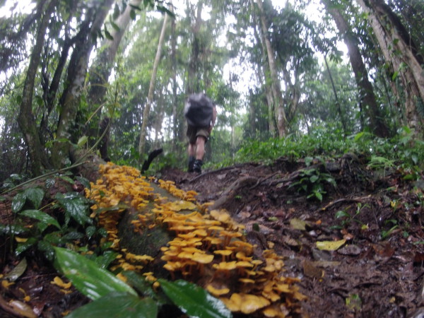
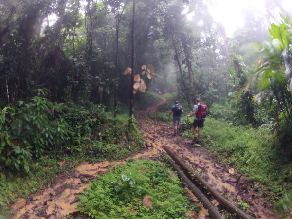
The BriBri Indigenous Path – Coroma to Kichuguecha

Waterfall
Waterfall

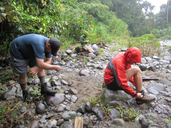
Coroma is the last place you can reach in a motor boat and all travel beyond that point in BriBri is on foot or horseback.

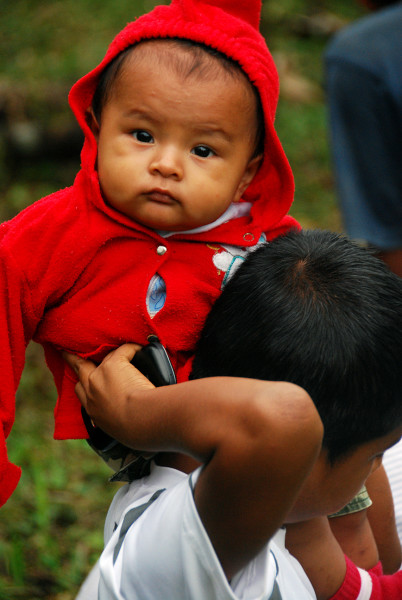
There are a few hundred people that live along the trail.  Small plots of bananas, coco and other crops provide a little income and kitchen gardens, chickens, pigs and fish from the river provide most of their sustenance.   If you’ve ever dreamed of giving it all up and living the simple life you could probably get started here for a couple hundred bucks.

As we headed west homesteads quickly became quite sparse.

Tents Under Thatch

Checking the map, getting started on dinner, pumping water through the filter
Filtering

Camp on the second night in Kichuguecha was downright luxurious inside the community house.  It drizzled and rained most of the time, but we happily bounced around on the springy split bamboo floor under a thatched roof.

We knew it was nice but the next few days would make it abundantly clear exactly how nice it was to have a dry kitchen.  Dinner was linguini with artichokes and sun dried tomatoes, Tuscan Parmesan potatoes, and sweet coconut rice with cloves and allspice for desert.

Go to Another Day
Caribbean – 0 – 1 – today – 3 – 4 – 5 – 6 – 7 – 8 – 9 – 10 – Pacific

Photo Gallery Day 2 – Coroma to Kichuguecha

Each of the images below is linked to a larger version with a detailed description

Breaking camp the morning of day two in Coroma was the last time we'd be clean and dry for over a week
Breaking camp
Our packs were smaller and lighter than the porters.
Packing up
We had a complete set of 1:50,000 topo maps from Omni maps. They're $18.95 a sheet and printed with water soluble inks on very thin paper so if you plan to use them in the back country you should plastic coat them somehow. I used transparent Con-Tact brand shelf paper.
Topo maps
The porters had their food and supplies in burlap sacks
Food and supplies
There was a lot of shuffling and discussion as the porters distributed the the packs and weight.
Sorting
I smashed the filter on a rock the first day
The first casualty
The whole village came out to watch our preparations and see us off
Saying adios
The porters had their food and supplies in burlap sacks that they attached to the top or outside of the backpacks we supplied
Porter 6
Ploting our course - Our "baqueano" (indigenous guide) knew the route by heart and didn't use maps, compasses or GPS. We knew his skill was the only thing that would get us to the other side of the Talamancas, but we were also curious about where we were headed. Each day we got a rough description of how many hours climbing, how steeply, when we'd hit rivers and other landmarks and from that we'd work out on the topo map where we were most likely headed.
Ploting our course
Setting out
Setting out
Up stream
Up stream
Tiny hikers in a giant forest
Tiny hikers
A hiker can disappear in just a few feet (look carefully a the orange spot at bottom center...it's wearing a hat).
Disappearing
We followed the south bank of the Río Coén
Río Coén
The water level is low in March
Low water
Treefalls were significant obstructions. This one took nearly fifteen minutes to navigate and hack through, around over and under
Tree fall
School and soccer field
School
Mist over the Río Coén
Mist
The region around Coroma is mostly low flat land
Banana plantation
Through a coco plantation
Coco plantation
The Río Coén was still quite wide and deep in the Valle de Talamanca
Wide and deep
River
River
The forest was interspersed with clearings, small farms and homes like this
Small farm
Many indigenous on the Caribbean side still live in fairly traditional thatched roof stilt houses.
Farm house
Canon ball tree
Canon ball tree
Even on the edge of La Amistad park miles from the nearest road or village the forest is being cleared for new fields
Clear cutting
Not clear cut
Not clear cut
Taking a break
Taking a break
Trail
Trail
Yes, there's a hiker in the middle of this picture!
Yes, there’s a hiker in the middle of this picture!
Whenever the riverbank became too steep or rugged to follow we climbed almost ladder steep straight up and over ridges
Climbing
Andy coming up through the trees on day two of the trans Talamanca trek when there was still a trail to follow.
Andy in clearing
Deforestation was very much in evidence in the Valle de Talamanca
Deforestation
Fossil of a scallop shell
Fossil
Rocky path
Rocky path
River
River
A cable car crosses the Río Coén at Quebrada Orosi
Cable car
We took a short break at Quebrada Orosi before the steep 320 meter (1,050 feet) climb out of the Valle Talamanca onto Fila Piste which we followed west four kilometers parallel to the Río Coén which runs in an inaccessible steep walled canyon.
Break
Rocks
Rocks
Quebrada Orosi
Quebrada Orosi
Up
Up
The trails between Coroma and Kichuguecha are fairly heavily used by the few hundred inigenous who live in the area
Good trail
Breaks were always on the top of a ridge or peak or along side a river or stream before starting a monster climb to the top of a a ridge or peak. Come to think of it, breaks couldn't have been anywhere else because every inch of it was nearly straight up or down.
Break on top
Andres cruises to the top of Fila Piste. A 320 meter (1,050 foot) climb in just over a kilometer. The first 100 meters of elevation gain comes is just over 100 meters of horizontal or about a 45 degree angle. Justin recalled from his days in construction that's equvalent to a 12:12 roof pitch... However you express it, it was steep.
Andres
Our porters had never tried pistachios, but they liked them
Something new – pistachios
Forest
Forest
Not the look you like to see on the map reader's face
Navigating
Wild nutmeng
Wild nutmeng
Chris crossing Quebrada Curi. The far side was the last time my boots were "dry" at 12:30 p.m. on day two I said the hell with it and waded across. Justin kept pulling off his boots at the crossings for a few more hours, but by the end of the second day we could all pour water out of our boots and ring out our socks.
Chris crossing
Suspension bridge over the Río Coén just west of where Quebrada Curi enters from the south. When we crossed over to the north side of the river we had no idea what would be in store for us the next morning when we had to re-cross to the southern bank
Suspension bridge
Most of the suspension walking bridges in Costa Rica are at tourist attractions but a few are still the only way to get from one side of a river or ravine to the other.
Suspension bridge
On top
On top
Butterfly
Butterfly
The woman in the lavender dress was a mystery
Lavender dress
Waterfall
Waterfall
Waterfall
Waterfall
Symbol rock
Symbol rock
Crossing
Crossing
Lunch in the rain
Lunch
Trail
Trail
We frequently crossed the same river dozens of times and it was completely hopeless to try to keep your feet dry
Across & across again
Things not to grab if you slip in the mud
Do not grab
At first Justin and I were trying to keep our boots dry by taking them off at river crossings
Dry boots?
Go Pro
Go Pro
Bridge
Bridge
Cup Fungus
Cup Fungus
Kichuguecha
Kichuguecha
Bridge
Bridge
Narrow trail
Narrow trail
Dry boots?
Dry boots?
Misty rainforest
Misty rainforest
Inching along a moss covered ledge
It's really important to stay clean in the rainforest, otherwise things start growing on you
Keeping clean
Waiting for the decision... Our "baqueano" (indigenous guide) was speaking with the village elder requesting permission to use the common house for the night
Awaiting permission
The floor was amazing. 20 foot long bamboo poles
Bamboo floor
Contemplating the crossing
Contemplating
Waiting for the coffee water to boil
Waiting for coffee
The view out the bedroom (and livingroom and kitchen...) window
Kitchen view
Coconut palms, bananas and yucca (casava) were planted in small patches all around the community
Coconut palms
A few things hanging out to dry
Drying gear
We set up the tents inside to keep the mosquitoes off while we slept, but it turned out there really weren't many
Tents inside
Camp Kichuguecha
Camp Kichuguecha
Our downstairs neighbors were noisy and smelled a bit, but really we had no complaints
Downstairs neighbors
We were going to bring everything but the kitchen sink, but in the end we brought the kitchen sink too. The collapsible 20 liter, four ounce kitchen sink by Sea to Sea turned out to be one of the best new gear items ever
Kitchen sink
Chris checking out the cable bridge we'd carry our packs over in the morning. I'd walked a dozen meters of it earlier and thought nothing of it until Chris went all the way across and came back and said "I'd be lying if I said it wasn't scary out in the middle" He's the one who taught me to walk slackline so that freaked me out.
Cable bridge
The house mascot
The house mascot
The kitchen in the community house consisted of an elevated hardwood sandbox to hold a cook fire
Fire box
Checking the map, getting started on dinner, pumping water through the filter
Filtering
Is it in there?
Is it in there?
It was incredibly nice to be cooking dinner with a (thatched) roof overhead while the rain came down outside.
Cooking dinner

Go to Another Day
Caribbean – 0 – 1 – today – 3 – 4 – 5 – 6 – 7 – 8 – 9 – 10 – Pacific

Ray & Sue

Cost · ToDo · Plan·Costa Rica Guide logo animated·Top10 · Best Time · Contact


toll free Costa Rica travel desk!
1-866-816-0197

CONTACT US

Over the Hill

Over the Hill
  • Trans Talamanca Trek – How To
  • Over the Hill
  • Puerto Viejo to Coroma
  • Coroma to Kichuguecha
  • Kichuguecha to Quebrada Mari
  • Quebrada Mari to Fila Bugu
  • Fila Bugu to Catarata Ririgu
  • Catarata Ririgu to Rio Lori
  • Rio Lori to Ujarras
  • Ujarras to Cordoncillo
  • Cordoncillo to La Gran Vista
  • La Gran Vista to Playa Hermosa
  • Meals & Gear Transcontinental


Costa Rica Guide on facebook
Costa Rica Guide on Facebook