Costa Rica Guide

travel information and maps

  • Vacation Planning
  • Discount Codes
  • Costa Rica
    • Top Ten
    • Best Time to Visit Costa Rica
    • Things To Do in Costa Rica
    • Maps
    • Transportation
      • Rental Cars
        • Advantages of Driving
        • Disadvantages Driving
        • Code of the Road
        • Navigation & Drive Time
        • Rental Insurance Explained
        • Can’t Get There
      • Airports
        • Flights Worth Taking
        • LIR or SJO
        • Airfare Deals
        • Domestic Airlines
        • Domestic Air Tips
      • Taxis
      • Bus Schedule
    • Food
      • Typical Menu
      • Batidos & Refrescos
      • Gallo Pinto
      • Tamales
      • Ceviche
      • Ensalada Palmito
      • Sopa Negra
      • Vinagre Chilera
    • Weather
      • Seasons in Costa Rica
      • Current Storms in Costa Rica
    • Regions
  • Nature & Wildlife
    • National Parks
    • Wildlife Refuges
    • Ecozones
    • Best Places to See Wildlife in Costa Rica
  • Practical Info
    • Health & Safety
      • Health Tips
        • Altitude Sickness
        • Chikungunya
        • Natural Disasters
      • Crime
        • Cons & Rip-offs
        • Corruption
        • Violent Crime
    • Will My Phone Work?
    • Packing List
    • Passports & Docs
    • Money – How To?
    • How Much Does it Cost?
    • Travel Tips
  • Stories
    • Photos
    • Trek Across Costa Rica
    • Sendero de Oro
    • Quebrada Gata
    • Bicycle Touring
    • About Us
  • Move to Costa Rica
no obligation custom trip plan & price quote

1-866-816-0197

· Copyright © 2026 ·

Fila Bugu to Catarata Ririgu

Day 5 – March 21

Hiking – 15.5 km (9.6 miles), 936 meters (3,071 ft) elevation gain.

Most of the time this was the view along the trail. It was extremely steep, muddy and slick so we were looking a few feet a head to plan the next step or two.
View ahead

Long slow climb along the 2,000 meter high ridge (Fila Bugú) that separates the drainage of the Río Coén from the Tapari.  After crossing high points at Alta Chinegucha, Surisan, Buikuari and Cerro Carguicacha we dropped back down to the headwaters of the Río Coén; now more like a stream 1,100 meters above where we’d last crossed.

Lost

I’ve always prided myself on my navigation skills and have been hiking and backpacking since I was about eight.  Chris has probably spent even more of his life wandering around the mountains and deserts and Andy does trail and off trail ultra-marathons.  I would have sworn you could have blindfolded any of the three of us and rolled us down a hill in a barrel and we could have gotten out, shaken off the dizzy, and been right back on track.

Boy was I wrong.

Up and down all day today...come to think of it every day
Up and down

The crew always walked strung out over a kilometer or more.  El Machete and a couple of the more gung-ho porters let the way followed by a couple of trekkers, then the main group of porters, a trekker or two and the other guide and any stragglers bringing up the rear.  I’d frequently hustle to the front of the line then fade to the rear when something to photograph or explore off trail caught my eye.

Andy, Chris and I were enjoying a rare section of level ground along a ridge line along chatting away when we realized we weren’t seeing the telltale broken leaves and machete chops to the cane or lianas that sometimes crossed the path.  We had been traveling without a trail for days and the ground was fairly open as it usually is under a dense canopy so we often drifted a little off route.

The procedure kicked in.  I noticed there were no signs of travel ahead and said “off route” Andy replied “checking right” and Chris “checking left.”  I took the middle and we split up and angled backwards looking for machete cuts, broken twigs, or foot prints that weren’t ours.  Every 30 second or so we’d call out “nothing left” etc. both as an update and so we didn’t loose track of each other.

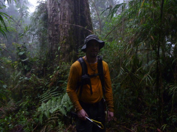
La Amistad International Peace park is one of the last refuges in the world for rainforest giants like this.
La Amistad

After three or four minutes someone found a cut and called out “on route” and we headed to the voice.  We took a couple of minutes to work back and forth making sure we were on the trail of our leader and not one we’d made and then set out again.

After about ten minutes we were surprised to see Justin and Andres in front of us.  We knew they’d started out quite a way behind because Justin wasn’t feeling well and Andres had been shooting pictures of the last little river we crossed.

We were even more surprised that they were walking towards us.  Justin asked “what’s up, why are you guys going back?”  We thought he was kidding.  They must have run and gotten ahead of us when they heard us fumbling around off route. Nope.
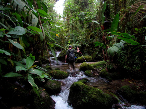
Chris hiking upstream

We had gotten turned around and were headed completely the wrong direction.  If it hadn’t happened I would have sworn it couldn’t happen.  One of the three outdoors men would have to notice we were going the wrong way.  Nope.

It’s incredible how much you rely on the sky or at least a horizon to navigate.  I’ve done 50 miles at night in the Colorado Rockies without a problem, but the dense canopy of the rainforest and the uniform horizon of green and tree trunks in every direction can be amazingly disorienting.

Camp Below Catarata Ririgu

I was pretty envious of Chris’ choice to go with the Hennessy Hammock and rainfly sleep system on the fifth night.  There was nowhere to set up a tent that wasn’t covered with roots and rocks.  Turned out it didn’t really matter because I probably could have slept on a pile of broken glass.

We share a fire in a rock ring with the porters and had Mountain meal Sweet and Sour Pork and Chicken Teriyaki for dinner.

Go to Another Day
Caribbean – 0 – 1 – 2 – 3 – 4 – today – 6 – 7 – 8 – 9 – 10 – Pacific

Photo Gallery Day 5 – Fila Bugu to Catarata Ririgu

Each of the images below is linked to a larger version with a detailed description

Camp at night
Camp at night
I have no idea how big bugs like this cricket ended up inside the tent
How’d he get in?
Taking down the tents and breaking camp the morning of day five
Taking down the tents
We got a reasonably early start the morning of the fifth day.
Early start
Not grapes
Not grapes
Epiphytes and vines on the trunk of a huge tree
Epiphytes and vines
The streaks are bees zipping through the patch of sunlight in front of the entrance to their nest just above the center of the frame
Streaking bees
Entrance to a bees nest
Bees nest
Light gap left by a giant tree fall
Light gap
Epiphytes and vines
Epiphytes and vines
Flower
Flower
Jaguar tracks - we saw a lot of big cat and tapir tracks but there were just too many of us making too much noise to have any hope of seeing the animals themselves
Jaguar tracks
Huge piles of Tapir scat were common along the trail...for scale, the toes of my boots are at the bottom of the frame
Tapir scat
Cloud forest
Cloud forest
Katydid
Katydid
Along this section of trail there were occasional flags of nylon tape. Our guide explained that the team brought in to look for a German couple who'd tried to make the trek on their own used the flags to mark
Search flag
A picture perfect spot to take a break in the middle of the stream
Picture perfect
Taking a photo
Taking a photo
There goes the other pole. The first Black Diamond broke on the second day and the second on day five. Black Diamond warns "Read all warnings and instructions insofar as aluminum poles have limitations resulting from denting and other effects of impacts as well as strength limitations which could result in structural failure."
Broken pole
Up and down all day today...come to think of it every day
Up and down
Jumping
Jumping
We crossed thousands of tiny creeks, streams and quebradas
One in a thousand
Vines
Vines
White water
White water
Photos don't even come close to showing how impressive the trees are
Impressive tree
Another stream
Another stream
Chris hiking upstream
Butterfly
Butterfly
It looked like it was going to rain so I decided to switch to my waterproof camera, but there seemed to be something wrong when I snapped this shot
Cracked lens
Crossing
Crossing
Moss
Moss
Lunch along the trail
Shockproof for a 3 meter drop, but apparently not shockproof against a 170lb guy falling on his ass 35 times in a row with the camera in his pack. I dented the case and broke the crystal in front of the lens, but after chipping it out the camera worked fine...it just isn't waterproof anymore.
Shock proof
Deciding on camp
Deciding on camp
A single immense trunk nearly fills the frame behind Andy
Immense trunk
Canopy
Canopy
Everything reaching for the sun
Reaching for the sun
Sky?
Sky?
White water
White water
The creek trail that we followed for the first half of the day
The creek trail
The Hennesey Hammock
Hennesey Hammock
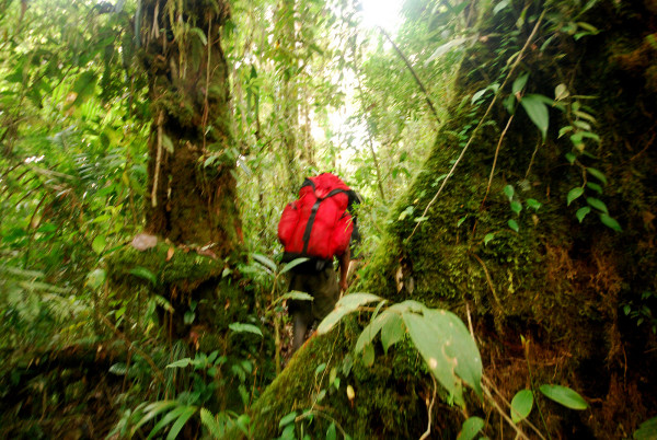
Hiking
Hiking
A little sun
A little sun
La Amistad International Peace park is one of the last refuges in the world for rainforest giants like this.
La Amistad
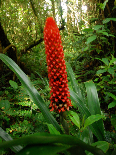
Red flower
Red flower
Big trees
Big trees
Amazing jungle
Amazing jungle
Sometimes there was nowhere flat to take a break so we just stood on the slope
Nowhere flat
Heliconia
Heliconia
Someone left behind a t-shirt along the trail
T shirt
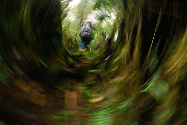
Swirl
Swirl
Rest, step, rest
Rest, step, rest
Most of the time this was the view along the trail. It was extremely steep, muddy and slick so we were looking a few feet a head to plan the next step or two.
View ahead

Go to Another Day
Caribbean – 0 – 1 – 2 – 3 – 4 – today – 6 – 7 – 8 – 9 – 10 – Pacific

Ray & Sue

Cost · ToDo · Plan·Costa Rica Guide logo animated·Top10 · Best Time · Coupons


toll free Costa Rica travel desk!
1-866-816-0197

CONTACT US

Over the Hill

Over the Hill
  • Trans Talamanca Trek – How To
  • Over the Hill
  • Puerto Viejo to Coroma
  • Coroma to Kichuguecha
  • Kichuguecha to Quebrada Mari
  • Quebrada Mari to Fila Bugu
  • Fila Bugu to Catarata Ririgu
  • Catarata Ririgu to Rio Lori
  • Rio Lori to Ujarras
  • Ujarras to Cordoncillo
  • Cordoncillo to La Gran Vista
  • La Gran Vista to Playa Hermosa
  • Meals & Gear Transcontinental


Costa Rica Guide on facebook
Costa Rica Guide on Facebook