Costa Rica Guide

travel information and maps

  • Vacation Planning
  • Best Trips Ever>>
  • More Fun Than Humanly Possible
  • Costa Rica
    • Top Ten
    • Best Time to Visit Costa Rica
    • Things To Do in Costa Rica
    • Maps
    • Transportation
      • Rental Cars
        • Advantages of Driving
        • Disadvantages Driving
        • Code of the Road
        • Navigation & Drive Time
        • Rental Insurance Explained
        • Can’t Get There
      • Airports
        • Flights Worth Taking
        • LIR or SJO
        • Airfare Deals
        • Domestic Airlines
        • Domestic Air Tips
      • Taxis
      • Bus Schedule
    • Food
      • Typical Menu
      • Batidos & Refrescos
      • Gallo Pinto
      • Tamales
      • Ceviche
      • Ensalada Palmito
      • Sopa Negra
      • Vinagre Chilera
    • Weather
      • Seasons in Costa Rica
      • Current Storms in Costa Rica
    • Regions
  • Nature & Wildlife
    • National Parks
    • Wildlife Refuges
    • Ecozones
    • Best Places to See Wildlife in Costa Rica
  • Practical Info
    • Health & Safety
      • Health Tips
        • Altitude Sickness
        • Chikungunya
        • Natural Disasters
      • Crime
        • Cons & Rip-offs
        • Corruption
        • Violent Crime
    • Will My Phone Work?
    • Packing List
    • Passports & Docs
    • Money – How To?
    • How Much Does it Cost?
    • Travel Tips
  • Stories
    • Photos
    • Trek Across Costa Rica
    • Sendero de Oro
    • Quebrada Gata
    • Bicycle Touring
    • About Us
  • Move to Costa Rica
  • Free Travel Pack
no obligation custom trip plan & price quote

1-866-816-0197

· Copyright © 2023 ·

Turrialba Volcano Photos

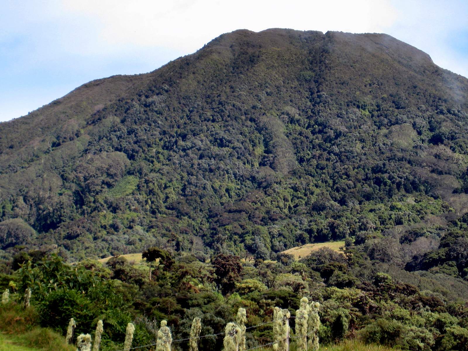
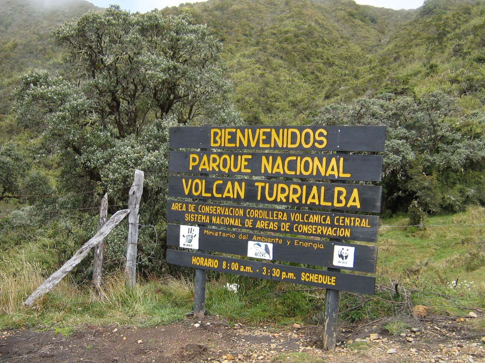
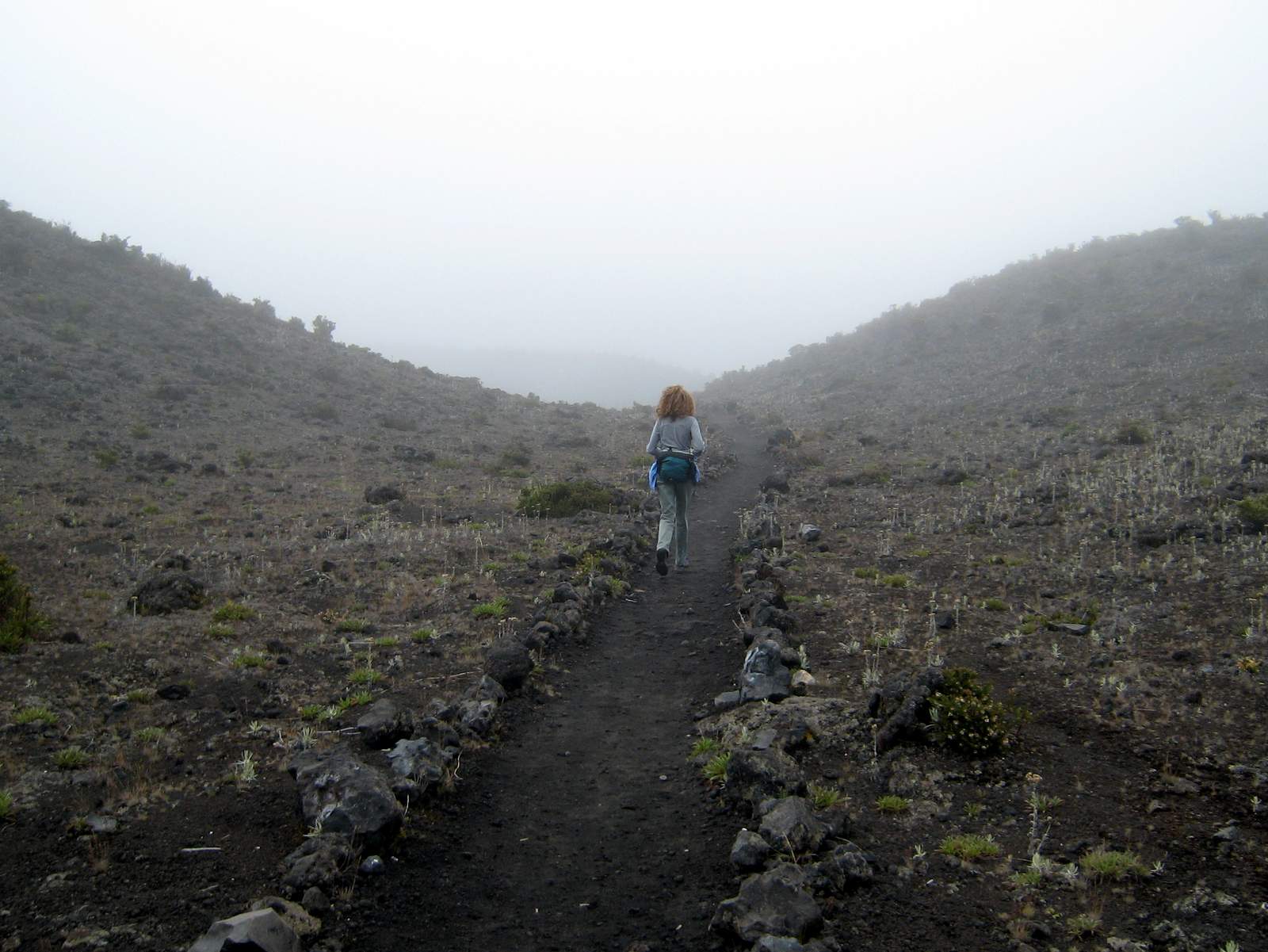
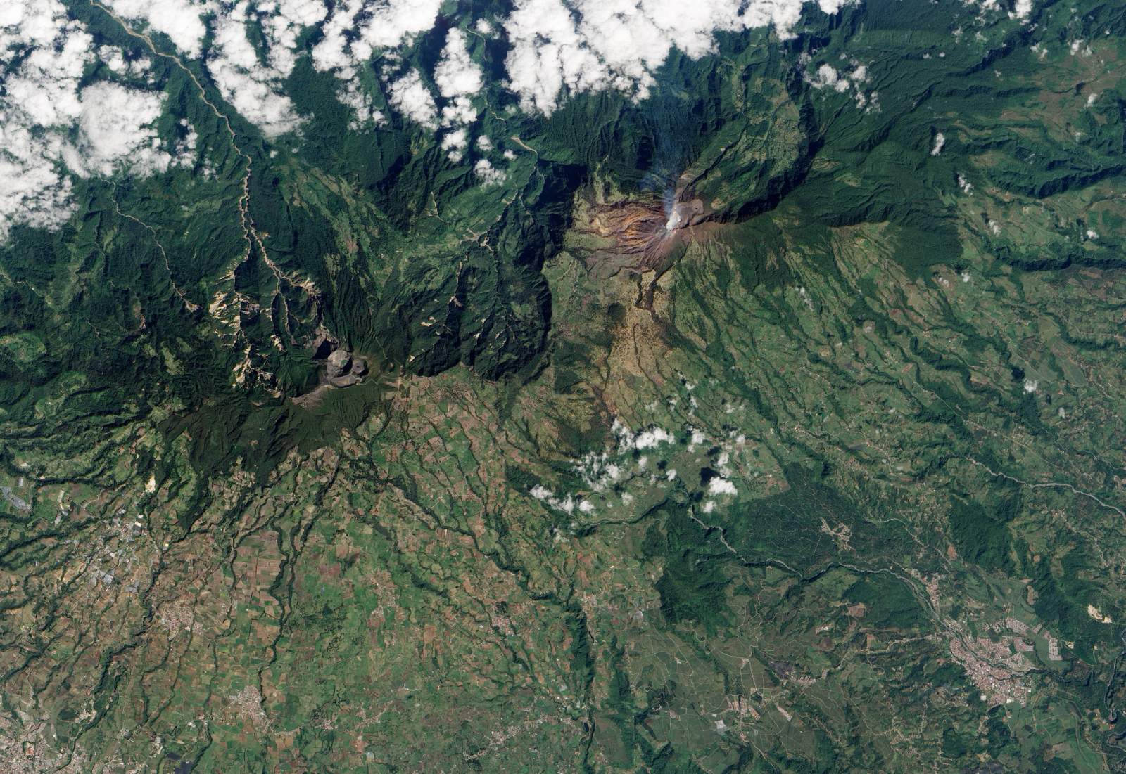
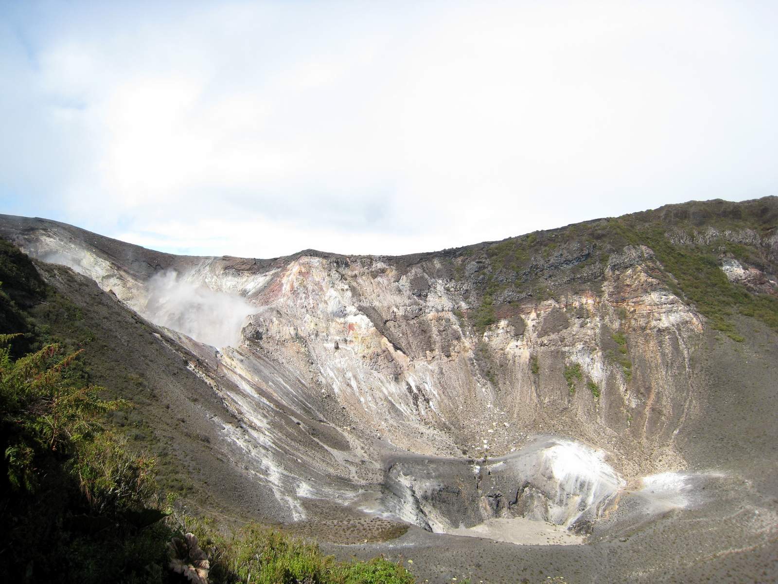
The Lost Hikes at Turrialba Volcano National Park

UPDATE: November 2020 – Closed to the public due to high levels of activity for most of the past decade, SINAC announced the reopening of portions of Turrialba National Park as of Dec 4, 2020.  New restrooms and overlooks have been constructed and in accordance with National Emergency Commission guidelines there are bunkers to shelter visitors if activity increases too quickly for evacuation.

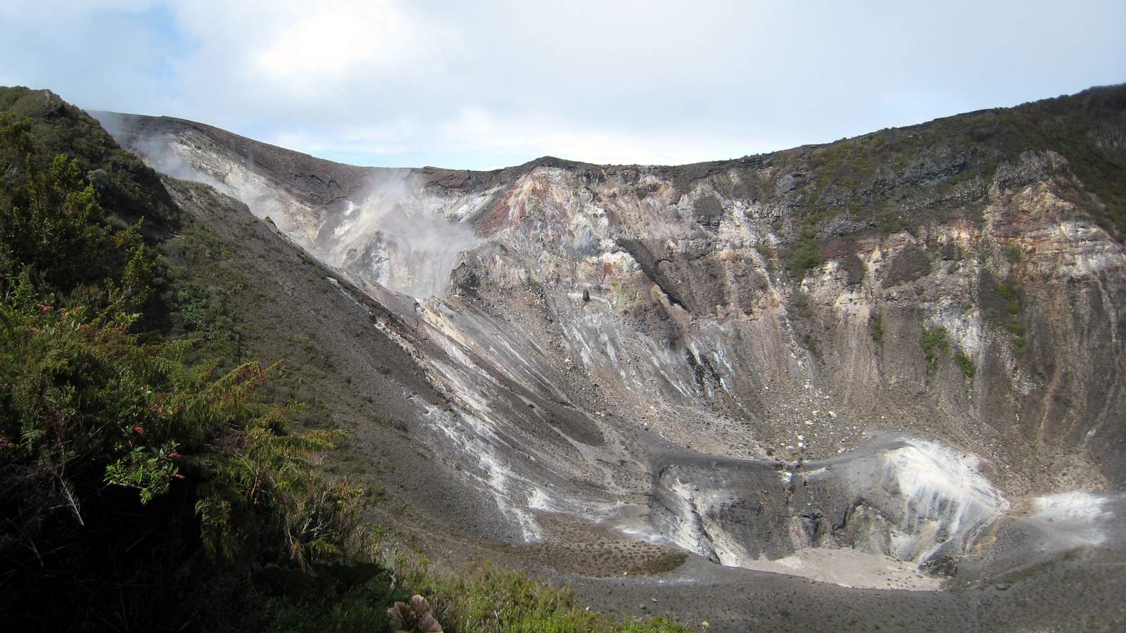
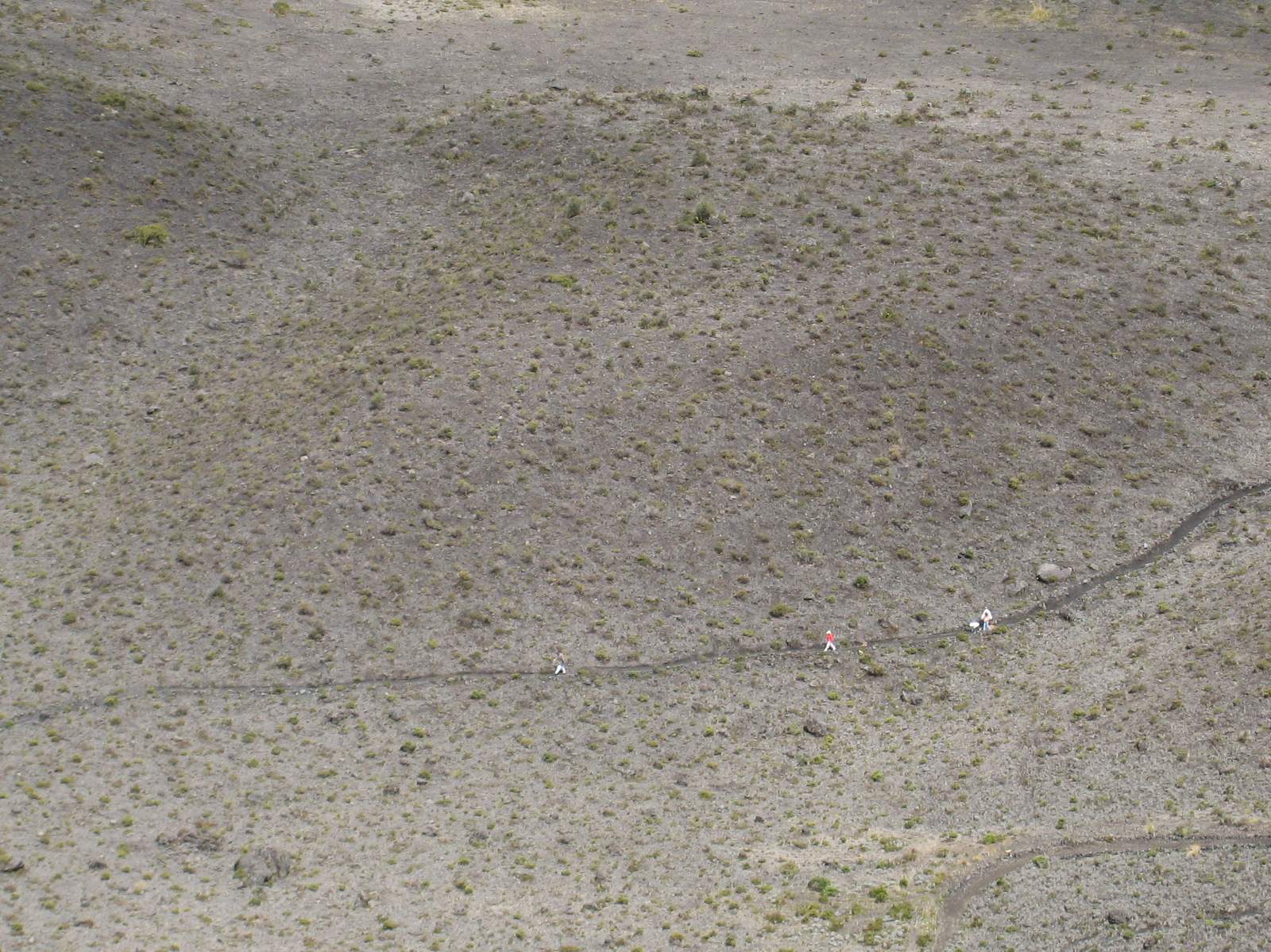
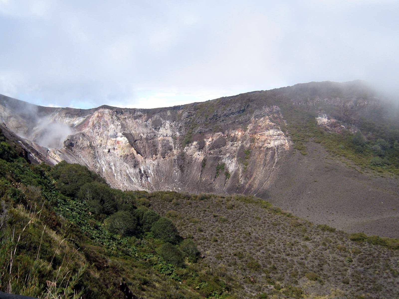
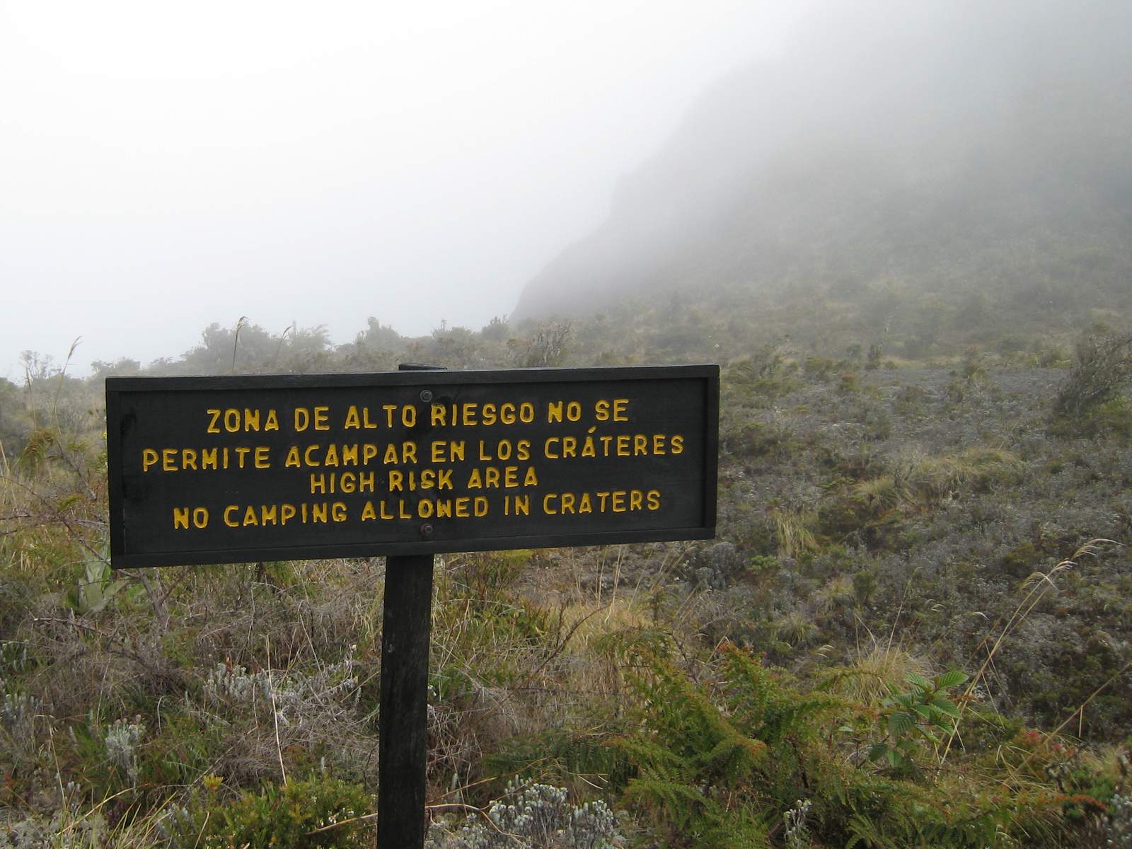
The crater trails remain off limits but there is a proposal to re-open them to 4 groups of 35 visitors each day participating in a two hour hike accompanied by trained guides.

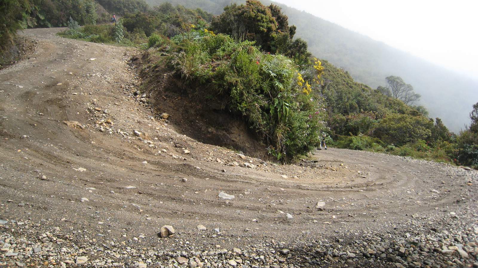
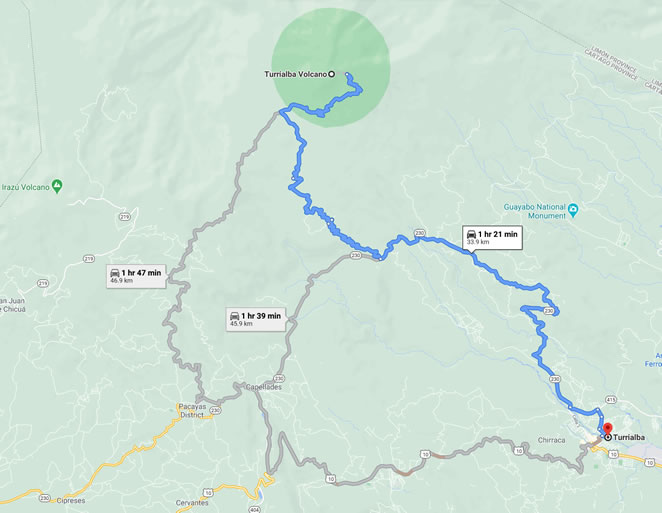
Local landowners are blocking access via the main entrance on route 417 claiming the road to the park is private.  The matter is being litigated and there is no estimate when route 417 will reopen so SINAC recommends route 230 – the “Montecalas.”
Driving Route to Turrialba Volcano


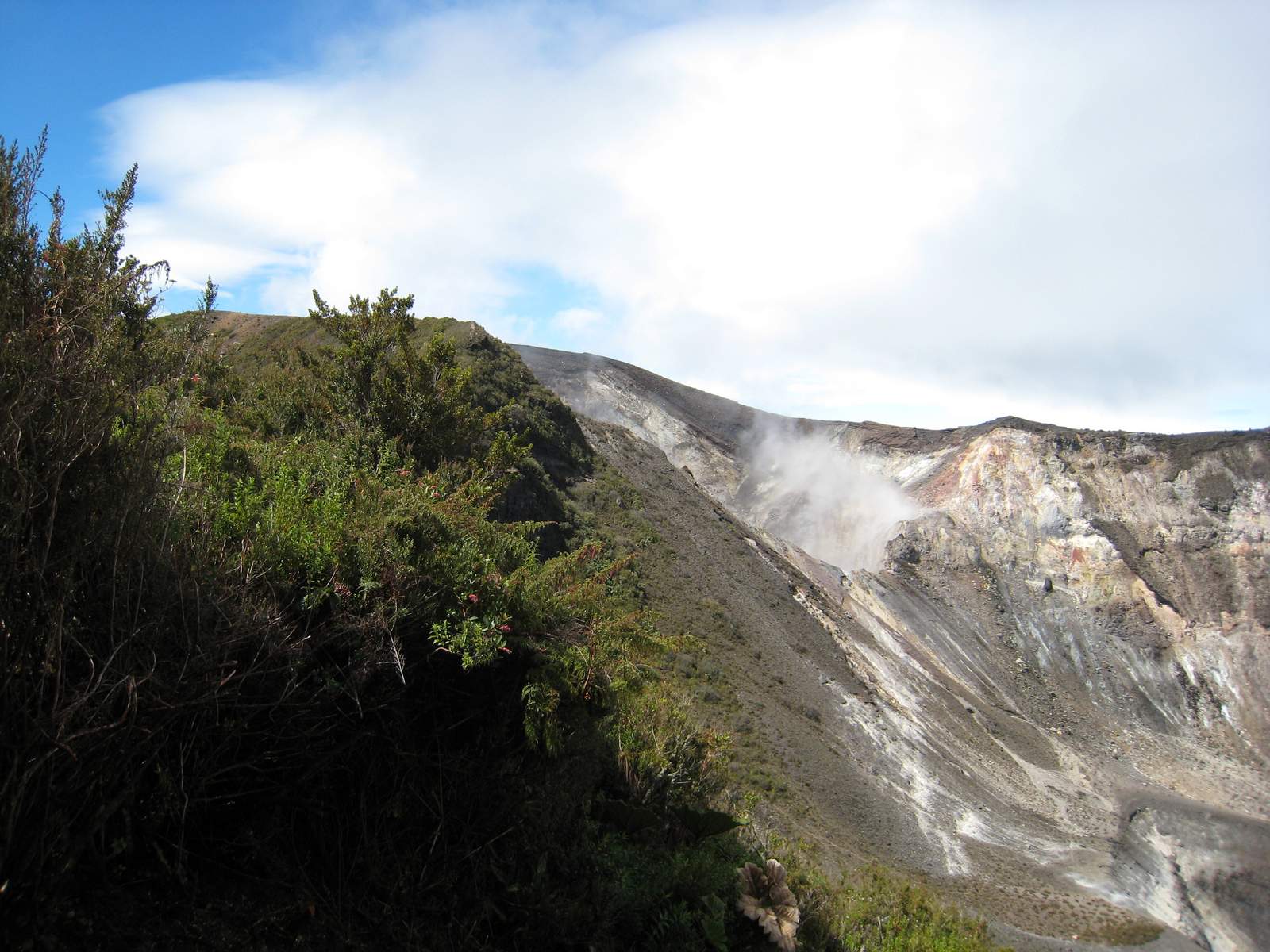
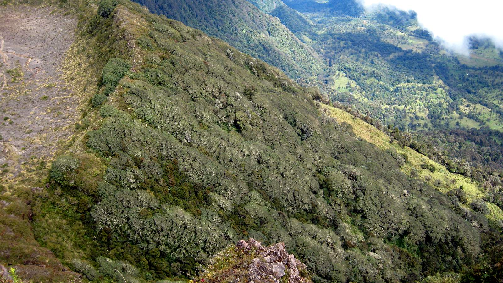
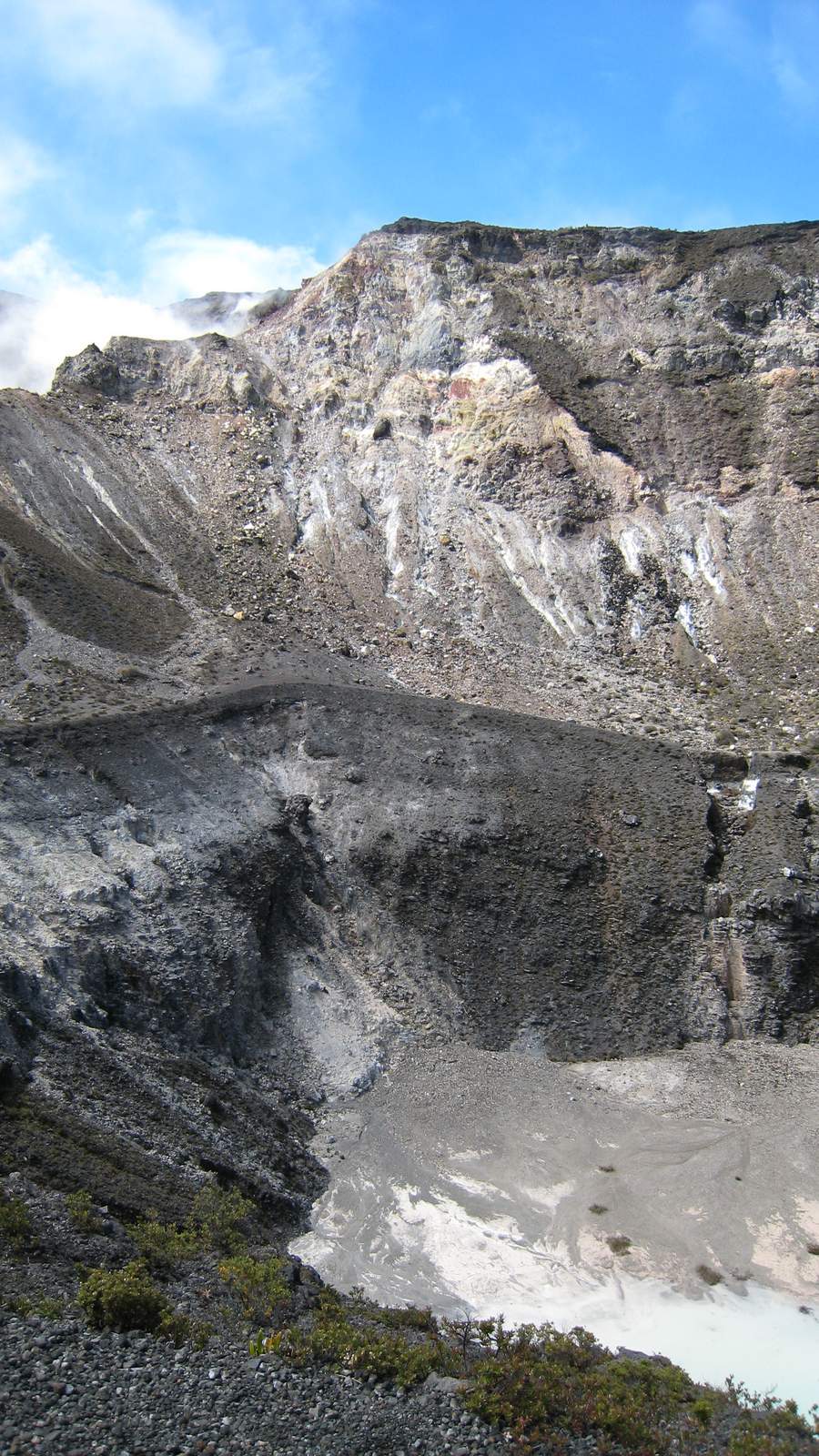
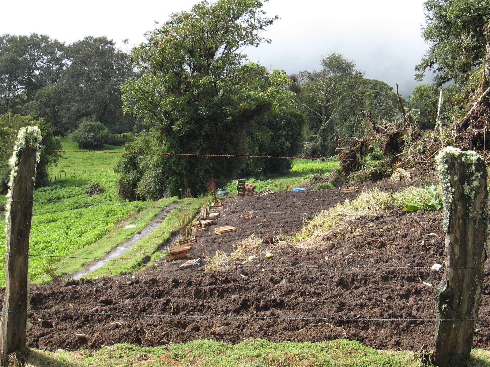
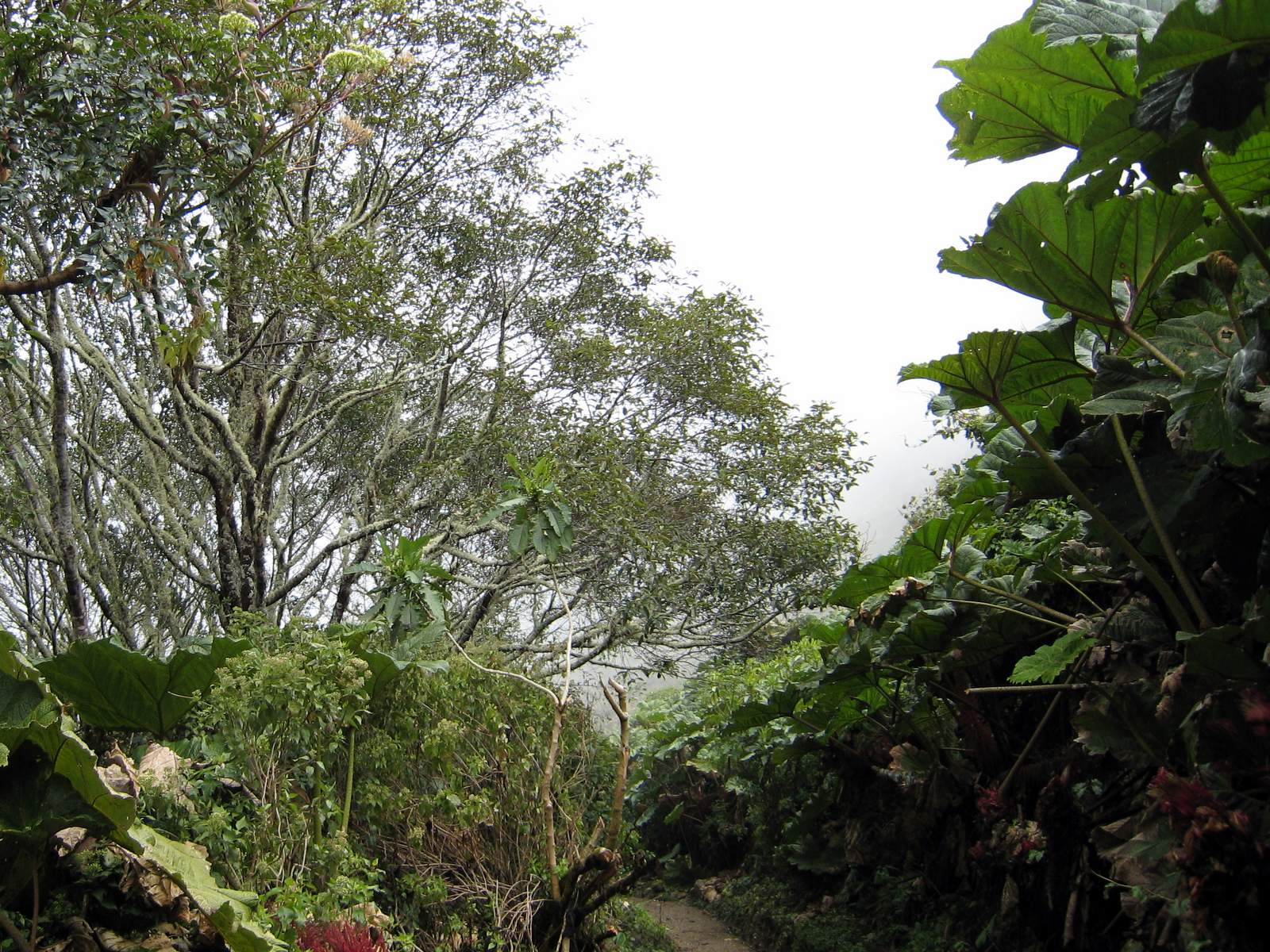
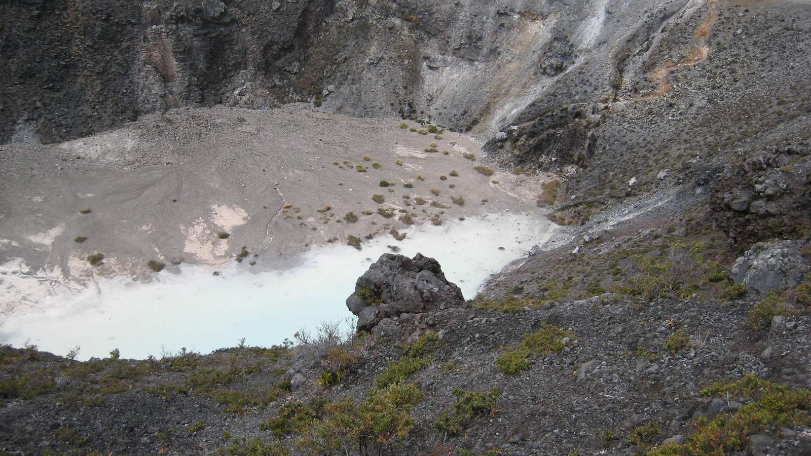
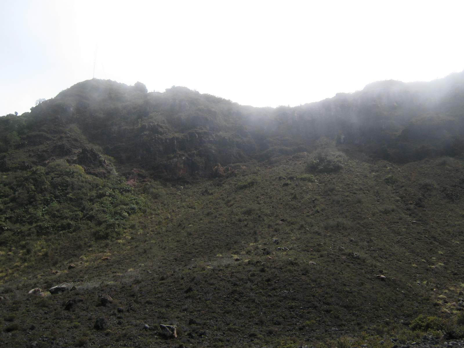
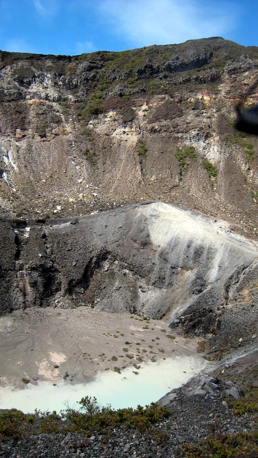
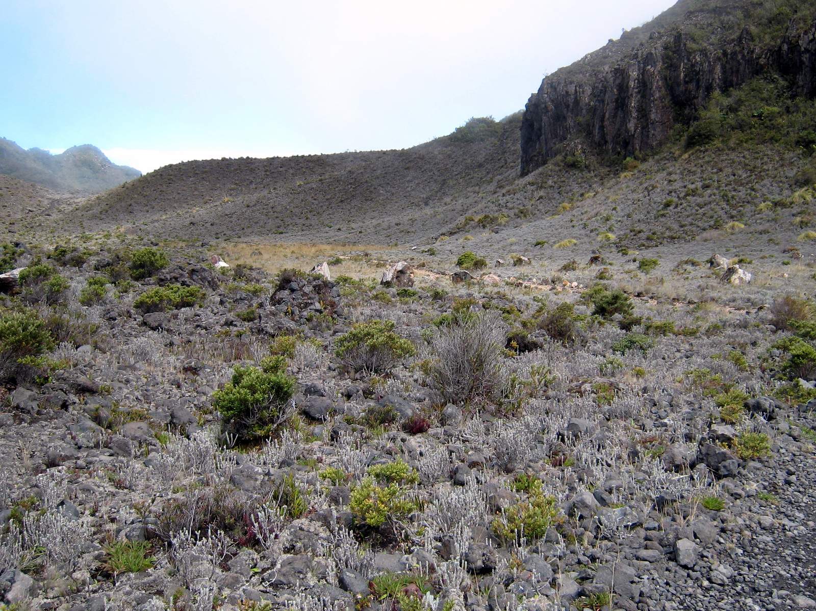
It seemed insignificant when people were losing their farms to the ash fall from the eruptions of Turrialba volcano, but the Costa Rican national parks system suffered a big loss when they had to close the park and trails.  It is one of Costa Rica’s finest and the trails in and around the craters were varied,  beautiful and incredibly photogenic.  Hopefully, with the re-opening of the visitors area and overlooks, the trail system will soon follow.

Volcán Turrialba
Volcán Turrialba. The steaming crater at the center is the west crater which has been so active since late 2009 that the trails in the park have been closed.
Elfin cloud forest
The elfin cloud forest climbs the slope above the rainforest a few thousand feet down in the background to the top and right. To the left is the treeless crater of Volcán Turrialba
Center crater and west crater Turrialba
Center crater and west crater above left. This is the one that really started spewing ash and a bit of lava in 2015 and has been acting up sporadically ever since
Roadside hawk
Roadside hawk on the way to Volcán Turrialba – possibly immature red tailed hawk (Bueto jamaicensis) or immature broadwing hawk or it could actually even literally be a Roadside Hawk (Buteo magnirostris). If you know contact us and let us know!
Cone of Volcán Turrialba
The cone of Volcán Turrialba. It seemed very close when the clouds blew off and we got our first view, but the rugged 4WD road wound around for another 8km before reaching the summit.
Red volcanic clay road approaching Turrialba
Entrance is free at Volcán Turrialba National Park
Welcome! Entrance is (was) free at Volcán Turrialba National Park when it was open.
Main crater trail, Volcán Turrialba National Park
Main crater trail
A rugged 4WD road winds around and climbs steeply to reach the summit of Volcán Turrialba
A rugged 4WD road winds around and climbs steeply to reach the summit of Volcán Turrialba. Now the road is closed a few km from the top.
Turrialba satellite image
Turrialba Volcano, located in central Costa Rica, emits a translucent plume of volcanic gases in this natural-color satellite image from January 21, 2010. According to the RED Sismológica Nacional (Costa Rican National Seismological Network), activity at the volcano increased markedly on January 4, 2010. Strong, long-lasting volcanic tremors were accompanied by gas plumes over the volcano, and emissions of ash began on January 5th. The “jet-type noise” of gas and ash rushing out of fumaroles was heard several kilometers away. On January 21, Nacion.com reported that potato and carrot farmers were asked to leave fields near the volcano’s summit due to further increases in gas emissions. The barren summit region of the 3,340-meter- (10,960-foot-) high Turrialba appears gray and brown, while the volcanic plume is a hazy blue. Fields and pastures are light green, in contrast to dark green forest that covers the high-elevation ridges. Since 2007, frequent acid rain showers caused by activity at the volcano killed or damaged much of the vegetation to the southwest of the summit, leaving the area brown and orange. This image was acquired by the Advanced Land Imager (ALI) aboard NASA’s Earth Observing-1 (EO-1) satellite.
Can you see the Caribbean
Can you see the Caribbean? On a clear day you can see all the way to the Caribbean coast from the top of sendero mirador Volcán Turrialba National Park. It’s hard to tell but there is a coastline 2/3 of the way up the photo and horizon blurs into the sea on the east coast
Volcán Turrialba
Volcán Turrialba
Tourists along one of the trails in the crater of Volcán Turrialba
Tourists along one of the trails in the crater
The trees stop abruptly at the crater rim, Volcán Turrialba National Park
sendero mirador Turrialba volcano
From sendero mirador looking down on the crater in Volcán Turrialba National Park
East crater tiny pond
The east crater contains a tiny pond and is the least distinct at Turrialba
Radio towers
Radio towers
Daisy
Daisy ? A the top of sendero mirador
Mirador
At the top of sendero mirador Volcán Turrialba
"Black Vulture" (Coragyps atratus)
“Black Vulture” (Coragyps atratus) is a bit smaller and not as good a flyer as its cousin, the “Turkey Vulture” (Cathartes aura), whose head is red instead of black. Black Vultures and Turkey Vultures are common in Costa Rica this one was alongside the road on the slopes of Volcán Turrialba
The trees stop abruptly at the crater rim due to the wind and toxic ground
Carrots field
Carrots and other vegetables are common crops in the cooler climate of the slopes of Volcán Turrialba and the neighboring Irazu where the elevation is high enough to grow cooler weather crops in the tropics.
Misty clouds at the top of sendero mirador Volcán Turrialba National Park
Misty clouds
Lichen sendero mirador Volcán Turrialba National Park
Lichen
Volcano Hummingbird
The flowers and birds were amazing along the last 800 meters of the 4WD road to the trailhead.
At the top of sendero mirador Volcán Turrialba National Park
Flowers
Dwarf bamboo
It looks like dwarf bamboo but it’s not…
At the top of sendero mirador Volcán Turrialba National Park
Moss
At the top of sendero mirador Volcán Turrialba National Park
At the top
Potatoes are common crops in the cooler climate of the slopes of Volcán Turrialba
crater trail Turrialba volcano
Heading down the crater trail
Sombrilla de pobre on the way down the crater trail Volcán Turrialba National Park
Sombrilla de pobre
Hummingbird along the upper portion of the crater trail, Volcán Turrialba National Park
Hummingbird along the upper portion of the crater trail. The vegetation and wildlife thinned and disappeared as we got closer to the active calderas
Radio tower in the mist
You can barely see the radio tower at the top of the mirador trail
Inside the south rim
Inside the south rim the trees grew until close to the crater floor
Costa Rica's national bird
Costa Rica’s national bird along the upper portion of the crater trail, Volcán Turrialba National Park
Big bee
Big bee (size of the end of my thumb) along the upper portion of the crater trail, Volcán Turrialba National Park
Across the main crater
Across the main crater from the crater trail
Here's your sign
Here’s your sign – High risk zone, no camping
At the top
At the top
Along the trail
Inside the main crater
Moss
Moss
Red flowers
Red flowers
Blister beetle along the lower mirador spur trail in the main crater, Volcán Turrialba National Park
Blister beetle along the lower mirador spur trail in the main crater,
Along the lower mirador spur trail in the main crater, Volcán Turrialba National Park
Along the lower mirador spur trail in the main crater,
Succulent
Succulent
Say Whiskey
Say Whiskey (I don’t know, that’s just what the girl who was taking the photo told us to say?) Center crater, Turrialba volcano
Center crater, Volcán Turrialba National Park
Center crater
Looking up at the main rim
Center crater, Volcán Turrialba National Park
Center crater
South loop trail
Returning on the south loop of the main crater trail
Yellow flower - Returning on the south loop of the main crater trail, Volcán Turrialba National Park
Yellow flower
Sulfurous rock
Sulfurous rock?
Language lesson
This character gave Sue a spontaneous language lesson at the top of the crater trail. We didn’t find out what the girl meant by say whiskey though
Log truck in Azúl
Log truck in Azúl near Turrialba – we saw them clearing the forest for a new housing development as we were returning to town from Turrialba National Park
Morning view from Guyabo Lodge
Morning view from Guyabo Lodge on the hillside below Santa Cruz on the slopes of Volcán Turrialba
Amazing flowers
The flowers and hummingbirds were amazing along the last 800 meters of the 4WD road to the trailhead.
central crater is the largest
The central crater is the largest and deepest at Volcán Turrialba
across the elfin cloud forest
Looking across the elfin cloud forest canopy from the top of sendero mirador Turrialba volcano Park
Sloped pitch on the slopes
I wonder if the home team gets to defend the uphill goal on this soccer field on the slopes of Volcán Turrialba


Ray & Sue

Cost · ToDo · Plan·Costa Rica Guide logo animated·Top10 · Best Time · Contact


toll free Costa Rica travel desk!
1-866-816-0197

CONTACT US

Costa Rica National Park Photos
  • Tortuguero Beach – National Park & Sea Turtles Nesting
  • Tortuguero Village & Canals Photos
  • Savegre National Park
  • La Cangreja National Park Photos
  • Carara National Park Photos
  • Irazu Volcano Photos
  • Tenorio Volcano Photos
  • Tortuguero Photos
  • Turrialba Volcano Photos
  • Arenal National Park Photos


Costa Rica Guide on facebook
Costa Rica Guide on Facebook