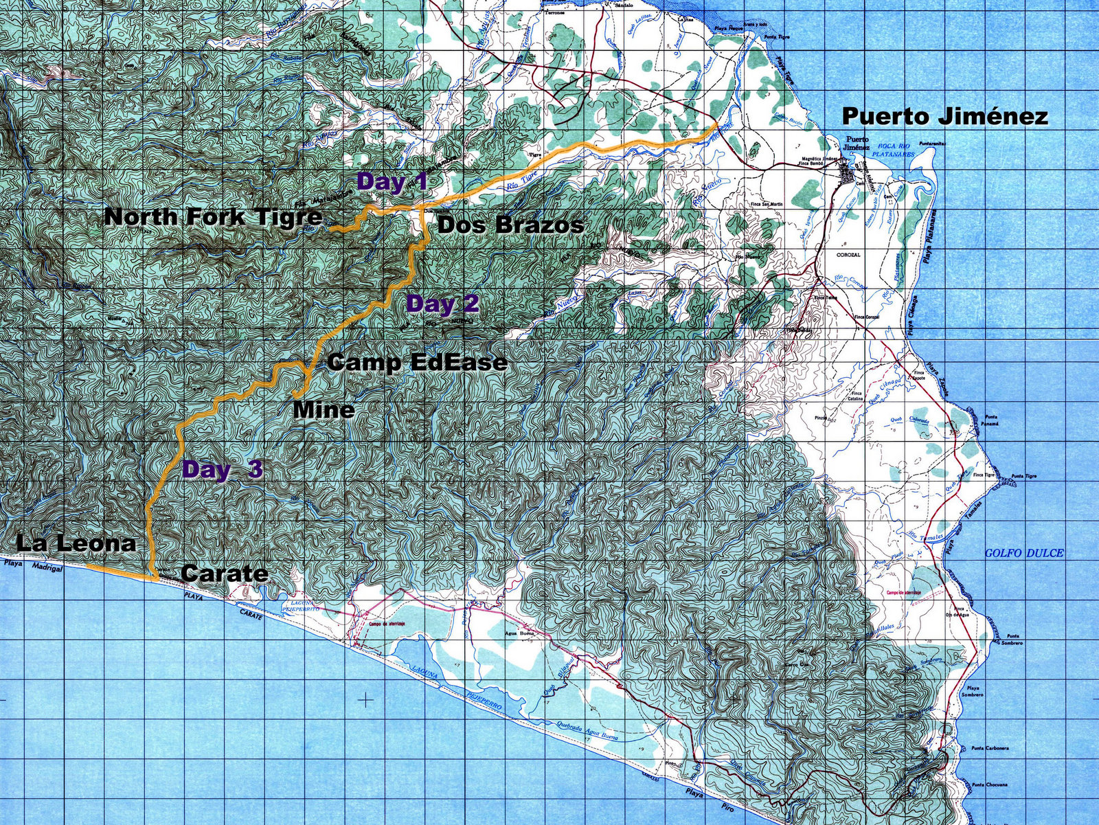
After an eventful night and a visit to the gold mines we headed out on the the third day of our trek on the Sendero de Oro (Gold Trail). Shown on the map as Day 3 – We left the Piedras Blancas headed southwest on indigenous footpaths which climbed steeply to about 1,600 feet (500 meters) over a ridge then dropped into the Carate river drainage. A quick dip in a waterfall pool then down to the airstrip at playa Carate, a right turn and headed west along the beach to La Leona.
UP the Hill
This was the remotest segment of trail. Up to this point we’d encountered small gold camps of two or three men every kilometer or so but the mines are all in the valley and we were climbing into protected forest reserve. The later segments at Madrigal in Corcovado national park and south of Drake Bay are popular with tourists and it’s not uncommon to see a few dozen other people in a day.

The sector we crossed is populated by birds, snakes, monkey and big cats but we didn’t see another person until we reached the coast.
The trail was plenty steep to make us happy our packs were light. Even though we were crossing some isolated terrain we always had either a camp or guesthouse to stay in. That meant we could leave our tents, sleeping bags and cooking gear at home and just carry clothes, food for the trail and a few other essentials.
The trail was faint and often nothing more than the path of least resistance around fallen logs and branches but it would have been difficult to get lost. From looking at the topo map we knew as long as we kept climbing eventually we’d reach the ridge and from there it was all downhill with a pretty big target to aim for – The Pacific Ocean.
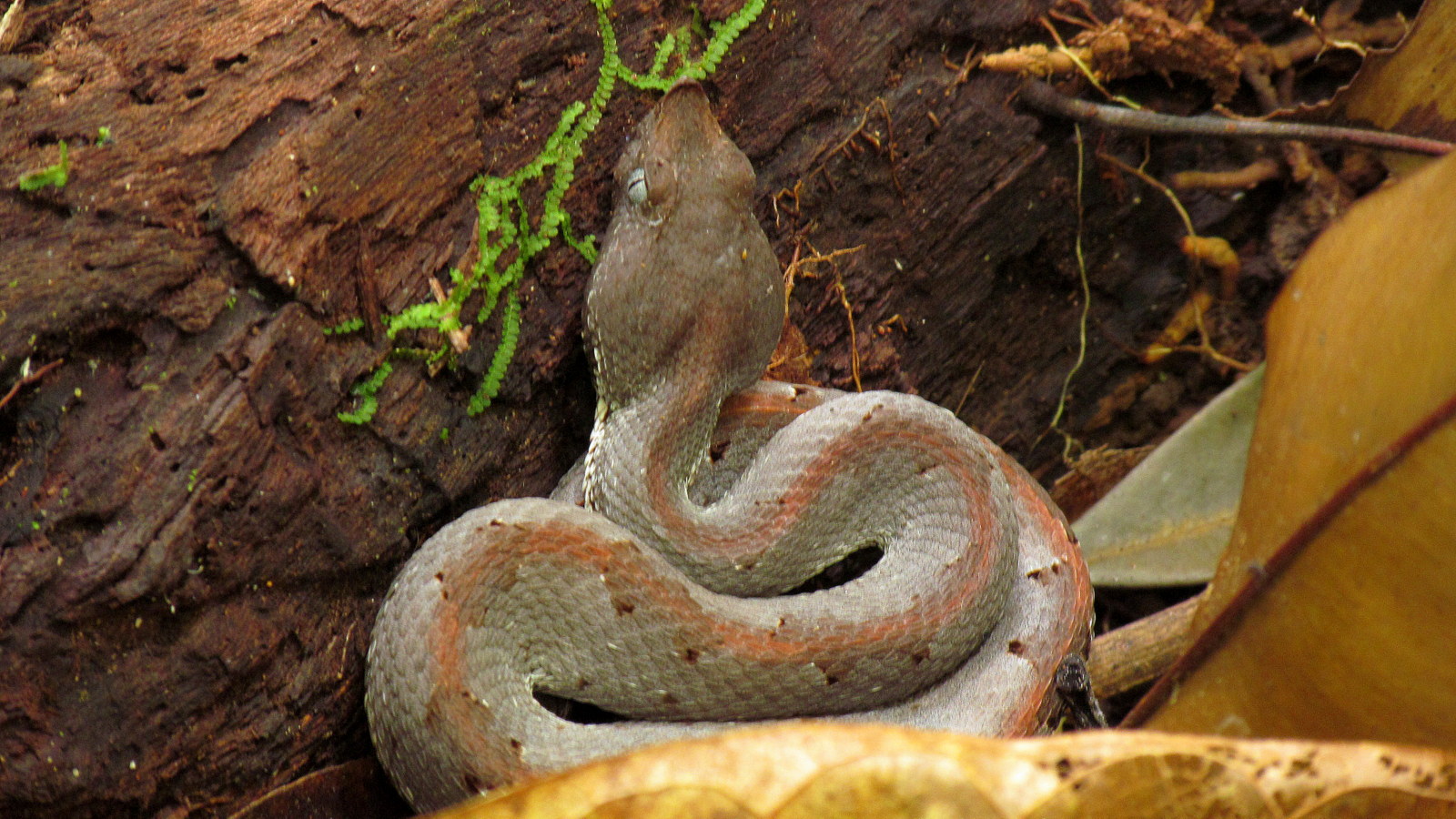
Everyone burned a few extra calories per step for a couple of kilometers after Edwin spotted a hog nosed viper (Porthidium nasutum) on the far side of a fallen log he was about to step over. It was perfectly positioned for his heel to land on it.
They often hunt by coiling on the ground up against the side of a fallen tree waiting for an mouse to scurry along the top of log which the unfortunate rodent believes is a nice clear trail through the underbrush.
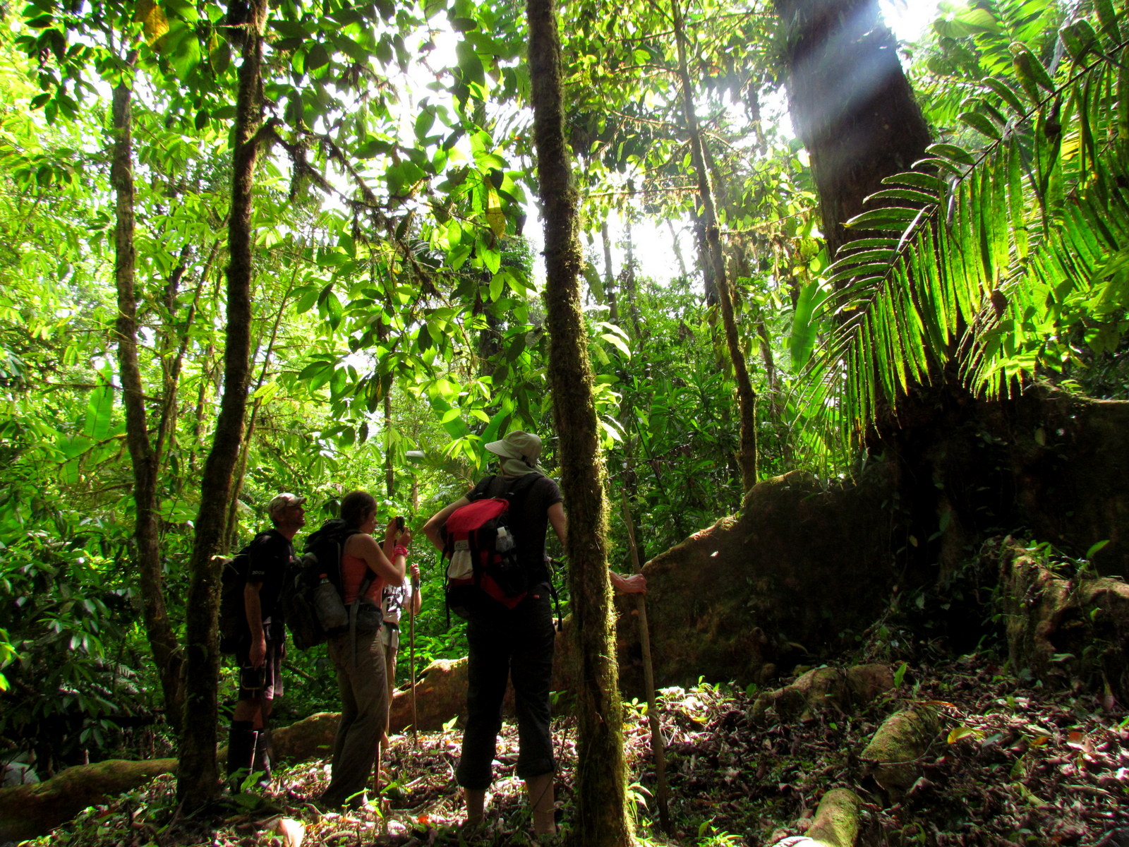
I’m not certain of the age of the forest we traveled through. It had many of the characteristics of a relatively new secondary growth but also many massive trees that were obviously at least a hundred if not two or three hundred years old.
Huge buttress roots on the one pictured were more than 20 meters (65feet) long extending in all directions.
It was certainly different than the forest we had crossed from Los Patos to Sirena through the heart of Corcovado on our first trip two decades earlier.
Down the Hill
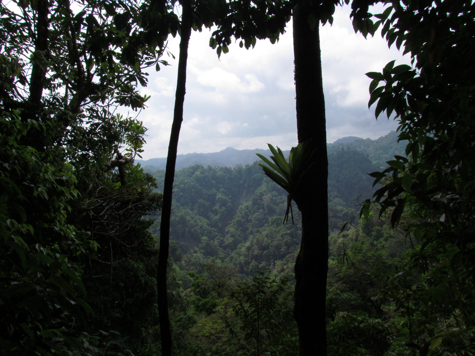
When we reached the top of the ridge we were only slightly disappointed that we didn’t have an amazing panorama across the forest and down to the beaches of the Pacific. We’ve hiked enough in Costa Rica to know that unless you get above treeline at about 3,500 meters (11,500 feet) on some of the bigger volcanoes, Cerro Chirripó or the other highest peaks of the Talamancas there wouldn’t be any openings for a vista.
We did at least get a small gap where we could see the mountains of Corcovado stretching into the distance and after a little consideration we realized the only way we’d have a great mirador would be if the forest were cut down. Obviously we were delighted that that wasn’t the case.
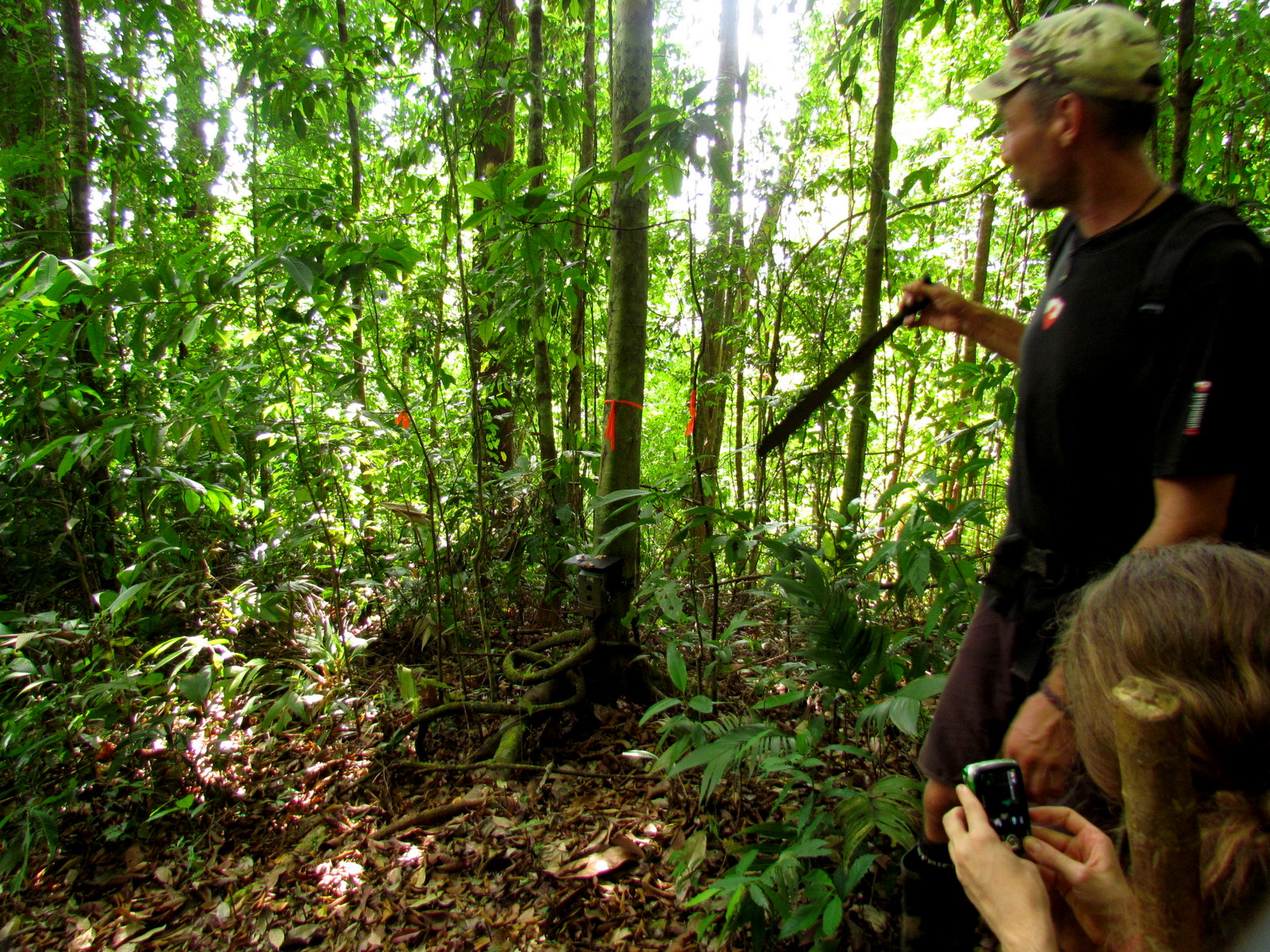
As we headed down the other side through Los Altos de las Hormigas national wildlife refuge we spotted a couple of camera traps one of which had a tag on it explaining that it was part of a puma and jaguar study – please don’t disturb. We made a few funny faces to entertain the researchers and continued down the slope.
We came off the ridge at the top of a rock formation where the Carate river sluiced down a little waterfall into a clear pool and couldn’t resist taking a break and a dip.
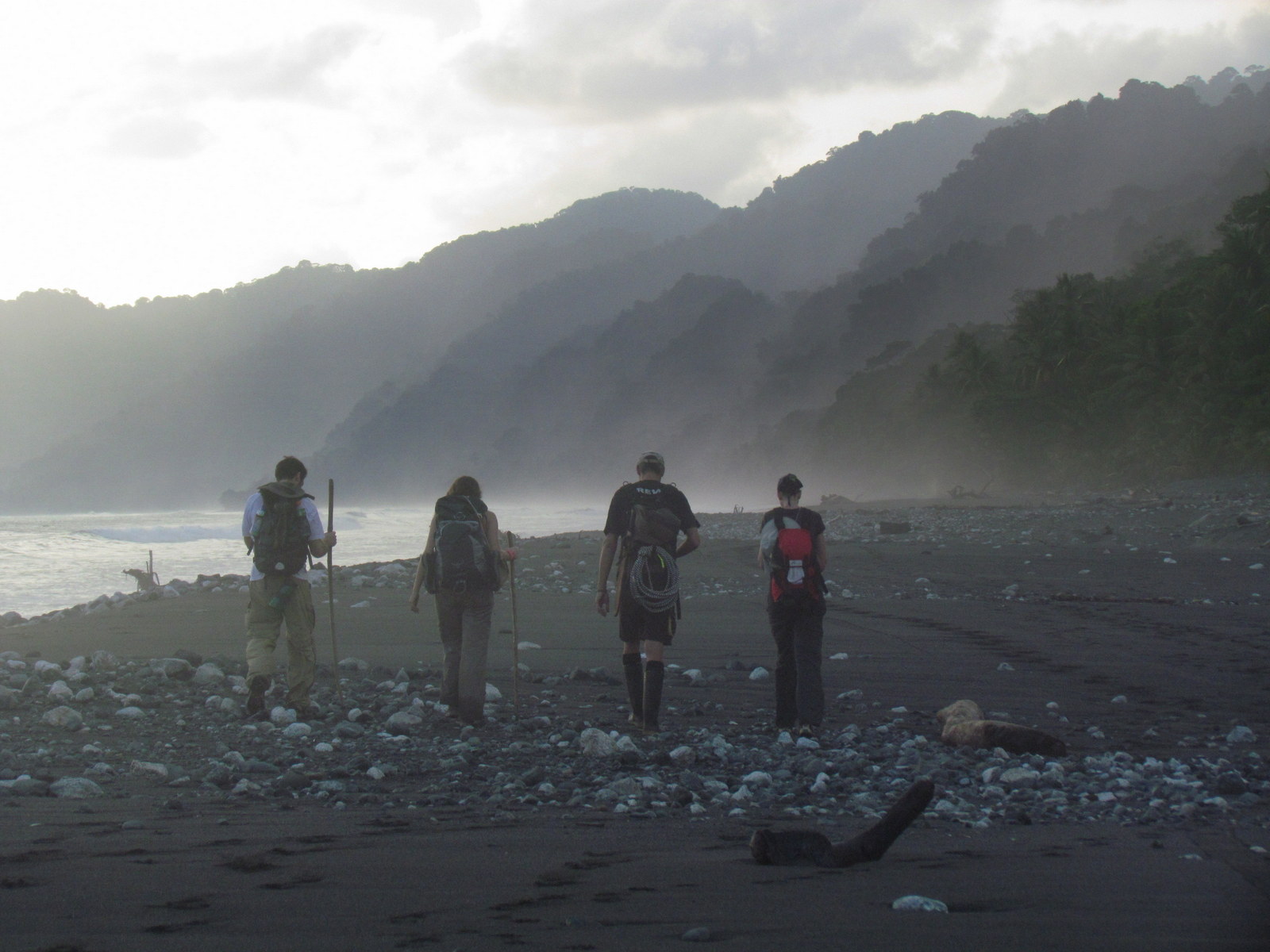
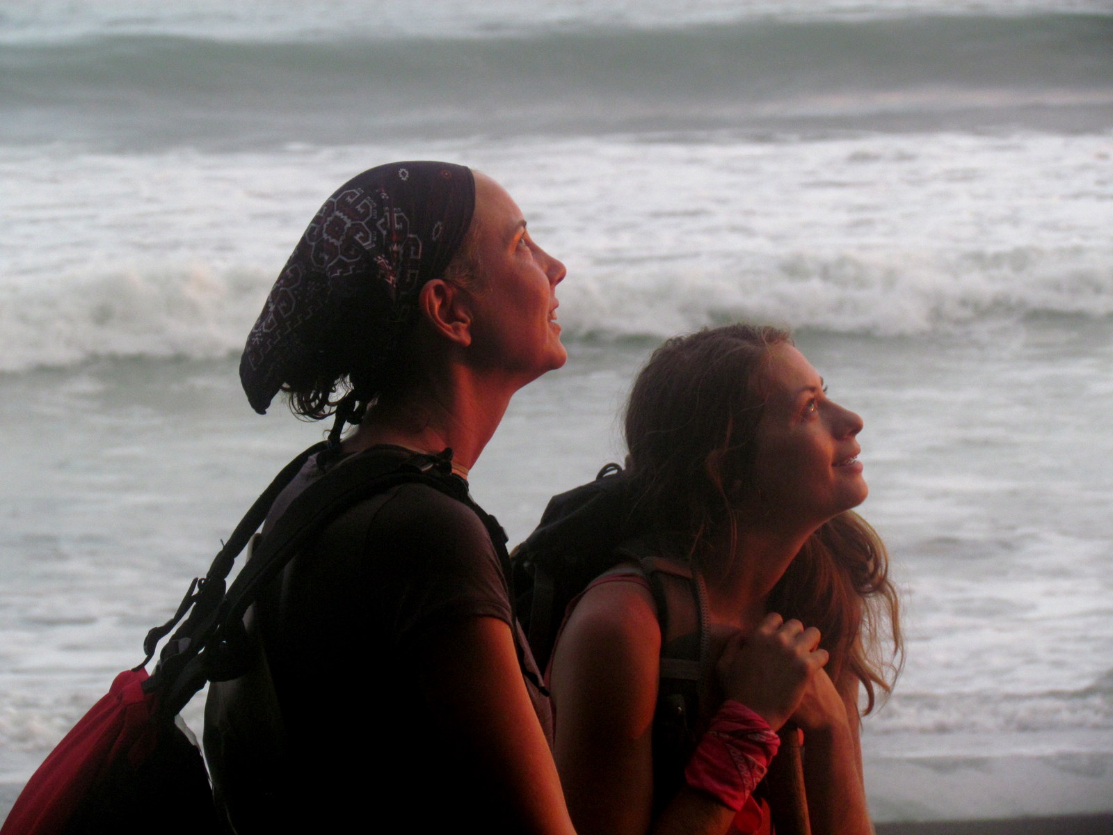
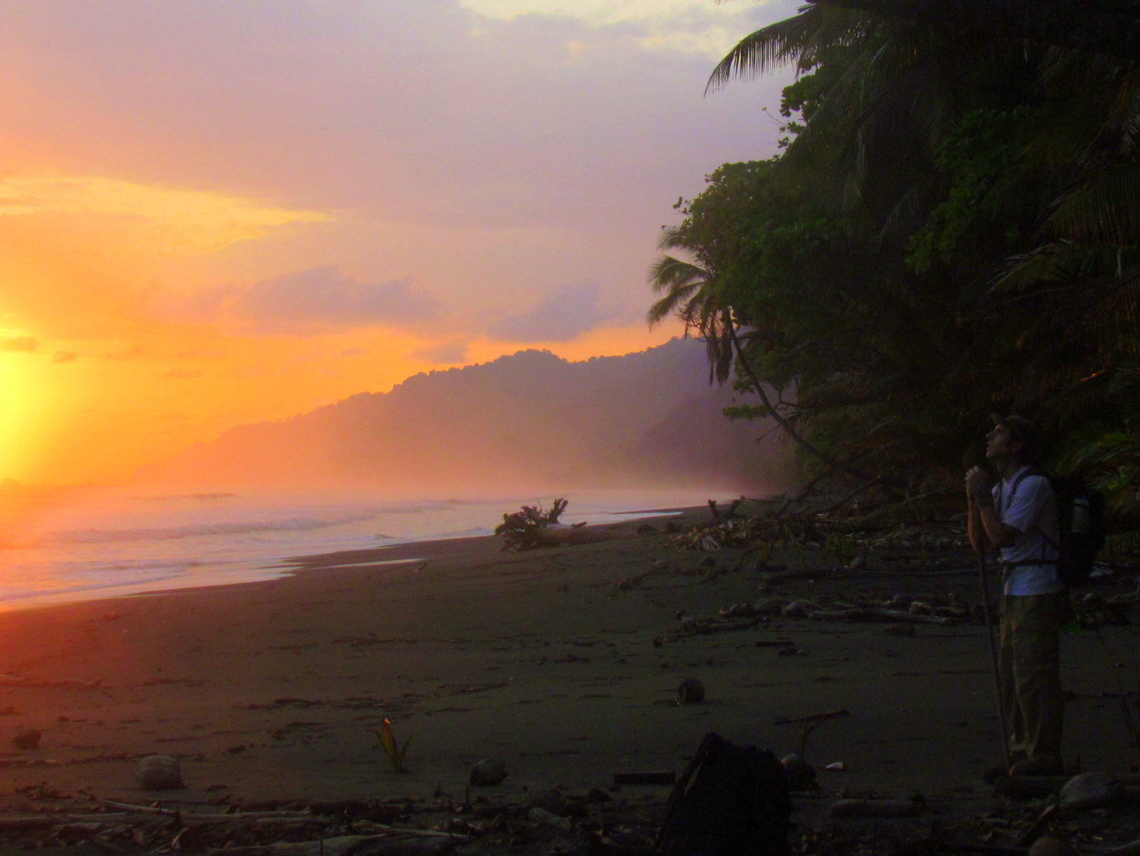
Along the Beach
As beautiful as the beach was it was almost a disappointment knowing that the trans peninsular part of the trek was over. We’d spend the rest of our time along the coast but I guess from the pictures below you can see that we got over the initial letdown pretty quickly.