Costa Rica Guide

travel information and maps

  • Vacation Planning
  • Best Trips Ever >>
  • Costa Rica
    • Top Ten
    • Best Time to Visit Costa Rica
    • Things To Do in Costa Rica
    • Maps
    • Transportation
      • Rental Cars
        • Advantages of Driving
        • Disadvantages Driving
        • Code of the Road
        • Navigation & Drive Time
        • Rental Insurance Explained
        • Can’t Get There
      • Airports
        • Flights Worth Taking
        • LIR or SJO
        • Airfare Deals
        • Domestic Airlines
        • Domestic Air Tips
      • Taxis
      • Bus Schedule
    • Food
      • Typical Menu
      • Batidos & Refrescos
      • Gallo Pinto
      • Tamales
      • Ceviche
      • Ensalada Palmito
      • Sopa Negra
      • Vinagre Chilera
    • Weather
      • Seasons in Costa Rica
      • Current Storms
    • Regions
  • Nature & Wildlife
    • National Parks
    • Wildlife Refuges
    • Ecozones
    • Best Places to See Wildlife in Costa Rica
  • Practical Info
    • Health & Safety
      • Health Tips
        • Altitude Sickness
        • Chikungunya
        • Natural Disasters
      • Crime
        • Cons & Rip-offs
        • Corruption
        • Violent Crime
    • Will My Phone Work?
    • Packing List
    • Passports & Docs
    • Money – How To?
    • How Much Does it Cost?
    • Travel Tips
  • Stories
    • Photos
    • Trek Across Costa Rica
    • Sendero de Oro
    • Quebrada Gata
    • Bicycle Touring
    • About Us
  • Move to Costa Rica
  • Free Travel Pack

· Copyright © 2018 ·

Páramo

Paramo from the peak of Chirripo

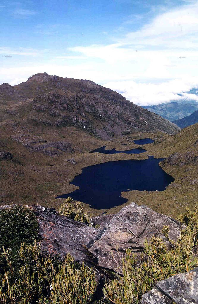
Rainy Páramo – also known as Andean Páramo is sort of the tropical equivalent of tundra and occurs at very high elevations above tree line.  The plant life is dominated by shrubs and small herbs on slopes and bogs in low lying areas where water accumulates.

Originally the páramo ecosystem was limited to only the highest peaks of the Talamanca mountain range at or near the elevation of Cerro Chirripó – 12,533′ (3,820 m) but as the trees were cut or burned on Cerro de la Muerte and other mountains some of the paramo species took advantage of the new lower artificial tree line to pioneer.

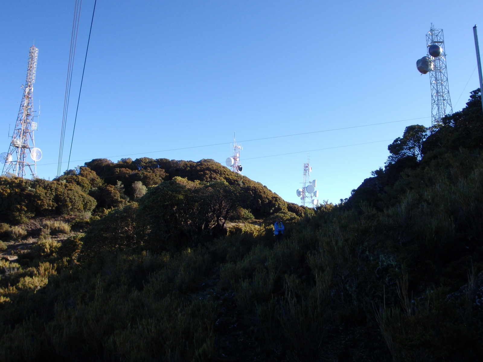
Now a sort of faux páramo dominated by miniature bamboo (Swallenochloa subtessellata) clones can be seen on both sides of the Pan American Highway as you approach the radio, cell phone and tv transmission towers on on Cerro Frio (3471 m) and Cerro Buvis (3491 m).  Hiking trails from nearby San Gerardo de Dota give much easier access than climbing the highest peak in Costa Rica at Chirripó national park.

Páramo like scrub on Cerro Frio (3471 m) from Cerro Buvis (3491 m) near Cerro de la Muerto

Costa Rica is the furthest north that this tropical life zone is found.

Ray & Sue

Cost · ToDo · Plan·Costa Rica Guide logo animated·Top10 · Best Time

Costa Rica Guide - Maps and Travel Infomation

Costa Rica Guide on Facebook

Ecozones
  • Cloud Forests
  • Dry Forests
  • Gallery Forest
  • Islands
  • Mangroves
  • Páramo
  • Rain Forest
  • Volcanoes
  • Wetlands

How can we help?

Please provide your phone number if we may call. A 10 minute call is often more helpful than 10 emails.