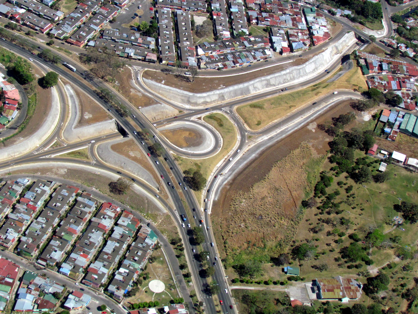
Reconnaissance from the air is an important tool that can give a quick and accurate overview of new construction like the Alajuelita radial on the circumvalacion (39). All of the photos are geocoded with the longitude, latitude and altitude (for scaling)